Please “pardon our dust” as we transition to a new website. Please email abbey@secooraorgpact.wpengine.com if you have any questions or need help finding information.
For a limited time, access the old site at legacy.secoora.org.
Take a minute and explore some of our new and updated pages:

High Frequency Radars
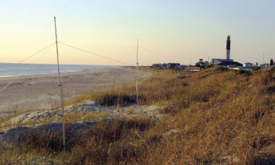
SECOORA supports High Frequency radars along the Southeast coast. The land-based instruments use radar technology to map ocean surface currents in near real-time.
This information supports Marine Operations by:
- Reducing search and rescue area of the U.S. Coast Guard
- Providing emergency managers transport information for oil spill or HAB response
- Supporting model validation
In-Situ Stations
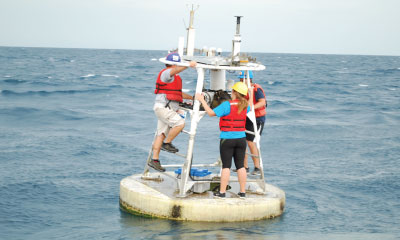
SECOORA funds many in-situ stations in the Southeast U.S. These technologies – buoys, metrological and coastal stations – support Climate Variability by:
- Sustaining a continuous ocean observing data set
- Measuring parameters, such as carbon dioxide and pH, that help study ocean acidification
Southeast Ocean and Coastal Acidification Network
SECOORA and NOAA formed SOCAN to bring experts and industry members together to identify the research needs related to Ocean Acidification (OA).
SOCAN supports the Climate Variability theme by:
- Enhancing collaborations and communications throughout the region about OA regional drivers
Biological Observation Experiment
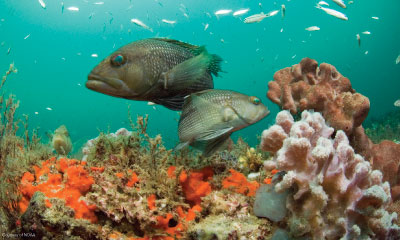
Research shows fish have evolved to use acoustics for courtship and spawning. Passive acoustic hydrophone surveys can be used to document the time and place where reproductive activity occurs.
This project supports Ecosystems: Water Quality & Living Marine Resources by:
- Testing to see if acoustic measurements of fish sounds and movement can be feasibly integrated into the existing operational observing systems
SECOORA Climatology
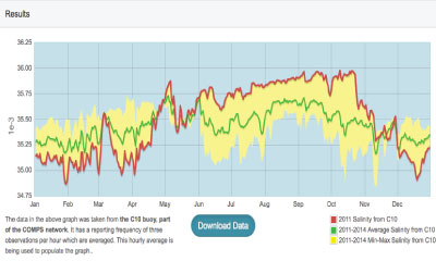
The tool allows users to view and analyze trends in temperature and salinity in both time and space. A key feature of this application is the ability to access historical temperature and salinity data from select SECOORA buoys and model results.
The climatology tool supports Ecosystems: Water Quality & Living Marine Resources by:
- Providing improved access to physical oceanographic data to scientists studying fish stocks
- Serving the NOAA NWS Weather Forecasts offices needs
How’s the Beach
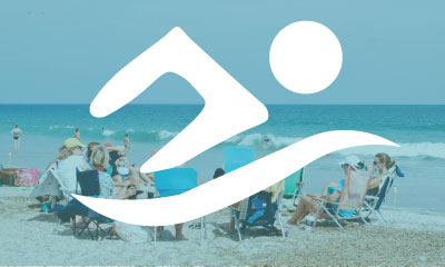
Bacteria levels can change rapidly between sampling dates. The beach water quality app posts swimming advisories for the day based on the relationship between bacteria level and rainfall, salinity, wind conditions, and water temperature.
The predictive modeling app supports Ecosystems: Water Quality & Living Marine Resources by:
- Estimating the bacteria load based on environmental conditions
- Providing managers easy access to the information through a web based app
Rip Currents Project
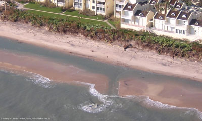
SECOORA partnered with NOAA to collect wave data and visual rip current observations for Emerald Isle, NC. The ocean data is needed to validate the NOAA National Weather Service Rip Current Forecast Model (RCFM).
The project supports Coastal Hazards by:
- Improving accuracy of rip current forecast
- Serving the NOAA NWS Weather Forecasts office needs
SECOORA Data Portal
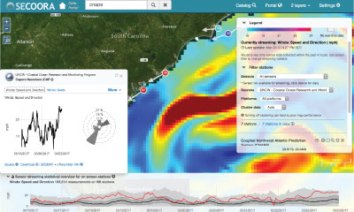
Over 4,000 datasets and 75 million observations are accessible through the SECOORA Data Portal.
Use the tool to explore, download, and visualize ocean and coastal data and models in the Southeast U.S.
The portal supports Coastal Hazards by:
- Visualizing data from multiple sources
- Providing an expansive data catalog featuring reliable, quality controlled datasets
Marine Weather Portal
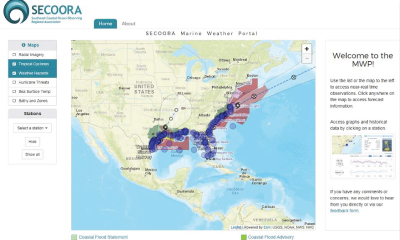
The Marine Weather Portal provides a one-stop shop for marine observations, forecasts, and short and long-fuse warnings for the coastal waters of the southeast region.
The application supports the Coastal Hazards theme by:
- Providing rapid access coastal and ocean weather and sea condition data
- Visualizing hazards such as storm tracks and severe weather
- Serving the NOAA NWS Weather Forecasts offices
In-situ Stations

SECOORA funds many in-situ stations in the Southeast U.S. These technologies – buoys, metrological and coastal stations – support Coastal Hazards resiliency by:
- Improving weather forecasts
- Providing real-time information on current sea conditions
- Increasing accuracy for storm track and storm surge inundation models.
Related news

New High Frequency Radar at the Dry Tortugas National Park Improves Ocean Surface Current Measurements Across the Straits of Florida
A new CODAR Low-Power SeaSonde HFR has been deployed by the University of South Florida at Fort Jefferson on Garden Key to measure surface currents to improve understanding and prediction of the Gulf of Mexico Loop Current.

President Biden Proposes Significant Budget Cuts to IOOS for 2025
President Biden’s recent 2025 budget proposal slashed the funding allocated for the Integrated Ocean Observing System (IOOS) by 76%, which would effectively shut down coastal and ocean observing efforts.

Webinar: NOAA Resources to Help Coastal Communities Understand Flood Risk
Join us Wednesday, March 27th at 12 PM Eastern Time for SECOORA's Coastal Observing in Your Community Webinar Series to hear from Doug Marcy with the NOAA Office for Coastal Management.