University of North Carolina Wilmington’s Coastal Ocean Research and Monitoring Program (CORMP) operate meteorological and oceanographic buoys off the North Carolina and South Carolina coasts. The buoys provide real-time weather, sea state, and water quality data for use by the public, as well as the scientific and public safety communities.
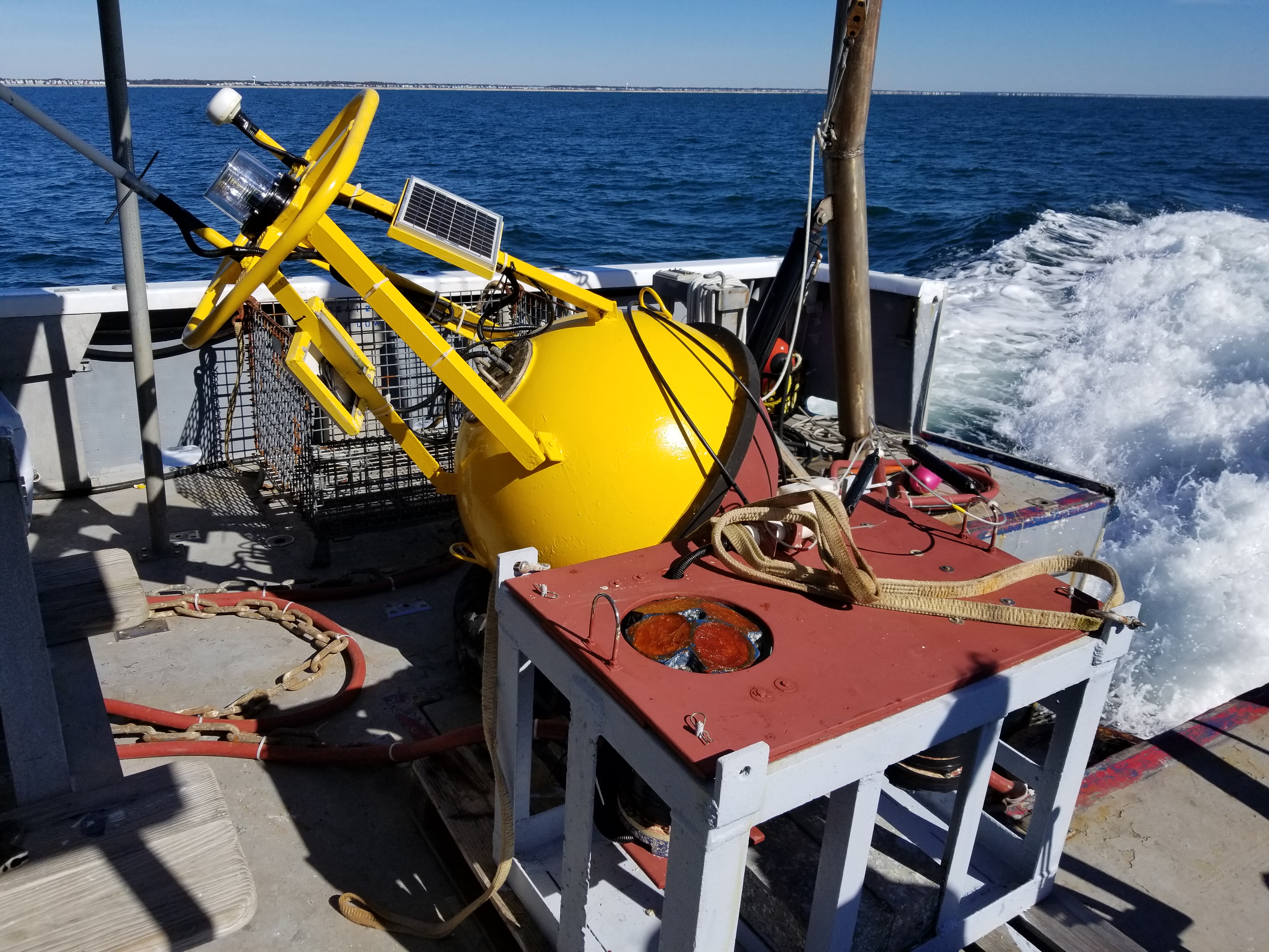
CORMP deploying SUN2wave buoy in February. The buoy is located off the coast of Sunset Beach, NC. Image credit: Brett Bolton, UNCW CORMP
Unfortunately, some of these buoys were damaged by the active 2017 Hurricane season. Solar panels and cables were damaged by the strong winds and tall waves. CORMP technicians have been working to get the buoys and sensors ready for deployment.
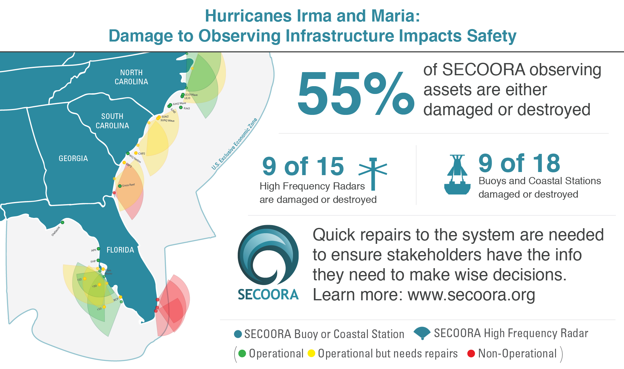
SECOORA’s observing infrastructure took a major hit during the 2017 hurricane season – 55% of our observing assets are either damaged or destroyed. This critical infrastructure informs us as to whether our ocean ‘highways’ are safe for work and recreation. Without data, our ability to forecast and respond to future disasters in our region will be significantly impact.
In February, CORMP redeployed the SUN2Wave buoy which is located off the coast of Sunset Beach, NC. The buoy provides bottom currents, surface currents, water temperature, and wave measurements. It communicates with a bottom mounted Acoustic Doppler Current Profiler (ADCP) and data is transmitted every hour.
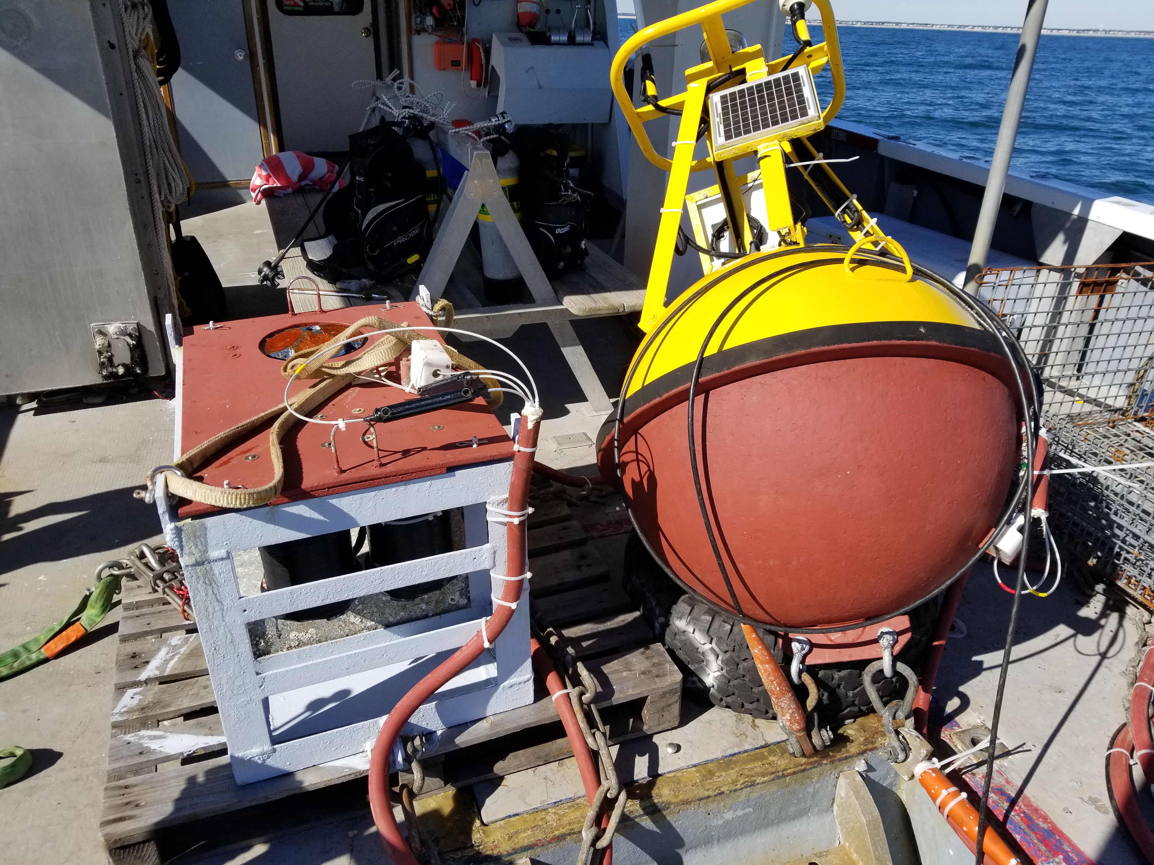
Another view of the SUN2wave buoy being deployed February. Image credit: Brett Bolton, UNCW CORMP
CAP2, located northwest of the Charleston Harbor entrance, was also damaged by Hurricane Irma.
According to Peter Mohlin, meteorologist with the NOAA National Weather Service’s (NWS) office in Charleston, SC, the NWS depends on data from CAP2 to produce and verify the forecast for the Atlantic waters off the Charleston County coast. In addition, they use CAP2 buoy data to verify severe weather – such as high winds of 34 knots or greater for Special Marine Warnings – and during tropical cyclone events.
CORMP technicians place a priority on the timely repair of any damaged or non-reporting buoy. The modular design of the buoy sensors and datalogging system allow for equipment to be simply swapped out at sea by technicians while working from a small workboat.
“As soon as we notice a problem with a buoy, we start prepping to fix it. When we do get the right weather to go out, we go with lots of spares, as you never know what you’re going to find when you get out there.” – Christopher LaClair, UNCW CORMP Technician.
In April, CORMP technicians will go to sea onboard the RV Savannah for a regularly scheduled buoy replacement cruise. The FRP2, CAP2 and SUN2 buoys will be swapped for new moorings. CORMP aims to replace buoys after they have spent a year at sea, ensuring continued accurate measurements.
NC and SC buoys are maintained by Coastal Ocean Research and Monitoring Program at the University of North Carolina Wilmington Center for Marine Science with funding from the NOAA led U.S. IOOS and SECOORA.
Related news

New High Frequency Radar at the Dry Tortugas National Park Improves Ocean Surface Current Measurements Across the Straits of Florida
A new CODAR Low-Power SeaSonde HFR has been deployed by the University of South Florida at Fort Jefferson on Garden Key to measure surface currents to improve understanding and prediction of the Gulf of Mexico Loop Current.

President Biden Proposes Significant Budget Cuts to IOOS for 2025
President Biden’s recent 2025 budget proposal slashed the funding allocated for the Integrated Ocean Observing System (IOOS) by 76%, which would effectively shut down coastal and ocean observing efforts.

Webinar: NOAA Resources to Help Coastal Communities Understand Flood Risk
Join us Wednesday, March 27th at 12 PM Eastern Time for SECOORA's Coastal Observing in Your Community Webinar Series to hear from Doug Marcy with the NOAA Office for Coastal Management.