Update 10:00 AM 9/4/2019
Hurricane Dorian, a slow moving and powerful storm, is impacting the entire southeast coast. Click for official updates from the NOAA National Weather Services National Hurricane Center.
SECOORA put together this page to highlight data and information related to the Hurricane Dorian. It will be updated as new information becomes available and the track is more certain.
If we are missing a resource, please email abbey@secooraorgpact.wpengine.com to have it included!
Marine Weather Portal
View more Dorian data: https://bit.ly/2kpGGAv
.
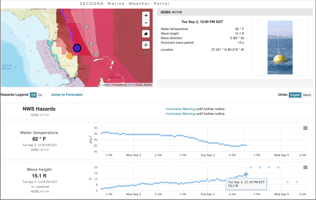
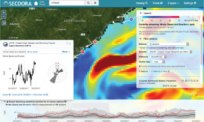
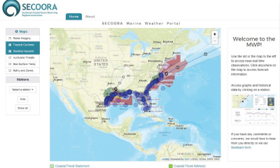
Explore Dorian data with the SECOORA Marine Weather Portal (MWP). View real time weather hazards, tropical cyclone forecasts, and data from ocean and coastal observations as the hurricane approaches.
Exploring Real Time Data
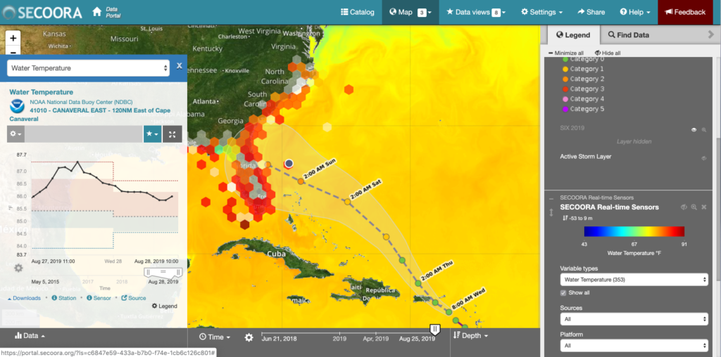
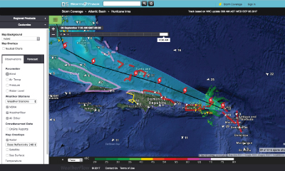
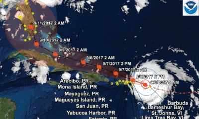
SECOORA assets are providing near real-time information on Hurricane Dorian. Pictured above is the SECOORA Data Portal paired with the NWS Hurricane track plus the HYCOM modeled water temperature and real time sensors layers. Use the portal to visualize Dorian’s track with other datasets.
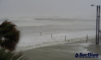
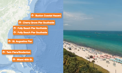
View Live Footage of Dorian as it Approaches
Users can choose a camera and view the coastal waters as Dorian approaches. This is part of the NOAA NOS Web Camera Applications Testbed (WebCAT) project.
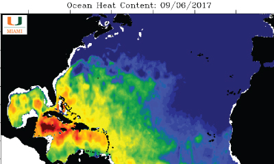
Ocean Heat Content for Hurricane Dorian
Ocean Heat Content (OHC) is an integrated measure of ocean heat relative to the depth where 78ºF/26ºC water is located in the water column (Figure 1). The satellite image above provides estimates of both sea surface temperature (SST) and sea surface height. The information is used to determine the depth of the warm water below the surface. Knowing the depth of the warm water allows researchers estimate hurricane intensity since warm waters “fuel” hurricanes. Hurricane Dorian’s track is overlaid on OHC image. Click for data.
Other Hurricane Resources
Explore more Hurricane Dorian data and other resources for the Southeast U.S. If we are missing a resource, please email abbey@secooraorgpact.wpengine.com to get it included! Jump to a resource:
- SECOORA Real Time Data
- Hurricane Tracking
- Storm Surge, Flooding, and Coastal Change
- Data, WebCams and Modeling
- IOOS Regional Associations and Other
SECOORA Real Time Data
 |
|
The SECOORA Data portal allows users to explore, download and visualize ocean and coastal data in the SECOORA domain. When a storm is approaching, check out the sensors map to see the storm data in real time. |
|
|
|
|
|
Buoy Data – Carolinas |
|
|
|
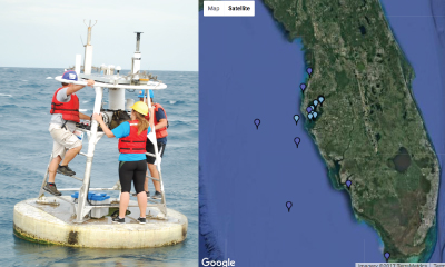
The University of North Carolina Wilmington’s Coastal Ocean Research and Monitoring Program, operates 9 mooring stations in North Carolina and South Carolina. |

|
|
|
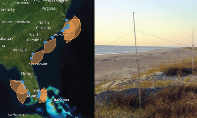
SECOORA partners operates 13 High Frequency radars (HFR) in the Southeast. HFR provide surface current direction and speed. |
Hurricane Tracking
 |
|
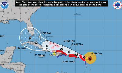
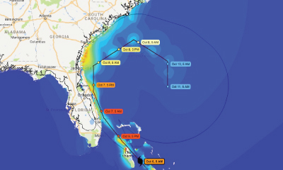
The National Hurricane Center (NHC) is the trusted source for hurricane information. Resources include predicted storm tracks and wind speed probabilities. |
 |
|
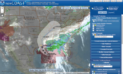
NOAA’s nowCOAST is a GIS-based online web mapping service which provides frequently updated weather and ocean observations, coastal and marine weather warnings and forecasts, and National Hurricane Center potential storm surge flooding maps. |
 |
|
Visit the SECOORA Marine Weather Portal (MWP) for up-to-date weather hazards, tropical cyclone forecasts, and observations as hurricanes and tropical storms approach the southeast. The new National Weather Service Hurricane Threats and Impacts map has been added to the MWP which indicates worse case scenarios for planning purposes. |
 |
|
StormTrack allows you to see the latest predicted track of an identified storm. By using their wealth of real time observations, meteorological tools, and precision models, you can see exactly how each storm is progressing. Each storm page grants access to premium level data for the duration of the storm. |
|
|
 |
|
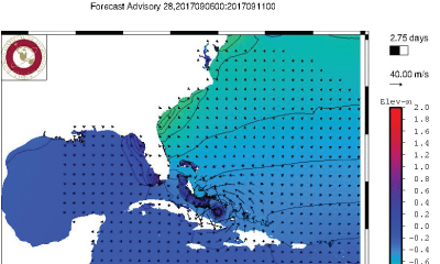
Real time coastal wind, wave, and water level guidance is presented for the east central Florida coast, focusing on the Indian River Lagoon and Brevard County. Model products available on the site include: ADCIRC+SWAN numerical model using NOAA’s North American Mesoscale (NAM) model and the latest forecast/advisory from the National Hurricane Center (NHC). |
Storm Surge, Flooding, and Coastal Change
 |
|
When NOAA issues a tropical storm warning for the U.S. or its territories, the Storm QuickLook is activated. This online tool is a snapshot of near real-time coastal and weather observations, the latest National Weather Service advisories, and time-series plots of water level and meteorological data at selected locations. |
 |
|
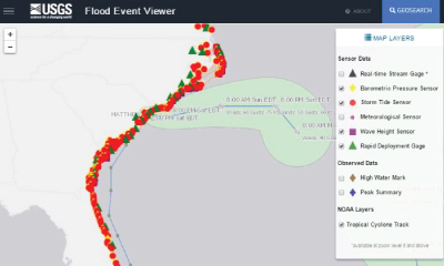
The USGS Flood Event Viewer (FEV) is the public data discovery component of the Short-Term Network (STN) database. It features 200+ USGS storm surge sensors and rapid deployment real-time gauges. |
 |
|
CERA is a component of the Advanced Surge Guidance System (ASGS). Based on the Advanced Circulation and Storm Surge model (ADCIRC), coupled with the SWAN Wave model, the ASGS generates real-time storm surge guidance for updating emergency response groups during a tropical or hurricane event. |
 |
|
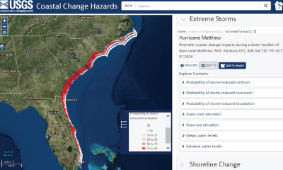
U.S. Geological Survey’s (USGS) Coastal Change Hazards Portal is an interactive portal that allows you access to forecasts on the probability of dune erosion, overwash, and inundation/flooding. The portal also allows you to view previous storm impacts. The portal is updated regularly as new NOAA surge forecasts are issued and include the impacts of waves and wave runup. |
Real Time Data, WebCams and Modeling
 |
|
Surfline has cameras located all across the US. With many cameras in the SECOORA domain, users can choose a location and view live feeds of an approaching storm. They also have detailed surf zone forecasts provided by their LOLA wave model. In addition, explore their “Regional Forecast” and “Premium Analysis” products where a team of meteorologists provide value added observations and forecasts (written, video and audio) 365 days a year, with enhanced coverage during tropical events. |
 |
|
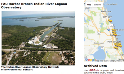
The Florida Atlantic University Harbor Branch operates Land/Ocean Biogeochemical Observatory (LOBO) units in the Indian River Lagoon and St. Lucie Estuary on the east coast of Florida. |
 |
|
Ocean heat help fuel storms. The satellite derived sea surface temperature maps represents the integrated heat from the surface to the seafloor. Operated by Nick Shay, University of Miami Rosenstiel School of Marine and Atmospheric Science. |
 |
|
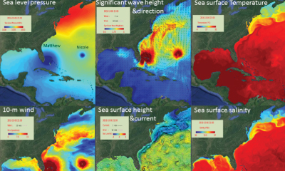
CNAPS is a three-dimensional marine environment nowcast and forecast model developed by the Ocean Observing and Modeling Group at North Carolina State University. This fully coupled ocean circulation, wave, and atmosphere model predicts ocean conditions based on data collected daily. |
|
|
|
NOAA NOS Web Camera Applications Testbed (WebCAT) provides an interactive web page to browse both live feeds and historical archived footage from five webcams in the Southeast US (Bradenton, FL; Miami, FL; St. Augustine, FL; Folly Beach, SC; Cherry Grove Pier, SC; and Buxton, NC). Users can choose a camera and view the coastal waters as the storm approaches. |
IOOS Regional Associations and Other
 |
|
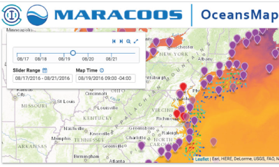
The IOOS region in the Mid-Atlantic, MARACOOS, operates a storm resource page for the East Coast. |
 |
|
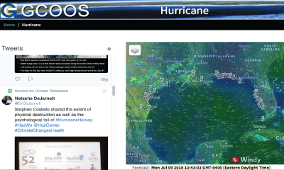
The IOOS region in the Gulf of Mexico, GCOOS, has a one-stop location for Gulf of Mexico data and information on extreme weather event such as hurricanes. |
 |
|
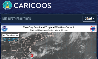
The IOOS region in the Caribbean, CariCOOS, has a Hurricane Season page the produces the most up to date information on hurricanes in the Atlantic. |
 |
|
A fun and educational blog concerning tropical storms and witty weather forecasting. From baby blobs to hectic hurricanes, this blog combines science and humor to inform and entertain. |
|
|
|
The NOAA Extreme Weather Information Sheets (NEWIS) contains regional emergency contact and evacuation information for coastal residents that are particularly at risk from tropical storms and hurricanes. Updated annually, use the county, state, and national databases on their website to search for phone numbers and websites. |
Related news

New High Frequency Radar at the Dry Tortugas National Park Improves Ocean Surface Current Measurements Across the Straits of Florida
A new CODAR Low-Power SeaSonde HFR has been deployed by the University of South Florida at Fort Jefferson on Garden Key to measure surface currents to improve understanding and prediction of the Gulf of Mexico Loop Current.

President Biden Proposes Significant Budget Cuts to IOOS for 2025
President Biden’s recent 2025 budget proposal slashed the funding allocated for the Integrated Ocean Observing System (IOOS) by 76%, which would effectively shut down coastal and ocean observing efforts.

Webinar: NOAA Resources to Help Coastal Communities Understand Flood Risk
Join us Wednesday, March 27th at 12 PM Eastern Time for SECOORA's Coastal Observing in Your Community Webinar Series to hear from Doug Marcy with the NOAA Office for Coastal Management.