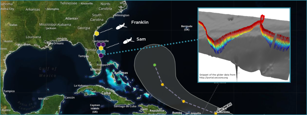
SECOORA gliders are capturing water column information ahead of Tropical Storm Jerry as he moves closer to the US. Data from gliders allows forecasters and scientists to improve predictions of the storm’s potential intensity.
Two gliders were deployed this month. The SECOORA glider Franklin (operated by UGA/SkIO) was deployed off the coast of Georgia and the USF glider Sam off the East coast of Florida.
Glider Data
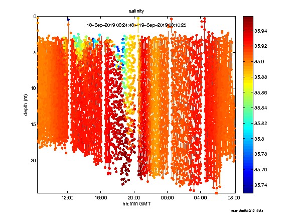
The fleet is collecting water temperature and salinity measurements throughout the water column. Every 4 hours they transmit data back to land via satellite. This data helps scientist and forecasters identify how hurricanes mix sub-surface and surface waters.
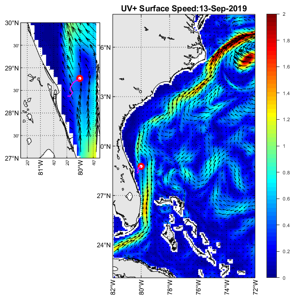
NC State University supplies daily CNAPS model output of surface currents. This model output provides context, such as the location of the Gulf Stream and Gulf Stream eddies, for the glider observations (pictured above).
Learn More
Listen to the Weather Geeks podcast, What Flies Beneath: How Underwater Gliders Can Improve Hurricane Forecasts, to learn more!
Related news

New High Frequency Radar at the Dry Tortugas National Park Improves Ocean Surface Current Measurements Across the Straits of Florida
A new CODAR Low-Power SeaSonde HFR has been deployed by the University of South Florida at Fort Jefferson on Garden Key to measure surface currents to improve understanding and prediction of the Gulf of Mexico Loop Current.

President Biden Proposes Significant Budget Cuts to IOOS for 2025
President Biden’s recent 2025 budget proposal slashed the funding allocated for the Integrated Ocean Observing System (IOOS) by 76%, which would effectively shut down coastal and ocean observing efforts.

Webinar: NOAA Resources to Help Coastal Communities Understand Flood Risk
Join us Wednesday, March 27th at 12 PM Eastern Time for SECOORA's Coastal Observing in Your Community Webinar Series to hear from Doug Marcy with the NOAA Office for Coastal Management.