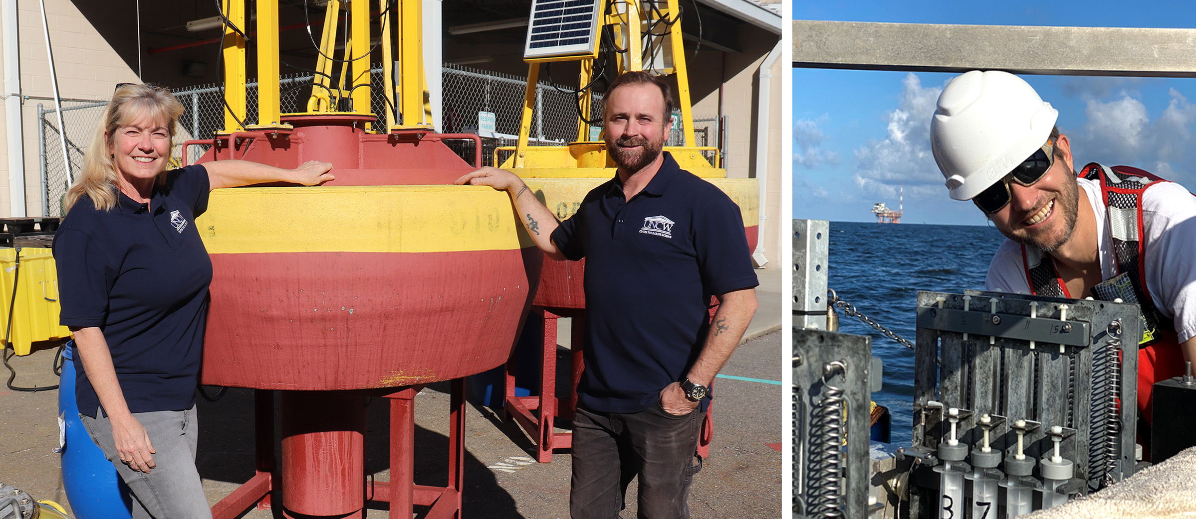
SECOORA is excited to announce Dr. Lynn Leonard (University of North Carolina Wilmington) and her team were selected as the recipients for the Filling Regional Observation Gaps on the Florida East Coast Request for Proposals for their proposal Filling the Gap: SECOORA Members Partnering to Affordably Increase Observations and Build Capacity Along the FL East Coast.
Dr. Leonard and her team of Co-Investigators (Florida Atlantic University Harbor Branch Oceanographic Institute, NOAA National Weather Service, FACT Network, and Second Creek Consulting) will deploy new real-time buoys in 2024 on the east coast of Florida.
The project is a collaborative effort combining resources from multiple SECOORA-affiliated institutions and local stakeholders. This project will improve availability of meteorological, oceanographic, wave, and fisheries observations at two data-poor locations offshore of St. Lucie County and offshore of Ponce de Leon Inlet.
“Our team is honored to have been selected for this opportunity and we look forward to working with SECOORA. The new buoy systems will not only fill critical observational gaps along the Florida East Coast, but also provide opportunities to grow partnerships and broaden usage of SECOORA information and products across the region.”
Dr. Lynn Leonard, University of North Carolina Wilmington
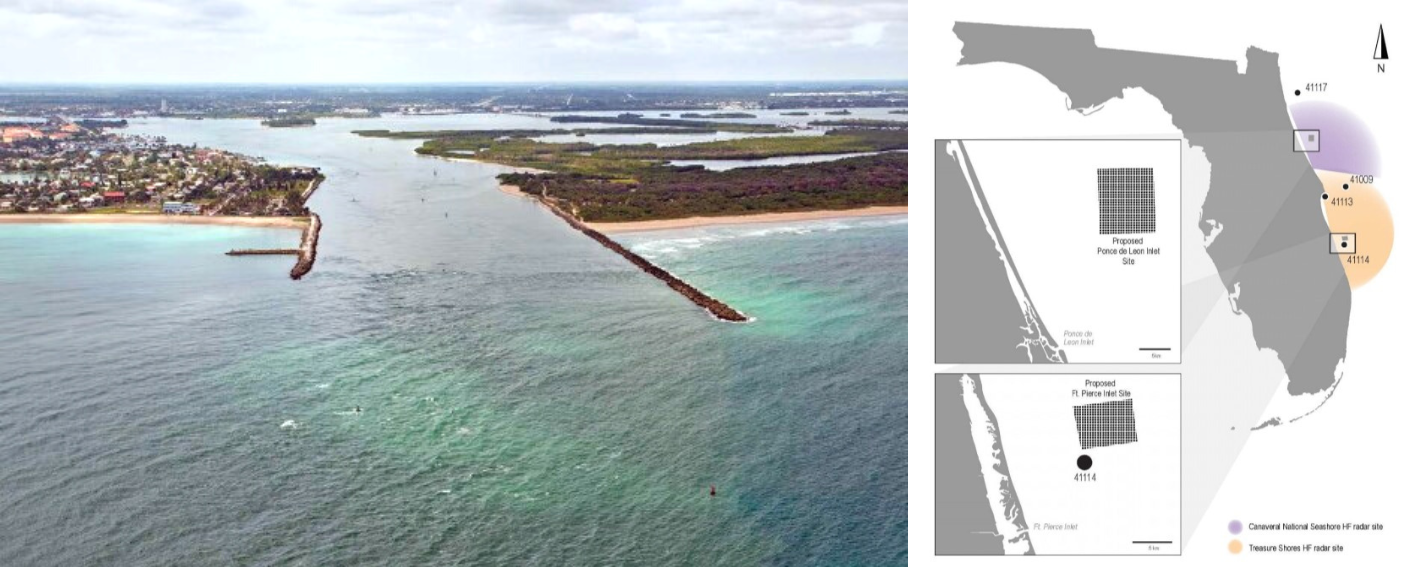
Data and Proposed Locations of New Buoys
The new real-time buoys will be deployed in 2024. A meteorological buoy and Sofar wave buoy will be co-located 5 to 9 miles offshore the Ponce de Leon Inlet in waters depths ranging from 55 to 80 feet. Another meteorological buoy will be deployed 6 to 9 miles offshore Ft. Pierce Inlet in waters depths ranging from 50 to 70 feet. The Ft. Pierce Inlet meteorological buoy will be co-located next to an existing Coastal Data Information Program (CDIP) wave buoy (NDBC 41114).
The two meteorological buoys will measure water temperature, salinity, air temperature, barometric pressure, and wind data (speed, gust, and direction). They will also be equipped with acoustic receivers to track tagged fish swimming in the area. The Sofar wave buoy will measure wave height, dominant wave period, mean wave direction, and water temperature. Data from the buoys will be updated hourly and accessible through SECOORA’s data portal.
Importance of Collecting Data on the Florida East Coast
The east coast of Florida is characterized by its narrow, shallow shelf that steeply separates the coastal ocean from the deep ocean. In addition, there are strong vertical and horizontal wind shears immediately offshore. These variables create difficult monitoring conditions in an area where accurate predictions of shelf circulation are critical for search and rescue efforts, extreme weather tracking, anticipation of rip current hazards, planning mitigation of man-made hazards, and understanding of ecosystems for fisheries interests. The two new buoys increase observations and enhance data availability in under-studied regions of the Florida East Coast.
“Monitoring of ocean conditions in this area will be important in tracking fish movements between our artificial reefs and the Oculina Banks Marine Protected Area. The proposed buoy will also help with boat traffic in the area. Knowledge of sea conditions in the area would be very important to the operation of a developing mega-yacht facility.”
James Oppenborn, Coastal Resources Coordinator, St. Lucie County Florida
Dr. Leonard manages the UNCW Coastal Ocean Research and Monitoring Program (CORMP). CORMP is partially funded by SECOORA and operates 15 near-shore stations in North Carolina and South Carolina. The new buoys will expand their footprint to Florida and create a new partnership with Dr. Jordon Beckler at Florida Atlantic University Harbor Branch Oceanographic Institute.
Related news

New High Frequency Radar at the Dry Tortugas National Park Improves Ocean Surface Current Measurements Across the Straits of Florida
A new CODAR Low-Power SeaSonde HFR has been deployed by the University of South Florida at Fort Jefferson on Garden Key to measure surface currents to improve understanding and prediction of the Gulf of Mexico Loop Current.

President Biden Proposes Significant Budget Cuts to IOOS for 2025
President Biden’s recent 2025 budget proposal slashed the funding allocated for the Integrated Ocean Observing System (IOOS) by 76%, which would effectively shut down coastal and ocean observing efforts.

Webinar: NOAA Resources to Help Coastal Communities Understand Flood Risk
Join us Wednesday, March 27th at 12 PM Eastern Time for SECOORA's Coastal Observing in Your Community Webinar Series to hear from Doug Marcy with the NOAA Office for Coastal Management.