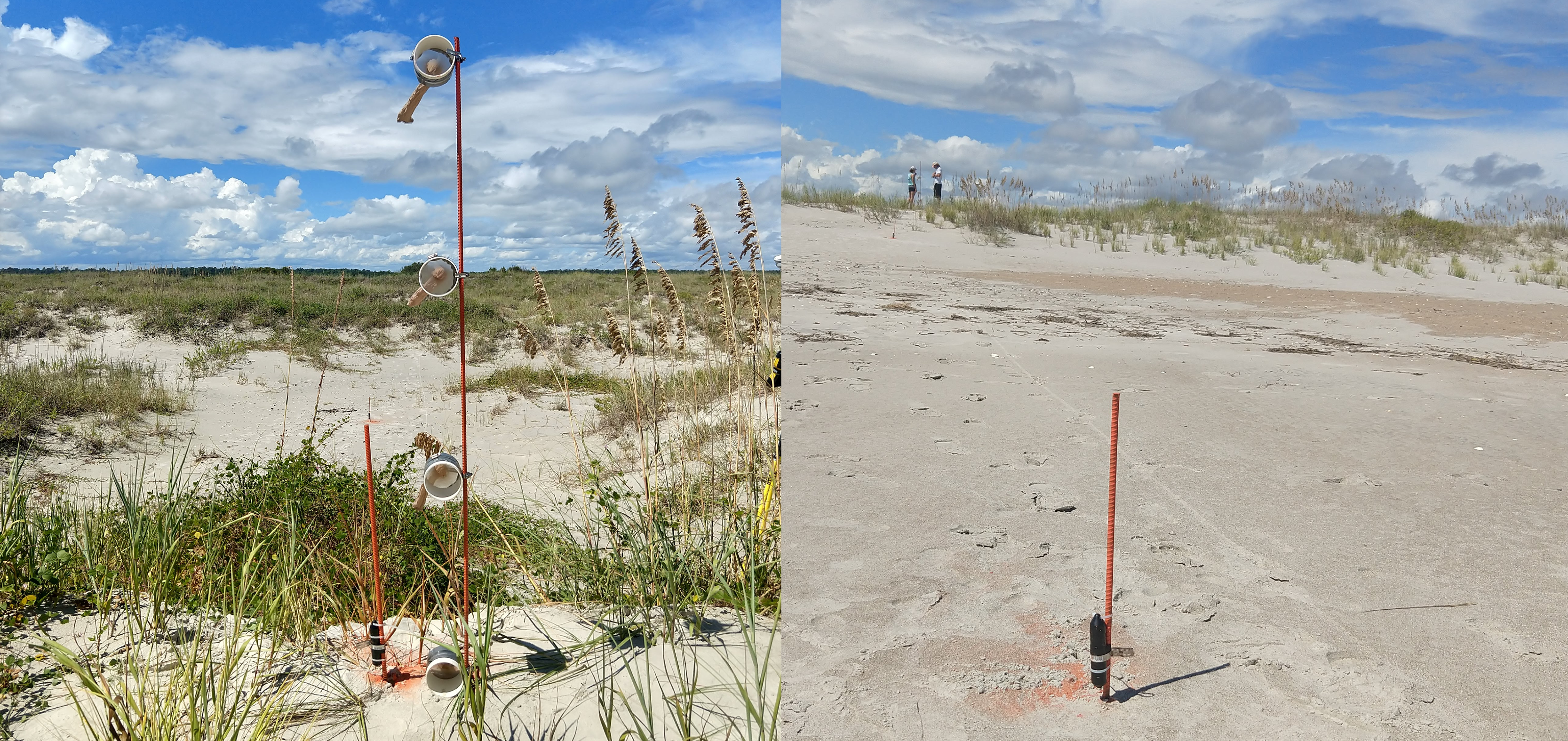
Pictured left is a sediment trap next to a pressure sensor. Pictured right is a pressure sensor. The data collected will help monitor storm surge, dune erosion and overwash. Images credited to Joe Long, UNCW.
As Florence is projected to make landfall near the Carolinas, SECOORA Members in North Carolina and their partners are collecting critical data ahead of the storm.
The University of North Carolina Wilmington (UNCW) deployed 9 pressure sensors on Masonboro Island, an uninhabited barrier island near Wilmington, NC. The sensors sample every 20 seconds. They will help observe the storm surge and the timing plus elevation of wave run-up. This is a dominant process in driving dune erosion and overwash.
While deploying the sensors, they also added sediment traps and tiles. Sediment traps will trap sand transported by overwash and winds at different heights. It will allow researchers to learn more about the coastal change processes by providing a rough estimate of overwash current strength based on the size of particles captured. The tiles will provide a measure of sediment deposition in the back-barrier regions.
In addition, UNCW digitally mapped most of Masonboro Island with a drone. After Florence passes, they will repeat the drone mapping. The before and after footage will provide an assessment of coastal landscape change driven by Hurricane Florence.
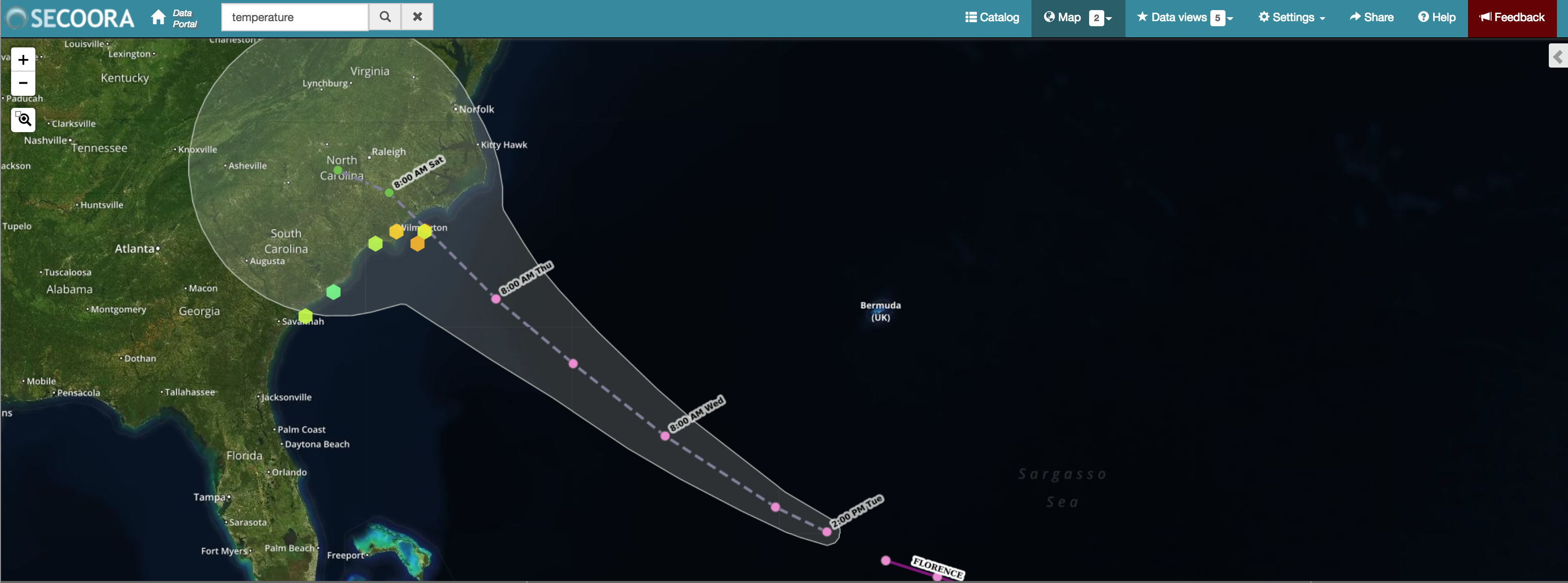
Pictured above is Hurricane Florence’s track and the buoys located off North Carolina and South Carolina. Access data.
UNCW also supports 9 buoys offshore of North Carolina and South Carolina in partnership with SECOORA and U.S. IOOS. The information collected by these assets provide real time updates for area residents and NOAA’s National Weather Service and National Hurricane Center on the approaching storm’s wind speed, wave heights, and more. All data management and web services have been migrated to Amazon cloud services so that the buoy data is available during the storm (provided that the buoys remain operational with the passage of the storm).
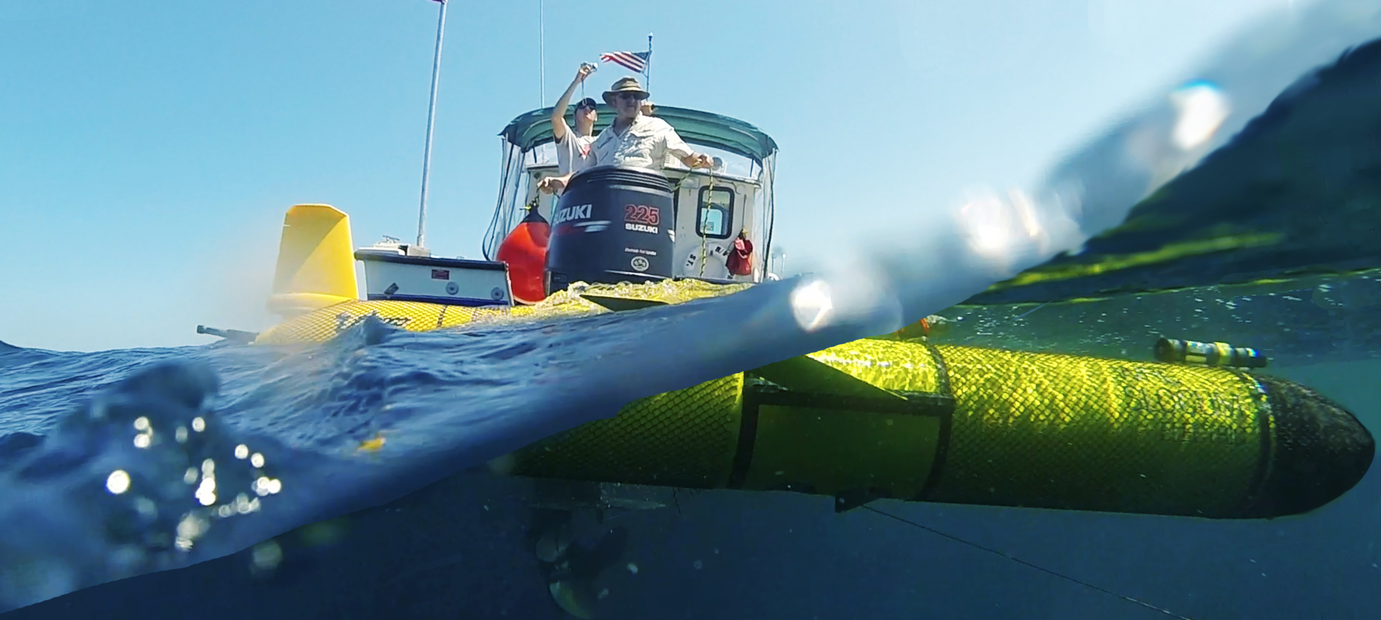
An underwater glider, RAMSES, was deployed off the North Carolina Outer Banks by the Coastal Studies Institute. It is collecting and reporting water temperature and salinity measurements throughout the water column. The gliders will help identify how hurricanes mix sub-surface and surface waters. Read more >
University of North Carolina Chapel Hill (UNC CH) operate 3 High Frequency radars (HFR) off North Carolina. HFR provides current direction and speed in near real time. The data helps scientists understand the hurricanes track and surface current impacts of the storm. Click here for HFR data. In addition, UNC CH operate two buoys. Buoy 41062 is located in Hatteras Bay, north of Cape Hatteras and buoy 41063 is Raleigh Bay. Data from the buoys will provide real time updates on the approaching storm’s wind speed and more.
Related news

President Biden Proposes Significant Budget Cuts to IOOS for 2025
President Biden’s recent 2025 budget proposal slashed the funding allocated for the Integrated Ocean Observing System (IOOS) by 76%, which would effectively shut down coastal and ocean observing efforts.

Webinar: NOAA Resources to Help Coastal Communities Understand Flood Risk
Join us Wednesday, March 27th at 12 PM Eastern Time for SECOORA's Coastal Observing in Your Community Webinar Series to hear from Doug Marcy with the NOAA Office for Coastal Management.

Hiring: SCDRP Program Coordinator
The Southeast & Caribbean Disaster Resilience Partnership (SCDRP) is seeking a part-time Program Coordinator. Applications are due by April 1st, 2024.