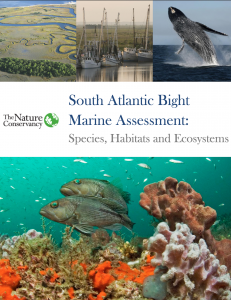
 The Nature’s Conservancy South Atlantic Bight Marine Assessment (SABMA) has been published online. The assessment is a data collection and analysis initiative designed to improve understanding of the regional distribution of key habitats and species. More information is available on the Nature Conservancy website.
Why the Assessment?
The SABMA is a mechanism to empower stakeholders to develop strategies for long-term sustainability of the South Atlantic Bight’s ecological services – from the fisheries that feed human populations to the reefs and barrier islands that absorb wave action and storm surges as sea level rises.
See story map of putting the SABMA into action.
What is it?
The SABMA is an online document and mapping product that provides regional baseline spatial data on the distribution and status of seafloor habitats, coastal systems, marine mammals and sea turtles.
The SABMA breaks down ocean resources into:
- Coastal Ecosystems: Chapter 2 / Data Description / Download Data
- Seafloor Habitat: Chapter 3 / Data Description / Download Data
- Marine Mammals and Sea Turtles: Chapter 4 / Data Description / Download Data
- Important Places (Portfolio): Chapter 5 / Download Data
View the story map for short synapsis on each section.
Learn More
The full report, data and associated materials are available through the Nature Conservancy website.
Funding
This project was supported by grants from the U.S. Department of Interior, Fish and Wildlife Service and the National Oceanic and Atmospheric Administration through the Southeast Coastal Ocean Observing Regional Association.
Related news

New High Frequency Radar at the Dry Tortugas National Park Improves Ocean Surface Current Measurements Across the Straits of Florida
A new CODAR Low-Power SeaSonde HFR has been deployed by the University of South Florida at Fort Jefferson on Garden Key to measure surface currents to improve understanding and prediction of the Gulf of Mexico Loop Current.

President Biden Proposes Significant Budget Cuts to IOOS for 2025
President Biden’s recent 2025 budget proposal slashed the funding allocated for the Integrated Ocean Observing System (IOOS) by 76%, which would effectively shut down coastal and ocean observing efforts.

Webinar: NOAA Resources to Help Coastal Communities Understand Flood Risk
Join us Wednesday, March 27th at 12 PM Eastern Time for SECOORA's Coastal Observing in Your Community Webinar Series to hear from Doug Marcy with the NOAA Office for Coastal Management.