
Glider News and Resources
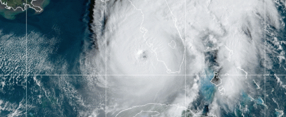
Improving Hurricane Forecasting with Gliders
During the 2023-2025 hurricane seasons, gliders are deployed in the Southeast and beyond to provide valuable data for hurricane intensity modeling. Glider deployments collect temperature and salinity profiles needed to accurately represent ocean features in ocean-atmosphere coupled models used for hurricane intensity forecasts.

Hurricane Gliders: Improving Tropical Storm Intensity Forecasts with Real Time Data
Learn how researchers are deploying gliders in the Southeast during hurricane season are providing valuable data for hurricane intensity modeling.
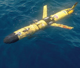
Underwater Glider Collects Data to Study Red Tide Bloom Dynamics off Gulf Coast of Florida
Read how a glider was diligently collecting water property data off the coast of Palm Harbor, FL for 12 days. Data collected by the glider will be incorporated in model simulations to better understand red tide bloom occurrence.
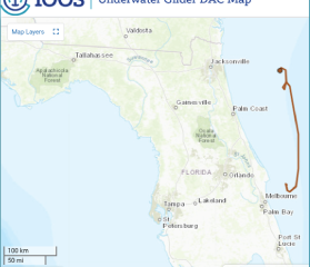
Glider Data Assembly Center
Access glider data from across the US in one location! The IOOS Glider Data Assembly Center allows users to visualize the glider data and download it for analyzation. All data is archived at the National Centers for Environmental Information.