Why We Observe
Our coastal observing systems play a critical role in protecting and managing coastal resources in the Southeast. By providing real-time data, supporting scientific research, and promoting education and public outreach, these systems can help ensure the long-term sustainability of our coastal ecosystems and the communities that rely on them.
Delivering Data for Decisions: SECOORA wants to ensure healthy coastal ocean ecosystems and communities by making observation data available and accessible to drive science-based decisions.
What We Observe
Water Quality:
Temperature, salinity, dissolved oxygen, pH, and turbidity helps identify sources of pollution and track changes in water quality over time.
Weather and Climate: Air temperature, wind speed and direction, barometric pressure, and precipitation information can be used to track severe weather events, forecast weather patterns, and monitor climate change.
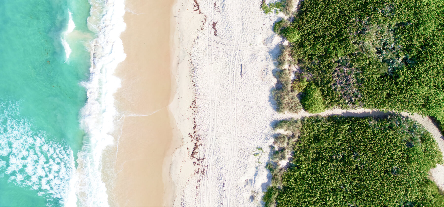
Coastal Hazards: Data on flooding, storm surges, sea-level rise, and beach erosion can help coastal communities prepare for these hazards and plan for their long-term effects.
Marine Life: Data on marine life, including fish populations, sea turtles, and marine mammals help track changing use of the marine ecosystem and inform management decisions about commercial and recreational fishing.
Ocean Currents and Waves: Data on ocean currents and waves, including measurements of wave height, wave direction, and ocean currents helps improve marine navigation and safety.
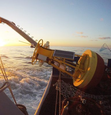
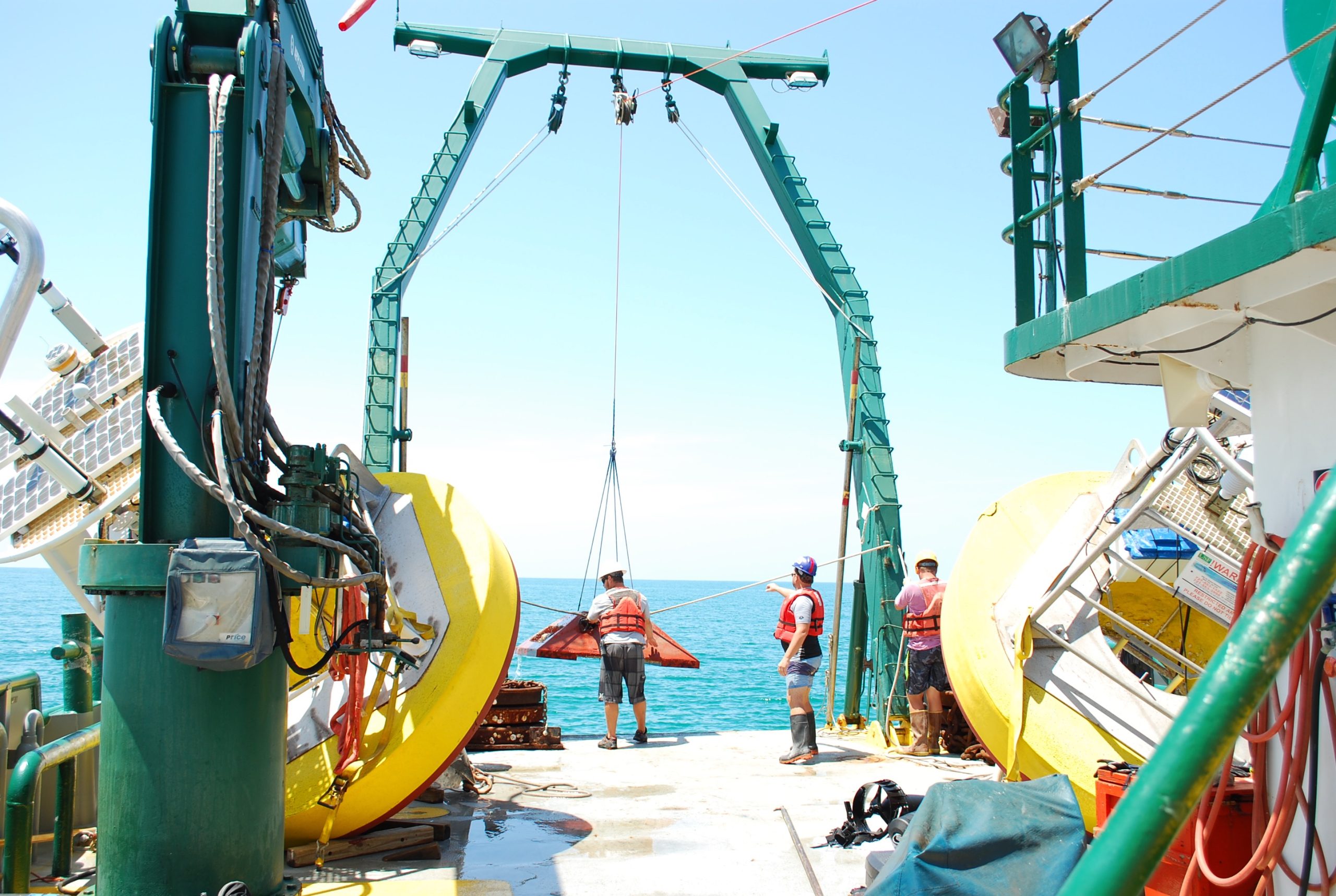
Buoys and Coastal Stations
Moorings, often called buoys, include a number of technologies that are anchored, i.e. moored, to the ocean floor with a floating surface structure. Buoys can be for a single purpose such as waves or include a variety of sensors mounted both above and below the water surface. Most buoys relay data back to shore in real-time. Profiling buoys include sensor packages that regularly move up and down the mooring rope providing a comprehensive look at the water quality. Buoys can be outfitted with sensors for wind, waves, currents, salinity, chlorophyll a, and other ocean chemistry and biology parameters.
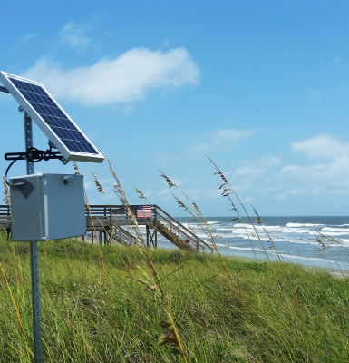
Shore stations are installed on coastal beaches, islands, on piers and offshore platforms to measure wind speed, gust and direction, air temperature, relative humidity, barometric pressure, solar radiation, rainfall, water temperature data and more. These basic measurements provide important real time information on storms and help predict changes to the weather. When measurements are collected over a long time period, they can also help predict changes in the climate.
Shore stations are installed on coastal beaches, islands, on piers and offshore platforms to measure wind speed, gust and direction, air temperature, relative humidity, barometric pressure, solar radiation, rainfall, water temperature data and more. These basic measurements provide important real time information on storms and help predict changes to the weather. When measurements are collected over a long time period, they can also help predict changes in the climate.
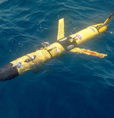
Gliders
A glider is an autonomous, uncrewed underwater vehicle that can be equipped with sensors that can measure ocean properties such as water temperature, chlorophyll a, salinity and fish acoustics. It sawtooths up and down the water column following a GPS path set by the researcher. Every few hours the glider surfaces to call home, transmits data and awaits further instructions. Gliders are flexible platforms that can be used for continuous monitoring or deployed in the event of an oil spill or harmful algae bloom or other major event.
High Frequency Radar
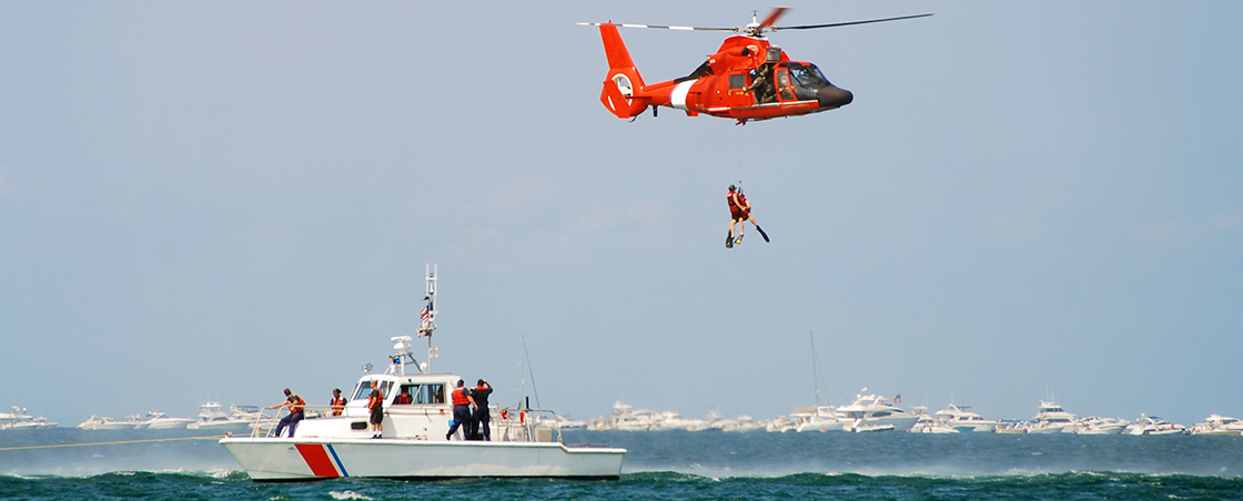
High frequency radars (HF radar) are land-based systems that measure the speed and direction of ocean surface currents in near real-time. SECOORA supports 16 HF radar in the southeastern U.S. Data is used to:
- Reduce search and rescue area for the U.S. Coast Guard
- Provide emergency managers transport information for oil spill or harmful algal bloom response
- Identify fish larvae transport
- Support model validation
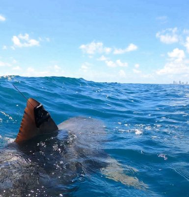
Marine Life
Scientists use acoustic sensors, fish tags, and other observing technologies to study marine life. Electronic tags can be attached to marine animals to monitor their movements and learn about their life cycle. Acoustic sensors are deployed to understand how sounds in the marine environment affect marine species movement and vocalization patterns. Data from marine life research are used to:
Image source: University of Miami Shark Research and Conservation Lab (Instagram: @sharktagging)
- Document marine diversity
- Inform fisheries management decisions
- Understand the impacts of human activities on marine species
- Provide insight into behaviors of species in rapidly changing environments
Image source: University of Miami Shark Research and Conservation Lab (Instagram: @sharktagging)
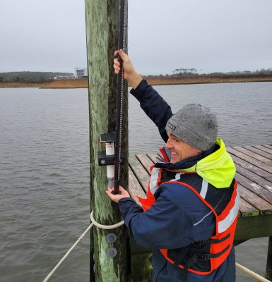
Water Level
Real-time water level sensors measure the height of the water and send that data back to shore to help communities with decisions related to flooding and tidal changes. There are multiple types of sensors that are used to measure water level. Some sensors sit in the water and can record the height of the water level, salinity, pressure, and temperature. Ultrasonic sensors sit above the water level, so they can be easily attached to a dock piling or similar above water structure. These sensors send an ultrasonic pulse to the surface of the water, which is used to measure the height of the water level. Some water level sensors are paired with weather stations, and collect local weather information near the sensor.
Web Cameras
Web cameras or webcams are a low-cost coastal observing platform transforming how community environmental monitoring is conducted. Webcams can address significant gaps in the nation’s ability to monitor and accurately forecast various weather, ocean, ecological, and public health hazards. Below are a few examples of how webcam data is transforming coastal monitoring:
- Rip Current Detection: Used to inform public of rip current dangers and issue alerts to lifeguards.
- Shoreline Change: Used to identify potential dune erosion or overwash events, infrastructure risk, and limitations to beach access.
- Automated Beach Usage Detection: Provides information to coastal managers on how busy a location is during different times of the day, season, or year for planning purposes.
- Flood Monitoring: Helps to document flooding impacts.
Charting the Course
The Regional Coastal Ocean Observing System Plan provides a roadmap for future investments in expanding data and products in the Southeast. All recommendations are user-influenced and stakeholder-driven, ensuring informed decisions.
How We Promote Data Accessibility
We ensure observing data is available, accessible, and free for everyone. We engage with user communities to understand their information needs – how they use the data, how often, in what format and for what purposes – in order to transform raw data into useful information.
Data Portal
Access over 2,300 real-time and historical ocean observing datasets through our Data Portal. Dive into the Southeast region with our integrated map and customizable layers.
Access Data
Products and Models
Text buoys for on-the-go data delivery, assess beach safety, explore hurricane data, and monitor red tide trajectory in West Florida.
Access Products
Community Observing
We collaborate with communities to provide real-time solutions. Water level and web cameras help answer questions like ‘Is the road flooded today?’ and ‘Is it safe to go to the beach?’
Learn More
Extreme Event Resources
We strive to be your trusted source for information and resources related to extreme events, focusing on hurricanes and harmful algal blooms.
Access Resources
Certification
We are certified to provide federal quality data from the water, to the user, and to the archive. This ensures all users have access trusted data.
Learn More
Learn More