Image credit: NOAA
Florida Harmful Algal Bloom Resources
Florida Fish and Wildlife Conservation Commission (FWC) Red Tide Status Update
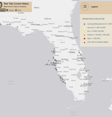
Florida Fish and Wildlife Conservation Commission (FWC) reports on the current status of Karenia brevis blooms using tables, static maps, and interactive Google Earth maps. FWC provides a statewide K. brevis map that breaks down coastal areas to highlight when concentrations are not present, very low, low, medium, and high. In addition, they report on respiratory irritation for southwest and northwest Florida.
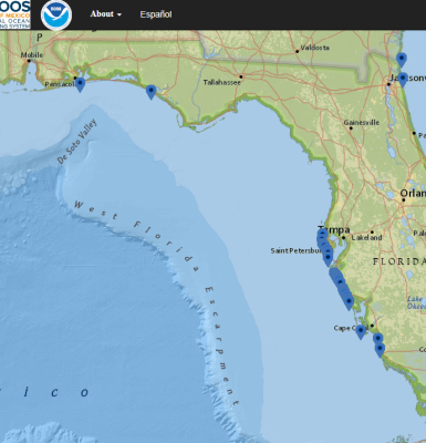
Beach Conditions Reporting System (BCRS)
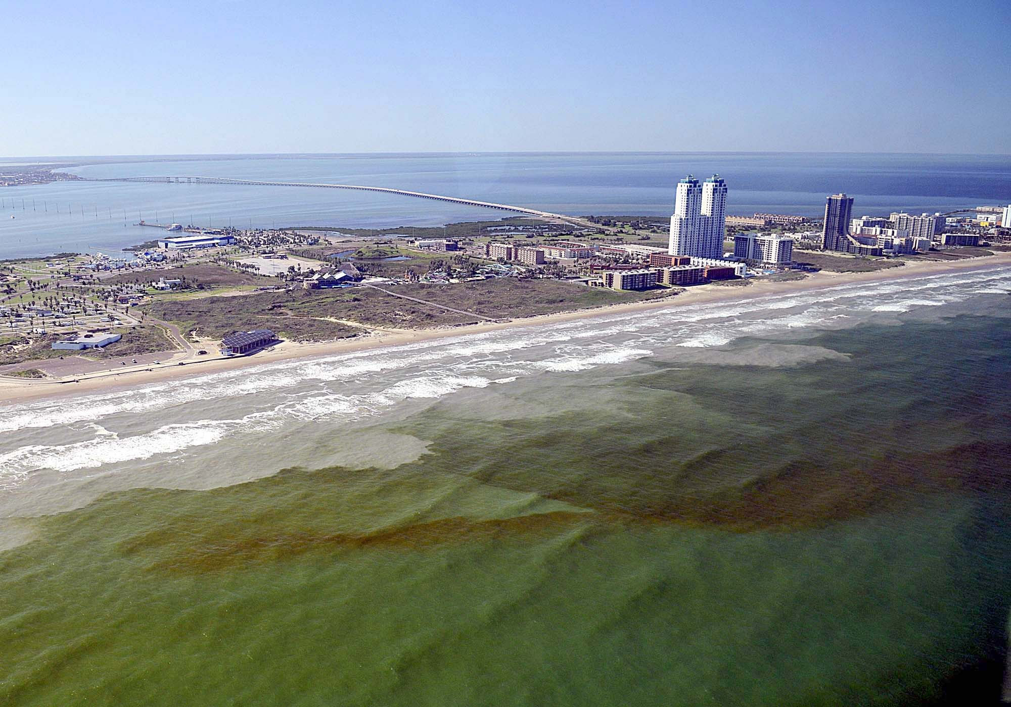
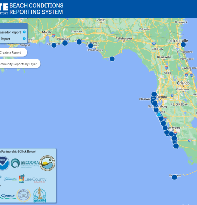
The Beach Conditions Reporting System by Mote Marine Laboratory provides condition reports for beaches and coastal recreation areas. There are several sites located along the east and west coasts of Florida. The reports provide descriptions of HAB-related beach conditions like presence of dead fish, respiratory irritation among beachgoers, and irregular water color, along with more general conditions such as the wind direction and rip current status. The reports are subjective (no measurements taken, just an estimate) and designed to indicate to the beachgoer which beach may be more preferable to visit at a particular time.
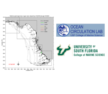
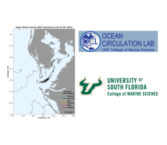
West Florida Coastal Ocean Model
For West Florida, access a short-term (4.5 day) HAB trajectory forecast provided by the University of South Florida College of Marine Science. The forecast is based on the nowcast/ forecast West Florida Coastal Ocean Model (WFCOM). Results are provided for both the surface and the near bottom waters. The two results differ due to water movement. Water movement is important to show where red tide may be transported. WFCOM provides the connectivity between three distinct ocean and coastal regions: deep ocean, nearshore shelf waters, and estuaries.
Tampa Bay Circulation Model
For the Tampa Bay Coastal region, access a short-term (4.5 day) HAB trajectory forecast provided by the University of South Florida College of Marine Science. The forecast is based on the high resolution nowcast/forecast Tampa Bay Circulation Model (TBCOM). Results are provided for both the surface and the near bottom waters. The two results differ due to water movement. Water movement is important to show where red tide may be transported. The TBCOM offers more detail by virtue of higher spatial resolution.
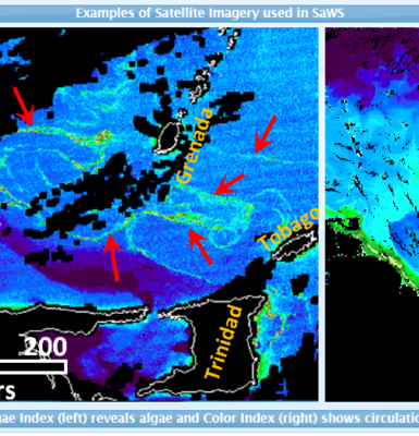
Sargassum Watch System (SaWS)
The Sargassum Watch System (SaWS), developed by Dr. Chuanmin Hu and his team at the University of South Florida, is a tool to forecast and monitor Sargassum trajectory and location. SaWS provides real-time information on Sargassum location and amount using satellite images. These images are accessible online by all users, and are compatible with Google Earth. SaWS provides imaging from the Caribbean, Western Atlantic Ocean, Gulf of Mexico, and Western Africa. A bulletin is released at the end of every month providing the present Sargassum outlook and a prediction extending over two months.
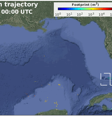
Sargassum Tracking for the Gulf, the Straits, and East Coast of Florida
A Sargassum short-term trajectory forecast product has been developed by combining satellite imagery with numerical models. Once a bloom is detected through remote sensing, its location and time information are used to initialize a trajectory model, and the patch is tracked by the simulated ocean currents.
Red Tide Respiratory Forecast
The Red Tide Respiratory Forecast can help beach visitors determine which beaches may be the safest to visit during a red tide event. The Red Tide Respiratory Forecast provides irritation risk levels in 3 hour increments projected over 24 hours to show when a red tide caused by Karenia brevis could be impacting area beaches. The Gulf of Mexico Coastal Ocean Observing System (GCOOS) and NOAA National Centers for Coastal Ocean Science (NCCOS) maintain the Red Tide Respiratory Forecast with daily data contributions from HABscope volunteers, as well as the Florida Fish and Wildlife Research Institute, Pinellas, Sarasota, Lee and Collier counties and the Sanibel Captiva Conservation Foundation (SCCF).
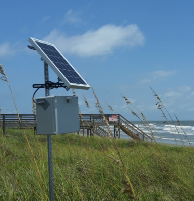
Web Camera Observation Network (WebCOOS)
The Webcams for Coastal Observations and Operational Support (WebCOOS) project is being implemented by SECOORA and its partners with funding from NOAA. The team is developing a webcam coastal observing network for quantitative scientific analysis, public safety, and resource management for coastal municipalities, scientists, and local communities. Web camera data has demonstrated value to address significant gaps in the nation’s ability to monitor and accurately forecast various weather, ocean, ecological and public health hazards.