SECOORA Partners with North Carolina Communities to Install New Water Level Sensors
SECOORA has partnered with North Carolina Public Safety, Beaufort County Emergency Services, and the town of Belhaven to install new water level stations in two flood-prone North Carolina communities.
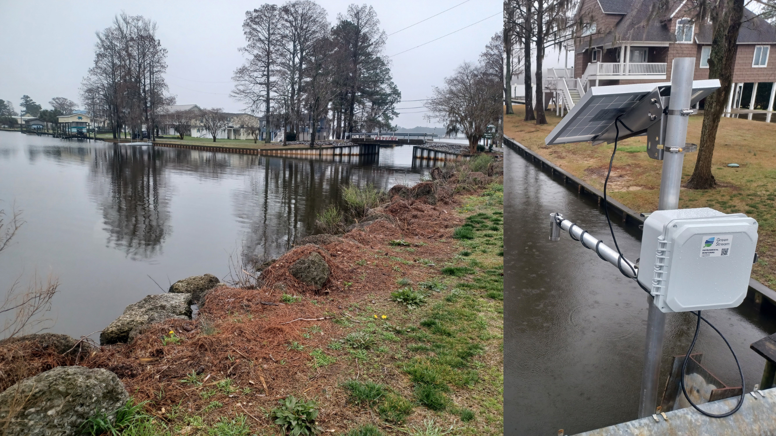
In March 2024, SECOORA installed two new water level stations in Beaufort County, North Carolina. Partners with Beaufort County Emergency Services, North Carolina Public Safety, and NC Sea Grant identified the Bayside Community (within Chocowinity) and the town of Belhaven as two frontline communities in need of flood monitoring. The water level gauges will assist local emergency officials, town managers, and community members with planning and preparing for flooding and inundation events.
Sensors to Support Decisions
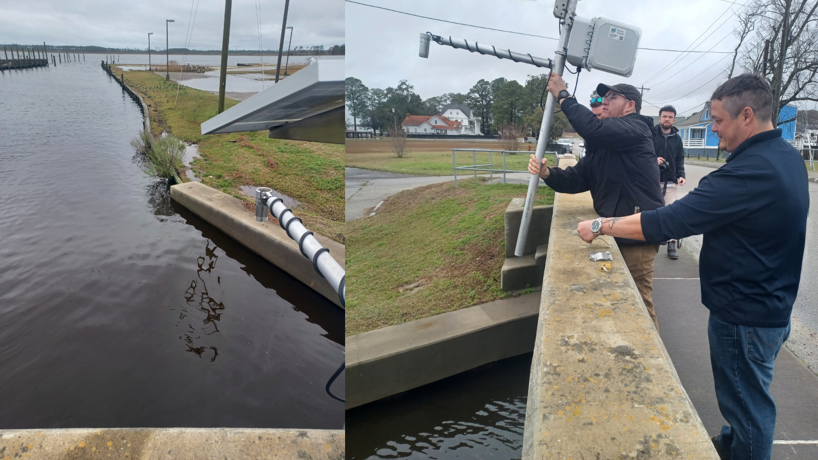
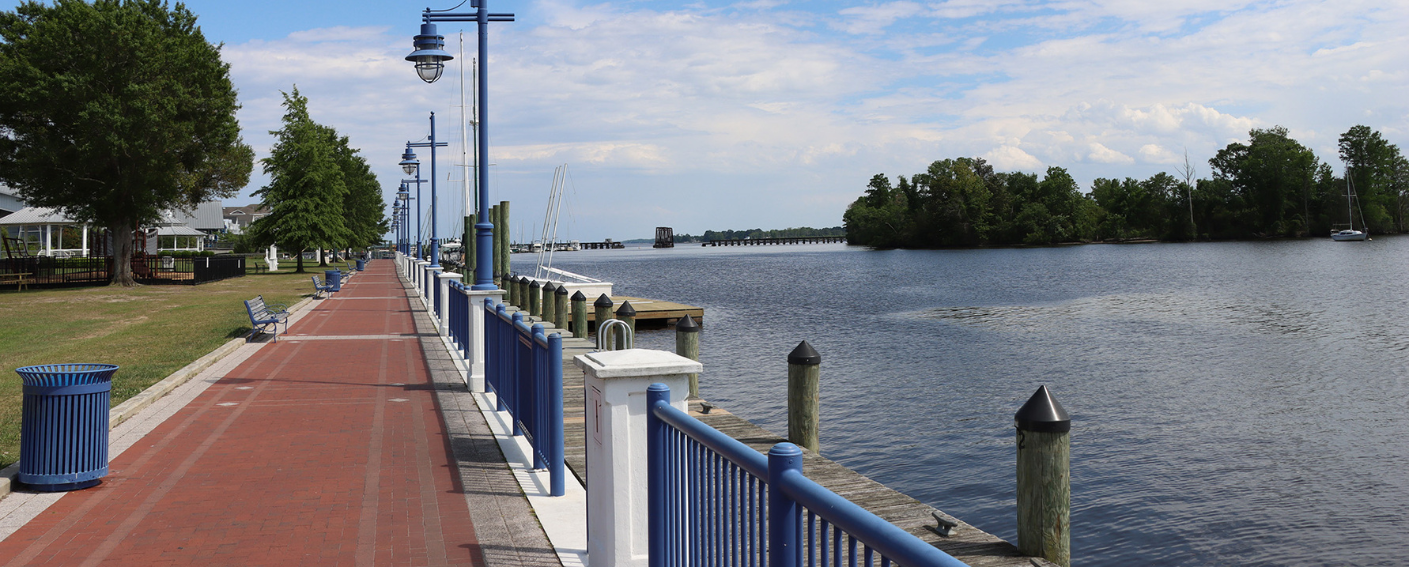
The Bayside community is on a peninsula between Chocowinity Bay and Pamlico River. The town of Belhaven is on the Pungo River and where it diverges into Pungo Creek. Due to their locations, both of these communities are impacted by flooding that results in regular road closures. In some cases, the closures impact the only road access into and out of these communities. The newly installed water level sensors will help emergency management make more informed and proactive decisions to mitigate complications caused by flooding and stay alert to flood hazards.
“Belhaven is no stranger to high water, so our people are resilient. The newly installed gauges will help to anticipate events and know what the water levels actually are. This information will help our citizens plan and prepare much better. We will be able to shift from being reactive to proactive because of these gauges.”
– Lynn Davis, Belhaven Town Manager
The Southeast Water Level Network
SECOORA’s Southeast Water Level Network provides water level sensors to communities within North Carolina, South Carolina, Georgia, and Florida. The goal of the network is to install and maintain low cost water level sensors in flood-prone areas to provide hyper local water level data for proactive decision making. SECOORA works directly with university and community partners to support the maintenance, development, and installation of water level sensors.
“Having water level monitoring stations in Beaufort County is one of the most critical things we can do to prepare our coastal communities. This is an avenue of information that the citizens can see and be alerted on. As a result, these monitors can offer communities the tools to prepare and plan for such incidents in advance. This will strengthen the resiliency of these communities to such impacts in the future.”
– DC Linton, Beaufort County Emergency Management Coordinator
Access the Data
The data can be accessed on SECOORA’s Water Level Data Portal. The Belhaven water level data can be accessed here and the Bayside community water level data can be accessed here. The network provides real-time local water level data to town managers, emergency managers, design engineers, and the public. This data is vital for monitoring coastal flooding and keeping citizens informed of hazardous conditions.
To learn more, please visit SECOORA’s water level webpage. From this page you can also access the Water Level Data Portal to see the nearest station near you!
Related news

Now Hiring: Director of Communications and External Affairs
SECOORA is seeking to fill the full-time role of Director of Communications and External Affairs. This role will serve as the organization’s strategic lead for engagement, communication, and external relations.
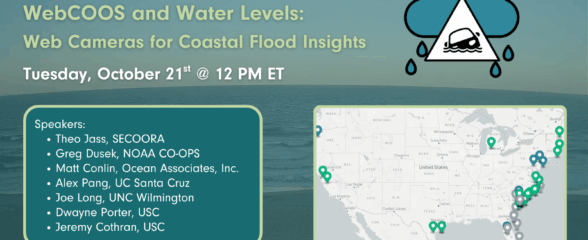
SECOORA Webinar | WebCOOS and Water Levels: Web Cameras for Coastal Flood Insights
On October 21st at 12 PM ET, SECOORA is hosting a webinar with investigators from the Webcam Coastal Observation System (WebCOOS) project team and the WebCOOS Project Manager. Web cameras are a low-cost technology that can be used to document flooding impacts to coastal communities. Register here.
SECOORA Funding Opportunity Announcement: Letters of Intent Solicitation
SECOORA will submit a coordinated regional proposal in response to the anticipated FY 2026 Implementation of the U.S. Integrated Ocean Observing System (IOOS) funding opportunity. Letters of Intent to be considered for inclusion in SECOORA’s full proposal are due September 9, 2025.