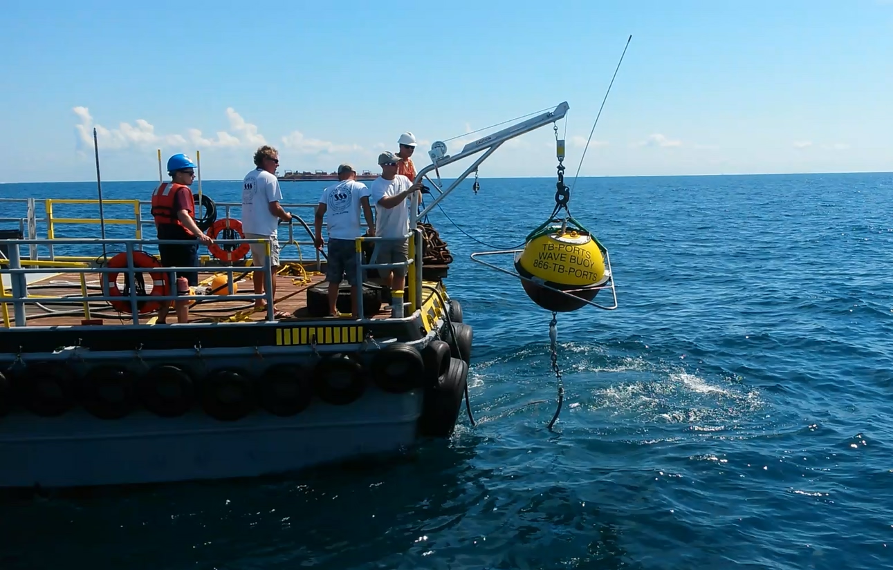
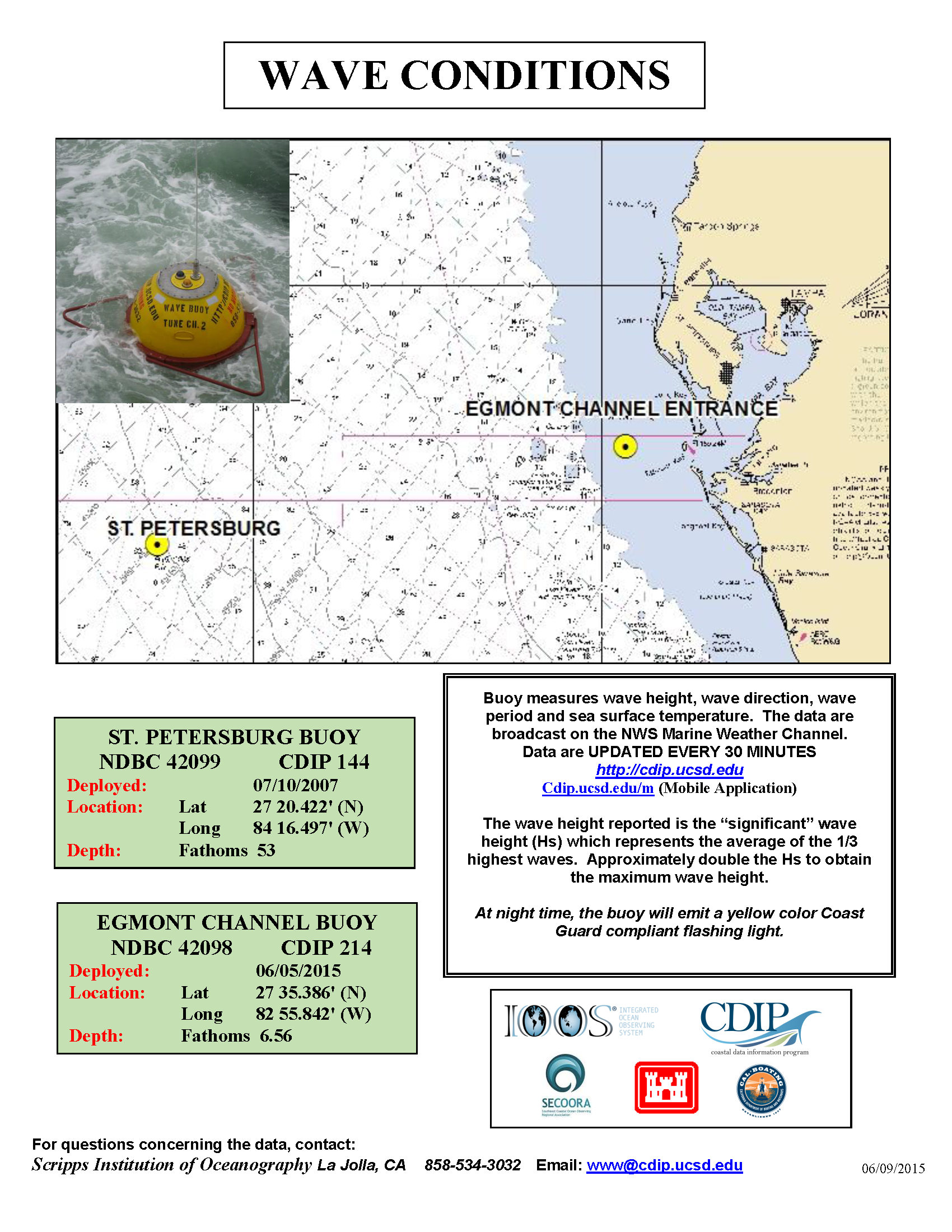
New Waverider Buoy Supports Harbor Pilots
A new Datawell Waverider Mk III wave monitoring buoy (WMO ID 42098) was deployed on June 5, 2015, near the entrance to the Tampa Bay shipping channel. The addition of this buoy to existing NOAA Physical Oceanographic Real Time System (PORTS) infrastructure supports the work of the Tampa Bay harbor pilots based out of Egmont Key, FL. Instruments on the Waverider buoy will provide the pilots with real-time data on wave height, period and direction, critical information to enhance safety as the pilots move between the station and inbound or outbound ships. Data from this buoy and photos of the deployment are available at http://tbports.org.
Funded by the Greater Tampa Bay Marine Advisory Council – PORTS, Inc., the local operator for Tampa Bay PORTS, and operated in collaboration with the University of South Florida College of Marine Science and the Coastal Data Information Program at Scripps Institution of Oceanography (CDIP), funded by the US Army Corps of Engineers, the information also supports broader efforts to monitor and predict waves and shoreline change.
“While the primary beneficiaries of wave data from this buoy are the Tampa Bay Pilots and related shipping interests, the wave information is critical to studies of beach erosion and channel dredging” said Mark Luther, the head of local operations for Tampa Bay PORTS.
All images are credited to Mark Luther, USF CMS
Related news
SECOORA Webinar | WebCOOS and Water Levels: Web Cameras for Coastal Flood Insights
On October 21st at 12 PM ET, SECOORA is hosting a webinar with investigators from the Webcam Coastal Observation System (WebCOOS) project team and the WebCOOS Project Manager. Web cameras are a low-cost technology that can be used to document flooding impacts to coastal communities. Register here.
SECOORA Funding Opportunity Announcement: Letters of Intent Solicitation
SECOORA will submit a coordinated regional proposal in response to the anticipated FY 2026 Implementation of the U.S. Integrated Ocean Observing System (IOOS) funding opportunity. Letters of Intent to be considered for inclusion in SECOORA’s full proposal are due September 9, 2025.

SECOORA Hosts the First Surface Elevation Table (SET) Community of Practice Virtual Workshop
The SECOORA SET Workshop was virtual on July 17, 2025. More than 50 Community of Practice members and stakeholders joined this collaborative workshop to discuss SET monitoring, coastal resilience, and data-driven decision making in the Southeast.