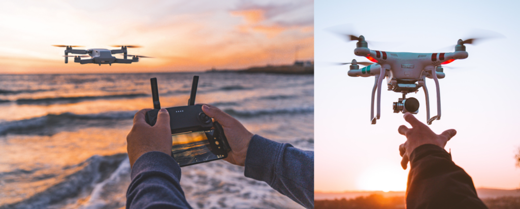
Meet the winners of the Attending Uncrewed Aircraft Systems Science Courses Request for Proposals! These twelve individuals have been selected to participate in three Uncrewed Aircraft Systems (UAS) executive education courses offered by the Nicholas School of the Environment at Duke University. Drones are rapidly-growing components of research, assessment, and monitoring of coastal regions within the U.S. Southeast and the Caribbean. Read below to learn how this valuable knowledge will be applied to each person’s work and research.
Aloyse Abreu

Habitat use and abundance of sea turtles, rays and sharks on Saona Island, Dominican Republic
Aloyse’s research in Saona Island drives her passion to understand the behaviors of sea turtles, rays and sharks that coexist within a mosaic of seagrass, coral reef and mangrove areas. As both an American and Dominican native, she is currently establishing a connection that can help understand how to restore marine ecosystems that depend on these taxa as key species, especially considering that the last study regarding their in-water behavior in this region was conducted 17 years ago. Her specific goals are to 1) quantify relative sighting abundance across the heterogeneous landscape through pre-programmed drone surveys along the site within different time slots, and 2) identify habitat associations of sea turtles, sharks and rays through drone data assessment.
“I look forward to deepening my understanding regarding the application of UAS at a research level in terms of certifications as I work directly with the Ministry of Environment of the Dominican Republic for the permits. I’m also interested in the types of software I can learn to use to get the most out of my collected data from the field!”
Aloyse Abreu
Gina Badlowski

From Fine to Broad Scales: Investigating Coastal Habitat Changes through the integration of Uncrewed Aircraft Systems
Through direct (e.g., extraction or mechanical modifications) and indirect impacts (e.g., changes in disturbance regimes), anthropogenic activities have significantly influenced the structural patterning of coastal and marine habitats across multiple spatiotemporal scales. These structural changes across multiple scales can alter coastal systems’ physical and biological integrity, with unknown consequences to ecological processes, ecosystem functioning, and associated services. Because of this, Gina is interested in exploring a multitude of questions: 1) predicting the foraging movements of consumers in relation to the availability of energetic food sources across the seascape, 2) measuring the fate of seagrass patches at relevant temporal scales (days to months) to construct size-structured models, and project seagrass seascape changes across different environmental scenarios, and many more questions!
“I am genuinely eager about participating in the UAS courses offered by the Nicholas School of the Environment at Duke University as they directly align with my dissertation research ideas and will equip me with the necessary knowledge and skills to effectively employ this cutting-edge tool in studying habitat patterns, ecological processes, and conservation strategies in coastal ecosystems. By gaining this experience and knowledge, I hope to one day introduce it to my future lab when I am a PI.”
Gina Badlowski
Brittany Bankovich
Training for an incipient UAS program at the Florida Fish and Wildlife Conservation Commission
Working as a spatial analyst for the Florida Fish and Wildlife Conservation Commission, Brittany models distribution patterns of fish and wildlife, and helps to identify lands and waters that are conservation priorities. She plans to utilize the knowledge gained in these UAS courses to incorporate higher resolution data into her agency’s projects, saving biologists time and money, and reducing safety risks incurred using traditional field techniques. Projects benefiting directly from this coursework include assessing vegetation management techniques to improve Florida grasshopper sparrow habitat, restoring coastal islands and oyster reefs for American oystercatchers, and population assessments of Florida mottled ducks and wood storks. Brittany hopes to expand this list to include regular use of UASs to monitor additional threatened and endangered species and their habitats, as well as game species populations.
“I am grateful to have been chosen for this opportunity and look forward to learning the latest advancements in UAS technology and data analysis to share with my agency. I hope that meeting classmates from neighboring states with similar conservation goals will spark collaboration efforts on a regional scale.”
Brittany Bankovich
Rachel Banton
Use of Drones to Monitor Fishing Vessel Effort for Applications of Commercial, Recreational, and For-Hire Landings in the US Caribbean
Scientists at the SEFSC hope to use drone technologies to obtain fishing effort by vessel type in the US Caribbean, specifically in St. Croix, where there is currently no established survey to collect this needed fishery-dependent information. This method of data collection would also augment ongoing port sampling efforts and allow us to ground truth other indirect measures of fishing effort including boat trailer and vessel counts at boat ramps and marinas. The collection of these missing data will get the SEFSC that much closer to successful stock assessments for US Caribbean fisheries and subsequent data-driven management advice.
“I am looking forward to taking the UAS courses and learning how to implement the use of drones as a modern, non-intrusive, and cost-effective mode of collecting fishery-dependent data in the US Caribbean. I am also eager to increase my own skill sets and continue my personal mission of being a lifelong learner.”
Rachel Banton

Alyah Bennett
Assessing unoccupied aircraft methods for long-term monitoring of intertidal oyster reefs
Alyah’s project is trying to use remote sensing, specifically drones in order to monitor oyster reefs in northeast Florida. She would like to see if drones can pick up certain measurements that traditional in-situ monitoring cannot pick up. She would also like to see if the drone is able to pick up certain disturbances such as monitoring activities, harvesting impact, and boat wakes. The overall goal of the project is to use drones and traditional monitoring in order to produce an inclusive long term monitoring protocol.
“I am excited to learn about an innovative and emerging technology like drones since I was unaware of the possibilities drones provide for scientific research.”
Alyah Bennett
Beth Darrow
Uncrewed Aircraft Systems for Barrier Island Sustainability
As Chief Scientist at Bald Head Island Conservancy, a conservation nonprofit organization in southeastern NC, Beth plans to use increased UAS training to collect baseline data for Bald Head Island and the Cape Fear region. BHI is threatened by relative sea level rise and frequent hurricanes. Recently, large federal projects have been proposed that may substantially alter geomorphology and hydrodynamics of the Cape Fear River and sustainability of barrier islands in the Cape Fear Region. These include new offshore wind energy leases, proposed use of Frying Pan Shoals as a sand borrow site for beach renourishment, and proposed deepening and widening of the river channel for increased access of larger ships to the Wilmington Harbor. BHI is in need of baseline data on coastal morphology, land cover, and wildlife habitat before further modifications are made. These data can be collected using uncrewed aircraft systems (UAS), an extremely powerful tool for research and monitoring to inform coastal decision-making.
“I am looking forward to learning not just how to fly UAVs and take amazing pictures, but how to analyze geospatial data to provide quantitative information on changes in coastal morphology and plant and animal species abundance to inform natural resource management. Thank you to SECOORA and Duke University for this opportunity!”
Beth Darrow
Lyndsey Davis
Utilizing Unmanned Aircraft Systems (UAS) for Coastal Management in South Carolina and Expanding the UAS Capabilities of the Department of Health and Environmental Control’s Office of Ocean and Coastal Resource Management
Lyndsey serves as a Coastal Services Project Manager within the South Carolina Department of Health and Environmental Control’s (DHEC) Office of Ocean and Coastal Resource Management (OCRM), and the use of UAS technology has become essential in supporting Coastal Zone Management Program initiatives. Lyndsey will apply the knowledge gained through the UAS executive education courses to expand and enhance the state’s use of UAS technology in coastal management, supporting both regulatory and nonregulatory work. Specific applications include mapping beachfront and tidelands areas, ensuring structures and mariculture operations are built in compliance to their issued permit, responding to complaints of critical area impacts, monitoring restoration efforts, and collecting aerial imagery for outreach and educational videos. Lyndsey will also use the knowledge to train colleagues, improve upon DHEC’s statewide drone program, and enhance collaborations with other state and regional agencies.
“I am excited about the opportunity to participate in the three UAS science courses to enhance my knowledge of UAS capabilities and applications in environmental science, learn how to best apply the technology to my agency’s mission, and expand the use of UAS technology in coastal South Carolina. The knowledge gained will increase my confidence in performing UAS operations, prepare me to plan and execute more complex science missions, and help me educate and inform my colleagues at DHEC and other state agencies.”
Lyndsey Davis
Katie Luciano
Applied UAS for Coastal Geomorphology and Salt Marsh Mapping Research in South Carolina
As a Coastal Geologist with the South Carolina Department of Natural Resources (SCDNR) – Geological Survey, Katie investigates the dynamics of landforms that can physically shift with a single storm or tide. The courses will assist Katie in understanding the fundamentals of UAS-derived datasets as well as the logistics of operating UAS for research purposes. Ultimately, her goal is to integrate UAS data collection into existing projects including a state-wide surface elevation table (SET) salt marsh monitoring network, and future marsh migration research. Learning how to collect data from UAS will also enhance short-term response capabilities for mapping geomorphic features following storms, such as washover deposits on barrier islands.
“The courses will help lay the groundwork for my plans to become FAA Part 107 certified for small drone operation. I’m excited to learn more about drone operation and how analytical applications of the data can benefit ongoing research projects.”
Katie Luciano
Reilly Maguire
Uncrewed Aircraft Systems – The Future for Mote Marine Laboratory Ocean Research
In the Ocean Technology program at Mote Marine Laboratory, they aim to enhance understanding of the expanding applications of various technologies in scientific research. With 27 diverse research programs at Mote, their primary objective is to support each of these programs by enhancing data collection and analysis capabilities. By completing these courses, Reilly can help better align the program with the requirements of other initiatives, fostering opportunities for new ideas and innovations. This aligns with Mote’s mission of advancing marine research, conservation, and education.
“I’m enthusiastic about enrolling in these courses to enhance my skills and knowledge in scientific drone flight. As an engineer, the curriculum will provide insights into utilizing UASs to advance my colleagues’ research while applying my technical expertise in a scientific context. Additionally, the courses will enhance my proficiency in UAS data analysis and effective data communication.”
Reilly Maguire
Joseph McGuinn

Using Drones to Further Knowledge and Research of Microphytobenthos in South Carolina’s Coastal Wetlands
Joseph aims to use the knowledge gained from these courses to further research in the remote sensing and forecasting of Harmful Algal Blooms in South Carolina. His intent with a MS in Geography is to blend the study of microphytobenthos distribution with remote sensing skills, particularly using GIS software and drone-acquired aerial photography of mudflats at intertidal coasts. Joseph hopes to use this research to create models of algae distribution, which would be used in forecasting harmful algal blooms. Recent literature indicates the applicability of drone-collected orthoimagery and point cloud in mapping HABs in high spatial scales. Already, Joseph and professors at the University of South Carolina have begun research talks and preliminary drone flight plans for image data collection in the North Inlet Estuary, Georgetown, SC. It is here where the knowledge gained from the UAS courses being offered with SECOORA would be invaluable. Courses where one can experience hands-on data from drones and draw conclusions about patterns in the environment are necessary for the type of research being done at USC.
“Remote sensing and UAS technologies are the future of Geography research. These
Joseph McGuinn
courses offered by Duke and SECOORA are valuable opportunities for me to learn practical data analysis skills. These skills will be applied to further my knowledge of harmful algal blooms and provide valuable research for South Carolina.”
Camilo Roa

Integrating UAVs into a health monitoring system of Biscayne Bay
Recurring incidents like fish kills, algal blooms, and sewage leaks have drawn the attention of the community and the state about the health of Biscayne Bay, in South Florida. Nutrient runoff, limited water circulation, and increasing water stagnation have raised concerns about the economic and ecological consequences of vital ecosystems. At the Institute of Environment at Florida International University, they are implementing a monitoring system for the Bay capable of rapidly sampling, sensing, and widely disseminating information regarding water quality conditions, and relevant levels of harmful algal bloom (HABs) and their toxins. The system, funded by a Florida Department for Environmental Protection (FDEP) grant, consists of a networked array of buoys, fixed platforms, and autonomous surface vehicles (ASVs). They would like to expand the system to include unmanned aerial vehicles (UAV) in the next phases. In addition, they recently constructed an NSF funded motion capture facility. The system was designed to visually record underwater, surface, and aerial vehicles and analyze their motion patterns and hydro and aerodynamics. These two projects, and potentially many more, could benefit from data gathered by UAVs with trained pilots from the SECCORA courses.
“You cannot heal what you cannot see. We are implementing a health monitoring system for our aquatic environments. UAVs are fundamental for rapid assessment and covering of large areas. These courses will expand our surveying capabilities so we can see further and collect actionable information.”
Camilo Roa
Deanna Webber
Drone Applications to Monitor Impacts of Sargassum Seaweed Inundation in Florida
Duke University’s Uncrewed Aircraft Systems or drone education courses will allow the inclusion of data collected from drones in harmful algal bloom research on macroalgae such as Sargassum and water quality. Therefore, this research will advance the mission of Harbor Branch Oceanographic Institute (HBOI) to preserve marine environments through understanding water quality and macroalgae dynamics. With the skills from Duke University’s drone education courses, Deanna will implement drones in capturing aerial imagery of pelagic Sargassum mats, correlate these images to satellite imagery, and be able to track correlations between Sargassum mats and water quality.
“I am very eager to attend Duke University’s UAS courses and to be sponsored by SECOORA. As an aspiring marine biologist and algologist, I am excited to learn more tools that can allow me to survey the marine environment. I look forward to learning new, accurate ways to collect data from the ocean.”
Deanna Webber
Related news

Claire McGrath Joins SECOORA as Program and Development Manager
SECOORA welcomes Claire McGrath as Program and Development Manager, supporting the Southeast & Caribbean Coastal Disaster Resilience Partnership and membership growth.

Spotlight: Mobilizing to Save Florida’s Coral Reefs
Learn how scientists are racing to save Florida's Coral Reef through coral rescue, gene banking, reef restoration, and innovative conservation efforts after disease and marine heatwaves devastated one of America's most important marine ecosystems.

From a Whale’s Song to an Ocean’s Symphony: How AI Decodes Underwater Sound
Explore how SECOORA-funded research is using AI and machine learning to decode ocean soundscapes, detect boat noise, and support coral reef restoration efforts.