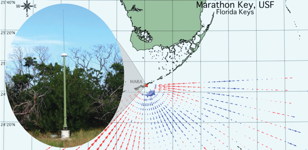
Figure 1. High frequency radars (HFR) are land-based systems that measure the speed and direction of ocean surface currents in near real-time. Pictured above is the newly deployed HFR receive antenna, location and measured data coverage.
A new High Frequency Radar (HFR) was installed near Marathon, Florida to study the Gulf of Mexico Loop Current System by the University of South Florida’s Coastal Ocean Monitoring and Prediction System (USF COMPS), in cooperation with Rutgers University and the University of Miami.
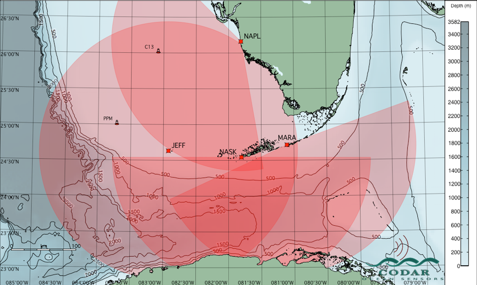
Figure 2. Picture of the three High Frequency radars and their projected radial coverage. When the surface current data from the three HFRs are combined, the project team will be able to provide real-time surface current maps within the Straits of Florida.
This new Marathon site is the first of three CODAR HFRs that will be deployed in the lower Florida Keys area. It was installed at Curry Hammock State Park in the Florida Keys, near Marathon, and has been operating since December 20, 2019..
This project is funded through an award from the National Academies of Sciences, Engineering, and Medicine Gulf Research Program (NAS-GRP). NAS-GRP funds long-term research projects to improve the understanding and prediction of the Gulf of Mexico Loop Current System. The project team is part of a larger Gulf of Mexico Loop Observing Partnership (LOOP) including Texas A&M University, the University of Southern Mississippi, and GCOOS.
Plans are underway to install a second HFR in Key West, Florida and a third in the Dry Tortugas National Park. These two HFRs are currently in the permitting stage with deployment anticipated before the end of 2020.
When the surface current data from the three HFRs are combined, the project team will be able to provide real-time surface current maps within the Straits of Florida.
Cliff Merz, lead Principal Investigator from USF COMPS, notes that “consistent data products from each of these three HFRs, when combined with other real-time observations, will provide valuable insight and enable a better understanding of the complex and variable surface outflow regions of the Loop Current System through the Straits of Florida.”
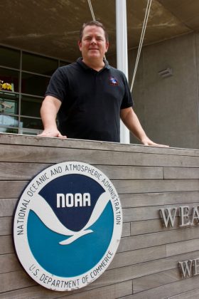
The complexity and importance of better understanding the ocean surface was supported by Chip Kasper, Meteorologist-in-Charge at the Florida Keys National Weather Service (pictured right), who indicated that “surface ocean currents, when they oppose wind-driven waves, act to increase both wave height and steepness, potentially creating hazardous conditions for mariners. Having knowledge of surface ocean current speed and direction from the project’s HFRs will improve the quality of NOAA/National Weather Service short-term weather and ocean warnings and forecasts in the maritime domain, and the decisions and actions by NOAA partners they support (like the U.S. Navy Port Operations and Florida Fish and Wildlife Conservation Commission law enforcement activities).”
USF COMPS operates six HFRs, deployed along Florida’s west coast and the Keys, as well as an array of offshore buoys and coastal stations. USF COMPS provides the HFR data from all of their stations to SECOORA and to the NOAA Integrated Ocean Observing System Coastal Observing Research and Development Center (CORDC), where it is integrated into ocean models that support important stakeholder issues such as increased boater safety, U.S Coast Guard Search and Rescue operations, and oil spill and harmful algal tracking within the Gulf of Mexico.
Data Made Possible By
The HFR installation is made possible by many partnerships. Thank you to Curry Hammock State Park, Florida Institute of Oceanography’s Keys Marine Laboratory, CODAR Ocean Sensors, Arlington Electric South, Inc. and Keys Community Construction, LLC for providing support for the project.
To learn more, please contact Dr. Merz at cmerz@usf.edu.




PS – If you are interested in HFR Data, SECOORA’s is seeking students and early career professionals to create tools that use archived SECOORA HFR data. There are two $3500 prizes. Proposals are due May 15, 2020. Click here to read more.
Related news
Abbey Wakely Joins SECOORA as Director of Communications and External Affairs
SECOORA welcomes Abbey Wakely as their new Director of Communications and External Affairs, where she will lead strategic engagement, communications, and external relations to strengthen the organization’s regional impact.

SECOORA Request for Proposals for a Data System Development, Operations, and Maintenance Service Provider
SECOORA seeks a Data System Development, Operations, and Maintenance (DMAC) service provider to act as a strategic partner while maintaining the current SECOORA Data System. Proposals are due to SECOORA by 5:00 PM ET, March 31, 2026.

Plankton Perfect: Using Imagery to Document Microscopic Marine Life
Dr. Enrique Montes is working to understand how plankton respond to changes in the ocean by capturing high resolution imagery with advanced technology. This work is funded by the Marine Biodiversity Observation Network (MBON) to use novel techniques like the Continuous Particle Imaging and Classification System (CPICS).