
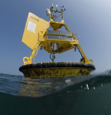
Southeast Water Level Network
Real-time water level sensors measure the height of the water so that communities have quick access to data to help with decisions related to flooding and tidal changes. Access SECOORA stations and sensors deployed by partners, state agencies, or individual communities in the southeast.
Webcam Coastal Observation System (WebCOOS)
The WebCOOS project is being implemented by SECOORA and its partners with funding from NOAA. Web cameras are a low cost coastal observing platform transforming how environmental monitoring is conducted. Web camera data has demonstrated value to address significant gaps in the nation’s ability to monitor and accurately forecast various weather, ocean, ecological and public health hazards.
Estuarine Soundscape Observatory Network in the Southeast (ESONS)
Estuarine Soundscape Observatory Network in the Southeast (ESONS) utilizes passive acoustic recorders that allow continuous and long-term sampling of the underwater soundscape. These recordings provide information on the behavior of marine life and noise levels associated with human activity.
Text A Buoy
Need quick access to your favorite buoy data? Get that data delivered directly to your phone by text message. Send a text message to (843) 603-8559 with the station “key” from this table. This is a free service from SECOORA. Standard message rates from your carrier may apply.
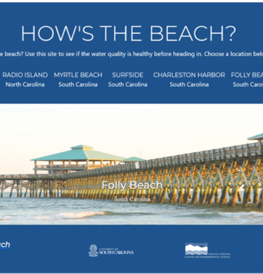
How's The Beach
Did you know bacterial levels at some swimming beaches and recreational waters are a public health concern? “How’s the Beach?” makes daily forecasts of bacteria conditions for Nags Head, NC, the Grand Strand and Charleston, SC, and Sarasota, FL. These forecasts do not represent swimming advisories; however, they do provide the public with information on beach water quality.
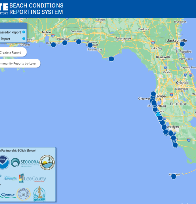
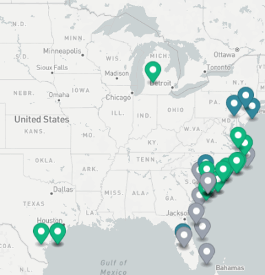
Beach Conditions Reporting System
The Beach Conditions Reporting System by Mote Marine Laboratory provides condition reports for beaches and coastal recreation areas. This citizen-science program is supported by volunteer Beach Ambassadors that undergo training to make accurate condition reports. Community members can also submit reports that are validated by other users. There are several sites located along the east and west coasts of Florida, South Carolina, North Carolina, Georgia, and the Gulf coast.

ShellCast
ShellCast is a weather forecasting system created by Dr. Natalie Nelson and her team at North Carolina State University to alert shellfish growers about predicted lease closures using rainfall predictions from the National Weather Service to allow growers time to prepare. Predictions cover shellfish waters along the North Carolina, South Carolina, and Florida coasts.
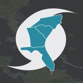
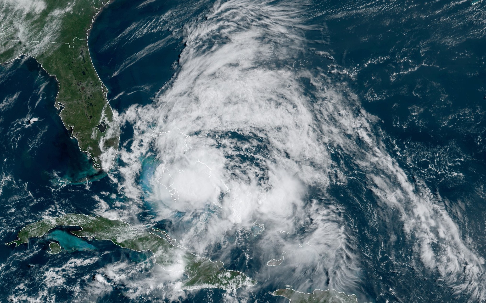
Eyes on the Storm
Eyes on the Storm is an interactive portal that connects you to live and past hurricane and tropical storm data. The tool pulls data from within 50 miles of a hurricane’s path and showcases the highest wind speeds and wave heights and lowest barometric pressure.
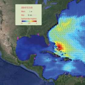
Fully Coupled Air-Sea-Wave Nowcast and Forecast
The Coupled Northwest Atlantic Prediction System (CNAPS) is a three-dimensional marine environment nowcast and forecast system developed by the Ocean Observing and Modeling Group at North Carolina State University. This fully coupled ocean circulation, wave, and atmosphere model predicts ocean conditions based on real-time observations and computer programs.
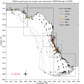
West Florida Coastal Ocean Model
For West Florida, access short-term (4.5 day) harmful algal bloom (HAB) trajectory forecast that is provided by the University of South Florida College of Marine Science. The forecast is based on the nowcast/ forecast West Florida Coastal Ocean Model (WFCOM). Results are provided for both the surface and the near bottom waters. The two results differ due to water movement. Water movement is important to show where red tide may be transported.
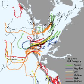
Tampa Bay Circulation Model
For the Tampa Bay Coastal region, access the short-term (4.5 day) HAB trajectory forecast that is provided by the University of South Florida College of Marine Science. The forecast is based on the high resolution nowcast/forecast Tampa Bay Circulation Model (TBCOM). Results are provided for both the surface and the near bottom waters. The two results differ due to water movement. The TBCOM offers more detail by virtue of higher spatial resolution.
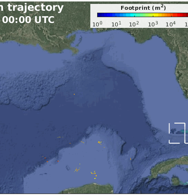
Sargassum Tracking for the Gulf, the Straits, and East Coast of Florida
A Sargassum short-term trajectory forecast product has been developed by combining satellite imagery with numerical models. Once a bloom is detected through remote sensing, its location and time information are used to initialize a trajectory model, and the patch is tracked by the simulated ocean currents.
Unified Water Level (Storm Surge) Forecast Guidance Product
This water level forecast guidance product is derived from three numerical models: the West Florida Coastal Ocean Model (WFCOM), the Tampa Bay Coastal Ocean Model (TBCOM), and the East Florida Coastal Ocean Model (EFCOM), all configured to perform realistic simulation of coastal ocean circulation and run as automated nowcast/forecast systems that updates daily.