ROFFS™ has analyzed the ocean conditions directly before and after Florence along the east coast of the United States from northern Florida to Virginia. They focused mainly on the Sea Surface Temperature and Ocean Color/Chlorophyll data. Of note, they used the exact same color palettes for direct comparisons. Hurricane Florence officially made landfall on the morning of Sept. 14, 2018.
Sea Surface Temperature (SST) Comparison
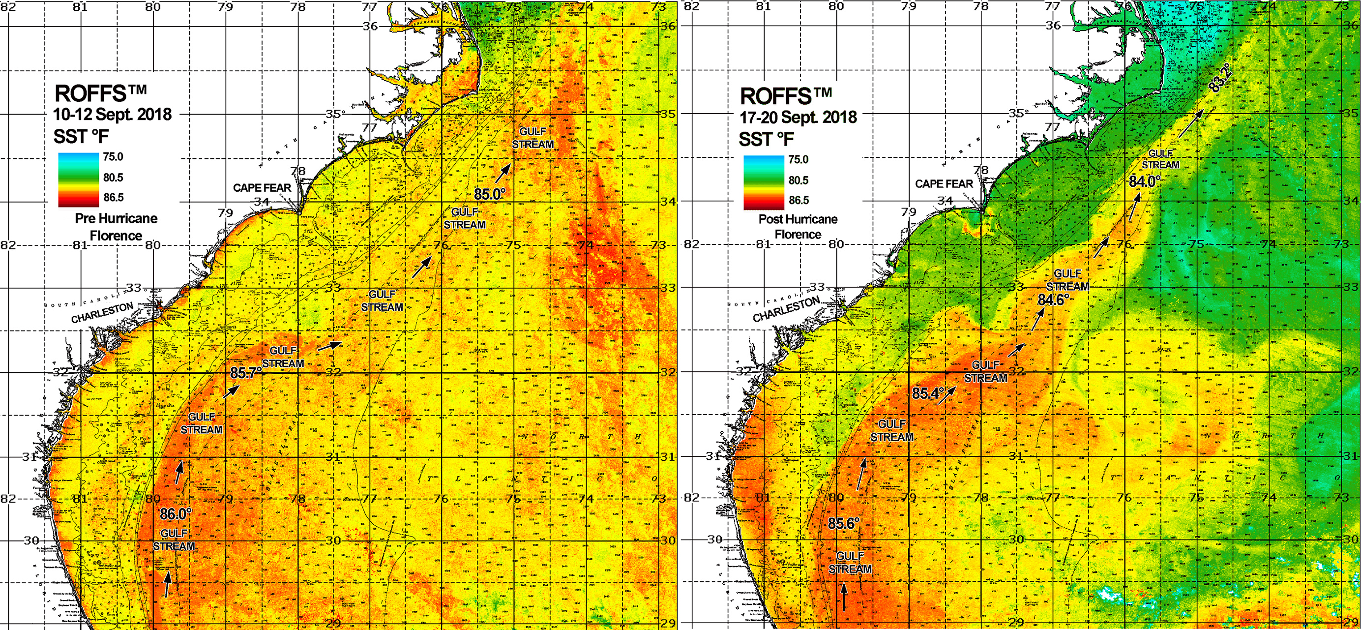
Before images on the left and after images on the right.
One can see in the SST images that the inshore and offshore temperatures dropped between 2.0°F to 4.5°F east of North Carolina and South Carolina after the hurricane, while the core of the Gulf Stream dropped approximately 0.5°F to 1.0°F overall. Notice in the SST post hurricane image (right), you can see the signal of the cool then warm ring of fresh water outflow from the Cape Fear River.
Ocean Color/Chlorophyll Comparison
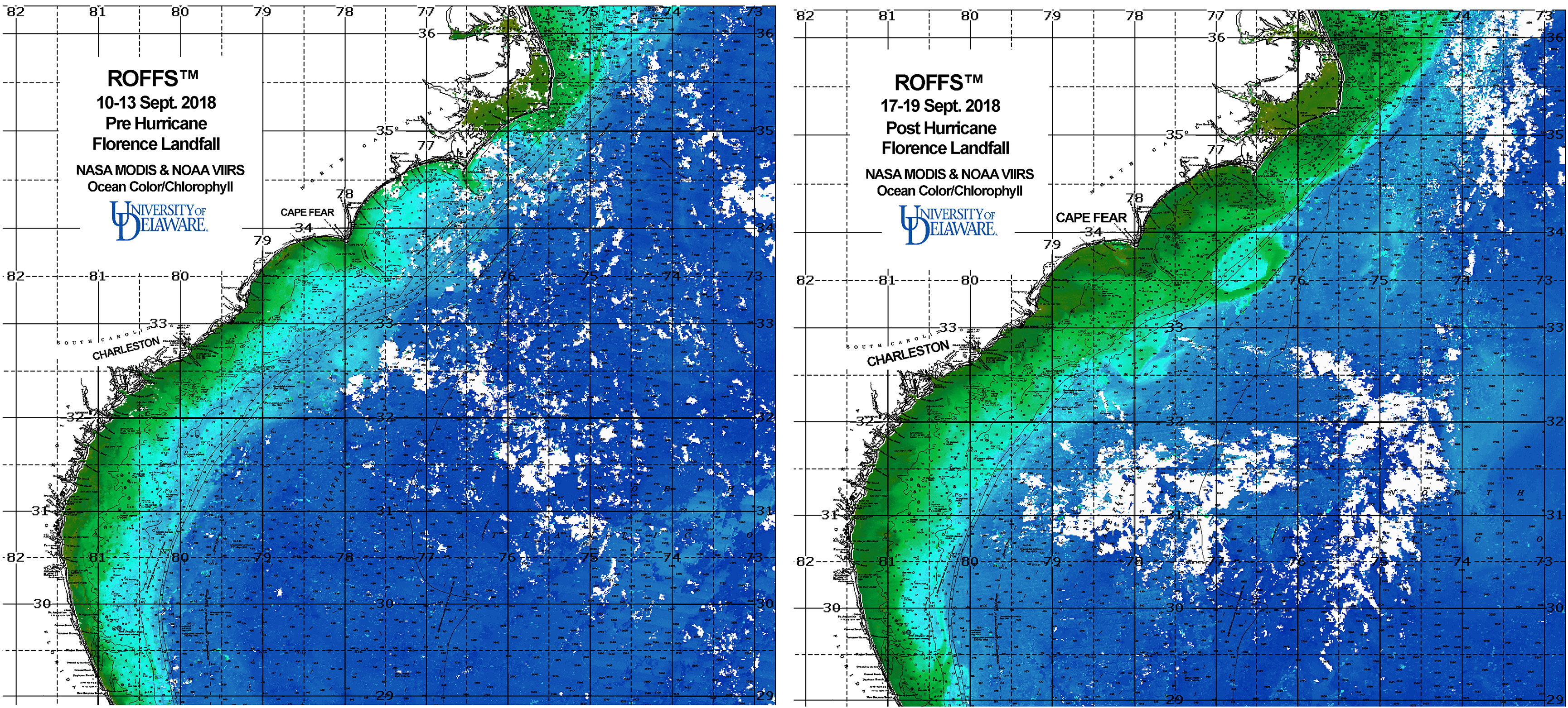
Before images on the left and after images on the right.
There is also a significant difference in the ocean color/chlorophyll images. The post hurricane image shows the signal of the greener to brown-green more turbid waters near the coast and the freshwater greener water coming out of the inlets and rivers specifically east of South Carolina and North Carolina. Overall, you can see the water from near shore to the Gulf Stream to way offshore has a much greener and less blue of a signal due to both wind mixing and freshwater plumes from inland flooding coming into the ocean. There is evidence of the river and inlet outflow already getting entrained within the Gulf Stream and pushing offshore and in a general northeast direction. Please contact ROFFS™ for further information or for tracking the polluted freshwater outflow plumes.
Story courtesy of ROFFS™ (see original).
Related news

SECOORA Webinar: Collaborative Fisheries with a SMILE (Size Matters: Innovative Length Estimates)
On Tuesday, June 24th at 12 PM ET, Dr. Jennifer Loch from Reef Environmental Education Foundation (REEF) will discuss the SMILE (Size Matters: Innovative Length Estimates) project as part of SECOORA's Coastal Observing in Your Community Webinar Series.

Funding Cuts to NOAA IOOS Will Hurt the Southeast
Proposed federal funding cuts would eliminate the IOOS Regional Observations budget for next year. Contrary to the budget Congress has already approved for this year, the Executive Branch wants these proposed cuts to go into effect in 2025.
SECOORA Webinar on the Rapid Intensification of Hurricane Ian: Warm Subsurface Water on the Wide Continental Shelf
Join us Thursday, April 24th at 12 PM ET for the April installment of the SECOORA Coastal Observing in Your Community Webinar Series! This month, we will hear from Dr. Yonggang Liu from the University of South Florida. He will discuss his research on the rapid intensification of Hurricane Ian in relation to anomalously warm subsurface water on the wide...