
Ongoing
Develop a Surface Elevation Tables (SETs) Inventory, Gap Analysis, and Community of Practice
SETs are used to measure the changes in elevation of wetlands, such as coastal marshes. SETs, once a long-term record has been established, help determine if a marsh is retaining enough sediment to keep up with sea level rise or if it is being “drowned”. This funding will support a coordinator to develop a comprehensive regional inventory of SET stations for the region, conduct a gap analysis, and formalize a community of practice (CoP) focused on sharing best practices and creating new knowledge around the data and its applications.

Support and Expand the Drone Community of Practice
Uncrewed Aircraft Systems (UAS), or drones, are a rapidly growing component of research, assessment, and monitoring of coastal regions within the U.S. Southeast and the Caribbean. A Drones in the Coastal Zone CoP has been established to continue supporting the sharing of knowledge and best practices related to the use of drone technologies to support coastal research. This funding will support a web page for the effort, a workshop, and a competition for winners to attend a 3-part UAS executive education course offered by the Nicholas School of the Environment at Duke University to build capacity in the region for implementing the technology and understanding the data.
Support to the Southeast & Caribbean Disaster Resilience Partnership
Support to the Southeast & Caribbean Disaster Resilience Partnership to enhance connections with state coastal zone managers. This strategic collaboration seeks to cultivate deeper relationships, streamline information sharing, and implement coordinated measures to strengthen the region’s preparedness and resilience against disasters.
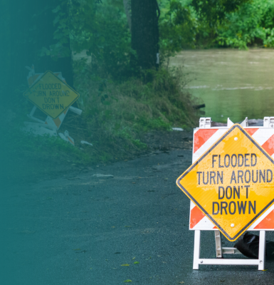
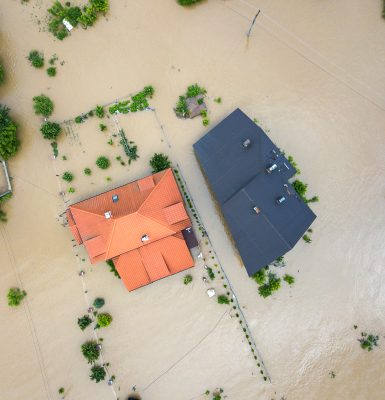
Increasing Water Level Data in the Southeast
Coastal communities throughout the southeast U.S. face threats from high tide flooding, storm surge, and sea-level rise. Flooding can impact daily commutes, emergency planning efforts during tropical storms and hurricanes, and strains public works infrastructure. New water level sensors are being installed in coastal communities that are facing these flood threats. SECOORA’s regional water level network will provide localized flooding alerts and support longer-term sea-level rise monitoring in North Carolina, South Carolina, Georgia, and Florida. The funding from the data sharing program is being used specifically to focus on engaging underserved communities in the water level project.
Completed
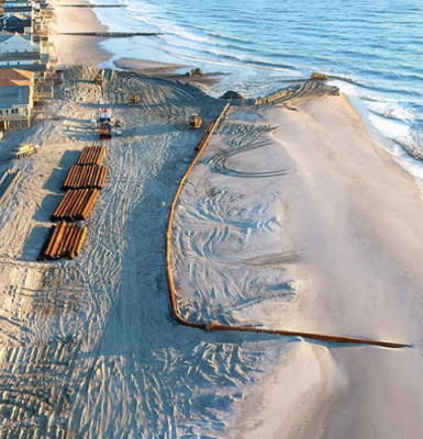
Provide Access to Southeast Sand Management Resources
Lead Principal Investigator: Mary Conley, The Nature Conservancy
Sand is a valuable resource for local beaches and it provides valuable habitat for a range of species, both on land, and underwater. The Sand Management web page provides an overview of socio-economic and ecological value of sand resources as well as user-friendly access to existing sand data sources at the state, federal, and local scale.
Sand is a valuable resource for local beaches and it provides valuable habitat for a range of species, both on land, and underwater. The Sand Management web page provides an overview of socio-economic and ecological value of sand resources as well as user-friendly access to existing sand data sources at the state, federal, and local scale.
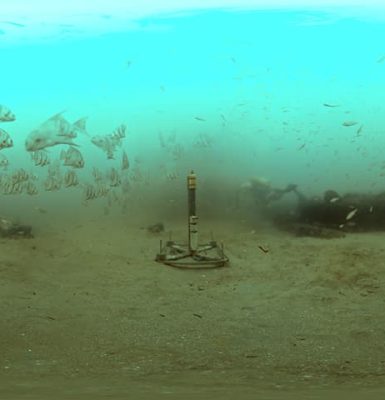
Incorporating Acoustic Telemetry Data Into Coastal Management
Lead Principal Investigator: Dr. Joy Young, FACT Network
The FACT Network uses acoustic telemetry and other technologies to better understand and conserve our region’s important fish and sea turtle species. Acoustic telemetry is an increasingly useful resource, however, few analytical tools exist to transform the data into usable outputs. A new data visualization tool, Data Visualization Tool (DaViT), based on FACT Network observations is illustrating changes in marine species diversity over time.
The FACT Network uses acoustic telemetry and other technologies to better understand and conserve our region’s important fish and sea turtle species. Acoustic telemetry is an increasingly useful resource, however, few analytical tools exist to transform the data into usable outputs. A new data visualization tool, Data Visualization Tool (DaViT), based on FACT Network observations is illustrating changes in marine species diversity over time.
Image Credit: NOAA National Ocean Service
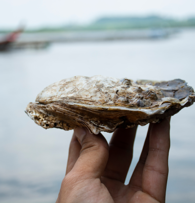
ShellBase - Southeast Shellfish Water Quality Database
Lead Principal Investigator: Dr. Natalie Nelson, North Carolina State University
Individual states across the Southeast collect water quality data to monitor shellfish habitats, but a lack of standardization across datasets makes monitoring long-term environmental trends difficult. The project synthesizes bacteriological monitoring data from the states in the region in a single location online called ShellBase. Using standardized database and metadata structures, ShellBase offers an accessible record of bacterial water quality data for the Southeast’s shellfish waters.
Individual states across the Southeast collect water quality data to monitor shellfish habitats, but a lack of standardization across datasets makes monitoring long-term environmental trends difficult. The project synthesizes bacteriological monitoring data from the states in the region in a single location online called ShellBase. Using standardized database and metadata structures, ShellBase offers an accessible record of bacterial water quality data for the Southeast’s shellfish waters.
Support Enhancement of the Southeast Marine Mapping Tool
Lead Principal Investigator: Mary Conley, The Nature Conservancy
The Nature Conservancy developed the Southeast Marine Mapping Tool, a tool that allows decision makers to draw from the best available regional data when making ocean planning decisions. The tool, initially designed to aid state and local agencies as they make decisions about wind energy projects, can also guide sustainable ocean activities and development, such as conservation efforts or siting of artificial reefs, the installation of undersea electrical transmission cables, or dredging sand to nourish beaches.
The Nature Conservancy developed the Southeast Marine Mapping Tool, a tool that allows decision makers to draw from the best available regional data when making ocean planning decisions. The tool, initially designed to aid state and local agencies as they make decisions about wind energy projects, can also guide sustainable ocean activities and development, such as conservation efforts or siting of artificial reefs, the installation of undersea electrical transmission cables, or dredging sand to nourish beaches.