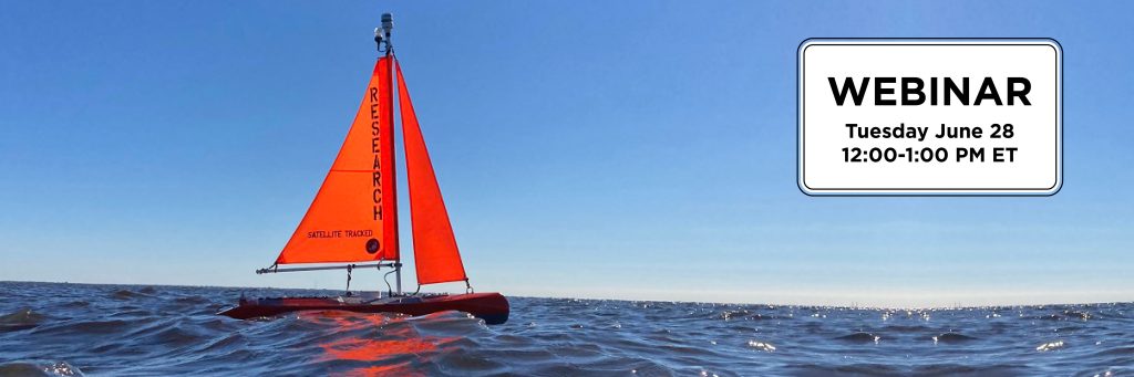
Join SECOORA for a webinar on June 28 at 12:00 PM ET presented by Scott Duncan, Navocean, and Veronica Ruiz Xomchuk, Florida Atlantic University. They will be presenting the results from a year long project that deployed Vela (a self-navigating sailboat fitted with several sensors) to better understand the onset, development, and die-off of harmful algal blooms (HAB) in Lake Okeechobee.
Click here to reserve your spot for the June 28 at 12:00 PM ET webinar.
Abstract
Vela, a self-navigating sailboat fitted with several sensors to monitor the surface, patrolled the northern portion of Lake Okeechobee during the entire year in 2021 as part of an effort to better understand the onset, development and die-off of harmful algal blooms (HAB).
Vela was fitted to transmit data in near real-time to respond with field checkups when high values of chlorophyll and phycocyanin were detected (pigments characterizing HABs) or adjust the route to explore data ‘hot spots’ in greater depth. The sailboat patrolled the lake during all weather conditions collecting other HAB-related parameters, including turbidity (backscatter), temperature, conductivity, dissolved oxygen, and atmospheric conditions above the surface. Vela was also equipped with an ADCP to monitor the 3-dimensional velocity structure of the water column.
After a year of measurements (287 operational days), more than 4 million data points per variable at a very high spatial and temporal resolution were collected.
Overall, blooms were detected as early as February while missed by the regular monitoring program. Furthermore, the large fluctuations observed in the recorded pigment data are much more complex than those captured by stationary continuous monitoring sensors. This is a clear indication that the spatial structure in the lake has significant variability and that single-point monitoring, even at high frequency, is not enough to characterize the evolution of HABs in the lake.
Spatial patterns from a continuously moving platform are challenging to interpret, but it was found that projecting the path onto transects into a space-time plane gave enough resolution to identify events of bloom formation, displacement or growth, and dissipation. The patterns obtained with Vela complement lake-wide observation from satellite-derived products, as we could gather data independently of weather and cloud coverage.
There will be discussion of the complexity of fluorometric measurements and sensor sensitivity in a very turbid environment and the challenges/benefits of utilizing an autonomous surface vehicle in this environment.
Click here to reserve your spot for the June 28 at 12:00 PM ET webinar.
About the Presenters
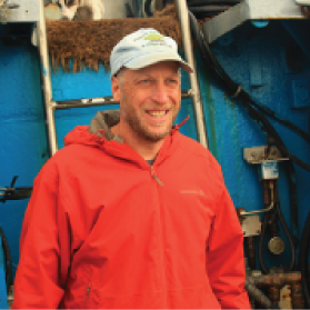
Scott Duncan has over 20 years of experience with design and fabrication of custom Automated Surface Vessels (ASVs) for ocean data collection. In 2000 he designed and built the first Navocean sail-powered prototype, the “mini-Nav I”, as a proof-of-concept for the University of Washington Applied Physics Laboratory (APL). He went on to develop numerous ASV prototypes of both sail-powered, electric propeller driven, and hybrid designs. Scott founded Navocean Inc in 2016 to pursue further development and application of the Nav2 Sail and Solar ASV for Ocean Data Collection.

Veronica Ruiz Xomchuk is a Senior Research Fellow at Harbor Branch Oceanographic Institute. She received her PhD in Oceanography from Texas A&M in 2020. As a postdoctoral research data scientist, she has been responsible for data flow and analysis for the Harmful Algal Bloom Assessment of Lake Okeechobee (HALO) project, including model, in-situ monitoring and remote sensing data.
Click here to reserve your spot for the June 28 at 12:00 PM ET webinar.
Related news

Funding Opportunity: Accepting Applications for 2026 Vembu Subramanian Ocean Scholars Award
Established in memory of Vembu Subramanian, this award supports the next generation of ocean professionals through mentorship, networking, and meaningful engagement at our Annual Meeting. Applications are due April 21, 2026.
2026 SET Community of Practice Workshop
The SECOORA Surface Elevation Table (SET) Community of Practice will convene for its 2026 in-person workshop on July 16 – 17, 2026, in Charleston, South Carolina.
Board Nominations Now Open
Nominations are now open for the 2026 Board of Directors election. Help shape the future of coastal ocean observing by submitting materials by April 10, 2026 at 5 PM ET.