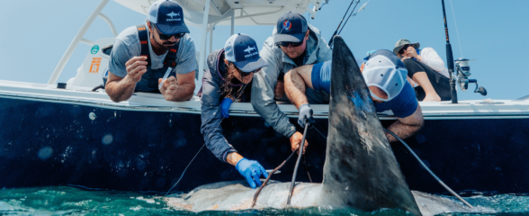
Glider Released off Southeast Coast
A glider has been deployed off the Atlantic coast of Florida with the mission to detect hotspots of reef fish activity in and around marine protected areas using funding provided by NOAA’s Southeast Fisheries Science Center (SEFSC).
 The University of South Florida’s Teledyne Webb Research Slocum Glider is equipped with a sensor suite, including two passive acoustic recording systems developed by Loggerhead Instruments and a Vemco VMT tag receiver provided by the Ocean Tracking Network at Dalhousie University. Post-mission analysis of the passive acoustic recordings will be conducted by Loggerhead Industries. The resulting data sets will be used to augment NOAA Fisheries SEFSC and NOAA Ocean Service (NCCOS) collaborative research on reef fish spawning aggregations and will contribute to their coral reef fish monitoring programs.
The glider will travel north along the continental shelf edge using the Gulf Stream to transport it until it reaches South Carolina, where the glider will attempt to transit onshore to about the 50m isobath. The remainder of the mission will entail traversing along shore in the Edisto and North Charleston Marine Protected Areas. For this effort, navigation is primarily being assisted by the utilization of the regional-scale nowcast/forecast ocean modeling system developed at North Carolina State University, as well as the region’s HF Radar. The resulting data sets will be provided to NOAA’s SEFSC and NCCOS, SECOORA, and the IOOS glider DAC.
The University of South Florida’s Teledyne Webb Research Slocum Glider is equipped with a sensor suite, including two passive acoustic recording systems developed by Loggerhead Instruments and a Vemco VMT tag receiver provided by the Ocean Tracking Network at Dalhousie University. Post-mission analysis of the passive acoustic recordings will be conducted by Loggerhead Industries. The resulting data sets will be used to augment NOAA Fisheries SEFSC and NOAA Ocean Service (NCCOS) collaborative research on reef fish spawning aggregations and will contribute to their coral reef fish monitoring programs.
The glider will travel north along the continental shelf edge using the Gulf Stream to transport it until it reaches South Carolina, where the glider will attempt to transit onshore to about the 50m isobath. The remainder of the mission will entail traversing along shore in the Edisto and North Charleston Marine Protected Areas. For this effort, navigation is primarily being assisted by the utilization of the regional-scale nowcast/forecast ocean modeling system developed at North Carolina State University, as well as the region’s HF Radar. The resulting data sets will be provided to NOAA’s SEFSC and NCCOS, SECOORA, and the IOOS glider DAC.

Follow the Glider's path in real-time on our data portal!
A glider has been deployed off the Atlantic coast of Florida with the mission to detect hotspots of reef fish activity in and around marine protected areas using funding provided by NOAA’s Southeast Fisheries Science Center (SEFSC).
The University of South Florida’s Teledyne Webb Research Slocum Glider is equipped with a sensor suite, including two passive acoustic recording systems developed by Loggerhead Instruments and a Vemco VMT tag receiver provided by the Ocean Tracking Network at Dalhousie University. Post-mission analysis of the passive acoustic recordings will be conducted by Loggerhead Industries. The resulting data sets will be used to augment NOAA Fisheries SEFSC and NOAA Ocean Service (NCCOS) collaborative research on reef fish spawning aggregations and will contribute to their coral reef fish monitoring programs.
The glider will travel north along the continental shelf edge using the Gulf Stream to transport it until it reaches South Carolina, where the glider will attempt to transit onshore to about the 50m isobath. The remainder of the mission will entail traversing along shore in the Edisto and North Charleston Marine Protected Areas. For this effort, navigation is primarily being assisted by the utilization of the regional-scale nowcast/forecast ocean modeling system developed at North Carolina State University, as well as the region’s HF Radar. The resulting data sets will be provided to NOAA’s SEFSC and NCCOS, SECOORA, and the IOOS glider DAC.
Follow the Glider’s path in real-time on our data portal!
Related news

Reimagining the Deep: BioTrack and the Whitespotted Eagle Rays of Florida’s Indian River Lagoon
Join FAU researchers as they track endangered whitespotted eagle rays in Florida’s Indian River Lagoon using advanced BioTrack acoustic and video tags.
Reimagining the Deep: BioTrack’s Quest to Map Marine Biodiversity Hotspots
Discover how the BioTrack initiative uses advanced satellite and acoustic animal tracking to map marine biodiversity hotspots and protect endangered wildlife.
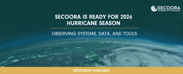
SECOORA Is Ready for the 2026 Hurricane Season
Hurricane season is here and SECOORA’s resources are available to help you stay informed. From real-time buoy data and live webcam feeds to ocean gliders and storm surge models, our network of observing systems is ready to support forecasters, emergency managers, researchers, and coastal communities throughout the Southeast.