SECOORA Partners with North Carolina Communities to Install New Water Level Sensors
SECOORA has partnered with North Carolina Public Safety, Beaufort County Emergency Services, and the town of Belhaven to install new water level stations in two flood-prone North Carolina communities.
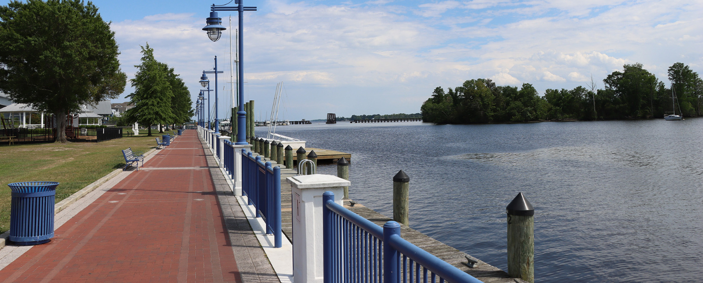
In March 2024, SECOORA installed two new water level stations in Beaufort County, North Carolina. Partners with Beaufort County Emergency Services, North Carolina Public Safety, and NC Sea Grant identified the Bayside Community (within Chocowinity) and the town of Belhaven as two frontline communities in need of flood monitoring. The water level gauges will assist local emergency officials, town managers, and community members with planning and preparing for flooding and inundation events.
Sensors to Support Decisions
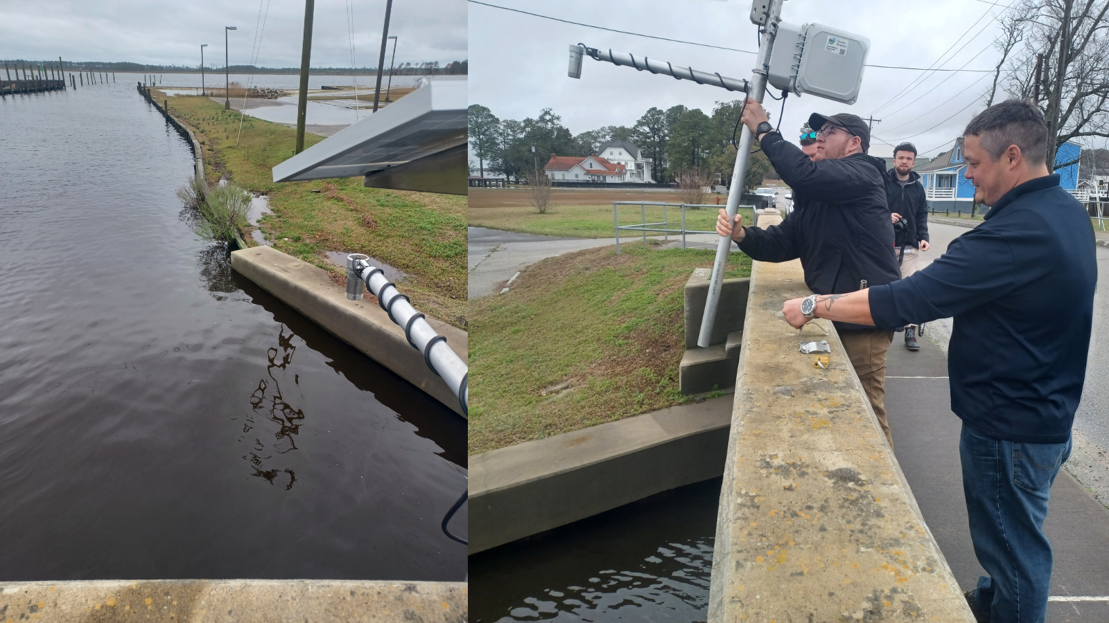
The Bayside community is on a peninsula between Chocowinity Bay and Pamlico River. The town of Belhaven is on the Pungo River and where it diverges into Pungo Creek. Due to their locations, both of these communities are impacted by flooding that results in regular road closures. In some cases, the closures impact the only road access into and out of these communities. The newly installed water level sensors will help emergency management make more informed and proactive decisions to mitigate complications caused by flooding and stay alert to flood hazards.
“Belhaven is no stranger to high water, so our people are resilient. The newly installed gauges will help to anticipate events and know what the water levels actually are. This information will help our citizens plan and prepare much better. We will be able to shift from being reactive to proactive because of these gauges.”
– Lynn Davis, Belhaven Town Manager
The Southeast Water Level Network
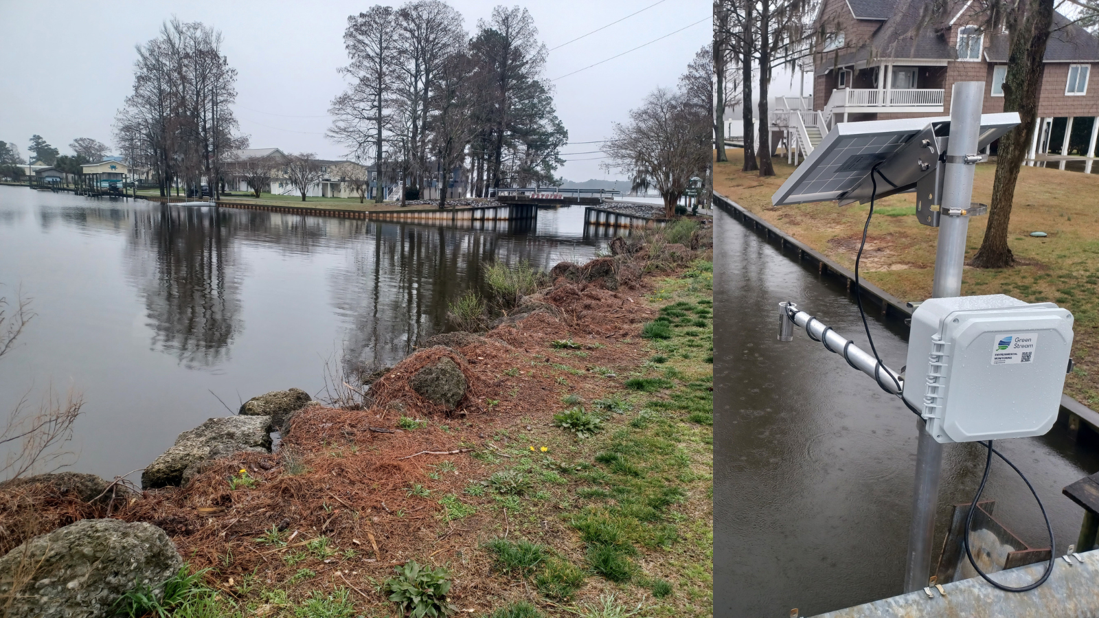
SECOORA’s Southeast Water Level Network provides water level sensors to communities within North Carolina, South Carolina, Georgia, and Florida. The goal of the network is to install and maintain low cost water level sensors in flood-prone areas to provide hyper local water level data for proactive decision making. SECOORA works directly with university and community partners to support the maintenance, development, and installation of water level sensors.
“Having water level monitoring stations in Beaufort County is one of the most critical things we can do to prepare our coastal communities. This is an avenue of information that the citizens can see and be alerted on. As a result, these monitors can offer communities the tools to prepare and plan for such incidents in advance. This will strengthen the resiliency of these communities to such impacts in the future.”
– DC Linton, Beaufort County Emergency Management Coordinator
Access the Data
The data can be accessed on SECOORA’s Water Level Data Portal. The Belhaven water level data can be accessed here and the Bayside community water level data can be accessed here. The network provides real-time local water level data to town managers, emergency managers, design engineers, and the public. This data is vital for monitoring coastal flooding and keeping citizens informed of hazardous conditions.
To learn more, please visit SECOORA’s water level webpage. From this page you can also access the Water Level Data Portal to see the nearest station near you!
Related news
SECOORA Hosts the Second Surface Elevation Table (SET) Community of Practice Workshop In Person in Charleston
The 2nd SECOORA SET Workshop convened in person on July 16-17, 2026 in Charleston, SC. More than 30 Community of Practice members and stakeholders joined this collaborative workshop to discuss SET monitoring, coastal resilience, and data-driven decision making in the Southeast.

Claire McGrath Joins SECOORA as Program and Development Manager
SECOORA welcomes Claire McGrath as Program and Development Manager, supporting the Southeast & Caribbean Coastal Disaster Resilience Partnership and membership growth.

Spotlight: Mobilizing to Save Florida’s Coral Reefs
Learn how scientists are racing to save Florida's Coral Reef through coral rescue, gene banking, reef restoration, and innovative conservation efforts after disease and marine heatwaves devastated one of America's most important marine ecosystems.