

Measuring Surface Currents on the East Coast of Florida with High Frequency Radars
The Florida Institute of Technology and UGA Skidaway Institute of Oceanography recently installed four high frequency radars on the east coast of Florida. These systems measure the speed and direction of ocean currents, which is helpful for search & rescue operations and tracking marine debris.
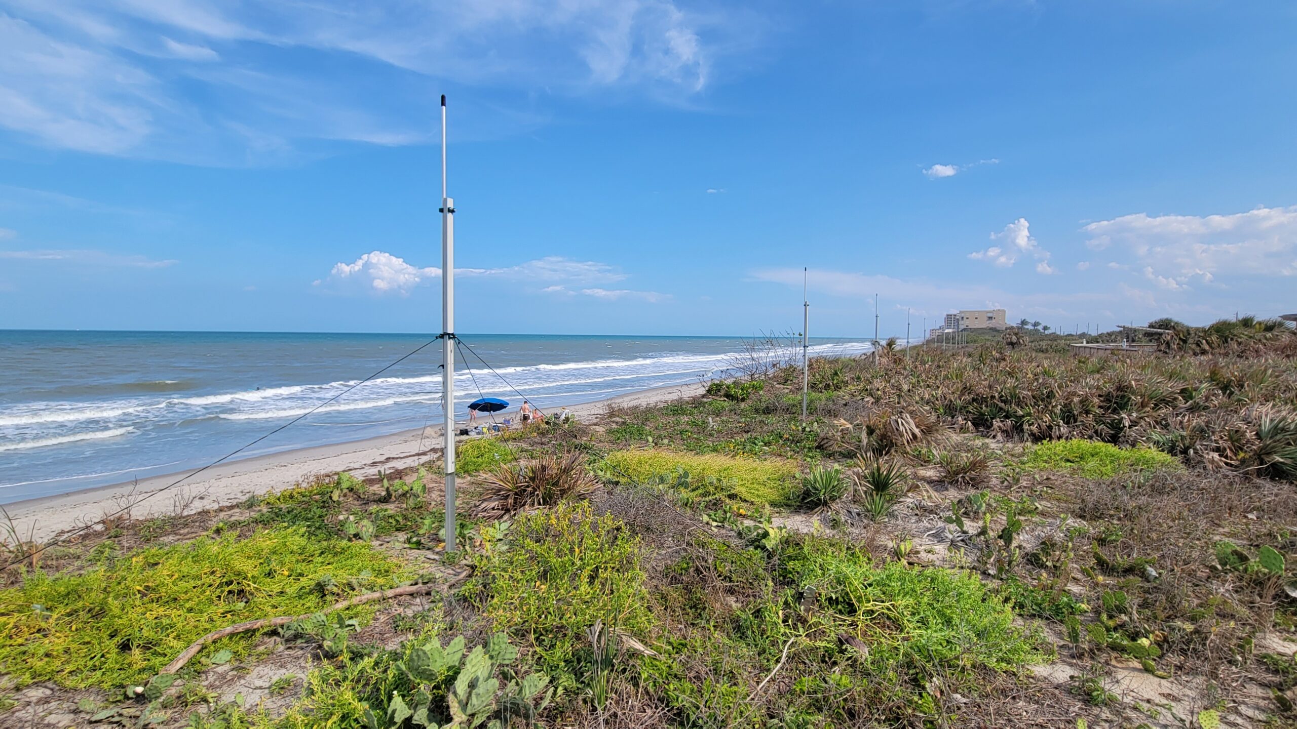
High frequency radars (HFR) are land-based systems that use radio waves to measure the speed and direction of ocean surface currents in near real-time. They provide broad spatial coverage of ocean surface currents along the coast. Recently, four HFRs have been installed on the central east coast of Florida to address gaps in coverage:
- Hightower Beach Park (Florida Institute of Technology)
- Treasure Shores Park (Florida Institute of Technology)
- Canaveral National Seashore (University of Georgia Skidaway Institute of Oceanography)
- Kennedy Space Center (University of Georgia Skidaway Institute of Oceanography)
The locations of HFR stations are carefully selected to maximize surface current coverage. These four radars on the east coast of Florida work together to provide surface current data supporting offshore search and rescue efforts, the tracking of oil spills and marine debris, and ocean modeling. In the areas where the radio signals from two HFR stations overlap, the system can make maps of surface current speed and direction.
Why Measure Surface Currents on the Florida East Coast?
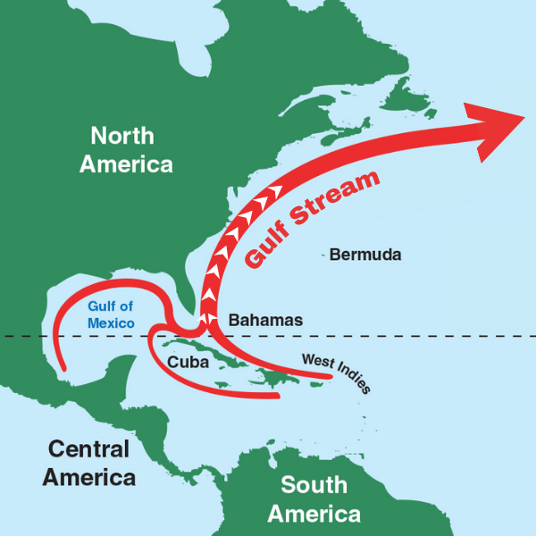
Many coastal areas of the United States have an extensive network of HFRs. However, until recently there has been a gap in coverage along the central east coast of Florida, despite the high levels of recreational boating, commercial fishing, and shipping activity in this area. The position of Gulf Stream – the strong, warm northward current that hugs the US East Coast – begins to shift slightly offshore in this area as the continental shelf widens, causing meanders and eddy-like features in the coastal currents.
Dr. Catherine Edwards, UGA Skidaway Institute of Oceanography, explains that these features support biological productivity, which makes the central east coast of Florida popular for offshore recreational and commercial fishing.
Using High Frequency Radar Data

Because surface currents influence the movement of floating objects, HFR data are used by the U.S. Coast Guard for Search and Rescue operations. These data allow the Coast Guard to predict the trajectory of objects on the ocean surface by establishing drift patterns, narrowing down the search area for vessels adrift at sea, wreckage, or other objects that may need to be recovered.
Similar to the U.S. Coast Guard use, HFR data can be used to track and predict the movement of marine pollution. Clean up efforts of marine debris, oil spills, and other hazardous waste discharges can be focused, potentially reducing impacts to environmentally vulnerable areas.
According to Dr. Steven Lazarus, Florida Institute of Technology, using HFR data to track the position of the Gulf Stream can help meteorologists forecast the offshore wave setup due to the Gulf Stream’s interaction with surface winds. Coupled atmosphere-ocean modeling can benefit as well – with the potential of providing more informed forecasts for land-falling hurricanes.
Forecast meteorologists are also interested in how nearshore currents interact with the sea breeze to produce waves, as well as the influence of the Gulf Stream on local weather. For example, surface current data can be applied to help monitor sea breeze evolution as it moves inland, which is important for accurately predicting summer precipitation near the coast.
Access the Data
The NOAA National Data Buoy Center HF Radar National Server provides surface current information from radars across the country, including the four on the east coast of Florida. To learn more about SECOORA HFRs and how the data is used, explore the High Frequency Radar page.
Related news

Meet SECOORA’s 2026-2027 Executive Committee
Meet SECOORA’s 2026-2027 Executive Committee, five leaders in marine science, coastal engineering, and weather who guide ocean observing in the Southeast.

Investing in People and Communities Across the Southeast
SECOORA begins its 4th five-year award from U.S. IOOS to continue coastal and ocean monitoring across the Southeast.
Meet the Scientist Helping Answer: Are Our Marshes Gaining Elevation?
Meet Ches Vervaeke, the scientist bringing 20+ years of Surface Elevation Table expertise to SECOORA's marsh elevation monitoring work in the Southeast.