SECOORA Partners Monitor Red Tide Bloom in Gulf
Red Tide Resources:
WFCOM Harmful Algal Bloom (HAB) 3.5 day trajectories forecast 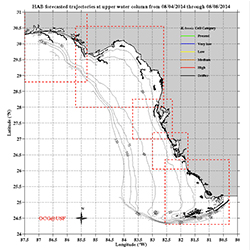 | FWC bulletin cell counts are inputted into the West Florida Coastal Ocean Model (WFCOM) Nowcast/Forecast model as available based on 5 detection levels (present, very low, low, medium, high) to trace physical transport of the observed biomass at the surface and bottom. |
USF Collaboration for Prediction of Red Tides Models 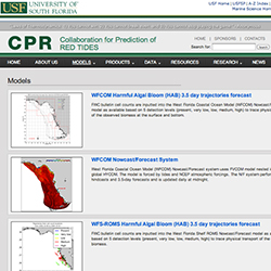 | |
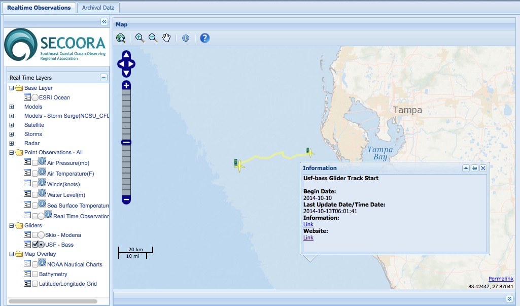
USF Bass Glider 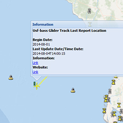 | Follow USF’s Bass Glider as it monitors and maps the red tide bloom. |
Ongoing Glider Mission on the West Florida Shelf  | As a joint effort of tracking and predicting the red tides in the eastern Gulf of Mexico and the U.S. southest coasts, a Slocum glider was deployed off the west Florida coast by the Ocean Technology Group at College of Marine Science, University of South Florida. The glider is collecting oceanographic data in the water clomun across the West Florida Continental Shelf. The near real-time data are shown in the following preliminary plots. |
FWC Red Tide Updates 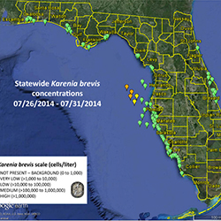 | Read summary reports of the current red tide conditions around Florida, including a map of sampling results and regional status reports. |
Red Tide Resources:
|
WFCOM Harmful Algal Bloom (HAB) 3.5 day trajectories forecast
|
FWC bulletin cell counts are inputted into the West Florida Coastal Ocean Model (WFCOM) Nowcast/Forecast model as available based on 5 detection levels (present, very low, low, medium, high) to trace physical transport of the observed biomass at the surface and bottom.
|
|
USF Collaboration for Prediction of Red Tides Models
|
|
|
USF Bass Glider
|
Follow USF’s Bass Glider as it monitors and maps the red tide bloom.
|
|
Ongoing Glider Mission on the West Florida Shelf
|
As a joint effort of tracking and predicting the red tides in the eastern Gulf of Mexico and the U.S. southest coasts, a Slocum glider was deployed off the west Florida coast by the Ocean Technology Group at College of Marine Science, University of South Florida. The glider is collecting oceanographic data in the water clomun across the West Florida Continental Shelf. The near real-time data are shown in the following preliminary plots.
|
|
FWC Red Tide Updates
|
Read summary reports of the current red tide conditions around Florida, including a map of sampling results and regional status reports.
|
Related news
GCOOS - SECOORA Joint Webinar Series: Building Synergy Across the US MBON & Ocean Acidification Networks
The GCOOS - SECOORA Webinar Series aims to strengthen collaborations across the Marine Biodiversity Observation Network (MBON) and regional Ocean Acidification Networks (GCAN and SOCAN).

New High Frequency Radar at the Dry Tortugas National Park Improves Ocean Surface Current Measurements Across the Straits of Florida
A new CODAR Low-Power SeaSonde HFR has been deployed by the University of South Florida at Fort Jefferson on Garden Key to measure surface currents to improve understanding and prediction of the Gulf of Mexico Loop Current.

President Biden Proposes Significant Budget Cuts to IOOS for 2025
President Biden’s recent 2025 budget proposal slashed the funding allocated for the Integrated Ocean Observing System (IOOS) by 76%, which would effectively shut down coastal and ocean observing efforts.