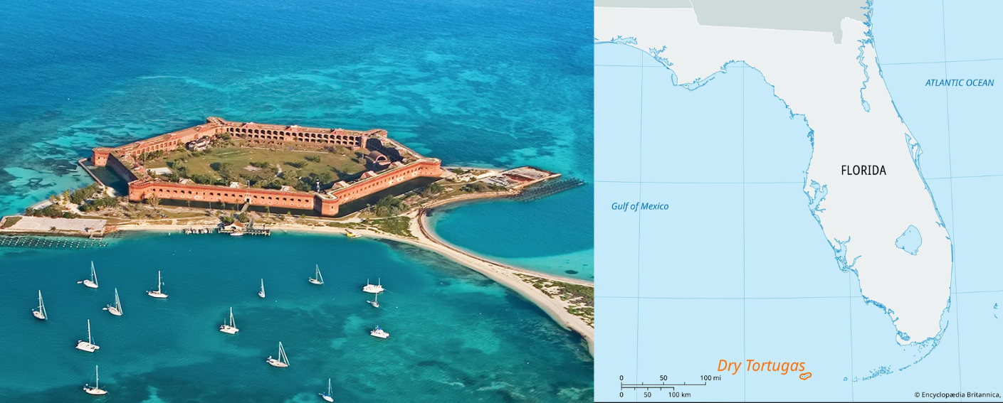
New High Frequency Radar at the Dry Tortugas National Park Improves Ocean Surface Current Measurements Across the Straits of Florida
A new CODAR Low-Power SeaSonde HFR has been deployed by the University of South Florida at Fort Jefferson on Garden Key to measure surface currents to improve understanding and prediction of the Gulf of Mexico Loop Current.
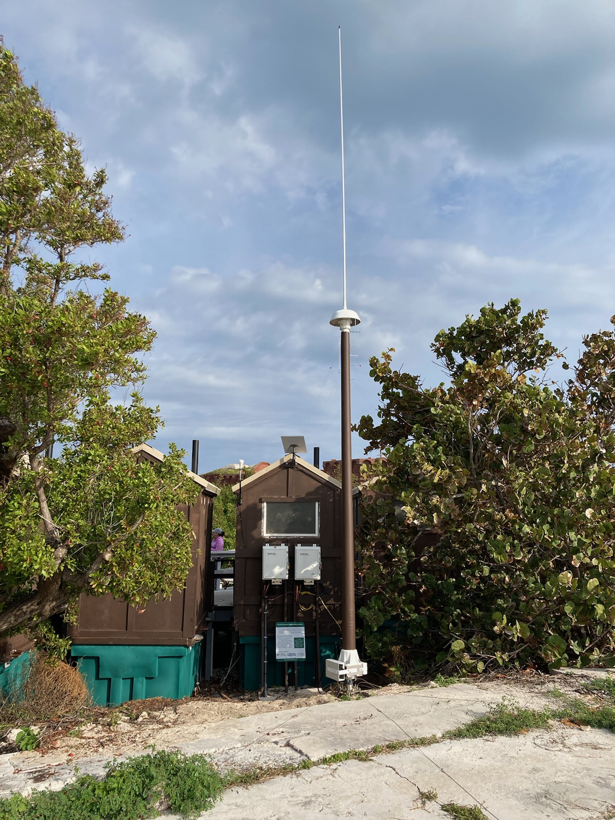
The University of South Florida’s Coastal Ocean Monitoring and Prediction System (USF COMPS), recently installed a new custom CODAR Low-Power SeaSonde® high frequency radar (HFR) at Fort Jefferson, in the Dry Tortugas National Park (Figure 1).
The new Fort Jefferson CODAR SeaSonde® HFR is the third of three CODAR HFRs deployed by USF in the lower Florida Keys region to measure surface currents (Figure 2). The three HFRs will help improve the understanding and prediction of the Gulf of Mexico Loop Current. Installation of the Fort Jefferson site (called JEFF), located near historic Fort Jefferson, 70 miles northwest of the City of Key West, was completed in late February 2024 with data flowing and available as of March 7, 2024 (Figure 1). Data from this site as well as all of the HFRs in the southeast, flow to NOAA’s Integrated Ocean Observing System Coastal Observing Research and Development Center (CORDC).
HFR are land-based systems that measure the speed and direction of ocean surface currents in near real-time. Surface currents can move objects in the ocean such as boats, marine debris, and nutrients. HFR systems transmit radio signals across the ocean. These radio signals bounce off of ocean waves and signals are scattered back to the coast where they are picked up by the radar’s receive antenna. Through thorough analysis of the returned signals, estimations of surface current speed and direction are derived (Figure 2).
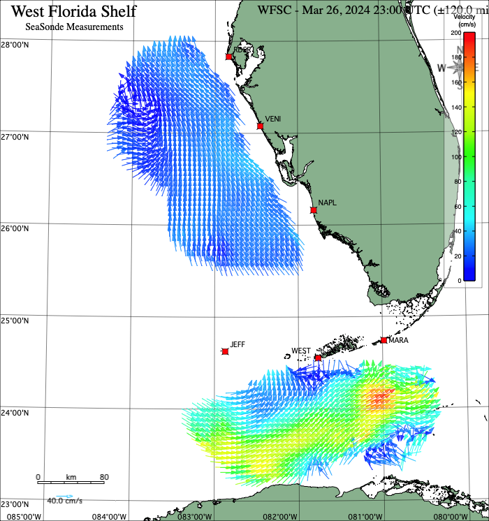
For accurate calculations of surface current speed and direction, it is necessary for the radio signals from one HFR system to overlap with signals from another independent HFR system. Currently the data obtained from the HFR systems at JEFF, WEST, and MARA are being merged to measure surface current speed and direction in the complex Straits of Florida. The MARA HFR system was installed within Curry Hammock State Park near Marathon, FL in December 2019 and the WEST HFR was installed in Key West in December 2022.
Applying Innovative and New Technology
Three unique features have been incorporated into the JEFF HFR installation. The first is the use of a CODAR 5 MHz Transmit/Receive (TR) antenna design that serves as both the transmit and receive antenna. Unlike traditional HFR low frequency installations which use two separate antennas, this new and innovative single 5 MHz TR antenna design minimizes environmental disturbance in the sensitive areas of the Dry Tortugas National Park, and provides data for areas that were previously difficult to monitor because of limited available coastal land frontage or site usage constraints. The new single low frequency 5 MHz TR antenna being used at Fort Jefferson is the third TR antenna to go into operational use within the USF HFR network (others include WEST and NAPL). The second unique feature is the use of a custom low power SeaSonde® HFR system specifically modified to work with on-island generators, required since there is no access to the mainland’s utility power grid at this remote location. The third unique feature is its use of the Starlink satellite system for system communications and data transfer. Due to JEFF’s remote location, this is the first site in the USF HFR network to require satellite communications rather than the cellular communications that are traditionally used.
Dr. Clifford Merz, lead Principal Investigator from USF COMPS, notes that “this new Fort Jefferson (JEFF) HFR site provides data coverage that extends westward of the existing lower Florida keys coverage area provided by HFR sites in Marathon (MARA) and Key West (WEST). This enables a better understanding of the complex and variable surface currents of the Gulf of Mexico Loop Current System through the Straits of Florida. Timely predictions supported by the HFR data will improve forecasts of hurricanes, fisheries productivity, climate induced coastal flooding, and sea level rise as well as support other important activities such as improved boater safety and U.S. Coast Guard Search and Rescue (SAR) operations”.
Data Made Possible
Site equipment funding provided was via a National Academies of Sciences, Engineering, Medicine (NASEM) Gulf Research Program (GRP) competitively awarded grant with site installation and operation and maintenance through a collaborative effort between the USF College of Marine Science’s COMPS program and the National Park Service. Local project support provided by the FIO Keys Marine Laboratory, and CODAR Ocean Sensors. NASEM-GRP funds long-term research projects to improve the understanding and prediction of the Gulf of Mexico Loop Current System. This project is part of a larger Gulf of Mexico Loop Observing Partnership including Texas A&M University, the University of Southern Mississippi, The University of Miami, Rutgers University, and GCOOS.
To learn more, please contact Dr. Merz at cmerz@usf.edu.
Related news

Spotlight: Mobilizing to Save Florida’s Coral Reefs
Learn how scientists are racing to save Florida's Coral Reef through coral rescue, gene banking, reef restoration, and innovative conservation efforts after disease and marine heatwaves devastated one of America's most important marine ecosystems.

From a Whale’s Song to an Ocean’s Symphony: How AI Decodes Underwater Sound
Explore how SECOORA-funded research is using AI and machine learning to decode ocean soundscapes, detect boat noise, and support coral reef restoration efforts.
Rebuilding the Future: USF’s College of Marine Science Recovers from Historic Blaze One Day at a Time
Following a devastating fire at USF’s Marine Science Lab, researchers rally to salvage decades of critical data and maintain vital ocean monitoring.