SECOORA Partners Trace Flow of Currents from Rivers to Reefs

|
Gray’s Reef National Marine Sancutary staff joined researchers from Georgia Southern University to release 50 gallons of fluorescent red dye into the Altamaha River outflow on September 9, 2014. The plume of dye that results, will be monitored visually and with instrumentation as it flows from the release point along the Georgia coast and offshore. Tracking the path of the dye will provide estimates of the extent to which the Altamaha River delivers dissolved substances, including contaminants and nutrients, along the Georgia coast and to hard-bottom reefs, such as Gray’s Reef National Marine Sanctuary, occurring up to 20 miles offshore.
In addition to releasing the dye, 2 satellite-enabled drifters will be deployed to collect information on how larger materials, such as dead stalks of marsh grass, may disperse after being transported by ocean currents from the Altamaha River estuary.
Local teachers were engaged in building the drifters and data obtained from the drifter paths will be made available to the public and to local school teachers for use in the classroom. As with the buoys, these drifters will be clearly labeled so please do not remove them if spotted offshore. Alternatively, please contact the investigators if a drifter is found to have come ashore.
Drifters trajectory path will be coming soon on the SECOORA website! Check back for updates.
For more information about this study, please contact:
Jody Patterson at 912-598-2431
Administrative Assistant
Gray's Reef National Marine Sanctuary
Amy Rath at 912-598-2397
Communications and Outreach Coordinator
Gray's Reef National Marine Sanctuary
Dr. Daniel Gleason at 912-478-5957 or Dr. Risa Cohen
Department of Biology
Georgia Southern University
912-478-5487
|
|
Gray’s Reef National Marine Sancutary staff joined researchers from Georgia Southern University to release 50 gallons of fluorescent red dye into the Altamaha River outflow on September 9, 2014. The plume of dye that results, will be monitored visually and with instrumentation as it flows from the release point along the Georgia coast and offshore. Tracking the path of the dye will provide estimates of the extent to which the Altamaha River delivers dissolved substances, including contaminants and nutrients, along the Georgia coast and to hard-bottom reefs, such as Gray’s Reef National Marine Sanctuary, occurring up to 20 miles offshore.
In addition to releasing the dye, 2 satellite-enabled drifters will be deployed to collect information on how larger materials, such as dead stalks of marsh grass, may disperse after being transported by ocean currents from the Altamaha River estuary.
Local teachers were engaged in building the drifters and data obtained from the drifter paths will be made available to the public and to local school teachers for use in the classroom. As with the buoys, these drifters will be clearly labeled so please do not remove them if spotted offshore. Alternatively, please contact the investigators if a drifter is found to have come ashore.
Drifters trajectory path will be coming soon on the SECOORA website! Check back for updates.
For more information about this study, please contact:
Jody Patterson at 912-598-2431
Administrative Assistant
Gray’s Reef National Marine Sanctuary
Amy Rath at 912-598-2397
Communications and Outreach Coordinator
Gray’s Reef National Marine Sanctuary
Dr. Daniel Gleason at 912-478-5957 or Dr. Risa Cohen
Department of Biology Georgia Southern University 912-478-5487 |
Re-posted from Grays Reef National Marine Sancutary – click here for orginal post
Related news
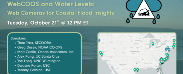
SECOORA Webinar | WebCOOS and Water Levels: Web Cameras for Coastal Flood Insights
On October 21st at 12 PM ET, SECOORA is hosting a webinar with investigators from the Webcam Coastal Observation System (WebCOOS) project team and the WebCOOS Project Manager. Web cameras are a low-cost technology that can be used to document flooding impacts to coastal communities. Register here.
SECOORA Funding Opportunity Announcement: Letters of Intent Solicitation
SECOORA will submit a coordinated regional proposal in response to the anticipated FY 2026 Implementation of the U.S. Integrated Ocean Observing System (IOOS) funding opportunity. Letters of Intent to be considered for inclusion in SECOORA’s full proposal are due September 9, 2025.

SECOORA Hosts the First Surface Elevation Table (SET) Community of Practice Virtual Workshop
The SECOORA SET Workshop was virtual on July 17, 2025. More than 50 Community of Practice members and stakeholders joined this collaborative workshop to discuss SET monitoring, coastal resilience, and data-driven decision making in the Southeast.