

SECOORA Inspires Future Ocean Experts at St. Petersburg Science Festival
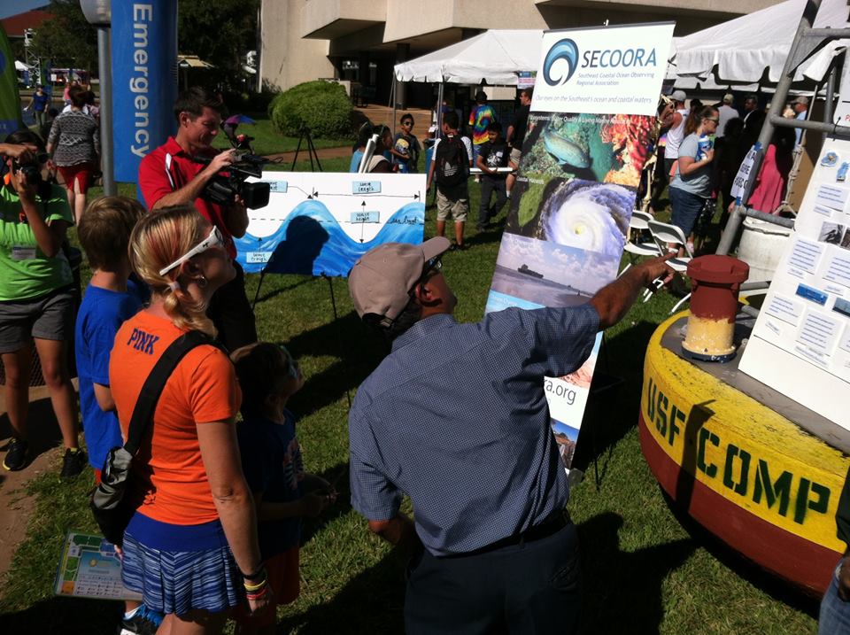
On October 18, SECOORA participated in the St. Petersburg Science Festival. Since 2011, the festival hosted on the Bayboro Harbor in St. Petersburg, FL has been inspiring children to get excited about Science, Technology, Engineering, and Mathematics (STEM) activities. It is estimated the two-day event attracts over 25,000 visitors.
SECOORA, Gulf of Mexico Coastal Ocean Observing Regional Association (GCOOS-RA), and the University of South Florida (USF) teamed together to help cultivate the future generation of ocean observers. The joint exhibit highlighted how to bring real-time ocean and coastal data to the classroom and household.
SECOORA would like to thank Jay Law of USF Coastal Ocean Monitoring and Prediction Systems and Chad Lembke of USF Center for Ocean Technology for providing a buoy and an autonomous underwater vehicle, Murphy, for display. The buoy and glider drew high traffic and media attention. As visitors explored SECOORA’s data portal they were able to relate the data to the piece of equipment.
WTSP/CBS produced a web story based on our collaborative exhibit. Click here to view video/ story.
---
All images are property of SECOORA
On October 18, SECOORA participated in the St. Petersburg Science Festival. Since 2011, the festival hosted on the Bayboro Harbor in St. Petersburg, FL has been inspiring children to get excited about Science, Technology, Engineering, and Mathematics (STEM) activities. It is estimated the two-day event attracts over 25,000 visitors.
SECOORA, Gulf of Mexico Coastal Ocean Observing Regional Association (GCOOS-RA), and the University of South Florida (USF) teamed together to help cultivate the future generation of ocean observers. The joint exhibit highlighted how to bring real-time ocean and coastal data to the classroom and household.
SECOORA would like to thank Jay Law of USF Coastal Ocean Monitoring and Prediction Systems and Chad Lembke of USF Center for Ocean Technology for providing a buoy and an autonomous underwater vehicle, Murphy, for display. The buoy and glider drew high traffic and media attention. As visitors explored SECOORA’s data portal they were able to relate the data to the piece of equipment.
WTSP/CBS produced a web story based on our collaborative exhibit. Click here to view video/ story.
—
All images are property of SECOORA
Related news
Empowering Communities: Real-Time Shoreline Monitoring in North Carolina
A new story map highlights how two cameras on Oak Island, North Carolina are being used to track changes along the coast from daily shifts in beach width to the impacts of major storms. These cameras provide continuous imagery that helps communities understand changing conditions and make informed management decisions.

FY2027 Presidents Budget Will Hurt the Southeast
The President’s Budget for NOAA proposes eliminating IOOS Regional Associations. This program provides critical data. Its elimination would have serious consequences for communities, businesses, and decision-makers across the nation and the Southeast.

Webinar | Preparing for Hurricane Season with SECOORA: Observing Systems, Data, and Tools
When a storm is approaching, having the right data matters. Join us on May 6 at 11:00 AM ET to explore how SECOORA’s observing systems, data, and tools can support hurricane monitoring and informed decision-making.