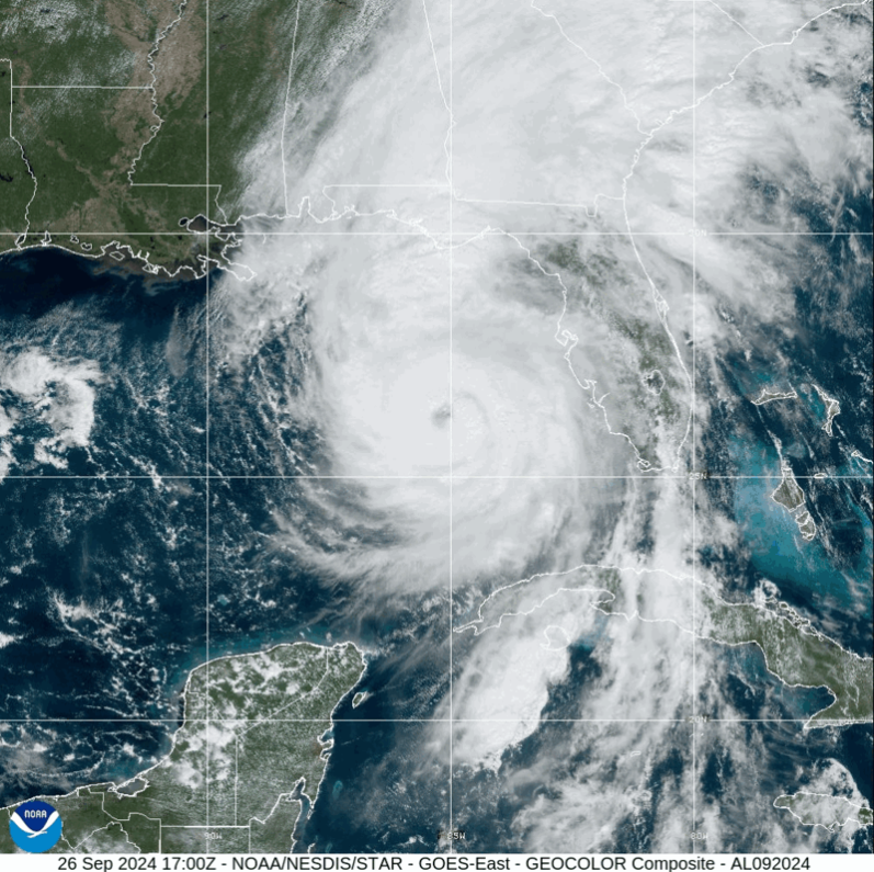
Hurricane Helene made landfall Thursday, September 26th in the Florida Big Bend area as a Category 4 storm. This storm brought severe storm surge and hurricane-force winds to the Florida panhandle and the Florida west coast, in addition to flash and urban flooding throughout the Southeast.
Click here to stay up-to-date with the NOAA National Hurricane Center updates on Helene.
View live camera feeds from the WebCOOS Network.
Access water level data from the Southeast Water Level Network here.
Access wind and wave data from SECOORA sensors in the path of Helene here.
Follow the Data
The SECOORA network has several resources to report out on relevant data that is crucial during active storms. Explore hurricane resources below or view the Hurricane Resources page.
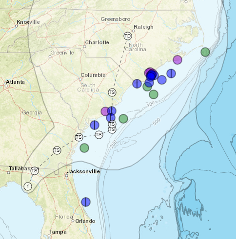
Eyes on the Storm
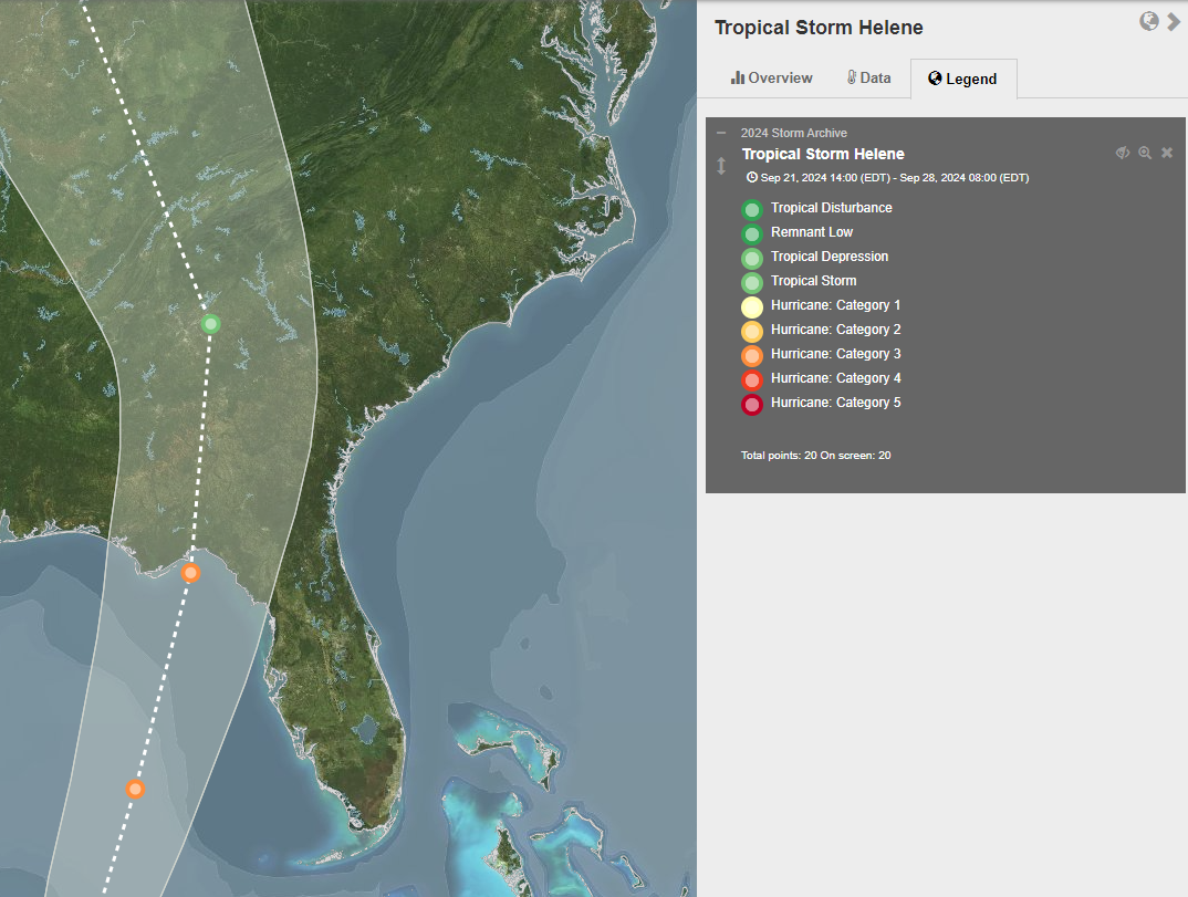
Eyes on the Storm on the SECOORA Data Portal pulls data from within 50 miles of Helene’s path. If you click on the colored dots on the path of Helene, you can access data from stations in the area.
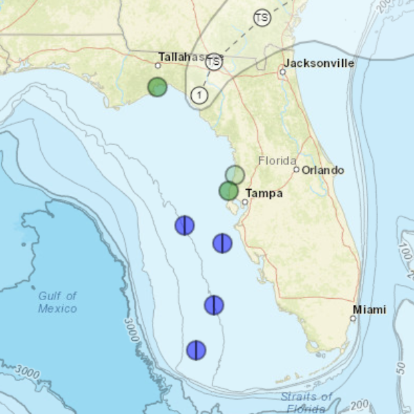
Integrated View on the SECOORA Data Portal
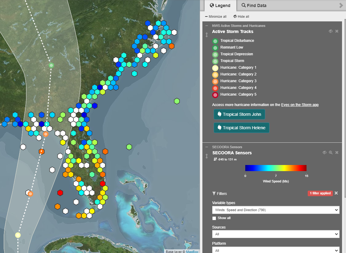
The Integrated View on the SECOORA Data Portal shows active storm tracks (Helene shown here) and the SECOORA sensors located within the storm path. Using the panel on the right-hand side, select the data variable you wish to see (i.e. wind speed and direction, wave height, etc.) then click on the colored hexagons that each represent a station.
SECOORA Water Level Portal
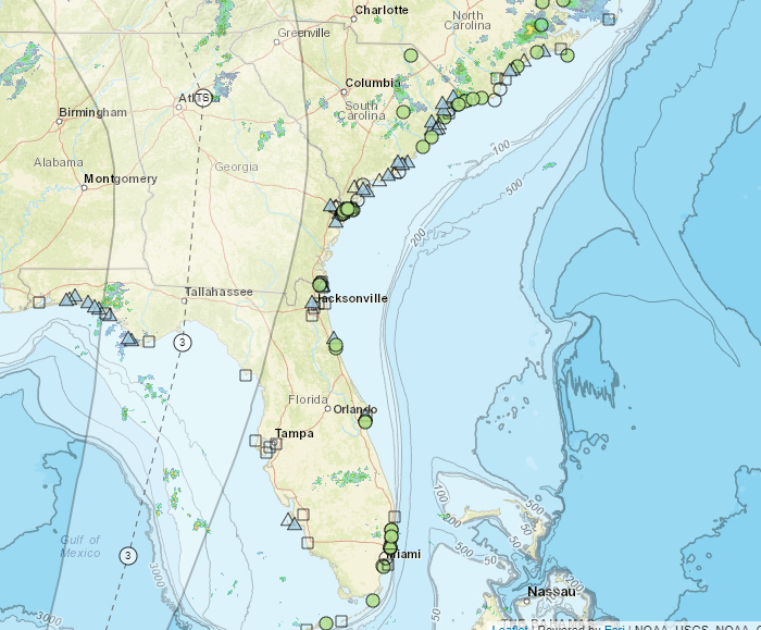
The SECOORA Water Level Data Portal shows SECOORA, NOAA, and partner stations within the Southeast Water Level Network. Click on the shapes to view station data within the storm’s path, which can be added using the right-hand panel titled “Additional Layers” along with the radar imagery.
Webcam Coastal Observation System (WebCOOS)
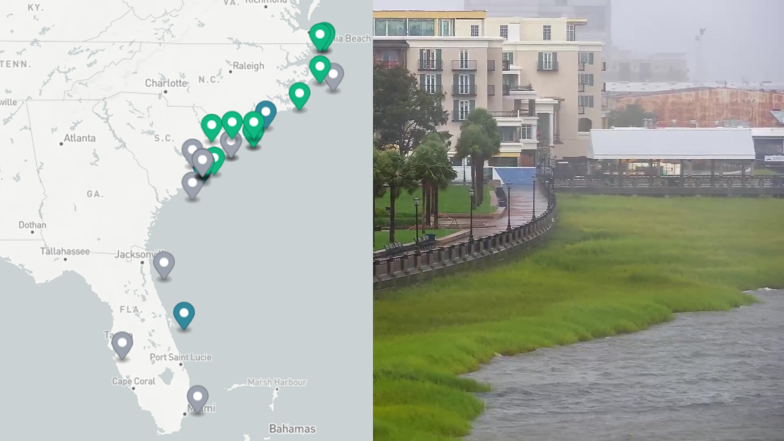
The Webcam Coastal Observation System (WebCOOS) allows users to stream live camera feeds in real-time as Helene impacts the Southeast. The cameras are being used to remotely monitor flooding, document the timing, duration, and extent of dune impacts, and predict rip currents.
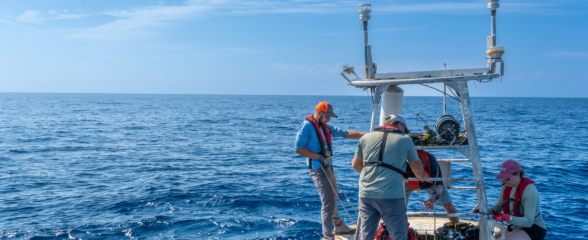
Real Time Buoy Data
Helene’s projected path is expected to impact the southeast U.S. coast throughout this week. As the storm moves north, explore mooring stations in the Southeast supported by SECOORA. The information collected provides real time updates on the storm’s wind speed and more.
North Carolina and South Carolina buoys are operated by UNCW Coastal Ocean Research and Monitoring Program (CORMP).
Florida buoys are operated by University of South Florida Coastal Ocean Monitoring Prediction System (COMPS).
Additional Resources
Explore additional hurricane resources for the Southeast on the SECOORA Hurricane Resources page on our website. Please email communications@secoora.org if you have additional resources to add to our list.
Related news

Spotlight: Mobilizing to Save Florida’s Coral Reefs
Learn how scientists are racing to save Florida's Coral Reef through coral rescue, gene banking, reef restoration, and innovative conservation efforts after disease and marine heatwaves devastated one of America's most important marine ecosystems.

From a Whale’s Song to an Ocean’s Symphony: How AI Decodes Underwater Sound
Explore how SECOORA-funded research is using AI and machine learning to decode ocean soundscapes, detect boat noise, and support coral reef restoration efforts.
Rebuilding the Future: USF’s College of Marine Science Recovers from Historic Blaze One Day at a Time
Following a devastating fire at USF’s Marine Science Lab, researchers rally to salvage decades of critical data and maintain vital ocean monitoring.