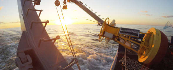
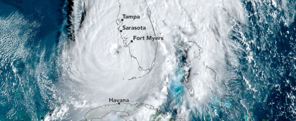
As Matthew moved from the Bahamas to the Carolinas, ocean observing technology – such as buoys – captured waves over 20 feet and wind speed of over 50 knots along its’ path.
Overview
Hurricane Matthew was the first category 5 Atlantic hurricane since 2007. After wreaking havoc in the Caribbean, Matthew started its path along the southern Atlantic seaboard of the US as a category 3 hurricane, eventually making landfall as a category 1 hurricane north of Charleston, SC on Oct. 8. Maximum sustained winds were near 120 mph during the US portion of its track. The Southeast Coastal Ocean Observing System (SECOORA) responded to the storm in real time.
SECOORA, a 501(c)(3) nonprofit, coordinates coastal and ocean monitoring activities in the southeast United States in partnership with NOAA, U.S. IOOS and a number of other public and private interests. SECOORA supports marine weather buoys and high frequency radar coastal stations located in the impact zone of Matthew. One buoy operated by University of North Carolina Wilmington reported wind speed of over 42 knots or 48 mph.
Data
Buoys, coastal stations, forecast models and other ocean technology transmit data – such as wind speed and wave height – in near real time to data servers and portals.
Near real time data is used by weather forecasters and Emergency Response Managers to confirm what the models are predicting and report the true conditions. It helps them accurately decide the best way to respond to dangerous situations.
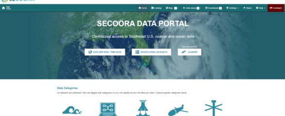
The SECOORA Data Portal allows visualization of data from multiple sources in near real-time. Our Hurricane Matthew resources page featured 20+ data resources from federal and non-federal partners.

Figure 1: Pictured is the track of Hurricane Matthew and wave buoys on the southeast coast. Buoys reported significant wave heights over 25 feet.

Figure 2: Pictured is the track of Hurricane Matthew and ocean buoys on the southeast coast. Many of the buoys have sensors that collect metrological data. The buoy in Grays Reef National Marine Sanctuary operated by NOAA transmitted wind speed of 54 knots or 62 mph before the anemometer stopped reporting.
Damages to Ocean Observing Assets
Although most ocean observing assets fared well in the storm, some were damaged or went adrift. For example, buoy 41114 operated by the Coastal Data Information Program broke loose during the storm. These observing assets are critical to all sorts of mariners and other stakeholders that live and work on and near the coast. SECOORA is working to document damages to this important infrastructure that informs us whether our ocean ‘highways’ are safe to work and play on.
Mark Rosen from Port St Lucie Anglers Club reached out to US IOOS when he noticed the buoy was not reporting. He stated, “As fishermen we [Port St Lucie Anglers Club] rely heavily on the information from buoy 41114. We really appreciate the work involved in keeping that buoy on station.”
Below are descriptions of the ocean observing instruments that were in the incident zone of Matthew, with those that were damaged highlighted in red. Please contact us if you know of assets that were damaged that are not listed. Click here to download the full excel file that includes information on federal and non federal assets.
SECOORA Region In-situ Assets (Funded Partners) in the incident zone – Post Matthew Impact Assessment (10/13/2016)
|
Name |
Responsible Party |
Display Title |
Platform Type |
Latitude |
Longitude |
Status during and after Hurricane Matthew |
Notes |
|
Onslow Bay 18M |
UNC-Wilmington |
ILM2 |
Fixed Surface Buoy |
34.13 |
-77.71 |
Operational |
This is maintained in collaboration with CDIP (150) – Masonboro Inlet |
|
Onslow Bay 30M |
UNC-Wilmington |
ILM3 |
Fixed Surface Buoy |
33.98 |
-77.35 |
Operational |
|
|
Sunset Beach Buoy 2 |
UNC-Wilmington |
SUN2 |
Fixed Surface Buoy |
33.848 |
-78.489 |
Operational |
|
|
Capers Island Buoy 2 |
UNC-Wilmington |
CAP2 |
Fixed Surface Buoy |
32.8 |
-79.62 |
Operational |
|
|
Fripp Island Buoy 2 |
UNC-Wilmington |
FRP2 |
Fixed Surface Buoy |
32.28 |
-80.41 |
Not transmitting |
Suspected damage from Hurricane Matthew (Yet to make site visit) |
|
Lejune Buoy 3 |
UNC-Wilmington |
LEJ3 |
Fixed Surface Buoy |
34.21083333 |
-76.9525 |
Operational |
|
|
NOAA OA Gray's Reef Mooring |
UGA |
Gray's Reef |
Fixed Surface Buoy |
31.4 |
-80.86 |
Wind sensors down since 8th Oct, they are maintained by NDBC |
The Ocean Acidification Sensors maintained by UGA were not affected |
SECOORA Region High Frequency Radar Assets in the incident zone – Post Matthew Impact Assessment (10/13/2016)
|
Name |
Responsible Party |
Display Title |
Latitude |
Longitude |
Status during and after Hurricane Matthew |
Notes |
|
University of North Carolina |
CODAR |
Duck |
36.18 |
-75.75 |
Operational |
|
|
University of North Carolina |
CODAR |
Cape Hatteras |
35.26 |
-75.52 |
Operational |
|
|
University of North Carolina – Chapel Hill |
CODAR |
Core Banks |
34.76 |
-76.41 |
Operational |
|
|
University of South Carolina |
WERA |
Georgetown |
33.25 |
-79.15 |
Operational |
Damages suspected (Yet to make site visit assessment) |
|
University of South Carolina |
WERA |
Caswell Beach |
33.88 |
-78.11 |
Operational |
Site visit was made. Cables were damaged due to wave action. Site is operational, but cable repairs need to be done. (10/13/2016) |
|
Skidaway Institute of Oceanography |
WERA |
St. Catherine |
31.69 |
-81.13 |
Down |
Possible damages suspected due to Matthew (Yet to make site visit assessment) |
|
Skidaway Institute of Oceanography |
WERA |
Jekyll Island |
31.06 |
-81.41 |
Operational |
Possible damages to antennas suspected (Yet to make site visit assessment) |
|
University of Miami |
WERA |
Dania Beach |
26.08 |
-80.12 |
Operational |
|
|
University of Miami |
WERA |
Virginia Key |
25.74 |
-80.15 |
Operational |
|
|
University of Miami |
WERA |
Crandon Park |
25.71 |
-80.15 |
Operational |
|
|
Florida Atlantic University |
CODAR |
Haulover Beach, FL |
25.91 |
-80.1 |
Operational (non- real-time) |
Not funded by SECOORA |
|
Florida Atlantic University |
CODAR |
Hillsboroug River, FL |
26.26 |
-80.08 |
Operational (non real-time) |
Not funded by SECOORA |
Related news

Funding Cuts to NOAA IOOS Will Hurt the Southeast
Proposed federal funding cuts would eliminate the IOOS Regional Observations budget for next year. Contrary to the budget Congress has already approved for this year, the Executive Branch wants these proposed cuts to go into effect in 2025.

SECOORA Webinar on the Rapid Intensification of Hurricane Ian: Warm Subsurface Water on the Wide Continental Shelf
Join us Thursday, April 24th at 12 PM ET for the April installment of the SECOORA Coastal Observing in Your Community Webinar Series! This month, we will hear from Dr. Yonggang Liu from the University of South Florida. He will discuss his research on the rapid intensification of Hurricane Ian in relation to anomalously warm subsurface water on the wide...

Webinar: SECOORA Data Portal Demo
Join us on Thursday, February 20, 2025 at 1:00 PM ET to learn more about the SECOORA Data Portal and how to navigate it. Axiom Data Science will be providing an overview of the portal, including how to search the Catalog and make a custom data view.