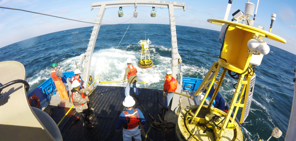
The UNCW Coastal Ocean Research and Monitoring Program maintains an array of moorings off the coasts of North Carolina and South Carolina. Pictured is the team deploying buoy. Image: UNCW CORMP
Usually this time of year, scientists and technicians are heading out to sea or to the coast for field work and to repair sensors on coastal observing assets. But instead, they are staying home wondering when they will be able to service moorings and bring critical data back online.
The COVID-19 pandemic is impacting SECOORA’s ability to provide a continuous stream of reliable ocean observing data. Operators cannot maintain our network of buoys, coastal stations, and high frequency radars due to travel restrictions and social distancing guidelines.
Data from our coastal observing platforms provide information for many operations such as weather forecasting, hurricane modeling, maritime transportation, and Coast Guard search and rescue. People rely on SECOORA data to make decisions.
Buoy Operations
Take, for example, the CAP2 buoy off the coast of Charleston, SC. The hourly data provided by this buoy is used by weather forecasters. Currently CAP2 is not reporting due to a suspected communications failure.
Peter Mohlin, a forecaster with the National Weather Service (NWS) in Charleston South Carolina, stated that meteorologists at the NWS need the data to create accurate weather forecasts and to verify forecasts. Mr. Mohlin noticed CAP2 stopped reporting on Wednesday, April 15, and reached out to the University of North Carolina Wilmington (UNCW) to see when the buoy would resume reporting.
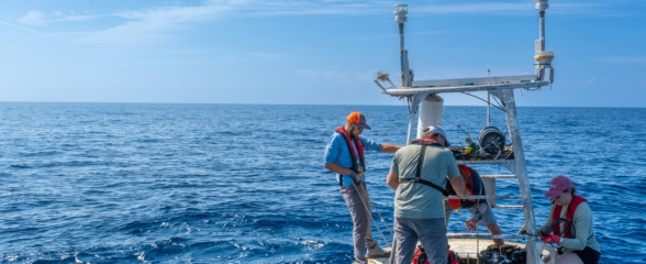
Normally the team from the UNCW who maintain the buoy would be conducting their annual spring turn around cruise on a large research vessel (like in the video to the right). This would bring valuable stations such as CAP2 back online and reporting data. However, because of shelter in place orders, research vessels are not operating so buoy turnaround cruises are being delayed. Instead, a UNCW technician plans to visit the buoy from a small boat and make temporary on-site repairs. There is a concern that, if this situation continues into the late summer or early fall, entire platforms may go offline during hurricane season; a time when the data are most needed to prepare for and respond to extreme weather.
Loss of data is not only affecting weather forecasts – it is also impacting harmful algal bloom research on the West Florida coast. Data collected by the University of South Florida (USF) operated buoys are incorporated in model simulations to better understand red tide bloom occurrence.
Dr. Bob Weisberg, USF oceanographer, noted, “The timing could not be worse as springtime is when the conditions are either conducive or not for a major red tide bloom. The Gulf of Mexico Loop Current, as seen in altimetry data and by our C22 mooring in Southwest Florida (funded by NASEM), is pushing against the shelf slope near the Dry Tortugas, which indicates an upwelling situation. An upwelling can bring slope water with higher nutrients onto the shelf; however, our other offshore moorings, especially C10 (funded by SECOORA and IOOS), are not collecting data to confirm that an upwelling event is being felt throughout the West Florida Shelf. We were planning to service these buoys this spring on a large research vessel.” Due to the COVID-19 restrictions, USF personnel cannot travel and research vessels as well as small boats are sitting at the dock.
High Frequency Radar
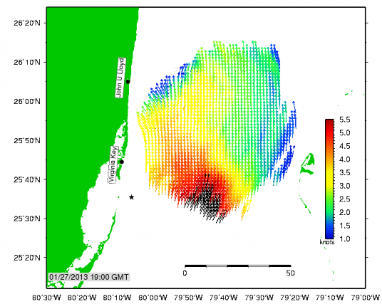
HFR are land-based systems that measure the speed and direction of ocean surface currents in near real-time. Pictured above is the example of the measured data coverage provided by UM RSMAS.
Another impact of COVID19 is the unexpected backlogs in orders and repairs and calibrations for platforms and sensors, as suppliers restrict their services. Two high frequency radars (HFR) operated by Dr. Nick Shay from the University of Miami (UM) have been offline in Southeast Florida and were expected to be brought back online this summer. Unfortunately, the new HFRs are made in Europe, and the manufacturer had to delay shipping. In addition, beach closures due to COVID-19 have also hampered efforts to complete a new HFR deployment by UM in North Key Largo.
Dr. Shay stated “HFR provides near real time surface current data that are needed for several reasons – such as resolving the Florida Current and its impact on sea level variations along Miami Beach and Virginia Key. The data is used by dredging operations sponsored by the Corps of Engineers for their hydrodynamic modeling efforts. The UM HFR team is waiting patiently to bring the data back online.”
Interruptions of Data
As the pandemic progresses, interruptions in these reliable data will cause:
- Reduced accuracy and quality of weather forecasts, including hurricanes, negatively impacting the economy and livelihoods;
- Reduced safety and efficiency of maritime commerce and shipping; and,
- Less effective Coast Guard search and rescue.
Not Alone
SECOORA is not alone with regards to impacts from the COVID-19 pandemic. The other 11 IOOS regional coastal observing networks are experiencing setbacks. Working together through the IOOS Association, the regional networks have responded to Congressional requests for information on impacts due to the pandemic. By noting the importance of building resiliency in the coastal ocean observing system, future funding can fix gaps and weaknesses in our coastal and ocean monitoring arrays.
Related news

Spotlight: Mobilizing to Save Florida’s Coral Reefs
Learn how scientists are racing to save Florida's Coral Reef through coral rescue, gene banking, reef restoration, and innovative conservation efforts after disease and marine heatwaves devastated one of America's most important marine ecosystems.

From a Whale’s Song to an Ocean’s Symphony: How AI Decodes Underwater Sound
Explore how SECOORA-funded research is using AI and machine learning to decode ocean soundscapes, detect boat noise, and support coral reef restoration efforts.
Rebuilding the Future: USF’s College of Marine Science Recovers from Historic Blaze One Day at a Time
Following a devastating fire at USF’s Marine Science Lab, researchers rally to salvage decades of critical data and maintain vital ocean monitoring.