Tropical Storm Debby continues to bring major flooding to the Southeast after causing significant storm surge and wind damage this week.
Click here to stay up-to-date with the NOAA National Hurricane Center updates on Debby.
View live camera feeds from the WebCOOS Network.
Access water level data from the Southeast Water Level Network here.
Access wind and wave data from SECOORA sensors in the path of Debby here.
Follow the Data
The SECOORA network has several resources to report out on relevant data that is crucial during active storms. Explore hurricane resources below or view the Hurricane Resources page.
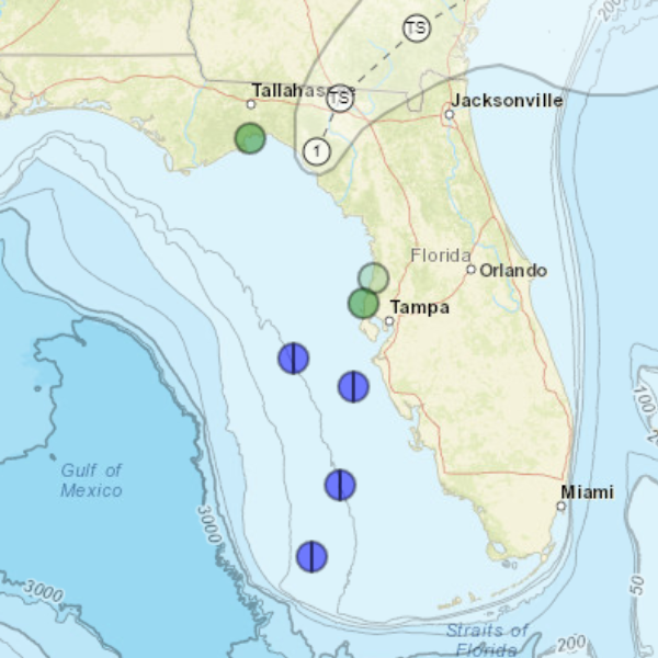
Eyes on the Storm
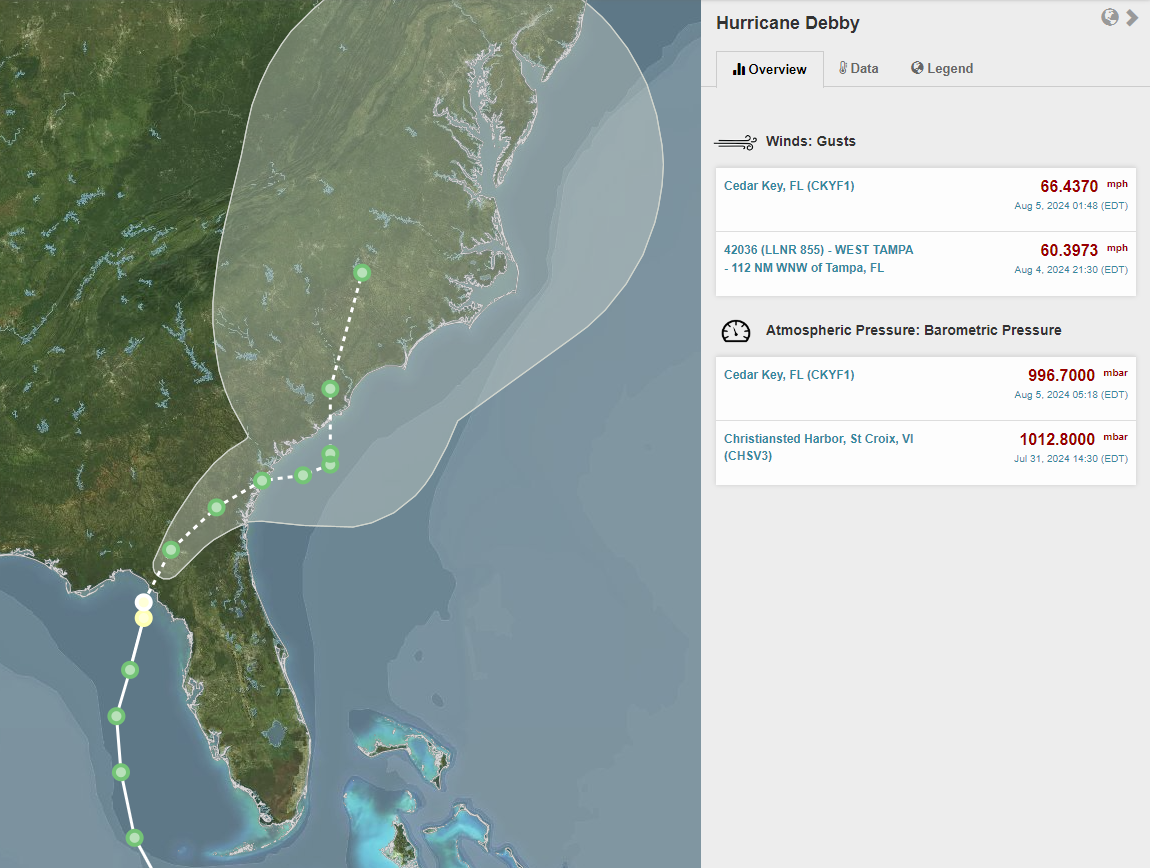
Eyes on the Storm on the SECOORA Data Portal pulls data from within 50 miles of Debby’s path. The Cedar Key, FL station recorded wind gusts of 66 mph on August 5th at 1:48 AM. If you click on the colored dots on the path of Debby, you can access data from stations in the area.
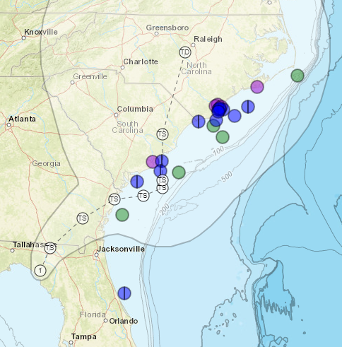
Integrated View on the SECOORA Data Portal
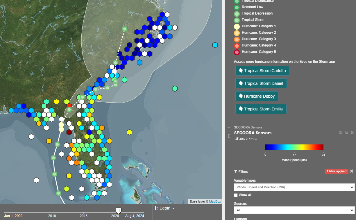
The Integrated View on the SECOORA Data Portal shows active storm tracks (Tropical Storm Debby shown here) and the SECOORA sensors located within the storm path. Using the panel on the right-hand side, select the data variable you wish to see (i.e. wind speed and direction, wave height, etc.) then click on the colored hexagons that each represent a station.
SECOORA Water Level Portal
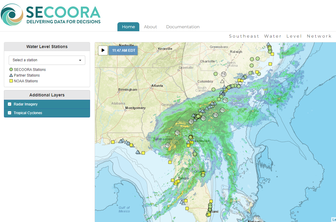
The SECOORA Water Level Data Portal shows SECOORA, NOAA, and partner stations within the Southeast Water Level Network. Click on the shapes to view station data within the storm’s path, which can be added using the right-hand panel titled “Additional Layers” along with the radar imagery.
Webcam Coastal Observation System (WebCOOS)
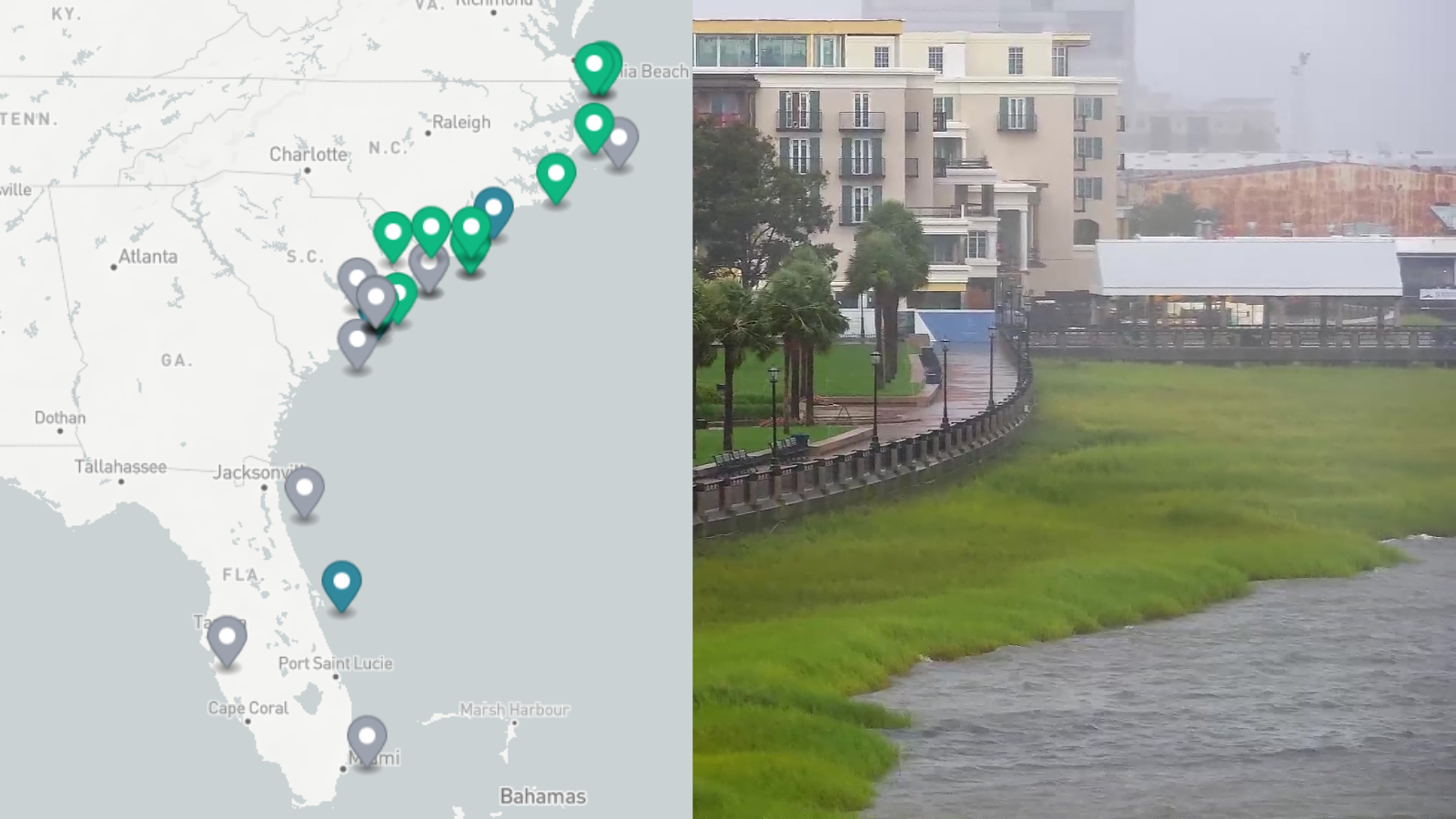
The Webcam Coastal Observation System (WebCOOS) allows users to stream live camera feeds in real-time as Debby impacts the Southeast. The cameras are being used to remotely monitor flooding, document the timing, duration, and extent of dune impacts, and predict rip currents.
Real Time Buoy Data
Debby’s projected path is expected to impact the southeast U.S. coast throughout this week. As the storm moves north, explore mooring stations in the Southeast supported by SECOORA. The information collected provides real time updates on the storm’s wind speed and more.
North Carolina and South Carolina buoys are operated by UNCW Coastal Ocean Research and Monitoring Program (CORMP).
Florida buoys are operated by University of South Florida Coastal Ocean Monitoring Prediction System (COMPS).
Additional Resources
Explore additional hurricane resources for the Southeast on the SECOORA Hurricane Resources page on our website. Please email communications@secoora.org if you have additional resources to add to our list.
Related news

Now Hiring: Director of Communications and External Affairs
SECOORA is seeking to fill the full-time role of Director of Communications and External Affairs. This role will serve as the organization’s strategic lead for engagement, communication, and external relations.
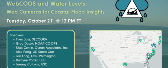
SECOORA Webinar | WebCOOS and Water Levels: Web Cameras for Coastal Flood Insights
On October 21st at 12 PM ET, SECOORA is hosting a webinar with investigators from the Webcam Coastal Observation System (WebCOOS) project team and the WebCOOS Project Manager. Web cameras are a low-cost technology that can be used to document flooding impacts to coastal communities. Register here.
SECOORA Funding Opportunity Announcement: Letters of Intent Solicitation
SECOORA will submit a coordinated regional proposal in response to the anticipated FY 2026 Implementation of the U.S. Integrated Ocean Observing System (IOOS) funding opportunity. Letters of Intent to be considered for inclusion in SECOORA’s full proposal are due September 9, 2025.