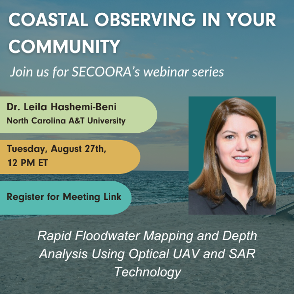
SECOORA’s August installment of the Coastal Observing in Your Community Webinar Series will feature Dr. Leila Hashemi-Beni, North Carolina Agricultural and Technical State University (NC A&T). She will provide an overview of rapid floodwater mapping and depth analysis using optical UAV and SAR technology.
This webinar is Tuesday, August 27th at 12 PM ET. Please click the button below to register for the webinar and access the meeting link. We will send a calendar invitation shortly after registration is submitted.
Webinar Abstract
Dr. Hashemi-Beni’s presentation will discuss harnessing geospatial data science and remote sensing data fusion for flood mapping. The need for fast processing and classification of massive remote sensing datasets for near real-time monitoring of floods and other rapidly changing events makes a compelling argument for integrating deep learning methods into sensing approaches to create fast and accurate flood maps. These maps can provide crucial information for delineating flood-affected areas, assessing damage (e.g., roads, bridges, infrastructures), and feeding models that predict the vulnerability of inland and coastal areas to flooding.
Speaker Bio
Dr. Leila Hashemi-Beni is an associate professor of Remote Sensing and GIS at the Dept. of Built Environment at College of Science and Technology, NC A&T State University. She’s the director of NCAT’s DEAP Institute of Geospatial Data Science and Remote Sensing for Environmental Management funded by NASA. She works as a PI/Co-PI on many projects supported by NASA, NSF, NOAA, Microsoft, North Carolina Collaboratory, North Carolina DoT. She is the Co-Chair of LiDAR, Laser Altimetry and Sensor Integration Working Group, International Society of Photogrammetry & Remote Sensing (ISPRS).
Related news

Claire McGrath Joins SECOORA as Program and Development Manager
SECOORA welcomes Claire McGrath as Program and Development Manager, supporting the Southeast & Caribbean Coastal Disaster Resilience Partnership and membership growth.

Spotlight: Mobilizing to Save Florida’s Coral Reefs
Learn how scientists are racing to save Florida's Coral Reef through coral rescue, gene banking, reef restoration, and innovative conservation efforts after disease and marine heatwaves devastated one of America's most important marine ecosystems.

From a Whale’s Song to an Ocean’s Symphony: How AI Decodes Underwater Sound
Explore how SECOORA-funded research is using AI and machine learning to decode ocean soundscapes, detect boat noise, and support coral reef restoration efforts.