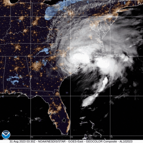
NOAA National Hurricane Center stated at 5:00 AM EDT (August 31, 2023) that the center of Idalia moved offshore of the coast of northeastern South Carolina. Strong southwesterly vertical wind shear has displaced the deep convective bands and heavy rainfall well north and northeast of the center over eastern North Carolina and the adjacent Atlantic.
Idalia has turned east-northeastward between a mid-level anticyclone over the Bahamas and a mid-tropospheric trough moving eastward over the northeastern United States. The anticyclone is forecast to retrograde over Florida during the next couple of days, causing Idalia to turn east-southeastward tonight and Friday.
Little change in strength is predicted today, but strong upper-level winds and drier mid-level air are likely to cause some gradual weakening by the weekend.
Key Updates:
- Areas of flash, urban, and moderate river flooding, with considerable impacts, will continue across coastal North Carolina through today.
- Coastal flooding is expected within the Storm Surge Watch area in North Carolina today. Residents in these areas should follow any advice given by local officials.
- Tropical storm conditions are expected in northeastern South Carolina and portions of eastern North Carolina today.
Click for official updates from the NOAA National Weather Service National Hurricane Center.
SECOORA put together this page to highlight data and information related to the Idalia. It will be updated as new information becomes available and the track is more certain.
Please email communications@secoora.org with additional resources to add!
Follow the Data
Eyes on the Storm pulls data from within 50 miles of Idalia pat
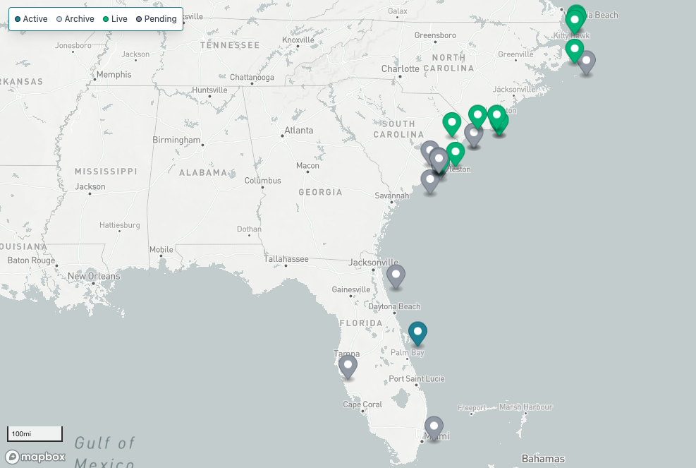
Real Time Buoy Data for Idalia
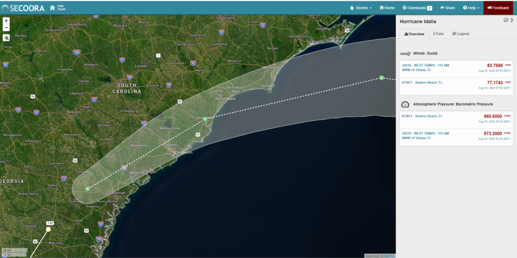
Idalia projected path is expected to impact the southeast U.S. coast through early next week. As the storm moves north, explore mooring stations in the Southeast supported by SECOORA. The information collected provides real time updates on the storm’s wind speed and more.
Florida buoys are operated by University of South Florida Coastal Ocean Monitoring Prediction System.
North Carolina and South Carolina buoys are operated by UNCW Coastal Ocean Research and Monitoring Program.
The WebCOOS (Webcamera Coastal Ocean Observing System) allows users to stream live camera feeds in real-time as Idalia approaches the Southeast. The cameras are being used to remotely monitor flooding, document the timing, duration, and extent of dune impacts, and predict rip currents.
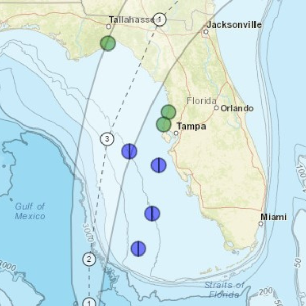
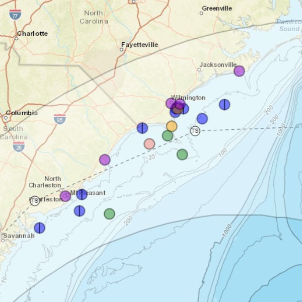
Integrated View of Idalia
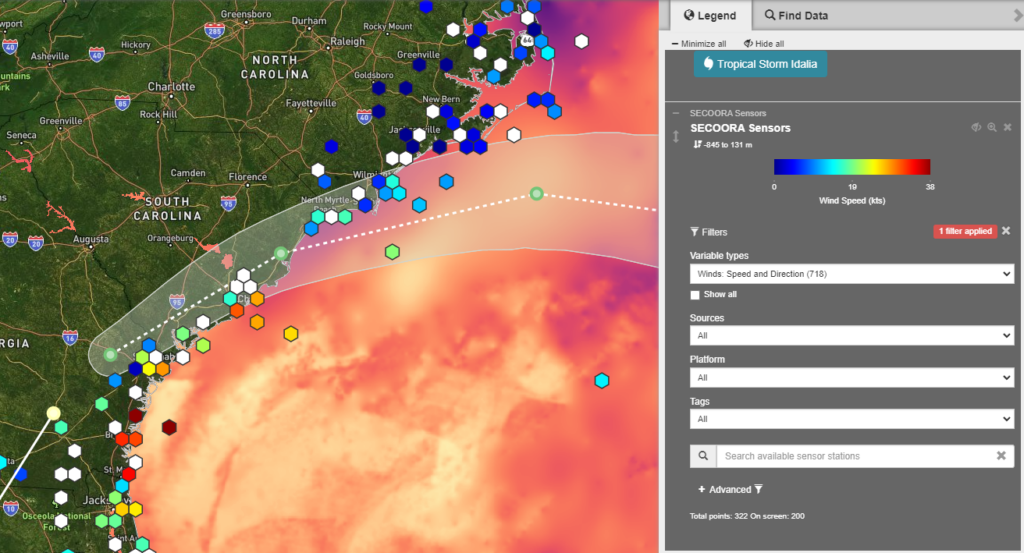
SECOORA’s Data Portal allows you to visualize Idalia track with other datasets. Pictured above is the SECOORA Data Portal displaying the NWS Hurricane track, the NASA Sea Surface Temperature Analysis model, and real time sensor layers.
More Hurricane Resources
Explore over 23 other hurricane data and other resources for the Southeast U.S. here.
Related news

SET Webinar Series: Partner Spotlight on the South Atlantic Salt Marsh Initiative
Join us on March 27, 2026, from 2:00 - 3:00 PM (ET) for the SECOORA SET Webinar Series where they will spotlight South Atlantic Salt Marsh Initiative (SASMI). This webinar will bring together SET Community of Practice members and partners to explore SASMI’s regional approach to salt marsh conservation and the role of scientific data in supporting restoration and coastal...

Abbey Wakely Joins SECOORA as Director of Communications and External Affairs
SECOORA welcomes Abbey Wakely as their new Director of Communications and External Affairs, where she will lead strategic engagement, communications, and external relations to strengthen the organization’s regional impact.
SECOORA Request for Proposals for a Data System Development, Operations, and Maintenance Service Provider
SECOORA seeks a Data System Development, Operations, and Maintenance (DMAC) service provider to act as a strategic partner while maintaining the current SECOORA Data System. Proposals are due to SECOORA by 5:00 PM ET, March 31, 2026.