

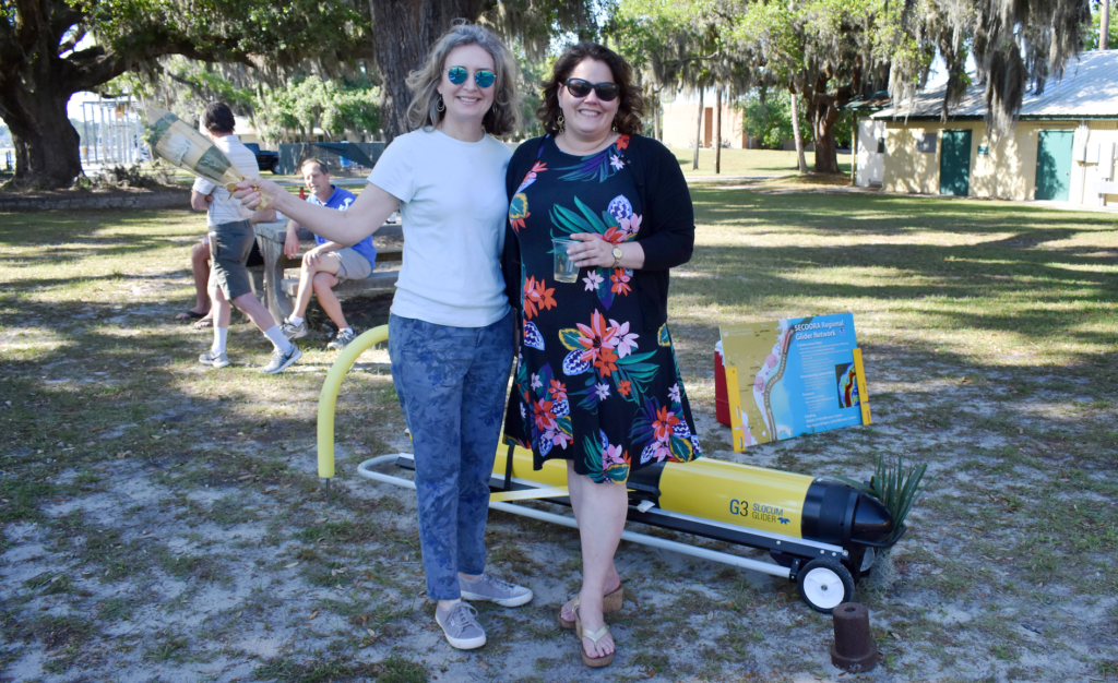
SECOORA received funding from the NOAA US Integrated Ocean Observing System (IOOS) to purchase a new G3 Slocum Glider. A naming competition was held to choose the new glider name and Franklin won with 46% of the votes. The name is in honor of Benjamin Franklin, the first person to chart the Gulf Stream. Franklin is operated by the SECOORA glider team lead, Dr. Catherine Edwards, Skidaway Institute of Oceanography at University of Georgia.
“An investment in knowledge pays the best interest.”
Benjamin Franklin
The SECOORA glider team is gathering data on hurricanes using autonomous underwater gliders as part of a NOAA initiative. SECOORA is partnering with the NOAA Atlantic Oceanographic and Meteorological Laboratory, U.S. IOOS, the U.S. Navy, GCOOS, MARACOOS, and CariCOOS.
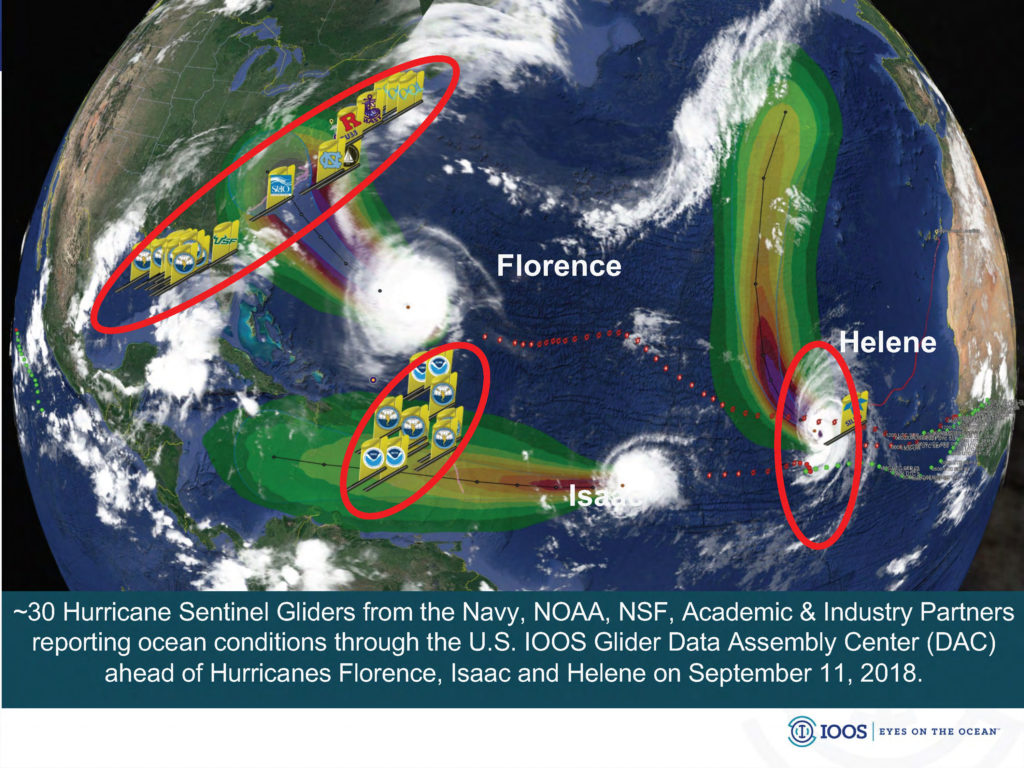
Hurricanes can grow rapidly in the Caribbean, Gulf of Mexico, and Atlantic Ocean off the Southeast US, where heat from the warm water can feed hurricane intensity. Satellites can be useful to predict where sea surface temperatures are warmer or cooler, subsurface temperatures are important to know, too. When a hurricane moves towards land, surface water mixes with sub-surface water. The colder, denser, deep-water mixes with the warmer, less dense surface water, potentially weakening a hurricane.
“The Gulf Stream is a potential source for a lot of energy that we can’t see with satellites, and the gliders can help us make a 3-D map of the heat in the Gulf Stream in our region.” Catherine Edwards, Skidaway Institute of Oceanography at University of Georgia.
Gliders propel themselves by changing buoyancy to produce forward motion with wings that provide stability as the glider moves through the water column. Sensors equipped on the glider measure subsurface temperature, salinity, and density. Gliders are capable of mapping ocean features that influence short-term weather, long-term climate variability, and marine life. “Each time it glider surfaces, it has a chance to improve the ocean and atmospheric predictions,” explains Edwards.
The glider transmits data each time it surfaces, and the data are shared with a network of ocean and atmospheric modelers in near-real time. Hurricane Glider data from the Caribbean, Gulf of Mexico, and Atlantic coasts is used to improve the operational ocean forecasts that provide information about heat exchange between the ocean and hurricane forecast models.
“Over the past several decades, hurricane forecasts have gotten a lot better at predicting where a hurricane will make landfall, and with more notice, but hurricane intensity forecasts remain a challenge,” states Catherine Edwards.
The SECOORA Glider team conducts six glider missions per year to study shelf circulation and water properties in the South Atlantic Bight. The hurricane glider missions are an added bonus to the SECOORA Glider Observatory; increasing our glider missions from six to eight missions each year.
As equipment ages, it needs to be replaced to ensure uninterrupted collection of crucial data. The purchase of Franklin means more glider days at sea and more data collection. The six-foot long underwater glider is capable of gathering reliable real-time data in any ocean conditions, including hurricane conditions.
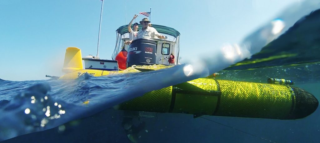
Instead of following the storm, the glider can close in on the storm. That proximity allows scientists and forecasters to better understand the trajectory and strength.
Data Made Possible By:


Related news
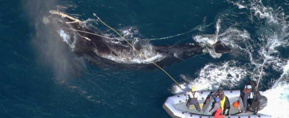
Saving the North Atlantic Right Whale: Underwater Gliders Join the Fight to Save a Species
Meet the SECOORA-funded scientists using underwater gliders and acoustic tech to protect critically endangered North Atlantic right whales.

Dave Wells Joins SECOORA as Ocean Observing Systems Team Lead
SECOORA welcomes Dave Wells as Ocean Observing Systems Team Lead where he will oversee SECOORA's coastal observing system assets and data management.
At the Water’s Edge: Lowcountry Coastlines in a Brave New World
A nor'easter's record storm tide. A stalled tropical storm. Two Lowcountry towns adapting to a new era of flooding, with SECOORA data in hand.