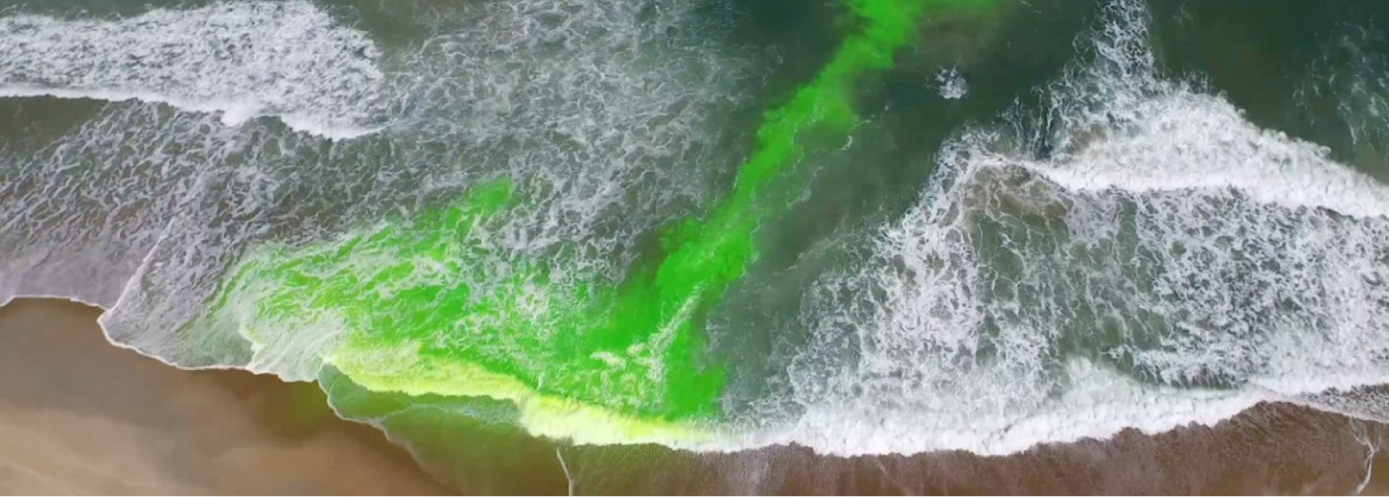
Rip currents are responsible for 80% of beach rescues and approximately 100 deaths each year. They are as dangerous as they are difficult to detect.
NOAA has released a new operational rip current model that will improve beach safety through sophisticated rip current forecasts. The model predicts the future likelihood of hazardous rip currents more accurately than previous prediction approaches, and offers hourly predictions up to six days in advance. Click here to access the model.
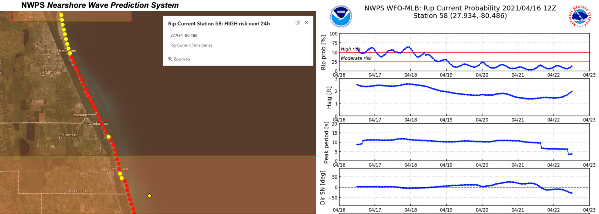
As lead NOAA scientist Dr. Greg Dusek explains, “This model can benefit life saving agencies who need to predict rip currents on busy weekends so they know how many lifeguards to schedule.”
SECOORA Funded Webcam Data to Help Validate and Improve Rip Current Forecasts

Early versions of Dr. Dusek’s rip current model relied on lifeguard observations for validation of rip currents. Though lifeguard observations are extremely valuable, irregular lifeguard presence and the subjectivity of human observations requires that these observations are supplemented through other approaches.
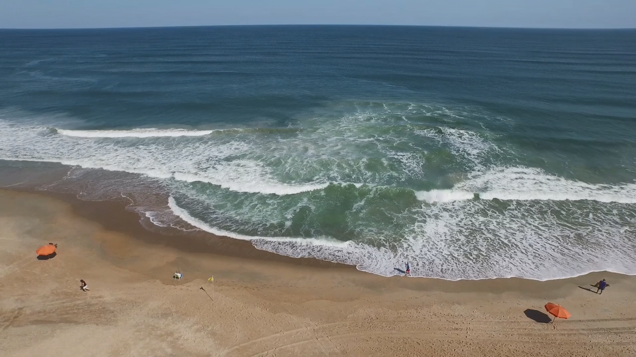
Low-cost shoreline cameras ultimately provided the ideal dataset with their many locations and near-constant data stream. Dr. Dusek explains, “You can’t easily observe rip currents with instruments in the water because they move, so we use cameras to detect them through time-averaged imagery.”
Dr. Dusek plans to validate his model using shoreline footage from SECOORA’s Webcams for Coastal Observations and Operational Support (WebCOOS) network. WebCOOS is a network of coastal observing webcams and used for quantitative scientific analysis, public safety, and resource management in coastal municipalities. Dr. Dusek says, “WebCOOS images give us something more quantitative than the lifeguard data, and increases the amount of data we have access to.”
Scientists Publish Paper on Machine Learning in Rip Current Models
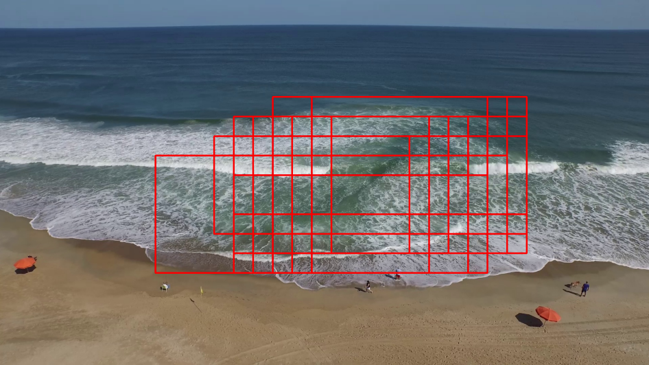
Rip currents may be an age-old public safety concern, but a UC Santa Cruz and NOAA team is using cutting edge machine learning technologies to identify rip currents. The end goal is to use the machine learning algorithms to enhance and improve the NOAA rip current forecast model.
Dr. Dusek worked alongside Akila de Silva, Issei Mori, James Davis, and Alex Pang of University of California Santa Cruz to publish a recent paper on algorithms inspired by the human brain called “neural networks.”
Computers are skilled at using neural networks to identify objects, but rip currents are particularly difficult to analyze since they have no clear edges. The research offers evidence that with enough data processing, a specialized type of neural network can indeed identify rip currents with high success.
More Machine Learning in the Future for WebCOOS
Debra Hernandez, SECOORA’s Executive Director, is equally enthusiastic about the role of WebCOOS in the new rip current model. Hernandez says, “We’re spending most of our funding at this stage on improving the ability of computers to do analysis work using webcam data. Whether it’s identifying a right whale or a rip current or shoreline erosion, we need faster analysis for more effective alerts to inform decision-makers.”
WebCOOS started as a successful pilot project, the Web Camera Applications Testbed, and is now transitioning into a sustained long-term observing network that will support multiple decision-maker needs. WebCOOS project partners include Dr. Dusek, NOAA; Dr. Joseph Long, UNCW; Dr. Alex Pang, UCSC; Dr. Dwayne Porter, UofSC; and other scientists from USGS and USACE.
Dr. Dusek stresses the importance of the WebCOOS partnership to his model, and says, “Rip currents are a national problem that’s best managed at a local level. Data needs and users vary by location. SECOORA and our academic partners have been able to provide boots on the ground, access to data, and cameras installed in a way that we can’t easily do at a federal level.”
Related news
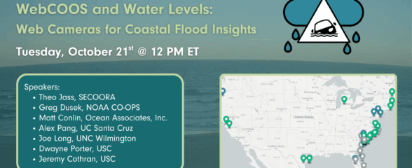
SECOORA Webinar | WebCOOS and Water Levels: Web Cameras for Coastal Flood Insights
On October 21st at 12 PM ET, SECOORA is hosting a webinar with investigators from the Webcam Coastal Observation System (WebCOOS) project team and the WebCOOS Project Manager. Web cameras are a low-cost technology that can be used to document flooding impacts to coastal communities. Register here.
SECOORA Funding Opportunity Announcement: Letters of Intent Solicitation
SECOORA will submit a coordinated regional proposal in response to the anticipated FY 2026 Implementation of the U.S. Integrated Ocean Observing System (IOOS) funding opportunity. Letters of Intent to be considered for inclusion in SECOORA’s full proposal are due September 9, 2025.

SECOORA Hosts the First Surface Elevation Table (SET) Community of Practice Virtual Workshop
The SECOORA SET Workshop was virtual on July 17, 2025. More than 50 Community of Practice members and stakeholders joined this collaborative workshop to discuss SET monitoring, coastal resilience, and data-driven decision making in the Southeast.