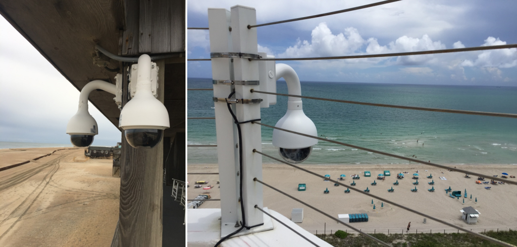
Two cameras installed for the webcam network. The left is located at Buxton, NC and the right is located in Miami, FL. Image Credit: Surfline, Inc.
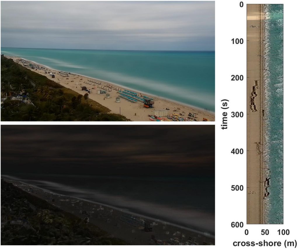
Example of a product using web camera data. Time-average (top), time-variance (bottom) and time-stack (right) images are calculated from video segments from the Miami, FL camera. These products support identification of morphological features, shoreline position and wave runup and overwash. Credit: Dusek et al., 2019.
SECOORA was recently awarded a $1.1 million grant to launch a sustained network of low-cost webcams throughout the Southeast, which will build off of a successful pilot project. Webcams are a low cost coastal observing platform transforming how environmental monitoring is conducted. Video data is being used for applications related to transportation and commerce, preparedness and risk reduction, and stewardship of coastal resources.
The project, Webcams for Coastal Observations and Operational Support (WebCOOS), will develop a webcam coastal observing network for quantitative scientific analysis, public safety, and resource management for coastal municipalities. To accomplish this, standardized data processing and management methodology will be established to provide stakeholders such as lifeguards, emergency managers, and coastal managers actionable information from webcam video.
“SECOORA is excited to be awarded NOAA funding to transition our successful pilot project, the Web Camera Applications Testbed, to a sustained network. Webcam data has demonstrated value to address significant gaps in the nation’s ability to monitor and accurately forecast various weather, ocean, ecological and public health hazards.”
– Debra Hernandez, SECOORA Executive Director
This project will result in immediate benefits to partners by filling gaps in critical coastal observations. For instance, webcam data will help NOAA validate and improve their rip current forecast model, and USGS relies on webcam observations of wave run-up for research on beach erosion, overwash, and inundation. In both of these cases and others, there are extremely limited coastal observations available to address these needs.
Project Funding
This project is funded by the NOAA U.S. Integrated Ocean Observing System’s (IOOS®) Ocean Technology Transition grant.
Project Partners
Related news

Species Spotlight: Trichodesmium
Discover the remarkable role of Trichodesmium, a microscopic cyanobacterium that helps fuel life across the ocean. In this Species Spotlight, explore how researchers supported by the Marine Biodiversity Observation Network (MBON) are using imaging technology, genomics, and eDNA to better understand this “shape-shifting” organism and its influence on marine ecosystems, ocean health, and coastal economies.
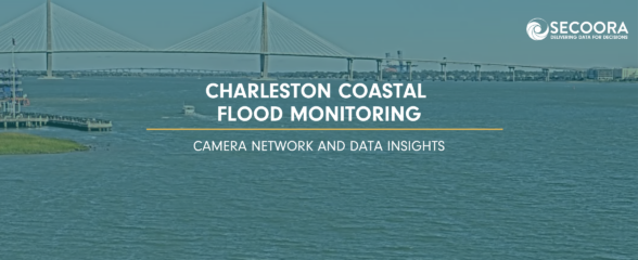
Charleston Coastal Flood Monitoring: Camera Network and Data Insights
A new story map explores how cameras in Charleston, South Carolina are helping communities monitor and respond to changing coastal conditions, from everyday weather impacts to flooding events. As a rapidly growing coastal city with a major working port, Charleston depends on an accurate understanding of water conditions to support transportation, public safety, infrastructure, and economic activity.

Scientist Spotlight: Dr. Frank Muller-Karger
Meet Dr. Frank Muller-Karger, a Biological Oceanographer and Distinguished University Professor at the USF College of Marine Science and co-lead of the U.S. Marine Biodiversity Observation Network. His research integrates satellite data, environmental DNA, and physical sensors to better understand how warming oceans are influencing marine populations.