Meet Matt Upton
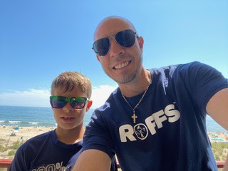
Matt and his son, Niles Upton
As the owner of the nationally successful oceanographic consulting group ROFFS™, Matt Upton splits his day between synthesizing a diverse array of data sets and chatting with fishermen about their catch. ROFFS™ integrates data from sources like SECOORA to develop powerful oceanographic analyses to inform recreational fishing, commercial seafood, oil and gas, and public research efforts. Upton came to the industry with education experience, including a Bachelor of Science in Atmospheric, Oceanic and Space Sciences at the University of Michigan and a Masters of Science in Physical Oceanography from the University of Massachusetts.
Now based in West Melbourne, Florida, Upton has used his 14 years of employment at ROFFS™ to expand near real-time spatial and temporal coverage of oceanographic data. ROFFS™ was previously owned by Dr. Mitchell Roffer, a past SECOORA Board member. Through partnerships with SECOORA and the marine modeling group Fathom Science, Matt secures the data ROFFS™ needs to strengthen their analyses and inform their clients.
Appealing to Recreational Fishermen
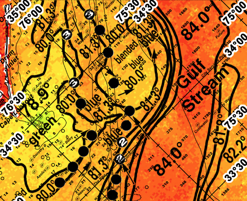
Sample of a ROFFS™ fishing forecast image near Cape Hatteras. Dots represent fishing ‘hot-spots’ with numerical indicators for the number of consecutive days a point has yielded successful catches.
Recreational fishermen make up 95% of all ROFFS™ clients and are what Upton calls “the bread and butter for our business.” ROFFS™ intentionally designs their oceanographic analyses to place a premium on clarity and include only information most relevant to recreational fishermen. Upton knows that for many of their clients, “this is their hobby for just a few months out of the year. They don’t want to spend their time looking at the raw data.” Although ROFFS™ serves a diversity of clients, the gallery of fishing tournament winners on their site suggests ROFFS™ has a soft spot for recreational fishermen.
Incorporating SECOORA Data Into Recreational Fishing Analyses
SECOORA data is crucial for serving fishermen at ROFFS™. Matt counts buoys and real-time sensors as invaluable datasets for his forecasts, saying, “we use [SECOORA’s buoys] up and down the coast nearly every day for Sea Surface Temperature calibration to give our clients the most accurate analysis.” ROFFS™ also uses the SECOORA buoys for offshore and near-shore wind measurements.
When clouds interfere with their satellite imagery, SECOORA’s High Frequency Radars, land-based observational instruments that measure the velocity of ocean surface currents in near real-time, play a special confirmatory role. Matt says, “If we can’t see ocean conditions through the clouds, we will from time to time look at HF radar data to confirm, say, where the edge of the Gulf Stream is.” And when reports of an algal bloom arise, ROFFS™ joins recreationalists in using SECOORA’s Harmful Algal Bloom data “to monitor the coastal and offshore conditions.”
Using Fathom Science Data
Fathom Science and ROFFS™ partner up to improve their weather forecasts
To improve next-day forecasts, ROFFS™ recently partnered with Fathom Science, a fellow SECOORA member. Fathom develops metocean and forecasting products through a proprietary modeling program that ROFFS™ uses to validate their fishing predictions. Matt is enthusiastic about the partnership, saying, “As a private business, we try to partner with academic, non-profit and private industry groups all together to get data out rather than keep it in the academic world.”
The partnership is beneficial to Fathom Science, too— ROFFS™ uses their ongoing contact with recreational users to provide Fathom Science with direct feedback on their models from offshore fishermen. Joe Zambron, Fathom Science, notes that “SECOORA was instrumental in helping us get together and develop [this] partnership.” Fathom Science has been assimilating SECOORA’s glider and buoy data into their models for years, and this partnership marks a new stage in their SECOORA membership.
Partnering for Further Research
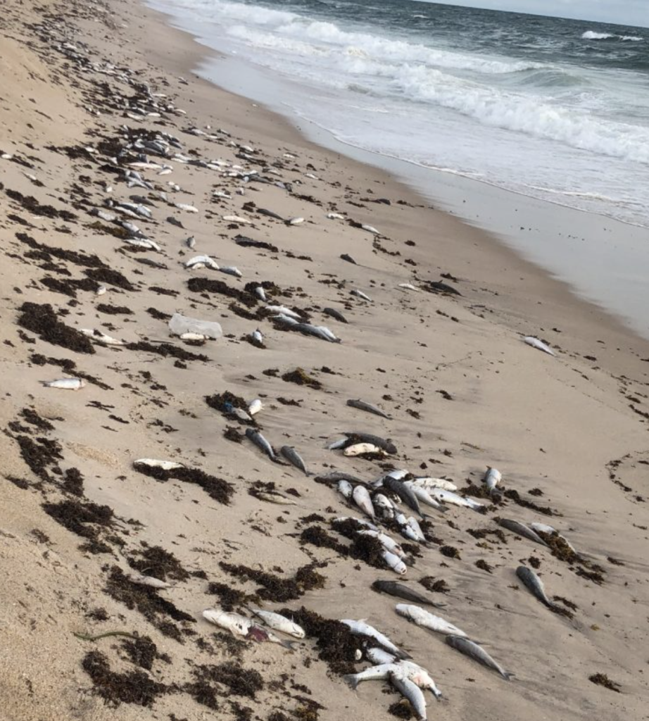
ROFFS™ gathered and analyzed satellite data to help monitor the 2018 Florida red tide outbreak that killed many fish surrounding Melbourne Beach.
ROFFS’s™ expertise in providing detailed, real-time information on the distribution of water masses lends itself well to scientific research efforts. ROFFS™ regularly partners with SECOORA, NOAA, and state government agencies to share information, monitor hazardous waste spills, and predict distribution patterns. These projects have included coastal runoff monitoring in Mississippi following Hurricane Katrina in 2005, Florida Red Tide monitoring in 2018, and a 2015 study on bluefin spawning patterns. Upton says, “For years it was thought that bluefin tuna only spawned in the Gulf of Mexico. One of the coolest things we found through sampling in the Caribbean and Bahamas was several bluefin tuna larvae, so we proved that they were spawning in other locations.”
For future research, Upton says, “The more buoys the better!” emphasizing their particular interest in seeing more buoys 15-20 miles offshore. For now, Upton is aware of the excitement that constant problem-solving, new partnerships, and constantly changing technology brings. Although the constant data wrangling across multiple regions and sources can be difficult, Upton admits that “We really enjoy what we do. We like getting to talk to fishermen, and the job is definitely a unique niche.”
Related news

Species Spotlight: Trichodesmium
Discover the remarkable role of Trichodesmium, a microscopic cyanobacterium that helps fuel life across the ocean. In this Species Spotlight, explore how researchers supported by the Marine Biodiversity Observation Network (MBON) are using imaging technology, genomics, and eDNA to better understand this “shape-shifting” organism and its influence on marine ecosystems, ocean health, and coastal economies.
Charleston Coastal Flood Monitoring: Camera Network and Data Insights
A new story map explores how cameras in Charleston, South Carolina are helping communities monitor and respond to changing coastal conditions, from everyday weather impacts to flooding events. As a rapidly growing coastal city with a major working port, Charleston depends on an accurate understanding of water conditions to support transportation, public safety, infrastructure, and economic activity.

Scientist Spotlight: Dr. Frank Muller-Karger
Meet Dr. Frank Muller-Karger, a Biological Oceanographer and Distinguished University Professor at the USF College of Marine Science and co-lead of the U.S. Marine Biodiversity Observation Network. His research integrates satellite data, environmental DNA, and physical sensors to better understand how warming oceans are influencing marine populations.