
After a slow start to the 2019 Atlantic hurricane season, the Southeast and Gulf of Mexico are starting to ramp up for Hurricane Dorian.
SECOORA is the coastal ocean observing system for the southeast U.S and eastern Gulf of Mexico. SECOORA invests in coastal and ocean observations that help with hurricane planning.
Explore our top four favorite hurricane resources and data products.
1) Eyes on the Storm
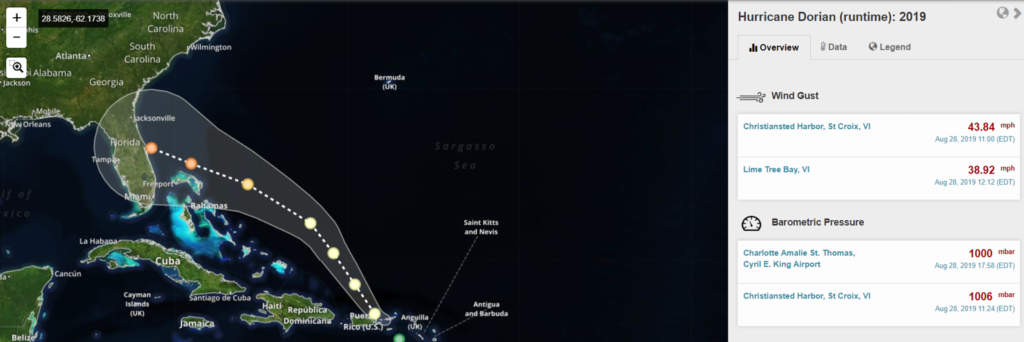
Eyes on the Storm is an interactive portal that connects you to hurricane and tropical storm data from past storms. Explore meteorological data as the storm progresses – see details on barometric pressure, wind gusts, temperature and wave heights.
Just launched in time for peak hurricane season- follow Hurricane Dorian live. Pull data from within 50 miles of the hurricane path and see highest wind speeds and wave heights and lowest barometric pressure. Click here to follow Hurricane Dorian.
2) Marine Weather Portal
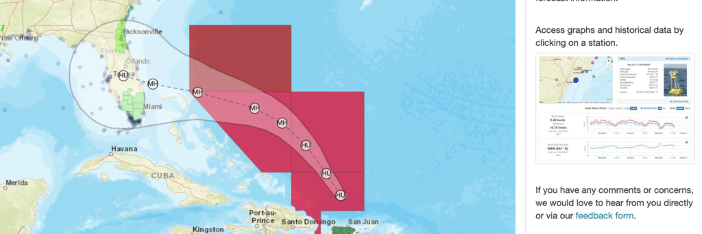
The SECOORA Marine Weather Portal (MWP) provides up-to-date weather hazards, tropical cyclone forecasts, and observations as hurricanes and tropical storms approach the Southeast and the Gulf of Mexico. The new National Weather Service Hurricane Threats and Impacts map overlays are available on the MWP, allowing you to identify worse case scenarios for planning purposes.
Access free coastal and offshore observations and forecasts in one convenient location by using the MWP.
3) SECOORA Data Portal and Data Views
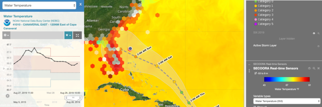
Having access to live storm data provides is essential for hurricane planning. The SECOORA Data Portal does its part by providing data to professionals, emergency planners, and scientists. Go to https://portal.secoora.org/ to explore the wide variety of information on weather, storms, climate and easy-to-browse data.
Create a Dorian Data View to stay up-to-date on the storm track and view environmental data near the storm. See the data view tutorial to learn how.
4) Hurricane Data Resource Page
A one-stop website for Hurricane Resources, SECOORA has compiled 23 useful links that go to regional data, live data, observation networks, and meteorological information. This reference is a great way to start exploring hurricane resources and regional ocean observing data.
—-
Data Disclaimer
Always adhere to your local to emergency management advisories during an extreme weather event.
There are no understandings, agreements, and representations, express or implied warranties (including any regarding merchantability or fitness for a particular purpose) respecting this data. Further, no employee of SECOORA, agent or other person is authorized to give any warranties on behalf of SECOORA, or to assume any liability in connection with the use of this data.
Related news

Now Hiring: Director of Communications and External Affairs
SECOORA is seeking to fill the full-time role of Director of Communications and External Affairs. This role will serve as the organization’s strategic lead for engagement, communication, and external relations.
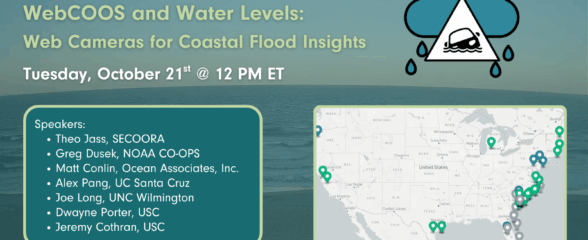
SECOORA Webinar | WebCOOS and Water Levels: Web Cameras for Coastal Flood Insights
On October 21st at 12 PM ET, SECOORA is hosting a webinar with investigators from the Webcam Coastal Observation System (WebCOOS) project team and the WebCOOS Project Manager. Web cameras are a low-cost technology that can be used to document flooding impacts to coastal communities. Register here.
SECOORA Funding Opportunity Announcement: Letters of Intent Solicitation
SECOORA will submit a coordinated regional proposal in response to the anticipated FY 2026 Implementation of the U.S. Integrated Ocean Observing System (IOOS) funding opportunity. Letters of Intent to be considered for inclusion in SECOORA’s full proposal are due September 9, 2025.