Written by Emily Noakes, SECOORA Communications Intern
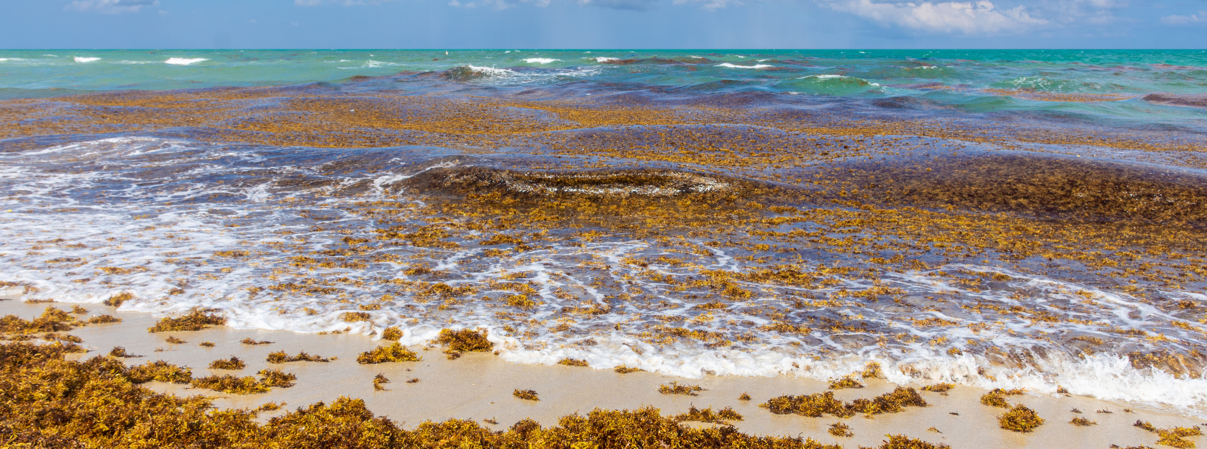
Sargassum is a brown macroalgae (also known as seaweed) that floats on the surface of the ocean and provides a critical habitat for fish and sea turtles; however, Sargassum can pose a problem when it blooms in mass quantities and washes up on beaches. Decomposing Sargassum not only creates costly clean-up operations for beach communities but also produces hydrogen sulfide gas which can cause breathing difficulties in humans.
Large mats of Sargassum have been washing ashore in the Southeast U.S., Gulf of Mexico, and Caribbean islands. The Sargassum Watch System (SaWS), developed by Dr. Chuanmin Hu and his team at the University of South Florida, is a tool to forecast and monitor Sargassum trajectory and location.
Tracking Sargassum with SaWS
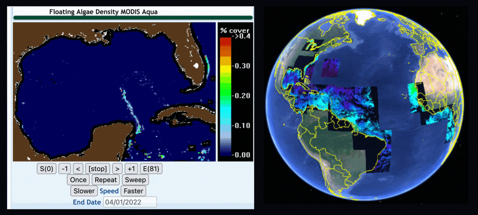
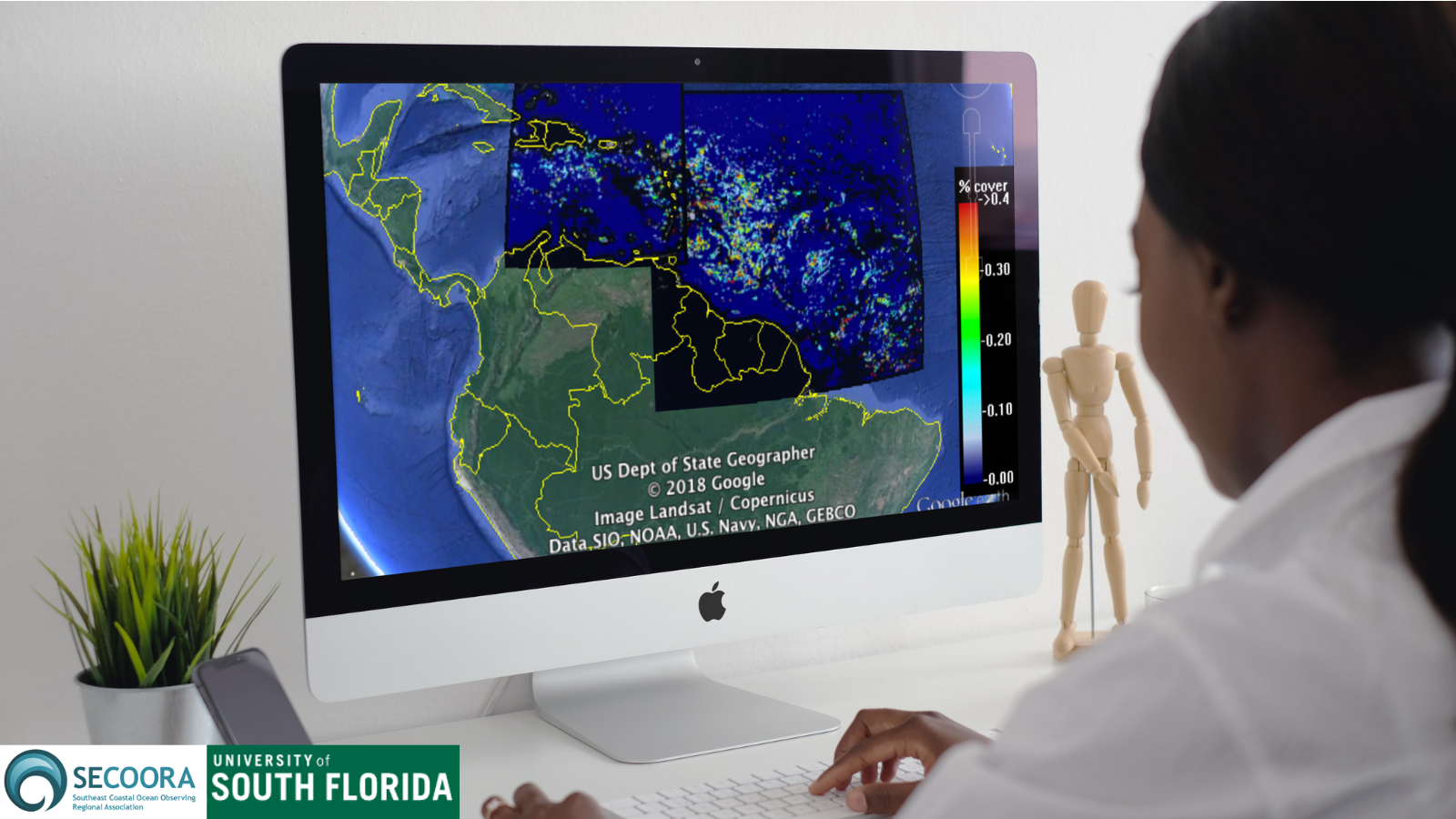
SaWS provides real-time information on Sargassum location and amount using satellite images. These images are accessible online by all users, and are compatible with Google Earth.
“We monitor and study Sargassum to satisfy our scientific curiosity and to serve the people.” — Dr. Chuanmin Hu, University of South Florida
SaWS provides imaging from the Caribbean, Western Atlantic Ocean, Gulf of Mexico, and Western Africa. A bulletin is released at the end of every month providing the present Sargassum outlook and a prediction extending over two months.
Users of SaWS
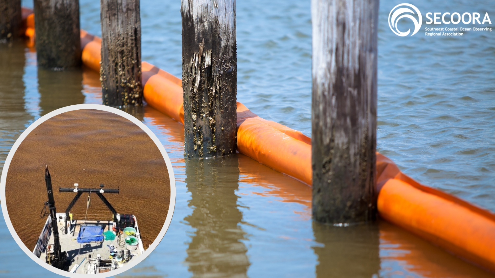
SaWS allows local managers to prepare equipment and personnel and to take swift action when a Sargassum bloom is expected to impact certain areas. For example, the Belize National Meteorological Service uses SaWS to track Sargassum in order to deploy debris booms. The booms block the seaweed from reaching the beach, allowing for easy collection from the water.
Many islands in the Caribbean heavily rely on desalination for safe drinking water during the drought season. Sargassum can clog power and desalination plant intake pipes. A state of emergency was recently declared due to a desalination plant failing in St. Croix, USVI because of Sargassum clogging vital equipment. SaWS can provide local plant managers early warning information on possible inundation of large amounts so they can prepare for mitigation efforts.
Fishermen use SaWS to visualize the size and location of the floating Sargassum mats. A variety of fish can be found around Sargassum, but potential damage to engines and fishing gear can occur if caution is not exercised.
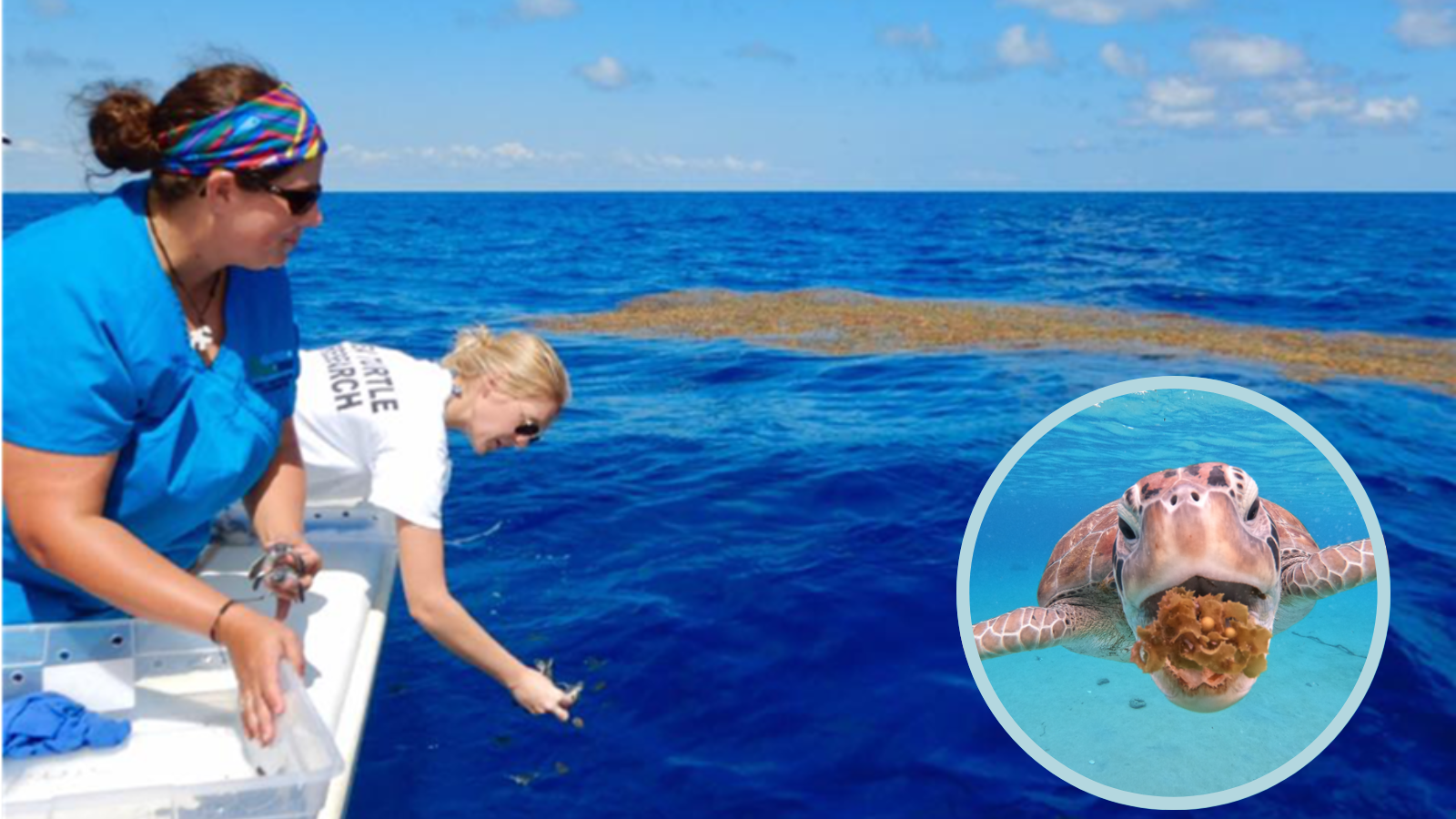
Scientists also need to know where the Sargassum is located in order to conduct research on Sargassum and on animals living around. Some sea turtle rehabilitators seek out Sargassum mats to use as safe releasing areas. During Hurricane Irma, over 2,500 hatchlings were washed ashore and later placed on Sargassum mats.
Improving Sargassum Tracking
Users of SaWS would like to “zoom in” on certain beaches in the Caribbean and United States to see localized sargassum blooms. SECOORA is providing funding to Dr. Hu to improve his high-resolution imagery products to allow for local beach monitoring.
Related news
SECOORA Hosts the Second Surface Elevation Table (SET) Community of Practice Workshop In Person in Charleston
The 2nd SECOORA SET Workshop convened in person on July 16-17, 2026 in Charleston, SC. More than 30 Community of Practice members and stakeholders joined this collaborative workshop to discuss SET monitoring, coastal resilience, and data-driven decision making in the Southeast.

Claire McGrath Joins SECOORA as Program and Development Manager
SECOORA welcomes Claire McGrath as Program and Development Manager, supporting the Southeast & Caribbean Coastal Disaster Resilience Partnership and membership growth.

Spotlight: Mobilizing to Save Florida’s Coral Reefs
Learn how scientists are racing to save Florida's Coral Reef through coral rescue, gene banking, reef restoration, and innovative conservation efforts after disease and marine heatwaves devastated one of America's most important marine ecosystems.