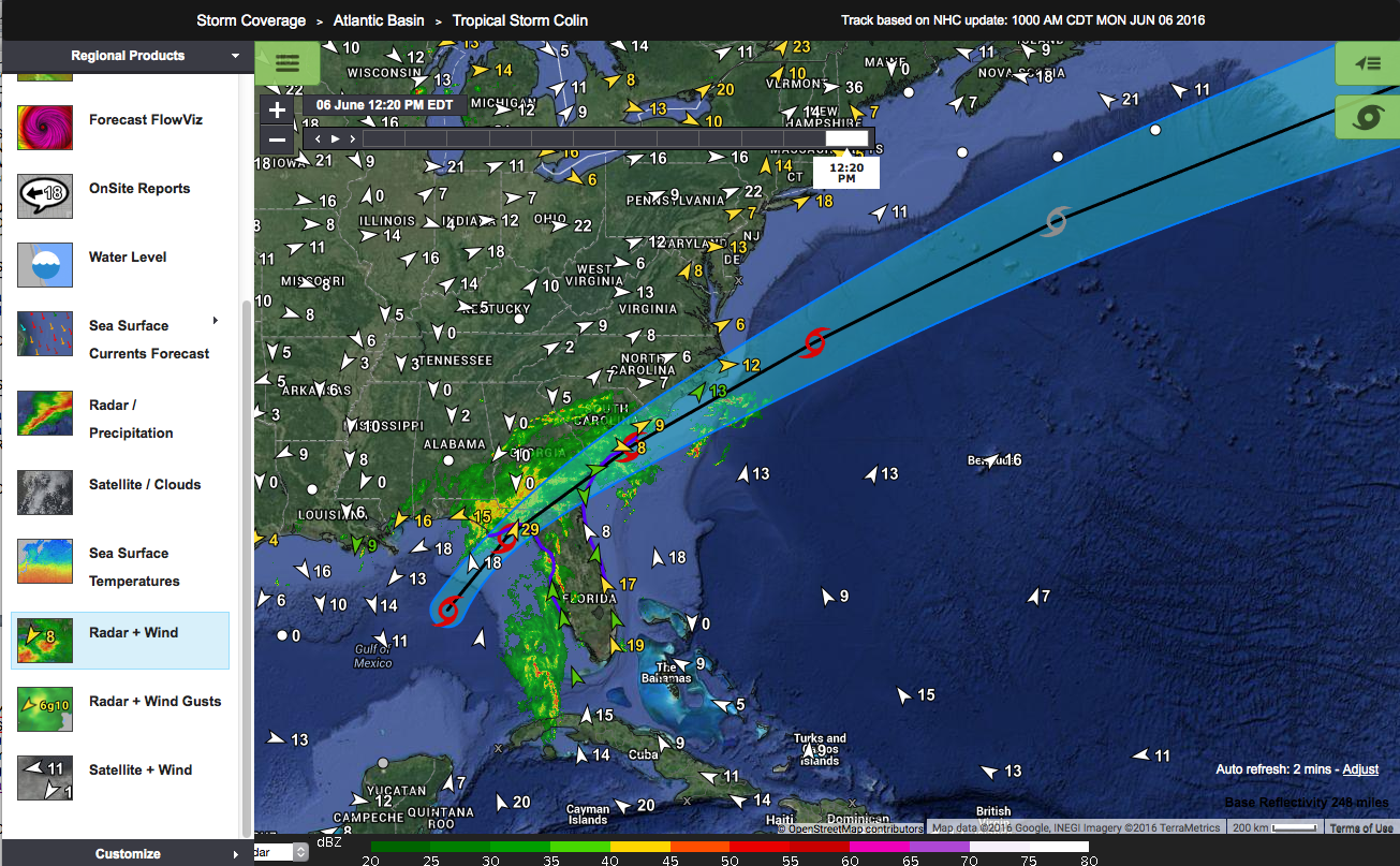
Tropical Depression Eight and Tropical Storm Hermine are dousing the SECOORA region.
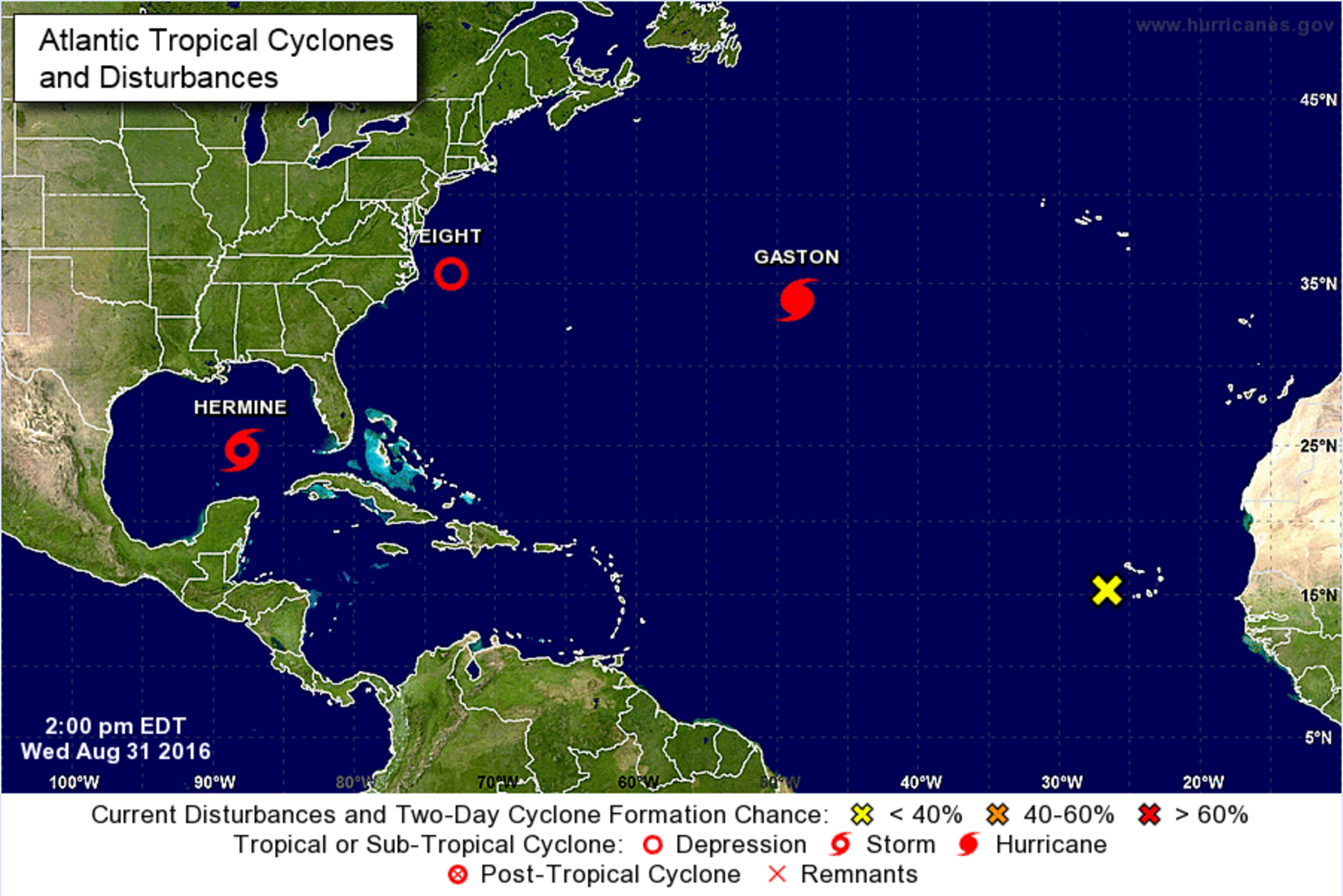
Tropical Depression Eight
Tropical Depression Eight is moving slowly away from the North Carolina coastline. According to the National Hurricane Center it is centered about 75 miles east-southeast of Cape Hatteras.
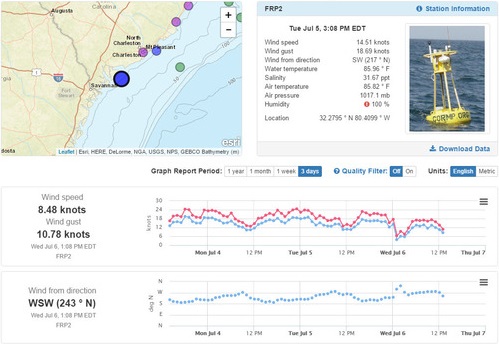
SECOORA and US IOOS support marine weather buoys off of the coast of North Carolina and South Carolina. The weather sensors on the buoys captured the data of Tropical Depression Eight in real time.
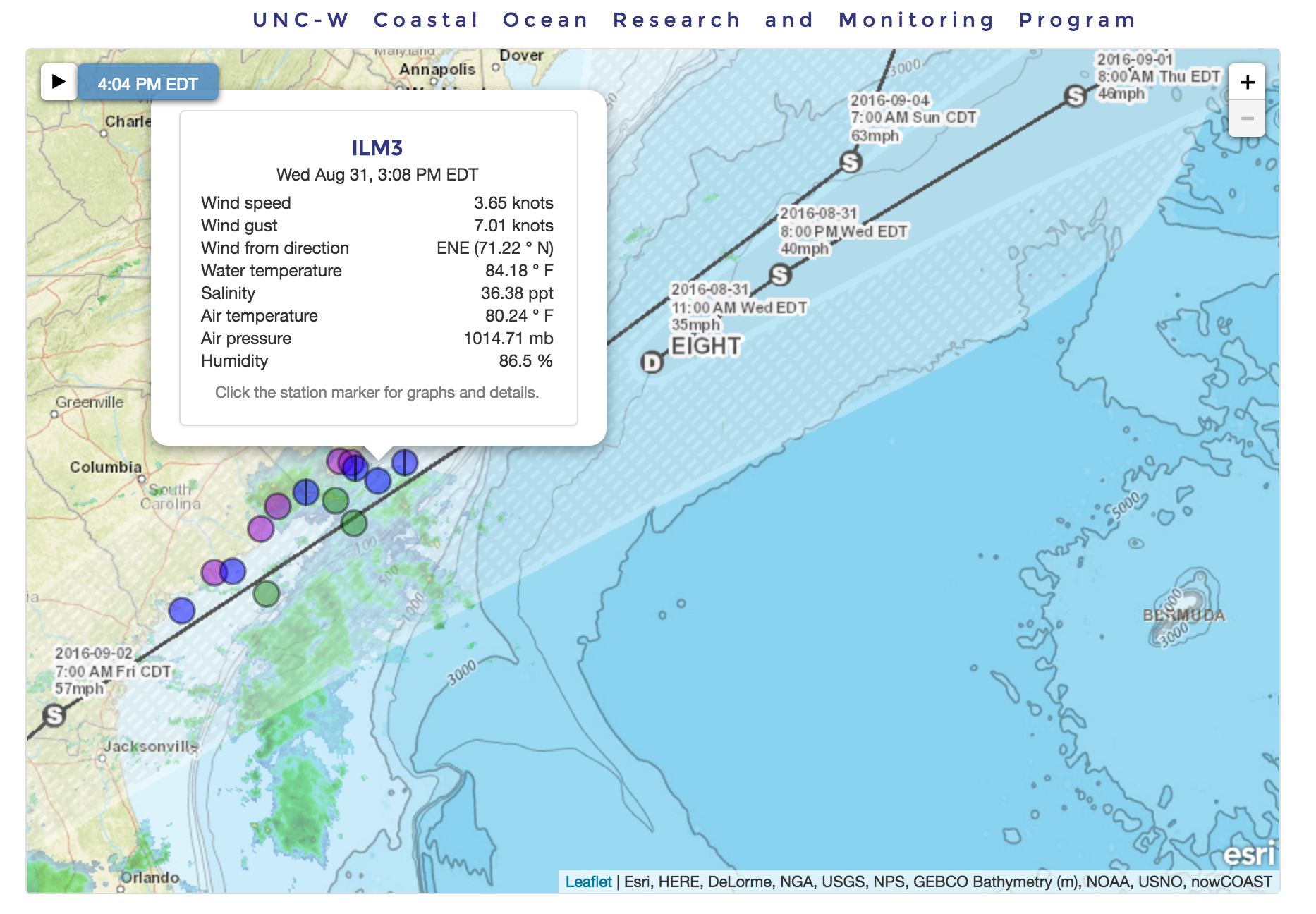
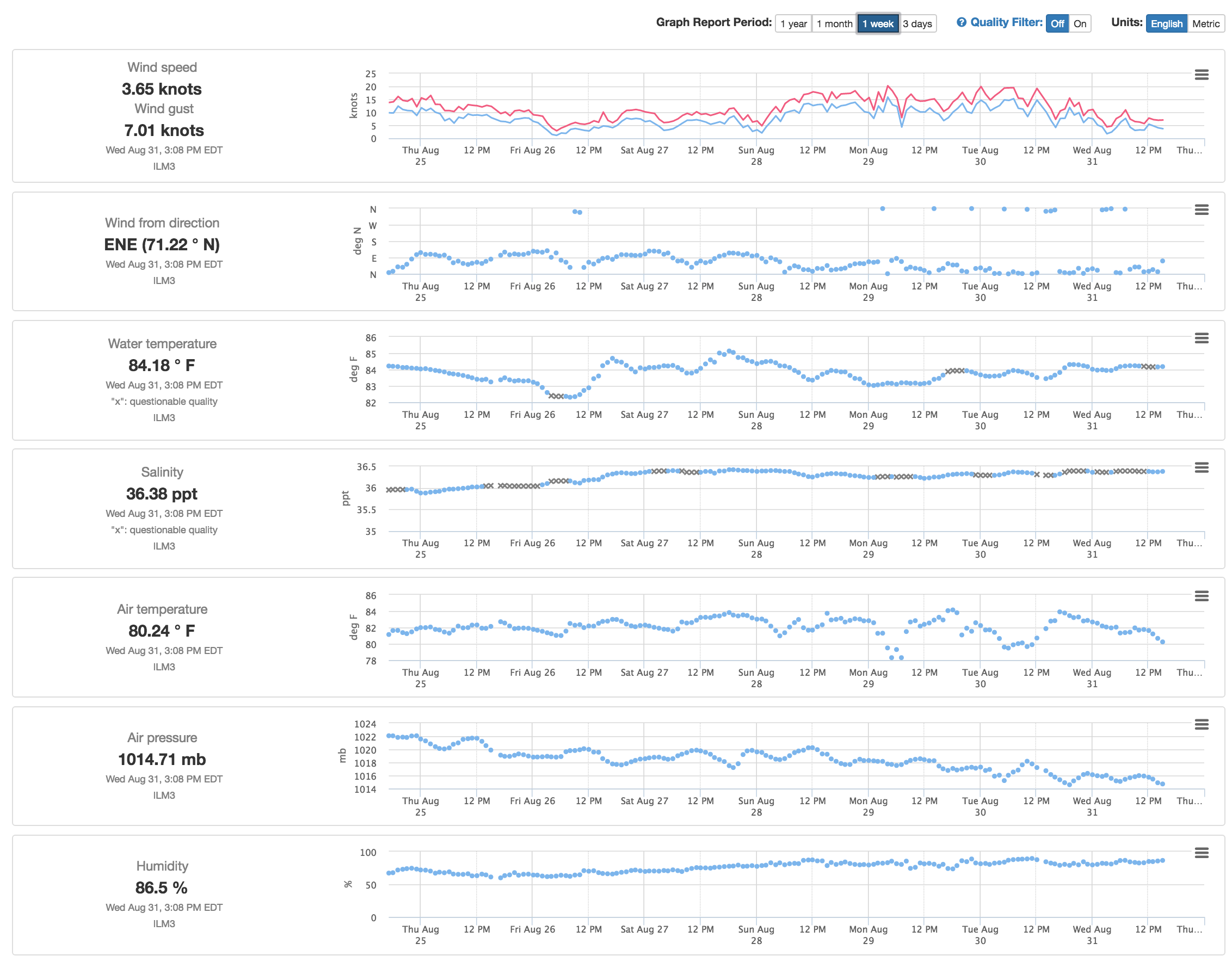
Pictured above is 1 week data plot from buoy ILM3. Monday August 29 and Tuesday August 30 is when the storm passed over the University of North Carolina Wilmington Coastal Ocean Research and Monitoring Program buoys. Contact Lynn Leonard, UNCW, for more information. Or visit the CORMP page to explore more data. For warnings and briefings visit the NWS Wilmington NC website.
Tropical Storm Hermine
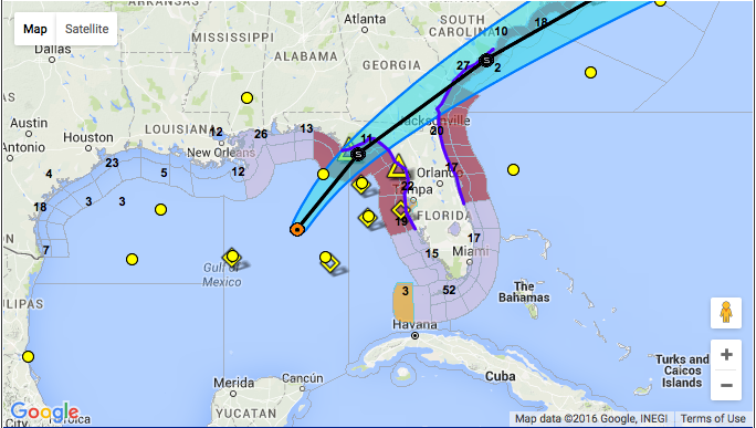
Wednesday August 31, Tropical Depression Nine was upgraded to Tropical Storm Hermine (pronounced “her MEEN”). According to the NWS Tampa Bay Weather Forecast Office, the storm is forecast to gradually strengthen as it lifts northward then northeast, eventually making landfall across the eastern Florida Panhandle and Big Bend region on Thursday. The system is forecast to slowly intensify over the next day or two.
Tropical Storm Hermine is the 8th named storm of the 2016 Atlantic hurricane season. A NOAA Hurricane Hunter aircraft found maximum sustained winds have increased to near 40 mph (65 km/h) with higher gusts. For warnings and briefings visit the NWS Tampa Bay website.
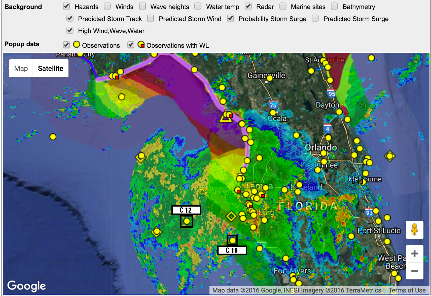
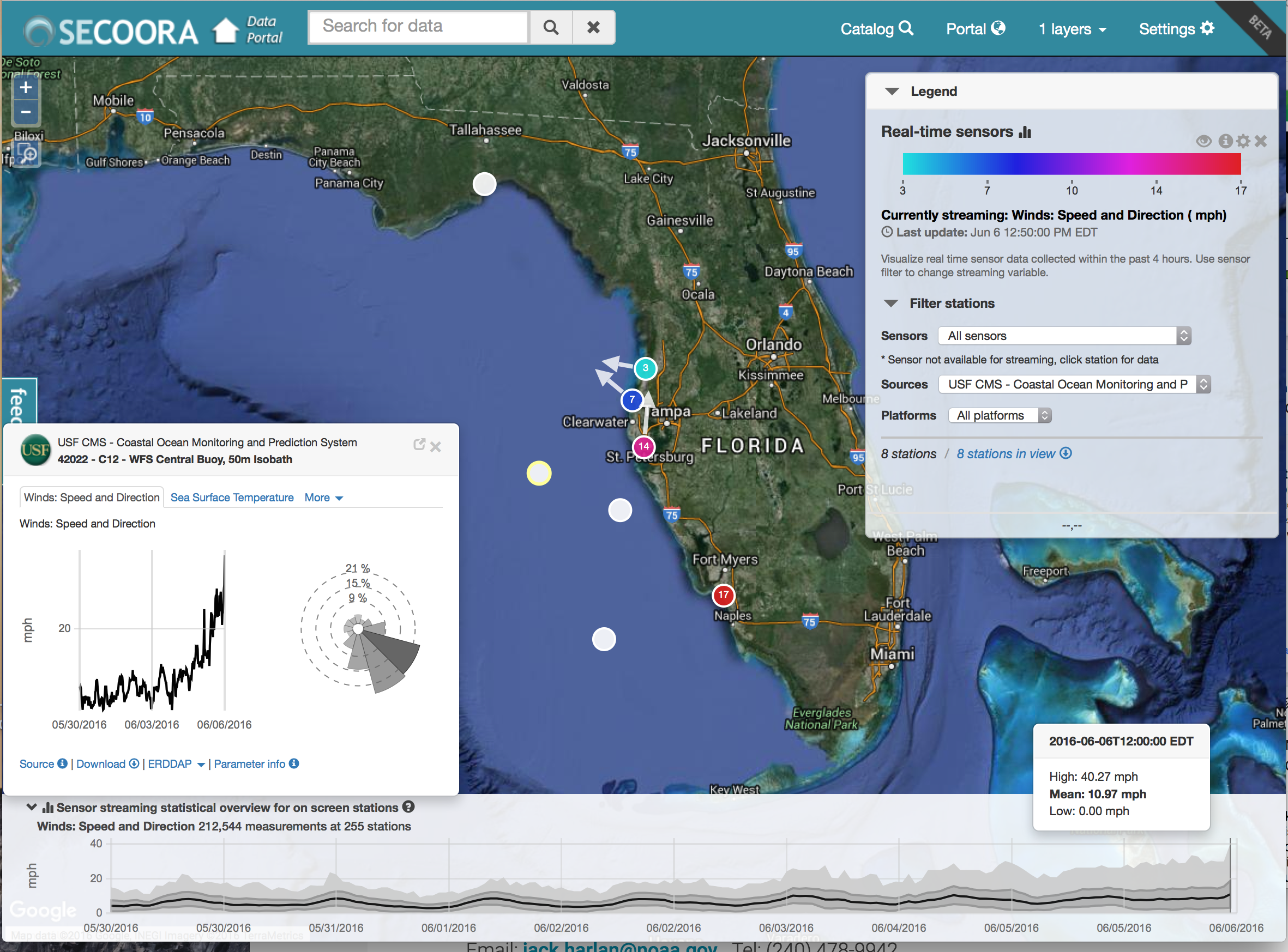
SECOORA and US IOOS funded marine weather buoys, C10, C12 and C13, in the Gulf of Mexico are capturing Tropical Storm Hermine in real time.
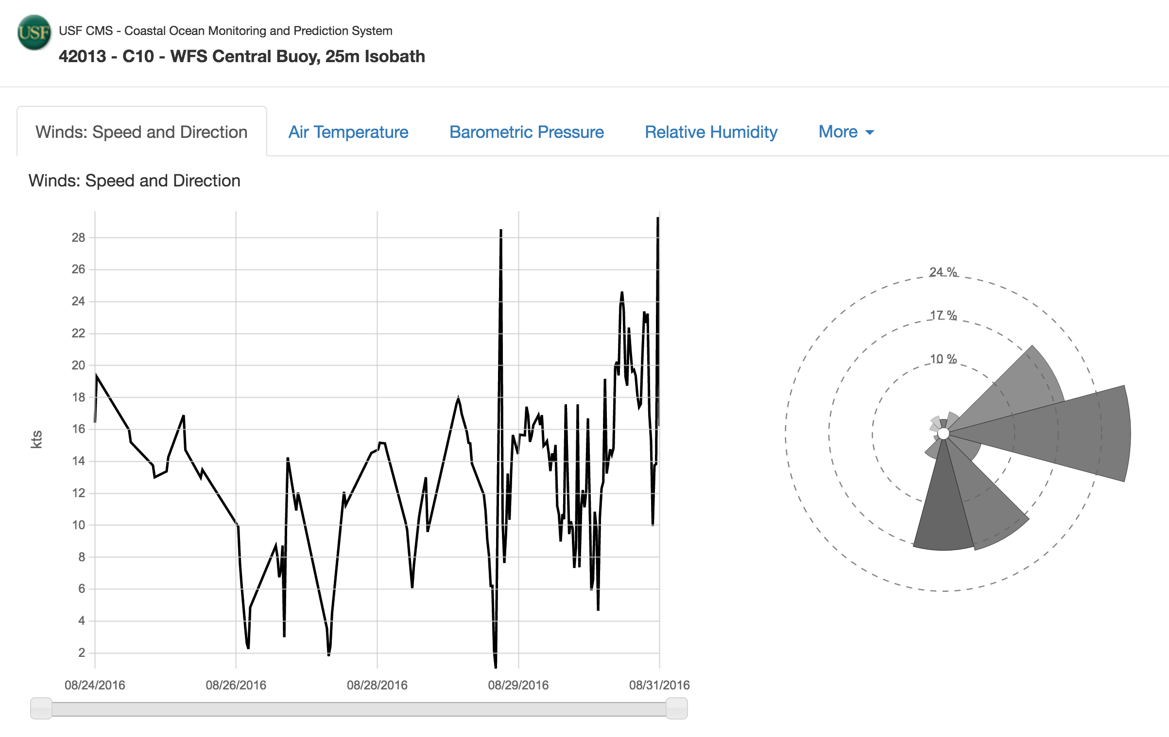
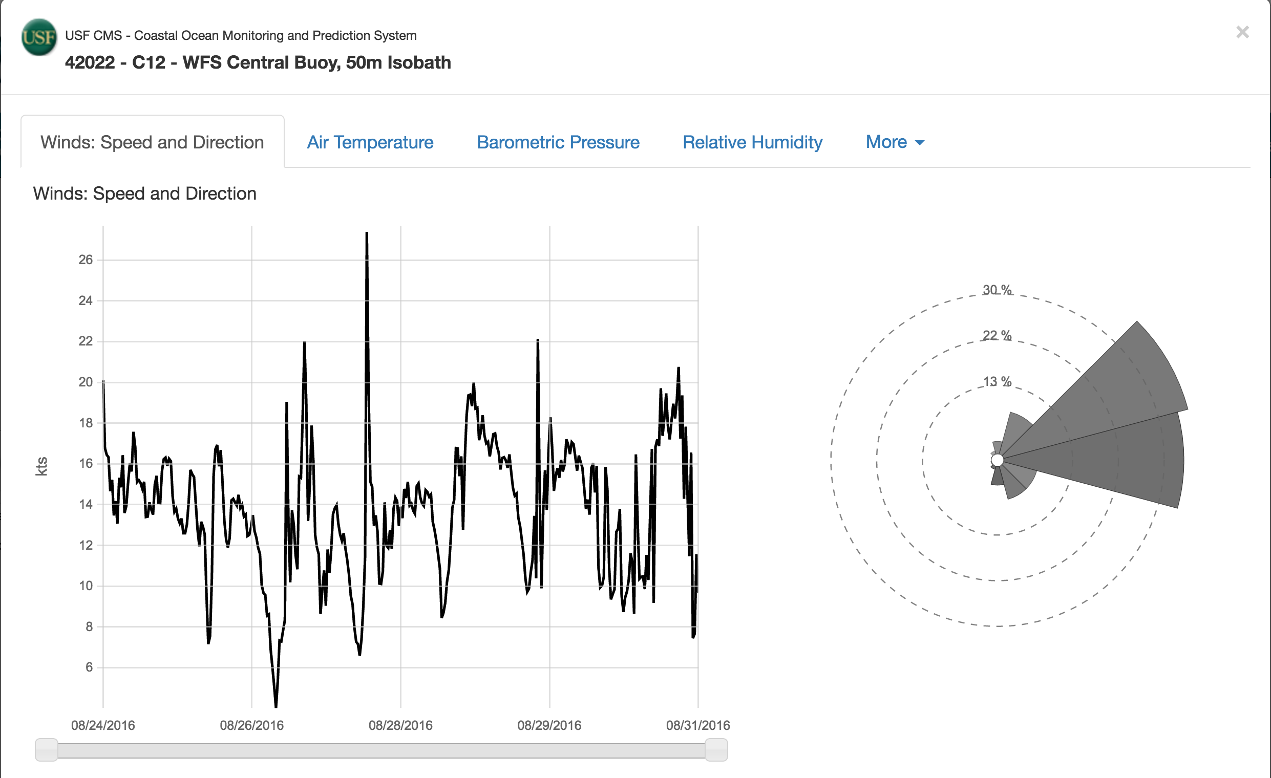
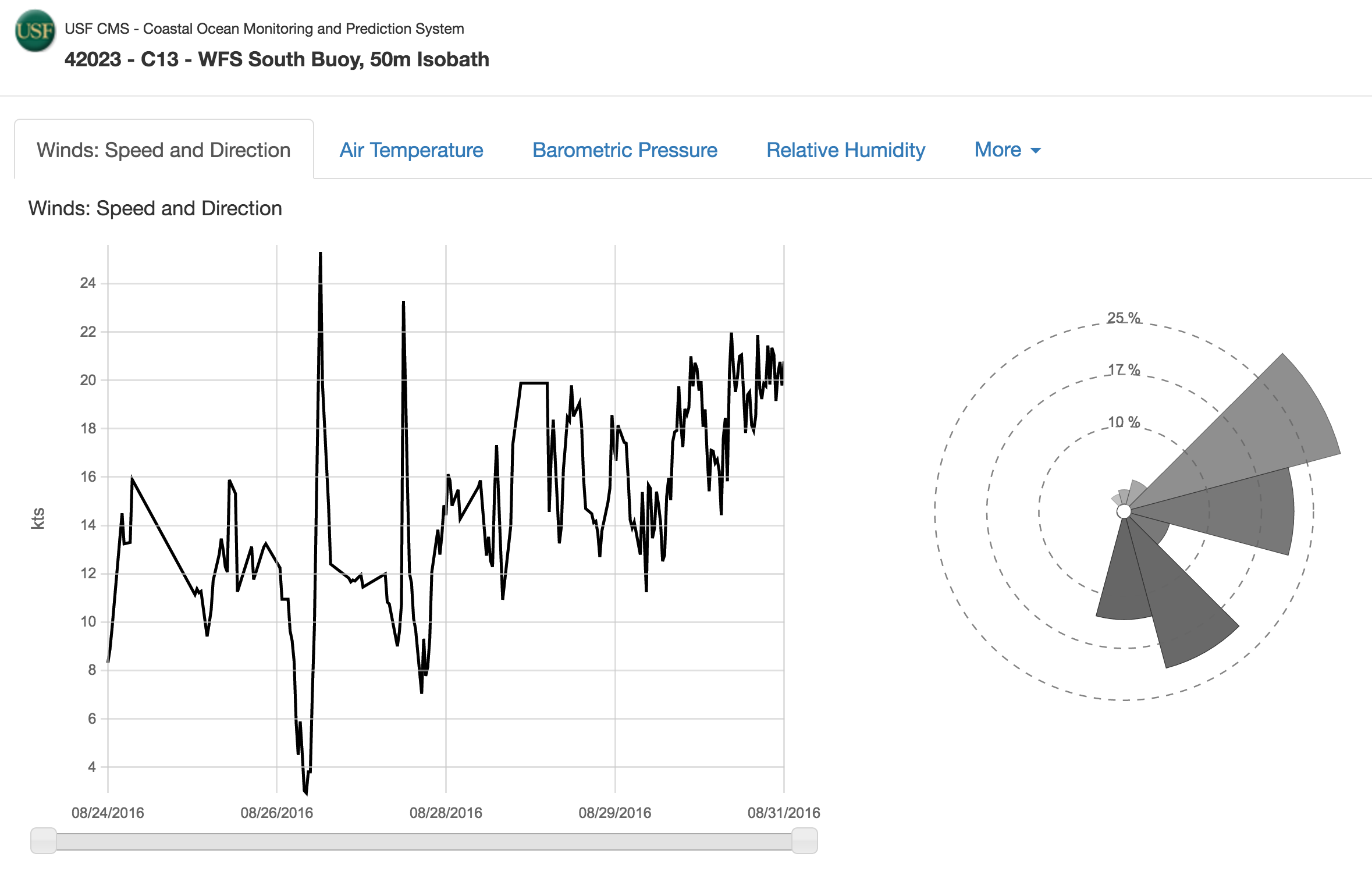
The buoys are part of the University of South Florida’s Coastal Ocean Monitoring and Prediction System (USF COMPS) program. Click here to explore the data. Contact Bob Weisberg, USF College of Marine Science, for more information.
Resources Relevant to the Tropical Depressions
Below are some resources for you to watch the storm and it’s effects.
| SECOORA Data Portal
|
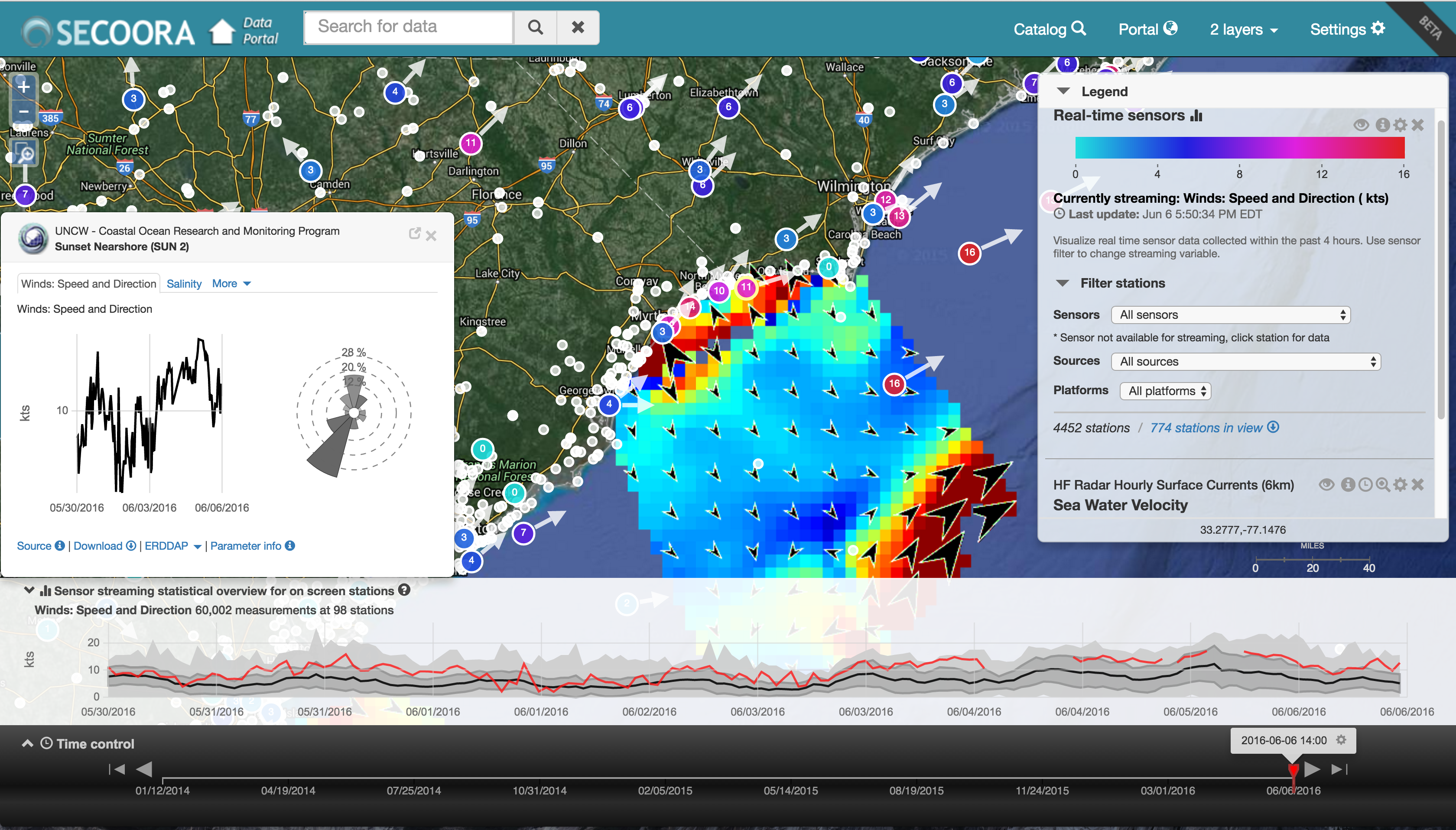
The SECOORA Data portal is a tool to explore, download and visualize ocean and coastal data in the SECOORA domain. When a storm is approaching, check out the sensors map to see the storm data in real time. |
| SECOORA Marine Weather Portal
|
The Marine Weather Portal provides marine observations, forecasts and short and long-fuse warnings for the coastal waters of North Carolina, South Carolina and northern Georgia and the Atlantic and Gulf Coast areas of the Southern Region. Click here to access the MWP. Please note the MWP will be upgraded next year. |
| University of South Florida’s Coastal Ocean Monitoring and Prediction System (USF COMPS)
|
USF COMPS consists of an array of instrumentations along the West Florida Shelf. The data collected supports the a variety of management issues, including more accurate predictions of coastal flooding by storm surge, safety and efficiency of marine navigation, search and rescue efforts, and fisheries management. . Buoy data from C12 in the Gulf of Mexico is pictured on the right. Access data here. |
| University of North Carolina Wilmington Coastal Ocean Research and Monitoring Program (UNCW CORMP)
|
The University of North Carolina Wilmington’s Coastal Ocean Research and Monitoring Program (CORMP), established in 2000, operates nine mooring stations in North Carolina and South Carolina. Access data here. |
| Weatherflow StormTrack
|
StormTrack allows you to see the latest predicted track of an identified storm. By using our wealth of real time observations, meteorological tools, and precision models, you can see exactly how each storm is progressing. Each storm page grants access to premium level data for the duration of the storm. Click here to access the StormTrack. |
Weather-Ready Nation Ambassador™
As a Weather-Ready Nation Ambassador™, SECOORA is committed to working with NOAA and other Ambassadors to strengthen national resilience against extreme weather. Click here to read more about WRN.Explore SECOORA partners and member organization hurricane support resources by clicking here.
Related news
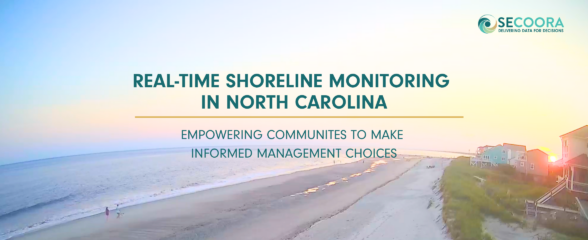
Empowering Communities: Real-Time Shoreline Monitoring in North Carolina
A new story map highlights how two cameras on Oak Island, North Carolina are being used to track changes along the coast from daily shifts in beach width to the impacts of major storms. These cameras provide continuous imagery that helps communities understand changing conditions and make informed management decisions.

FY2027 Presidents Budget Will Hurt the Southeast
The President’s Budget for NOAA proposes eliminating IOOS Regional Associations. This program provides critical data. Its elimination would have serious consequences for communities, businesses, and decision-makers across the nation and the Southeast.

Webinar | Preparing for Hurricane Season with SECOORA: Observing Systems, Data, and Tools
When a storm is approaching, having the right data matters. Join us on May 6 at 11:00 AM ET to explore how SECOORA’s observing systems, data, and tools can support hurricane monitoring and informed decision-making.
