

Date: Tuesday – December 19, 2017
Time: 12:00 – 1:00 PM ET
Speaker: Christine Buckel, National Oceanic and Atmospheric Administration’s National Centers for Coastal Ocean Science
Abstract
National Oceanic and Atmospheric Administration (NOAA) in partnership with the University of North Carolina, Institute of Marine Sciences, has developed a water level reporting application. The application collects and aggregates reports of observed water levels submitted through citizen scientists. These contributions are photographs with locations and a few simple details that will help weather predictors, scientists, and the public to better visualize and understand changing water levels. This application can be used globally to document high water levels at the coast, such as king tide events, but also far inland, such as snow melt or heavy rainfall events.
Various state and federal partners are currently using water level reports and photographs as communication and model validation tools. Explore the web-based application: What’s your water level? Or log a report from your mobile device.
About the Presenter
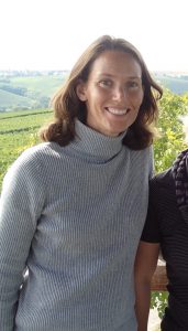 Christine Buckel has been a member of the National Oceanic and Atmospheric Administration’s National Centers for Coastal Ocean Science since 2001. She is an ecologist and examines geospatial relationships of species and habitats in the marine environment. Most recently she has been examining these relationships and human interactions under future conditions with sea level rise. She has degrees from University of Nebraska (BS) and the University of California, Santa Barbara (MS).
Related news
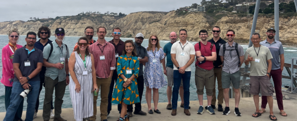
SECOORA Co-Hosts the 2026 WebCOOS Workshop In Person in La Jolla, CA
The 2026 WebCOOS Workshop convened in person on July 21-22, 2026 in La Jolla, CA. 45 attendees representing all 11 IOOS Regional Associations and national partners joined this collaborative workshop to discuss webcam-derived coastal products, stakeholder needs, and the network's transition into its next phase under IRA T2.

SET Webinar Series: Exploring Coastal Change: Digital Coast Resources
Join us on August 28, 2026, from 1:00 - 2:00 PM for the SECOORA SET Webinar Series, where we will explore coastal change using NOAA's Digital Coast resources. This webinar will bring together SET Community of Practice members and partners to learn how geospatial data and tools can support SET monitoring and place site-level observations within a broader landscape context.
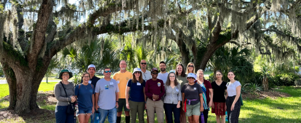
SECOORA Hosts the Second Surface Elevation Table (SET) Community of Practice Workshop In Person in Charleston
The 2nd SECOORA SET Workshop convened in person on July 16-17, 2026 in Charleston, SC. More than 30 Community of Practice members and stakeholders joined this collaborative workshop to discuss SET monitoring, coastal resilience, and data-driven decision making in the Southeast.