Tropical Storm Arthur
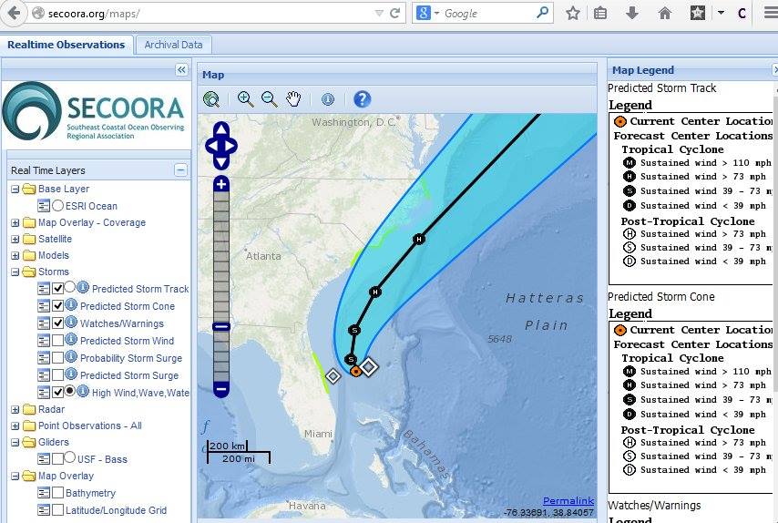
Follow Tropical Storm Arthur's path and more on our Interactive Regional Map or Marine Weather Portal. The diamonds represent an aggreagation of high wind, wave, water. The green highlighted areas along the coast of NC, SC, and FL represent watches/ warnings.
Follow our Facebook or Twitter for more frequent updates on Tropical Storm Arthur. |
|
Follow Tropical Storm Arthur's path and more on our Interactive Regional Map or Marine Weather Portal.
The diamonds represent an aggreagation of high wind, wave, water. The green highlighted areas along the coast of NC, SC, and FL represent watches/ warnings.
Follow our Facebook or Twitter for more frequent updates on Tropical Storm Arthur. |
Related news

Claire McGrath Joins SECOORA as Program and Development Manager
SECOORA welcomes Claire McGrath as Program and Development Manager, supporting the Southeast & Caribbean Coastal Disaster Resilience Partnership and membership growth.

Spotlight: Mobilizing to Save Florida’s Coral Reefs
Learn how scientists are racing to save Florida's Coral Reef through coral rescue, gene banking, reef restoration, and innovative conservation efforts after disease and marine heatwaves devastated one of America's most important marine ecosystems.

From a Whale’s Song to an Ocean’s Symphony: How AI Decodes Underwater Sound
Explore how SECOORA-funded research is using AI and machine learning to decode ocean soundscapes, detect boat noise, and support coral reef restoration efforts.