Last updated at noon on November 10, 2022.
Nicole’s center made landfall around 3 AM EST near Vero Beach, Florida. Now that the center is inland over Florida. It is assumed that weakening has begun, and Nicole is being designated as a tropical storm with maximum winds of 60 knots.
SECOORA put together this page to highlight data and information related to Nicole. It will be updated as new information becomes available.
Please email communications@secooraorgpact.wpengine.com with additional resources to add!
Visit the NOAA National Hurricane page for official updates.
Real Time Data from Buoys
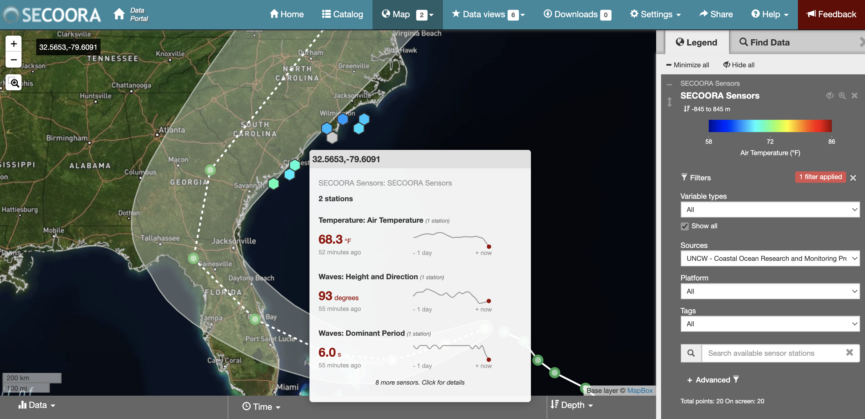
Nicole is predicted to traverse through the South Atlantic Bight. SECOORA, U.S. IOOS and partners support marine weather and wave buoys off the coast of the Carolinas. As the storm moves north, explore mooring stations in North Carolina and South Carolina. The buoys are operated by UNCW Coastal Ocean Research and Monitoring Program.
Watch Nicole via Web Cameras
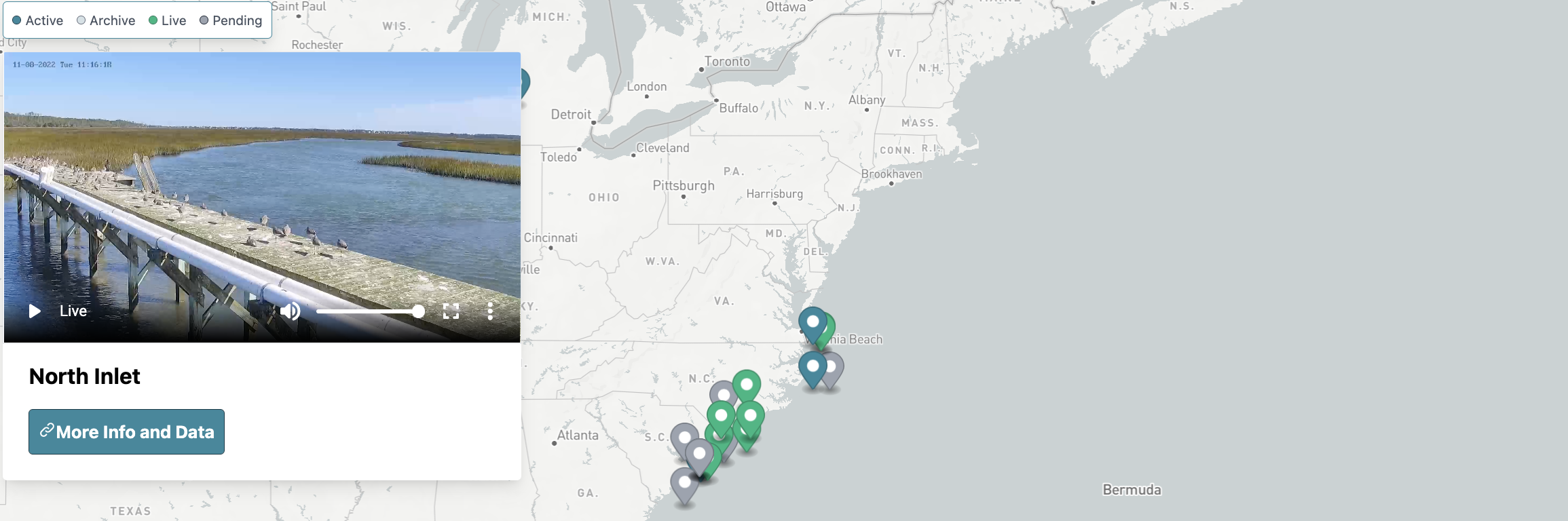
Check out SECOORA’s network of coastal web cameras. You will be able to see live images as Nicole moves along the coast. These web cameras are a low-cost coastal observing platform transforming how environmental monitoring is conducted. Web camera data has demonstrated value to address significant gaps in the nation’s ability to monitor and accurately forecast various weather, ocean, ecological, and public health hazards.
Follow the Data
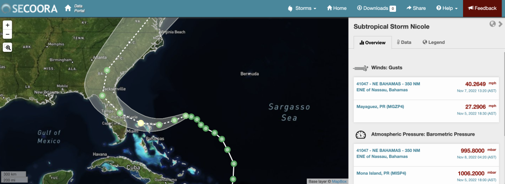
Eyes on the Storm is an interactive portal that connects you to live and past hurricane and tropical storm data. The tool pulls data from within 50 miles of a hurricane’s path and showcases the highest wind speeds and wave heights and lowest barometric pressure.
Marine Weather Portal
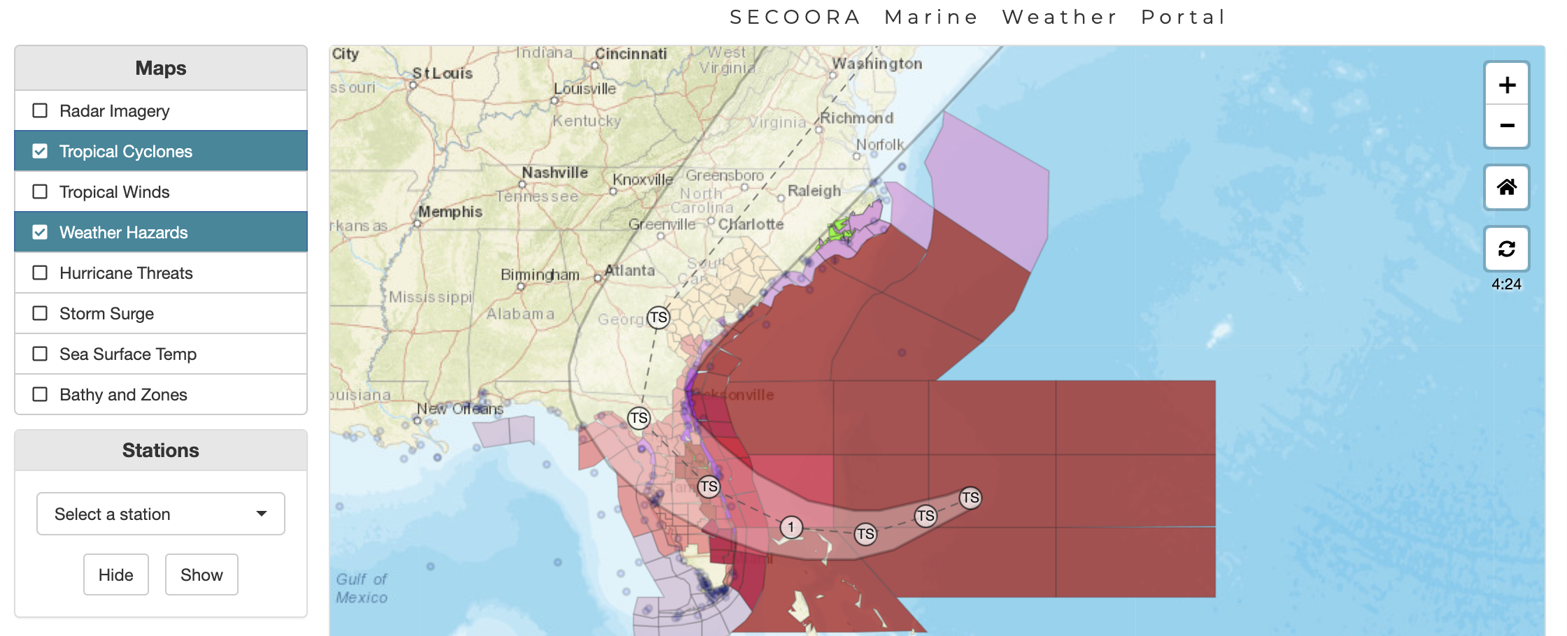
Visit the SECOORA Marine Weather Portal (MWP) for up-to-date weather hazards, tropical cyclone forecasts, and observations as Nicole approach’s the southeast. The new National Weather Service Hurricane Threats and Impacts map has been added to the MWP which indicates worse case scenarios for planning purposes.
Related news

Funding Opportunity: Accepting Applications for 2026 Vembu Subramanian Ocean Scholars Award
Established in memory of Vembu Subramanian, this award supports the next generation of ocean professionals through mentorship, networking, and meaningful engagement at our Annual Meeting. Applications are due April 21, 2026.
2026 SET Community of Practice Workshop
The SECOORA Surface Elevation Table (SET) Community of Practice will convene for its 2026 in-person workshop on July 16 – 17, 2026, in Charleston, South Carolina.
Board Nominations Now Open
Nominations are now open for the 2026 Board of Directors election. Help shape the future of coastal ocean observing by submitting materials by April 10, 2026 at 5 PM ET.