SECOORA’s glider, Franklin, has a friend for his first mission of the 2022 hurricane season. Franklin is flying under the Saildrone SD-1059 for the next 30-60 days collecting water column data to help forecasters better understand the forces that drive hurricane intensity. Click here for Franklin data.
Franklin is part of a larger National Oceanic and Atmospheric Administration (NOAA) coordinated effort to collect data in the Atlantic Ocean and Gulf of Mexico during the 2022 hurricane season. Gliders are collecting data under the surface of the ocean, while Saildrones are being used on the surface to collect surface oceanographic and meteorological data.
During a hurricane, collecting data offshore is dangerous and is best done by in-situ or uncrewed ocean instruments. The gliders collect ocean temperature and salinity data throughout the water column. Water temperature data is vital to understanding the amount of energy, in the form of heat, available to feed hurricanes.
Franklin’s on a Mission Collecting Water Column Data
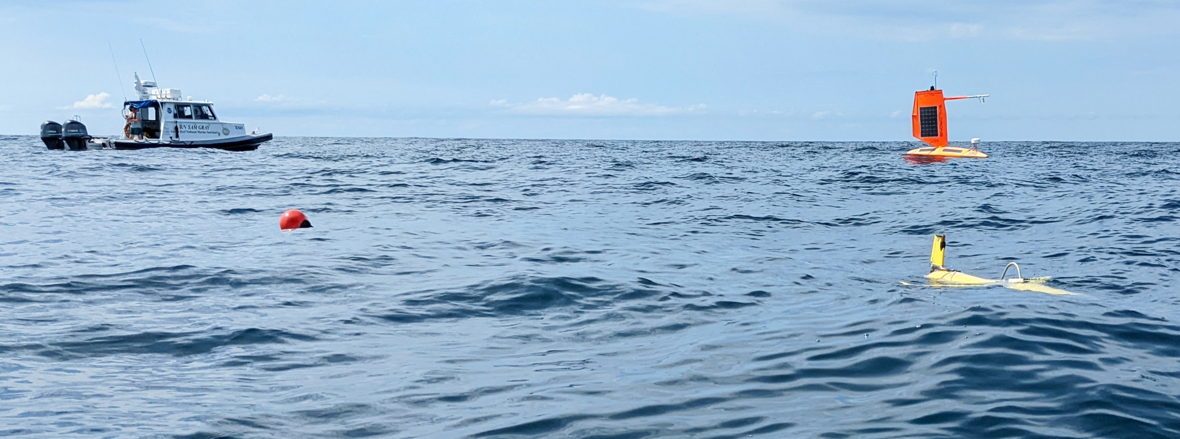
Dr. Catherine Edwards led the deployment of Franklin off the coast of Georgia, in Gray’s Reef National Marine Sanctuary, on August 3. Franklin is collecting data as it profiles underneath Saildrone SD-1059. The Saildrone will collect surface ocean data, such as water temperature and salinity as well as meteorological data. Click here for Franklin data.
During the course of the 2022 hurricane season, the SECOORA glider team will deploy 2-3 more gliders off the coasts of Florida and Georgia. The SECOORA Glider team has been deploying gliders during hurricane season since 2018 in the Gulf of Mexico and the Atlantic Coast. This is Saildrone’s first year tracking conditions in the Gulf of Mexico as part of the NOAA observing efforts. Accuweather published a story on Saildrone’s recent deployment in St. Petersburg, FL here.
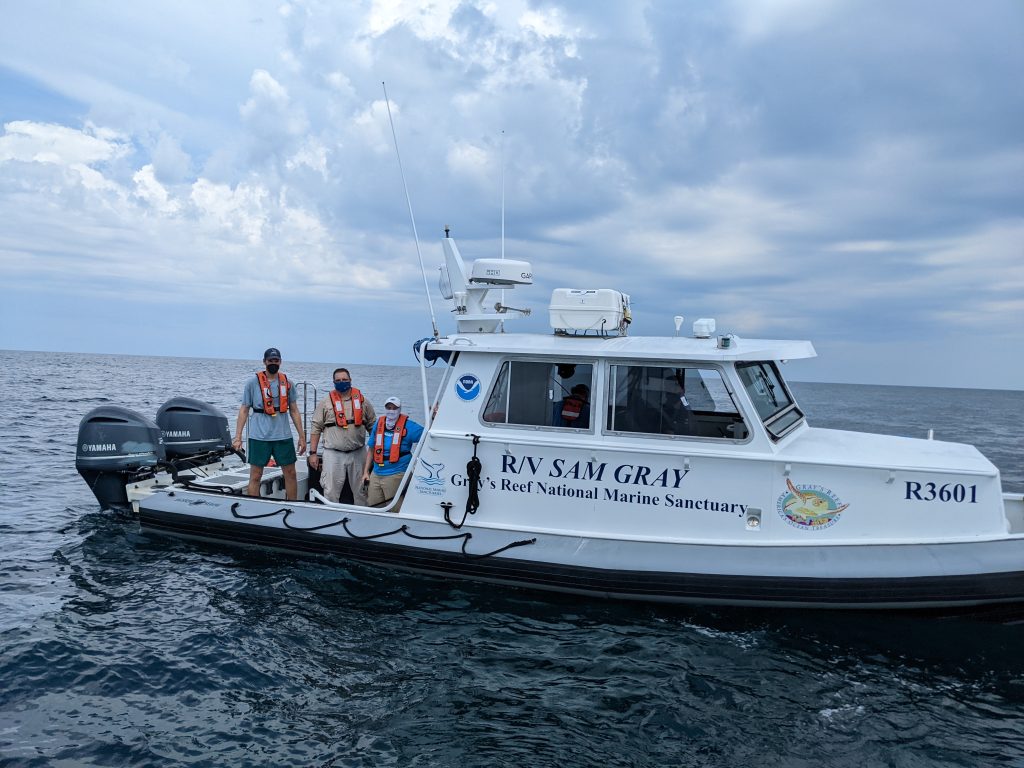
A photo of the science team. Thank you to Karen Dreger (SkIO/UGA), James Bird (Savannah State University/SkIO/UGA, and Ben Prueitt from Gray’s Reef National Marine Sanctuary who provided vessel support for the glider deployment on August 3. Image credit: Catherine Edwards 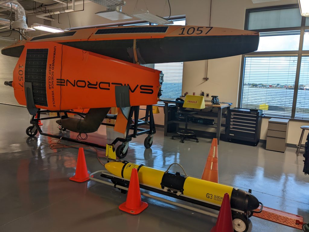
Franklin and the Saildrone SD-1059 side by side in the garage before deployment. Image Credit: Catherine Edwards 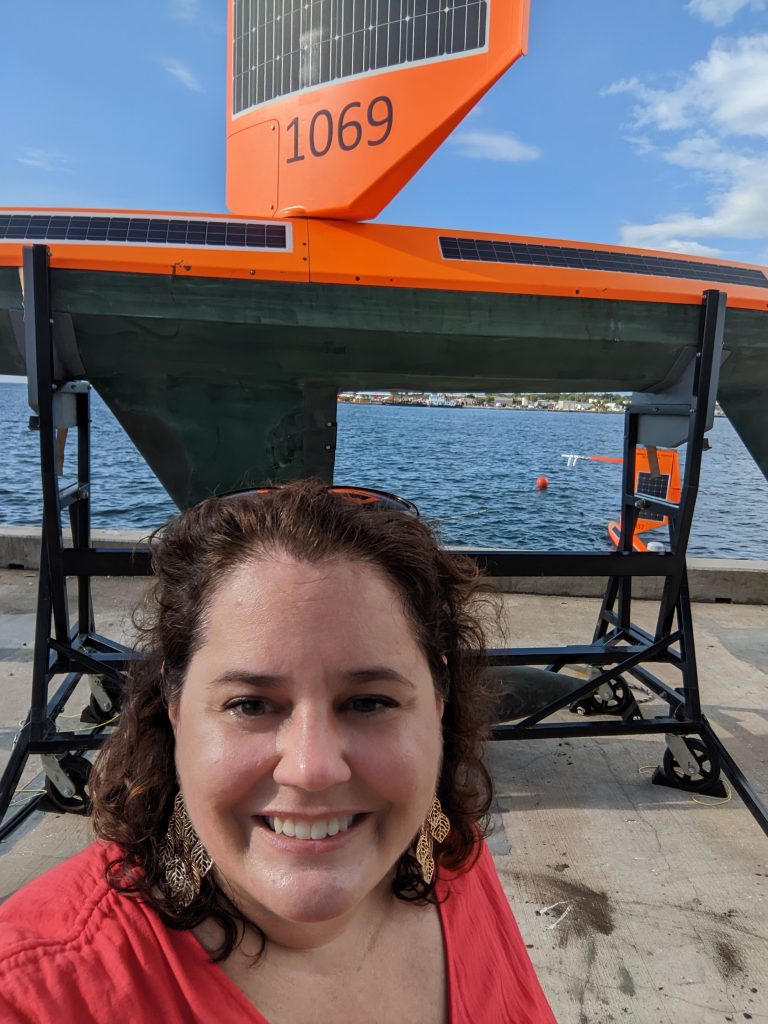
Dr. Catherine Edwards (UGA SkIO) lead scientist for SECOORA’s Glider team pictured in front of the Saildrone SD-1059. The Saildrone will collect surface ocean data, such as water temperature and salinity as well as meteorological data. 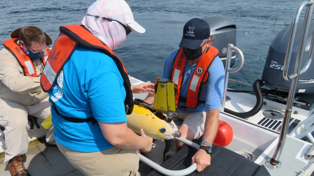
Three members of the field team preparing to deploy Franklin. Franklin is collecting ocean temperature and salinity data throughout the water column as it profiles underneath Saildrone SD-1059. Image Credit: Ben Prueitt 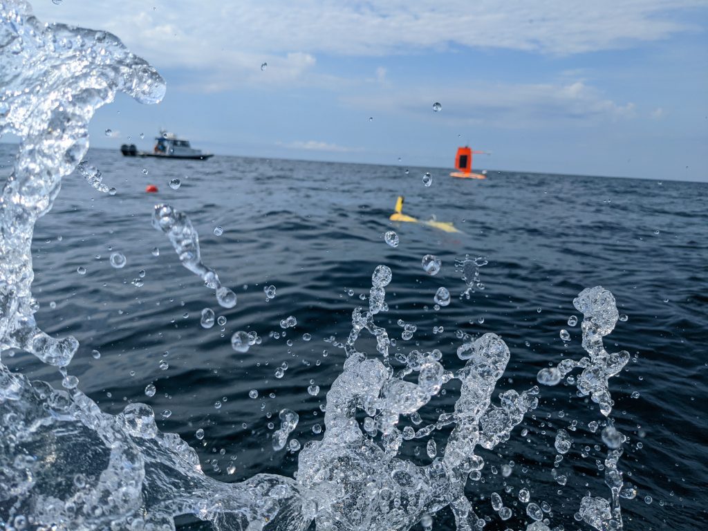
Action shot of Franklin and the Saildrone side by side at Gray’s Reef National Marine Sanctuary. Image credit: Catherine Edwards 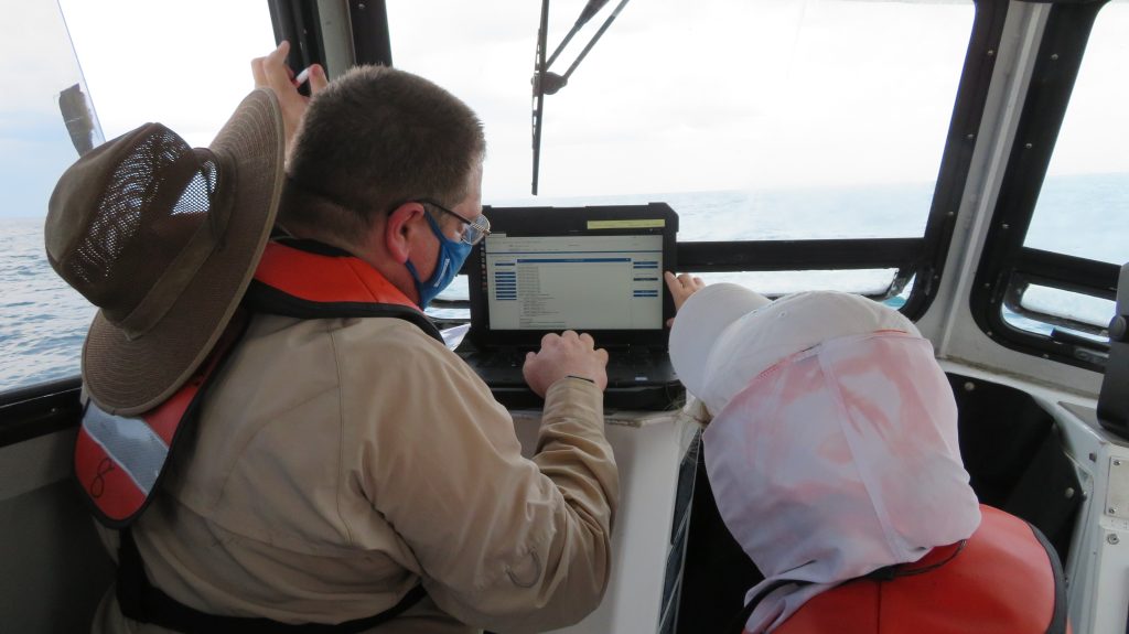
James Bird (Savannah State University/SkIO/UGA)and Karen Dreger (SkIO/UGA) checking on Franklin. Image Credit: Ben Prueitt, NOAA
Coordinated Approach to Collecting Data to Improve Hurricane Forecasts
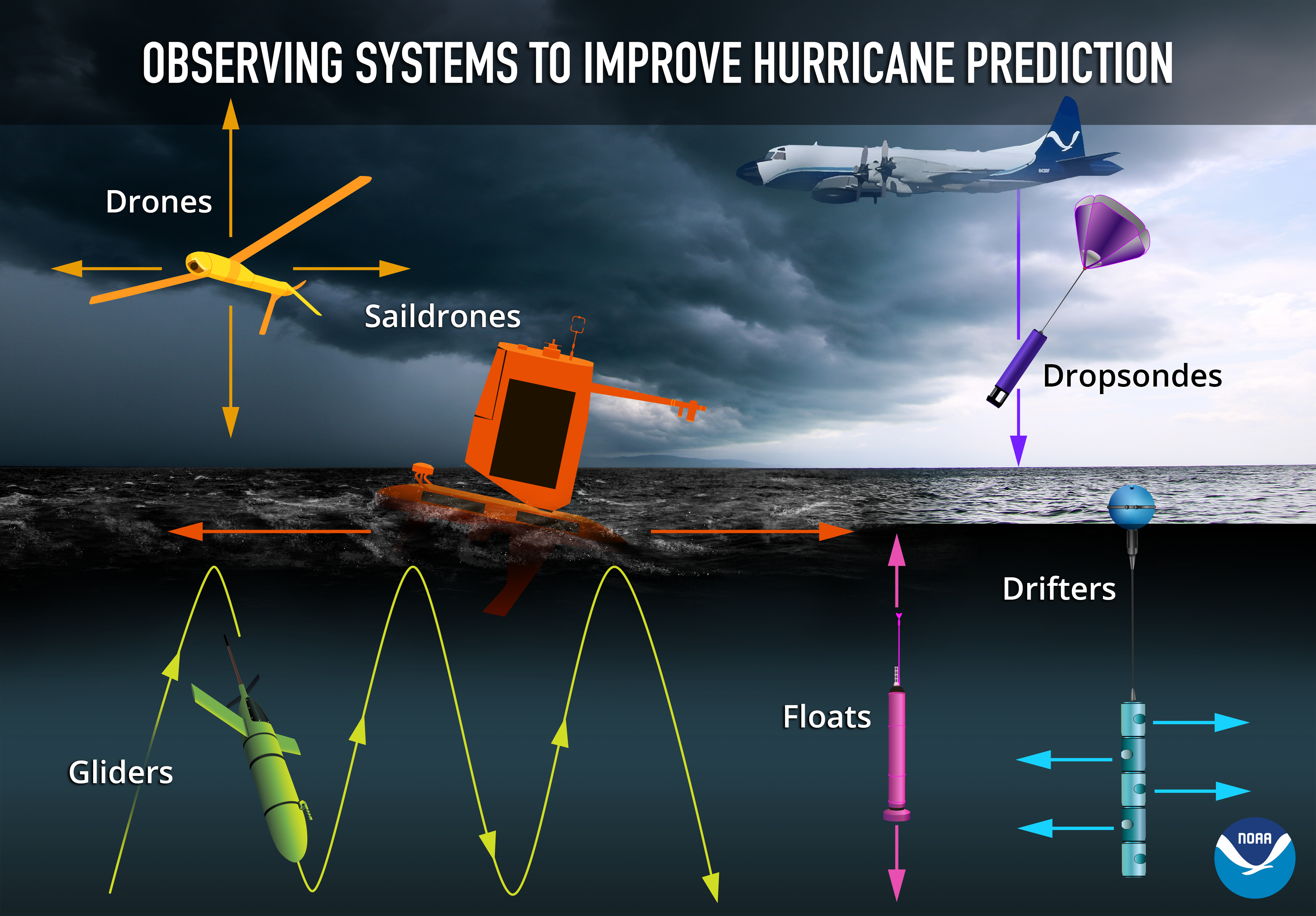
Gliders and Saildrones are just two of the technologies being used to collect data this hurricane season. NOAA is also funding the deployment of small uncrewed aircraft systems (i.e., drones) that will be deployed into hurricanes for the first time from NOAA’s Hurricane Hunter aircraft (source).
John Cortinas, Director of NOAA’s Atlantic Oceanographic and Meteorological Laboratory (AOML) stated in NOAA and Saildrone launch seven hurricane-tracking surface drones, “This season, NOAA will work with numerous partners to gather oceanic and atmospheric observations using a suite of platforms to monitor the conditions that play a role in hurricane intensity changes. Storms that intensify rapidly can cause extensive damage and loss of life and real-time observing systems are crucial to better understanding the atmospheric and oceanic processes that lead to the formation and intensification of these hurricanes.”
For more information please contact communications@secooraorgpact.wpengine.com .
Related news

Species Spotlight: Trichodesmium
Discover the remarkable role of Trichodesmium, a microscopic cyanobacterium that helps fuel life across the ocean. In this Species Spotlight, explore how researchers supported by the Marine Biodiversity Observation Network (MBON) are using imaging technology, genomics, and eDNA to better understand this “shape-shifting” organism and its influence on marine ecosystems, ocean health, and coastal economies.
Charleston Coastal Flood Monitoring: Camera Network and Data Insights
A new story map explores how cameras in Charleston, South Carolina are helping communities monitor and respond to changing coastal conditions, from everyday weather impacts to flooding events. As a rapidly growing coastal city with a major working port, Charleston depends on an accurate understanding of water conditions to support transportation, public safety, infrastructure, and economic activity.

Scientist Spotlight: Dr. Frank Muller-Karger
Meet Dr. Frank Muller-Karger, a Biological Oceanographer and Distinguished University Professor at the USF College of Marine Science and co-lead of the U.S. Marine Biodiversity Observation Network. His research integrates satellite data, environmental DNA, and physical sensors to better understand how warming oceans are influencing marine populations.