

Satellites Track White Marlin on the Run
Eight hooked, seven tagged, and a race deep offshore. See what satellite tags reveal about the white marlin’s life history.

By Zoraida Díaz
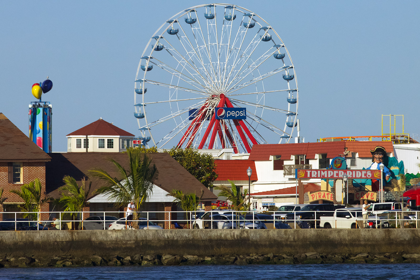
Ocean City, the quintessential summer vacation spot on the Eastern Shore, has been Marylanders’ Coney Island for over a hundred years. Generations of teenagers grew up riding the Ferris wheel overlooking the Atlantic Ocean and walking the length of the boardwalk—sauntering in and out of all-you-can-eat crab fests and cramming into photo booths for a strip of black-and-white photos that encapsulated the memory of youth.
In 1933, a hurricane carved a channel south of Ocean City, splitting the 60-plus-mile sand barrier running from Delaware to Virginia. The storm severed Assateague Island, isolating the famous herd of wild horses within a natural sanctuary and opening a deepwater inlet that transformed Ocean City into a premier sportsfishing port known as the “White Marlin Capital of the World.”
The white marlin (Kajikia albida), a small pelagic billfish with distinct seasonal migrations into shelf-edge canyon waters off the U.S. East Coast and Southern New England, is one of the Atlantic Ocean’s most coveted game fish—and among the least understood in its population dynamics. Whereas the blue marlin (Makaira nigricans) reigns in popular culture—Hemingway’s old Cuban fisherman Santiago and his 1500-lbs monster of a fish come to mind—the white marlin is a sleek contortionist, averaging 50-80 pounds, with the all-tackle world record reaching a modest 181 lbs.
Dr. Walter Golet, Associate Professor at the School of Marine Science (SMC) at the University of Maine and Director of the Pelagic Fisheries Lab (PFL), received a call from Viking Yachts Master Captain Sean Dooley in mid-September 2026 with an ideal billfish weather forecast: clear skies, light winds, and 3- to 4-foot seas across the open shelf promising a comfortable 30+ knot run and stable trolling conditions. With one caveat: depart from Ocean City within 48 hours.
Golet had been waiting for an opportunity like this to deploy five real-time tethered SPOT (Smart Position and Temperature) satellite tags through the Marine Biodiversity Observation Network’s (MBON) BioTrack initiative. Supported by NOAA’s Animal Telemetry Network, BioTrack leverages academic and institutional partnerships to incorporate tracking data into an expanding network of more than 3,000 tagged marine animals across more than 60 species. The collaborative project integrates satellite and acoustic tracking data with oceanographic and biological modeling to map marine biodiversity hotspots and deliver those insights as practical products for coastal managers and decision-makers.
To address spatial blind spots and underrepresented species across the network, BioTrack distributed 231 acoustic and satellite tags to researchers this year. When Dr. Neil Hammerschlag, Executive Director of the Shark Research Foundation and BioTrack’s lead researcher, asked Golet for highly migratory species (HMS) candidates, the white marlin was first on Golet’s list.
Golet knew the tagging window would soon close for the season. Not only because the fish would start migrating south as the waters began to cool, but because weather conditions could change drastically. (Just a week later, a nor’easter with 45-50+ mph wind gusts and 6-12 feet waves caused widespread tidal flooding in Ocean City and throughout the barrier islands of the Delmarva Peninsula.)
SMC Quantitative Fisheries Scientist John Carlucci and PFL Lab Manager Sammi Nadeau quickly came on board, eager to deploy the newer SPOT tag technology: they packed scientific gear and tagging equipment, including the MBON tags and additional Pop-up Satellite Archival Tags (PSATs), into a green Kia and left Portland, ME early the next morning for the 10-hour drive to Ocean City.
Although Golet’s team can efficiently analyze oceanographic data and run complex stock assessment models, getting to the animal is a different matter. To tag a white marlin, you first have to catch it!
“They’re not something you can catch from a dock or a pier or the beach,” says Golet. And it’s not every day that scientists have access to professional anglers and state-of-the-art sportfishing boats to run successful HMS tagging expeditions deep offshore.
When Nadeau and Carlucci arrived at Sunset Marina’s C Dock at 4:45 a.m. the next morning, the crew of the 82-foot Viking demonstration boat out of New Gretna, N.J., had finished loading supplies and was ready for a sharp 5 a.m. departure.
A slight chill in the air heralded the autumnal September morning as Captain West Rivers piloted the boat past the stone jetties at the inlet mouth. It was too dark to see the Assateague horses walking the sandy berms. Powered by twin MTU diesel engines generating 2,000+ horsepower each, the boat gathered speed. An hour later, a streak of orange glimmered over the horizon, illuminating the nascent blue sky.
Well on their way to the fishing grounds, Nadeau readied a tethered SPOT tag on the end of a long tagging pole, voicing her hopes for a catch—all too aware of past outings when not one fish was caught. Though her graduate work centered on the foraging ecology of bluefin tuna, Nadeau now oversees the PFL’s bluefin and billfish tagging initiatives.
Nearby, Carlucci, whose expertise is in using differential equations and computational models to estimate fish population sizes and mortality rates, checked the equipment to ensure the tag’s satellite ID was actively logging pings to his laptop.
Tracking highly migratory species (HMS) that spend their lives in the open ocean and routinely cross international borders is incredibly expensive and heavily reliant on the cooperation of recreational anglers and commercial fleets.
As an example, PFL has deployed eight PSATs on white marlin since 2024 as part of the Skillie Project, a Lab partnership with the Billfish Foundation supported by local captains and key marine industry sponsors. The initiative aims to fill the lack of baseline data on white marlin in the northernmost extent of their range off Cape Cod and Nantucket. Of those eight tags, two were never heard from, two popped off early, and two are still active on fish, out at sea. Of the remaining pair, one stayed attached to the white marlin for 8 months, while the other reached the full 12-month targeted duration. That year-long tag yielded a compelling migration story: the white marlin tagged on the Nantucket Shoals traveled down the Eastern Seaboard to the Bahamas, looped through Bermuda, and returned north. The tag finally popped to the surface and transmitted its data, placing the fish in Georges Bank—just east of where it had been tagged the year before.
Although PFL has the largest archive of bluefin tuna samples in the Atlantic basin, collected over years through a robust relationship with commercial and recreational fishermen, the knowledge base for other HMS like the white marlin is in its infancy.
“Commercial fisheries like the bluefin provide tons and tons of data to scientists,” says Carlucci, recounting midnight trips to collect fish heads from tournament landings in other states. “From the heads we can get our genetics—from the otoliths [the calcium carbonate ear stones] we can figure out how old the fish was, where it came from—all from a part of the animal that is considered garbage.”
With a strict U.S. recreational landing limit of just 250 combined blue marlin, white marlin, and roundscale spearfish (Tetrapturus georgii), alongside an ingrained sportfishing culture of catch-and-release, scientists rarely get access to the landed fish—missing out on the tissue samples crucial to establishing the species’ genetic profiles.
“There’s also not much highly migratory species data that gets incorporated into environmental impact reviews,” he notes. Billfish anglers are only required to report the port where fish are landed or where tournament catches are weighed. A massive data gap exists in current offshore spatial planning models and regulatory reviews, as there aren’t enough historical records to show where the fish lived or fed. For example, managers can’t easily calculate the fine-scale spatial overlap between active fishing grounds or shifting billfish habitats and proposed offshore wind arrays.
The deafening roar of an F/A-18 Super Hornet returning to the Naval Air Station Oceana breaks overhead, momentarily muting the crew’s happy chatter and the Scotty McCreery song playing loudly from the boat’s speakers:
Eight years old, couple cane poles sittin’ down by the creek
Lines in the water watchin’ those bobbers, seein’ that red sun sink
Mama’s on the porch yellin’, “Supper’s hot, y’all come and get it”
We yelled, “Five more minutes.”
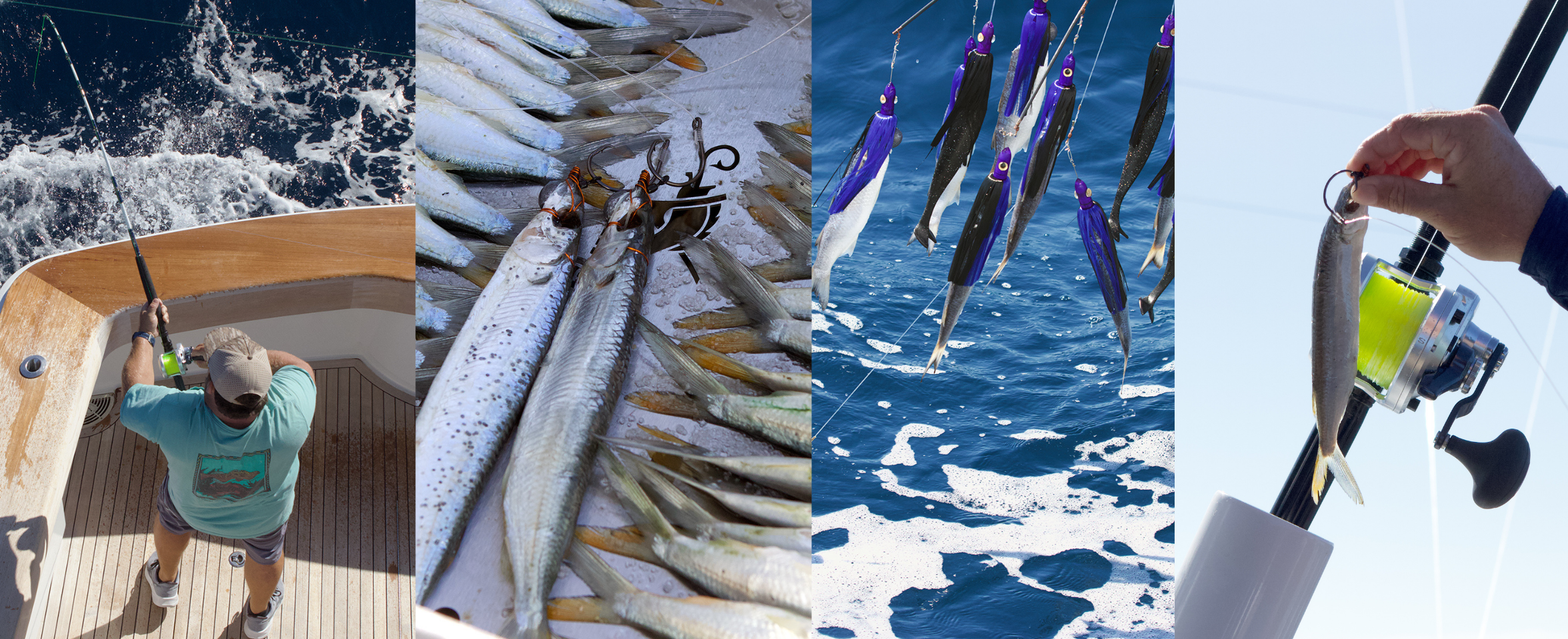
The Viking continues its southeasterly run along the Atlantic coastal plain. Two hours later, near the continental shelf edge—some 65 miles east of the mouth of the Chesapeake Bay, where the seafloor plunges into Norfolk Canyon—the boat slows. Rivers sets a trolling speed of 8.2 knots and tilts the Omni Sonar’s transducer beam 6 degrees downward relative to the surface—an angle ideal for detecting surface-skimming fish at a depth of 14 feet.
Screens on the flybridge console and on the deck below show a continuous 360-degree real-time scan of the water with a radius extending 800 feet from the boat. The water temperature is 25.9°C (78.6°F). Within minutes, moving green-yellow blotches appear on the screen indicating fish movement.
Thomas “Smalls” Garmany, a champion angler with a lauded fishing pedigree, has fished alongside his father—a retired boat captain—and his brothers for as long as he can remember. He jokes with his mates as he sets up multiple rods, occasionally glancing toward the bulkhead sonar display to exchange heading adjustments with Rivers up at the flybridge helm.
The crew pulls a complex, multi-rod tiered spread to mimic a fleeing school of bait on either side of the boat. Long outrigger poles angle outward like wings from the cabin, spreading the outer trolling lines wide into undisturbed water well beyond the engines’ churning wake. Beneath them, heavy dredge teasers form an umbrella-like frame, with bright red rubber squids above real ballyhoo bait, their purple caps like festoons. Engineered with weighted leads and ball-bearing swivels to prevent spinning or tangling, the ensemble looks like a mobile over a baby’s crib. The framework is dropped and dragged below the surface to draw the fish toward the trailing teasers—and into range of a waiting pitch bait.
Acting as deck boss on the cruise, Captain Dooley keeps fresh ballyhoo pre-rigged in the cockpit, each fitted with a non-offset circle hook bridled to its pointed snout. When Rivers shouts from the flybridge “Fish up!” precise, almost choreographed maneuvers ensue: mate Brad Kicklighter cranks in the hookless dredge teaser, luring the billfish toward the surface behind the boat’s transom. Dooley grabs a bridled ballyhoo rigged to the pitch rod and tosses it into the wake over the gunwale. With the pitch rod in hand and the reel in free-spool, Garmany lets the line feed out smoothly under his thumb. A sudden pull tells him the fish has taken the bait—he feels the animal through the filament like a pulse against his skin. He gives the marlin measured seconds to turn with the bait headfirst, then, in one fluid motion, pushes the lever drag to the strike position and winds steadily until the line comes tight, catching the circle hook in the corner of the fish’s jaw. Garmany steps to the transom as Rivers pivots the boat, backing down to keep tension on the line.
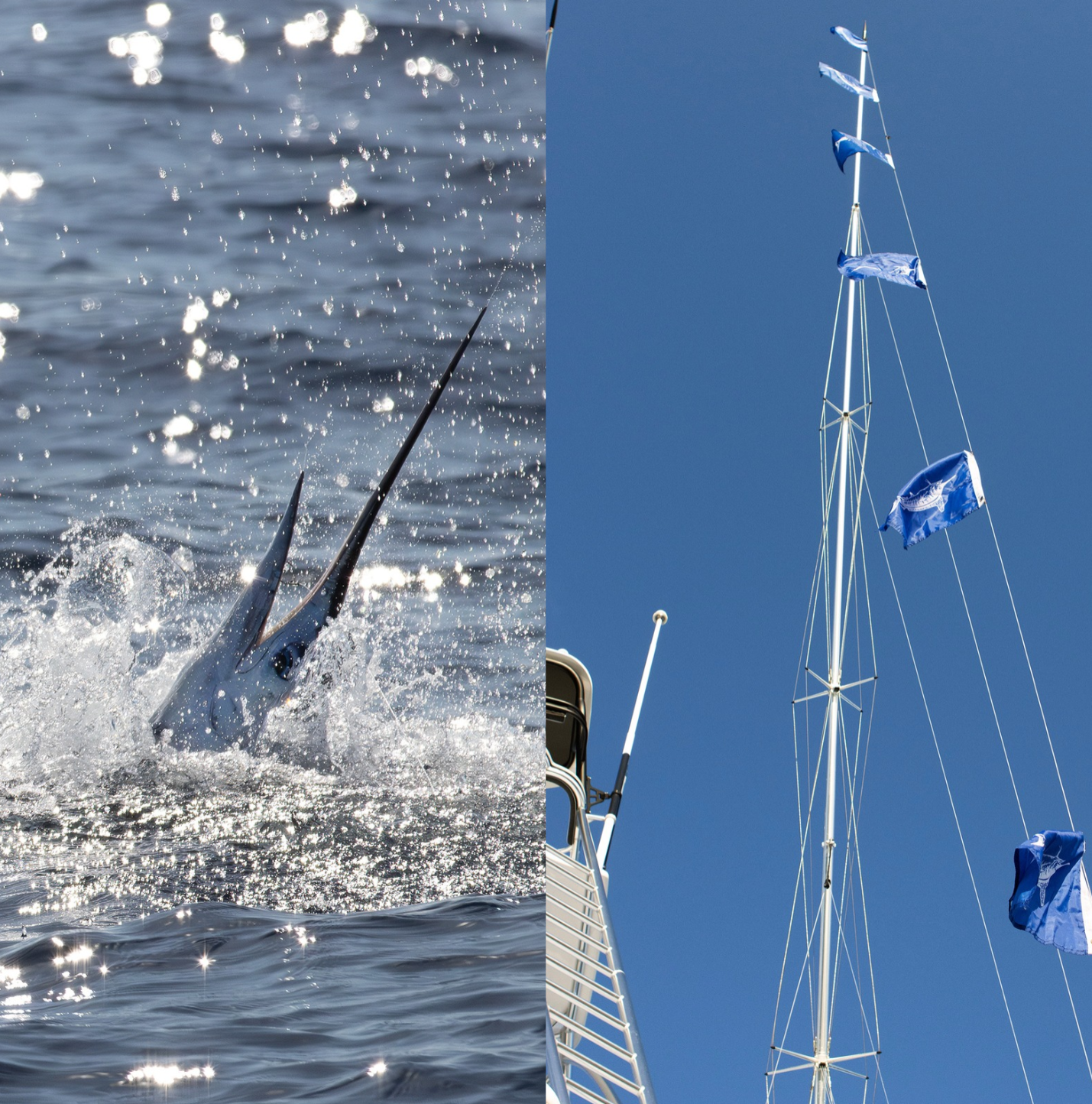
Carlucci brings out a loaded tagging pole and stands at the ready. Only the Viking’s mates seem certain of the fish’s exact location. About two hundred feet off the starboard quarter, a white marlin shoots out of the water—twisting, somersaulting, and tail-walking before disappearing beneath the waves. The crew’s excited hollers are contagious, and the researchers join in.
Garmany reels in the catch with rhythmic pulls, moving from side to side on the deck as the heavy rod bends double. Jumping out occasionally, the marlin is worked closer to the slow-towing boat until a kaleidoscope of bronze, violet, and green shimmers past, just a few feet below the surface.
Kicklighter leans out over the gunwale and secures the marlin by its bill alongside the hull. He holds the fish steady in the water while Rivers keeps the boat idling forward, making sure oxygenated water runs through the marlin’s mouth and gills. Carlucci aims the applicator pole and, with a quick, well-aimed jab, anchors the dart into the high dorsal muscle. The tethered SPOT tag antenna trails above the fish’s back—whenever the antenna breaks the surface, it will transmit real-time location data to Argos satellites for the tag’s battery life. Kicklighter is handed a soft measuring tape, lays it along the fish’s flank, and calls out: “Sixty-two inches! He deftly removes the round hook, ensures the marlin has revived, and lets go.
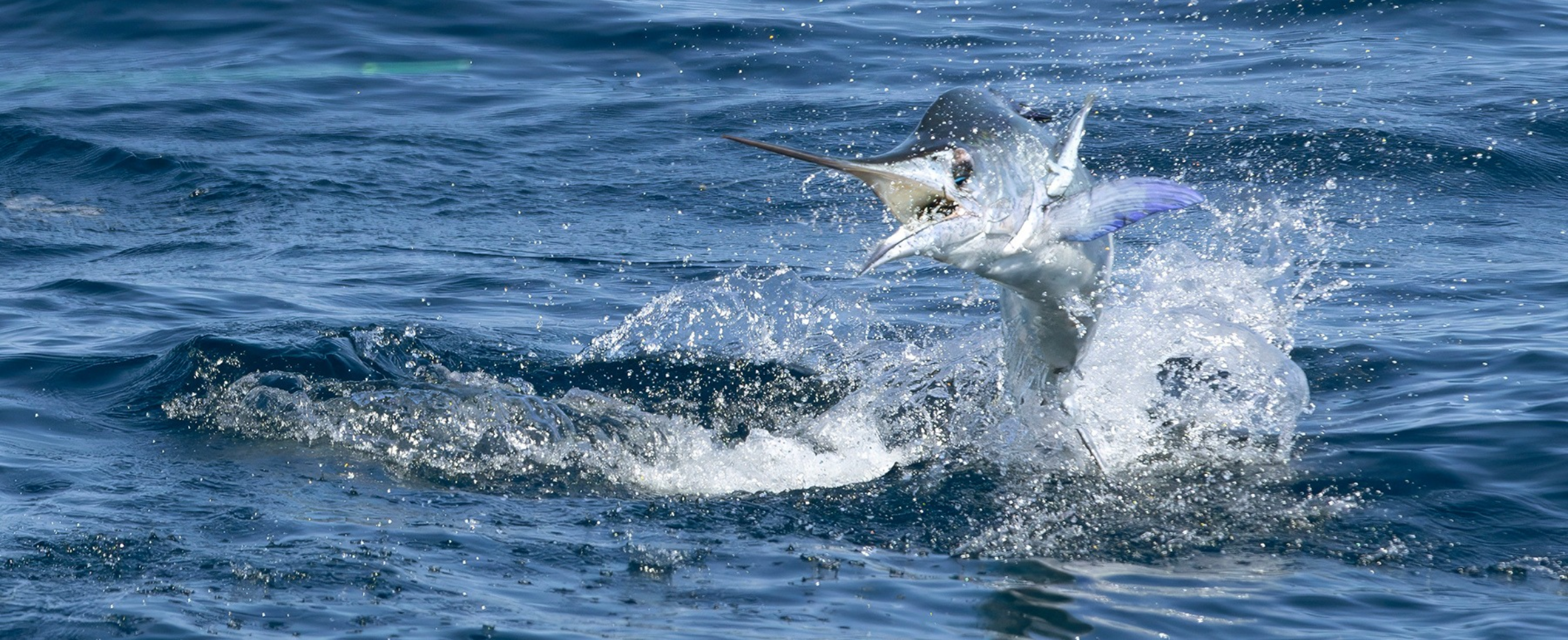

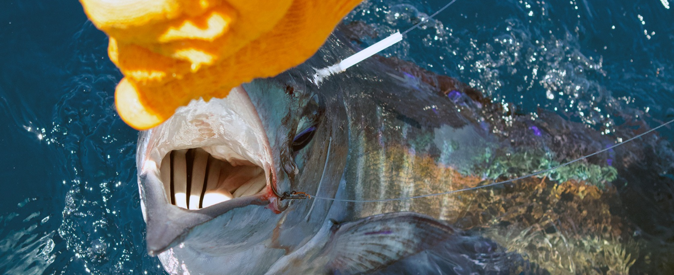
The crew repeats the practiced drill six more times to the whoops of the anglers and the quieter disbelief of the scientists. When Dooley hooks one of the last successful catches, he hands the rod over to Carlucci, who takes over wide-eyed. It’s the first time he has ever had a white marlin on a line.
Reeling in one more marlin on the eighth attempt, the line goes slack—somewhere between the first acrobatic jumps and the boat, the marlin breaks free.
After tagging the first five catches with tethered SPOT tags, Carlucci uses backup pop-up tags on two additional white marlin. The last two tags—the PSATs (Pop-up Satellite Archival Tags), which he hopes will remain on the animals for their programmed 8- and 12-month deployments—will provide a different picture: “They can’t communicate live via GPS while underwater,” he says, “but they’re collecting temperature, depth, light levels, acceleration, and rotational velocity data.” Built-in light sensors estimate latitude and longitude, tracing broad movements into expanses like the Gulf of Maine rather than pinpointing exact locations. The run back to the aptly named Sunset Marina is quieter as the crew busies itself returning the yacht to pristine condition, the sound of music softening the steady thrum of the engines.
I’m gon’ think about them lighters way up in the sky
And how we rode that rocket as far as it could fly…
And that feeling in the air, lighting that live wire
Carlucci and Nadeau talk excitedly about the day’s work. In one day, they had almost doubled the Lab’s white marlin tagging count! Carlucci couldn’t wait to see how the MBON’s SPOT satellite tags would track the marlin. “We will get a real-time location, with the strongest evidence that the fish is there.”
Nadeau stares out at the white water churned by the yacht running at speed. “Fishermen have so much knowledge about their fishery and the history and their craft,” she says, “and learning more about what they care about in relation to our research is really, really amazing.”
“We’re in the background collecting all this data, and sometimes we forget that this has real-world implications and it does affect people. That can be a humbling experience.”
As the Viking enters the Ocean City inlet, seven small release flags wave jauntily from the outrigger halyard. The blue flags are flown upside-down with the bill of the drawn marlin pointing down, signaling the fish were caught and released alive.
Seven flags to celebrate the white marlin. Seven new flags for conservation.
Beyond the Sargasso Sea
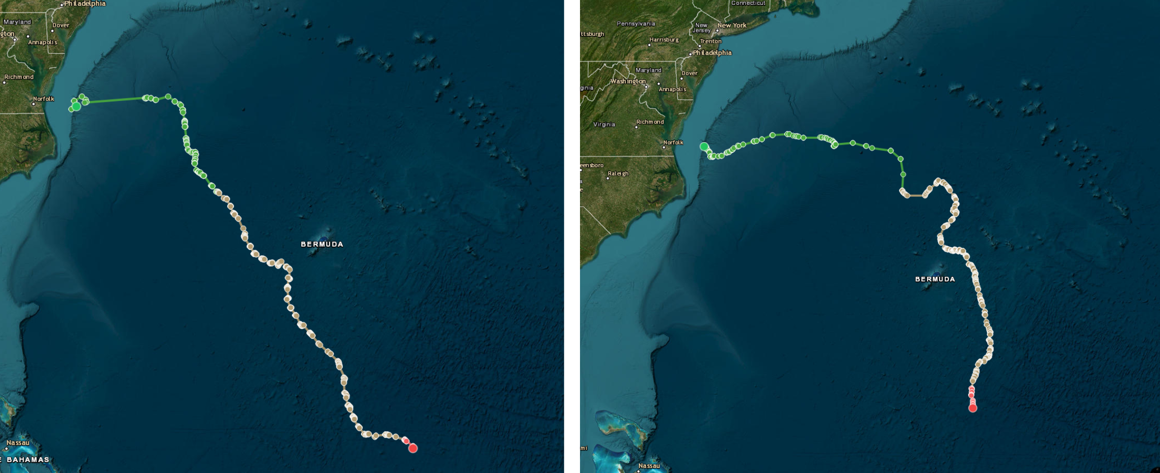
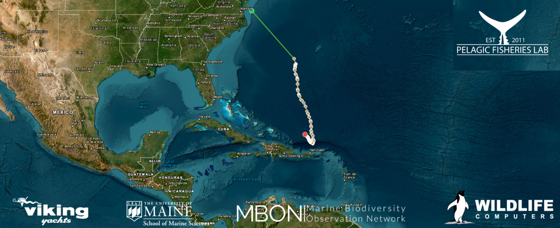
Forty-eight days later, Pelagic Fisheries Lab (PFL) Quantitative Scientist John Carlucci is as excited to see three tags pinging strong as he was when, barely off the boat, he saw the first satellite location captures. Each time the white marlin surface, the tags’ tethered antennas transmit positional data to polar-orbiting Argos satellites, tracking the animals’ migration routes. A fourth tag went offline after a few weeks, and the fifth, thought lost, had recently come back online with questionable reporting.
“Billfish have a notoriously difficult tag retention,” he notes. “Between sheer force, athleticism, and just the lack of body depth, they’re famous for shedding tags early.” If the marlin keep their tags and transmissions continue, Carlucci anticipates gathering three to five months of location data: “The less the fish surfaces and pings—and the warmer the temperature—the longer the battery life.”
The five white marlin tagged boatside from the Viking in mid-September with MBON/BioTrack SPOT tags fought valiantly against championship-level anglers and some of the world’s most advanced sportfishing technology. Yet each fish was hooked, tagged, and safely released in under 15 minutes. Much of the success of these tag deployments hinges on elite sportfishers’ ability to locate fish, minimize fight time, and limit handling stress—drastically reducing post-release mortality and maximizing long-term tag performance.
Fish 40410, 40418, and 40429 are reporting their whereabouts faithfully, already providing researchers with valuable information, including some surprising discoveries.
“The most unexpected result is how much time these marlin spend at the surface—so much that the tags are exposed and we can see the fish,” said the PFL Director, Dr. Walter Golet.
“With these real-time, exceptionally accurate positions, we can overlay oceanographic variables—sea surface temperature, ocean fronts, chlorophyll production, secondary production—with marlin positions and look for associations,” explains Golet.
Dr. Neil Hammerschlag, BioTrack’s lead researcher, is thrilled with the early returns: “I had no idea of the scale of the marlin’s movement and speed,” he said. “Just phenomenal data!”
Beyond billfish, the MBON/BioTrack’s initiative includes tag deployments across other highly migratory species and pelagic predators such as bluefin tuna, sharks, and marine mammals. Tagging data map migration corridors and identify critical habitats—upwelling zones, seamounts, and offshore canyon edges—where predators and prey converge in biodiversity hotspots. From ocean sunfish (Mola mola) to rare blue whales (Balaenoptera musculus) and white marlin (Kajikia albida), these marine superstars act as living oceanographers, transmitting evolutionary knowledge of the open ocean in real time.
Golet’s white marlin are the first for BioTrack in the Atlantic. Released off the mid-Atlantic continental shelf edge, all three turned southeast within days, pinging multiple times daily—except Fish 40418, a 62-inch specimen and the first tagged from the Viking, which went dark for almost two weeks, as if the stress of capture had driven the animal into deeper waters.
Each marlin has since logged at least 1,300 nautical miles on its sprint past the Sargasso Sea. Fish 40429 rounded Bermuda to the east, while the other two cut west, all three converging on warmer Caribbean waters. Fish 40418 eventually resurfaced along a south-southeasterly track, crossing the deep oceanic basin along the outer margin of the Puerto Rico Trench to reach waters just west of the island, where the deep Atlantic transitions into the Mona Passage.
Highly migratory species share distinct behavioral cycles, alternating between marathon transit periods and intense localized foraging. “They’re darting in and off the continental shelf, seemingly feeding,” says Carlucci, “but then a light switches and you’ll see them take off, traversing the Atlantic in a month and a half.”
“They just go!”
What triggers that shift from transit to foraging? Where do they feed, migrate, and spawn? Are there distinct Atlantic substocks? If so, where are their boundaries?
These questions, Carlucci says, are what satellite tags—paired with expanded sampling of muscle and hard tissue like otoliths—will help answer. Because of the white marlin’s strict harvest limits, researchers have few opportunities for large-scale biological sampling, leaving gaps in the data needed to build robust absolute abundance models and set sustainable management thresholds.
“We would need thousands of genetic samples like the ones we get from bluefin, but if we’re getting 10, 20, 100, or even 1,000 samples a year, that’s not very much in the grand scheme of building a white marlin genetic family tree,” says Carlucci.
“We are at the beginning phases of some of the genomics work on white marlin in the Atlantic,” adds Golet, “and preliminary work has not yet identified any stock structure.”
As research collaborations expand, a clearer picture of the white marlin’s life history is bound to emerge. “Colleagues at Woods Hole Oceanographic Institution, at NOAA Fisheries and at the Southeast Fisheries Science Center are also doing some white marlin tagging,” notes Golet. “All of us together can accomplish a lot more than any one of us individually.”
The Pelagic Fisheries Lab team will be ready for another tagging season when the white marlin return to Mid-Atlantic shelf waters in the summer of 2027.

This work was supported by the U.S. Marine Biodiversity Observation Network (MBON) co-organized by NOAA, NASA, BOEM, and ONR through the National Oceanographic Partnership Program (NOPP).
Related news

Satellites Track White Marlin on the Run
Eight hooked, seven tagged, and a race deep offshore. See what satellite tags reveal about the white marlin’s life history.
Fish and Ships: Standardizing Marine eDNA Surveillance
Standardization across the eDNA metabarcoding workflow—from field sampling to laboratory sequencing and bioinformatics—is rapidly transforming marine observation.

Meet the Scientist Turning Ocean DNA Into Open Data
Meet Dr. Luke Thompson, the NOAA AOML scientist building open tools that turn ocean eDNA sequences into data anyone can search and use.