Meet the Winners of the Surface Elevation Table (SET) Call for Proposals
SECOORA hosted a request for proposals for the installation of new Surface Elevation Table (SET) stations or the reactivation of historic SET stations within the Southeast region. This opportunity covers the cost of materials and supplies for the stations. Meet the winners here!
The SECOORA SET Community of Practice (CoP) brings together stakeholders, practitioners, and communities spanning North Carolina, South Carolina, Georgia, and Florida. They are dedicated to providing stakeholders with insights into elevational changes within wetlands, including marshes, mangroves, forested wetlands, swamps, and pocosins. This fosters a deeper comprehension of coastal dynamics, pinpointing areas of vulnerability, and advocating for effective adaptation strategies. Their goal is to equip stakeholders with the necessary tools to promote environmental awareness and community engagement in safeguarding our coastal regions.
SECOORA hosted a call for proposals for the installation of new Surface Elevation Table (SET) stations or the reactivation of historic SET stations within the Southeast region. This opportunity covers the cost of materials and supplies for the stations. The winners include the following:
- Dr. Scott Curtis, Professor, Center for Climate Studies at The Citadel
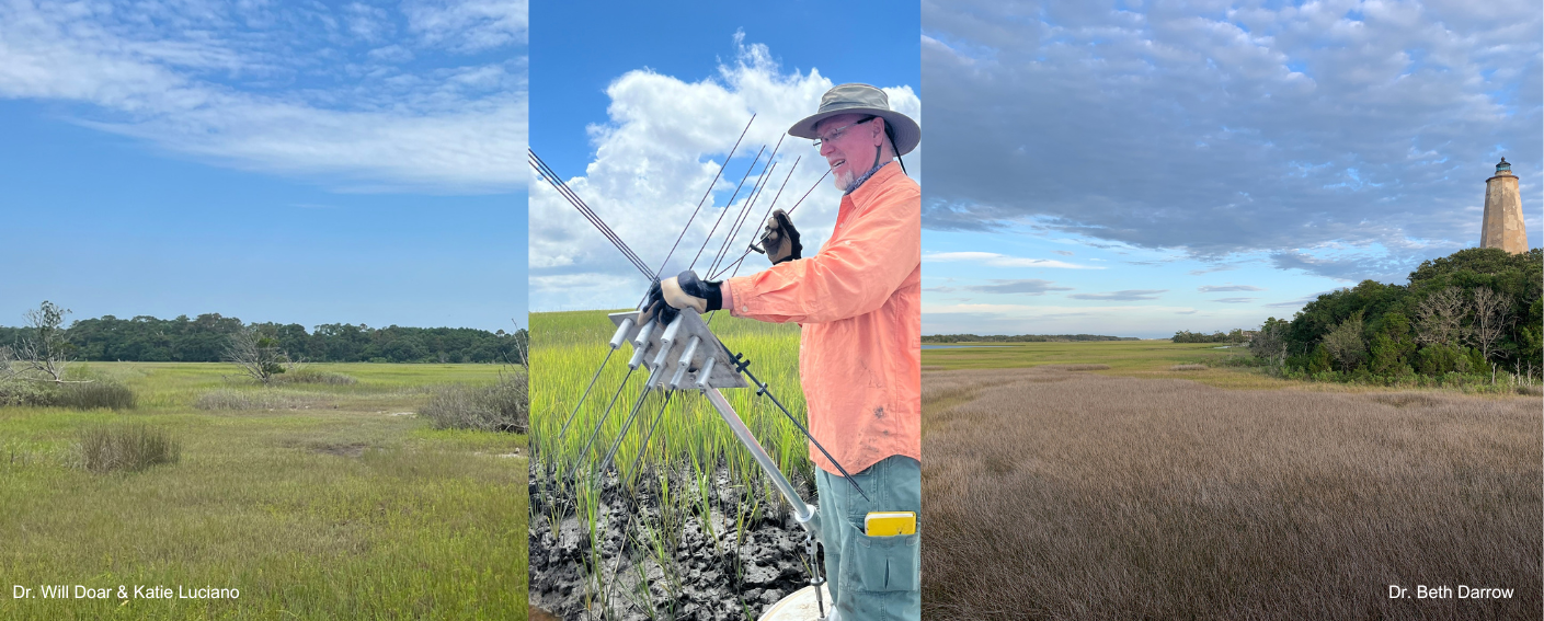
- Dr. Beth Darrow, Estuarine Ecologist and Director of Science, Bald Head Island Conservancy
- Dr. Will Doar and Katie Luciano, Senior Coastal Plain Geologist and Coastal Geologist (respectively), South Carolina Geological Survey (SCGS)
- Dr. Lori Sutter, Professor, University of North Carolina Wilmington (UNCW)
- Dr. Courtney Kimmel, Director of Conservation, Port Royal Sound Foundation
Read about the winning projects below.
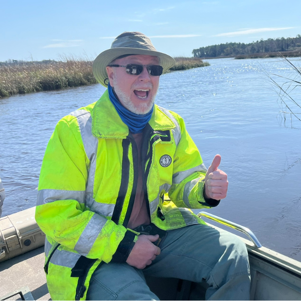
Dr. Scott Curtis, The Citadel
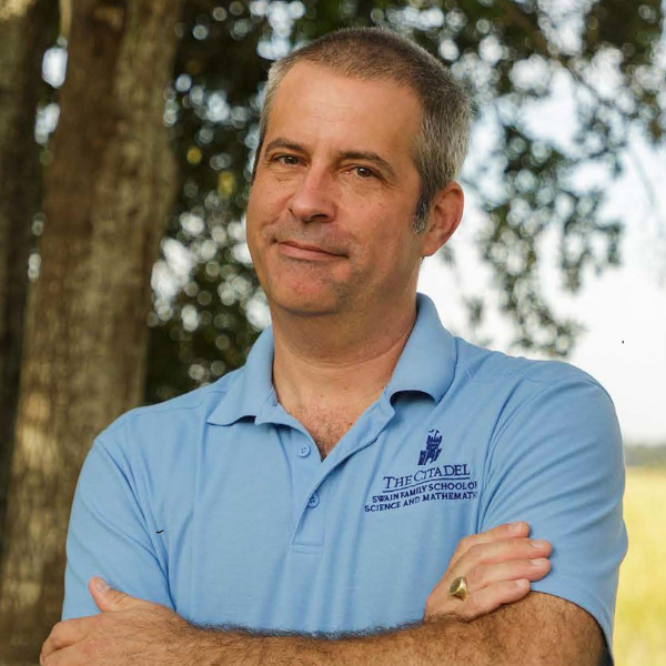
Scott Curtis is the Dr. John Lining Professor of Physics and the inaugural director of the Lt. Col. James B. Near Jr. ’77, Center for Climate Studies at The Citadel. He came to The Citadel from East Carolina University (ECU) where he was titled Distinguished Professor in the Natural Sciences and Mathematics. Over his career he has either led or contributed to 29 grants worth over $4.5 million. Dr. Curtis’s research is focused on climate variability and extremes. He earned a Ph.D. and a Master of Science, both in Atmospheric & Oceanic Sciences, from the University of Wisconsin. He holds a bachelor’s degree in Environmental Sciences from the University of Virginia.
“The Near Center for Climate Studies and The Citadel are excited to receive funding for a Surface Elevation Table to be installed on campus. The Citadel fronts the Ashley River in Charleston, SC and has access to many acres of salt marsh. This affords opportunities for student research and hands-on learning at a mainly undergraduate institution.”
— Dr. Scott Curtis, The Citadel
Dr. Curtis’s team intends to monitor how the marshes respond to the dredging of the Citadel creek, which could support the development of a beneficial use project. Furthermore, the SET station will be in close proximity to a SECOORA funded tide gauge (hohonu-104_the_citadel_ashley_ri) and a MetOne research grade weather station. Thus, they can link major tidal and weather events to sedimentation and marsh health.
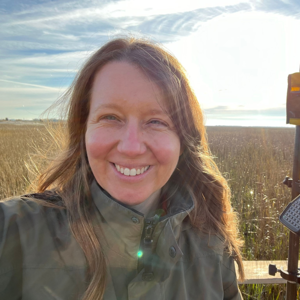
Dr. Beth Darrow, Bald Head Island Conservancy
Dr. Beth Darrow is an estuarine ecologist and the Director of Science at Bald Head Island Conservancy, a nonprofit organization on Bald Head Island, NC, whose mission is “We Discover, Learn, Conserve, and Preserve.” Beth has led science and conservation programs at BHIC since summer 2018. Her research specialty is estuarine and shellfish ecology and stakeholder-driven science. Beth and the science team are working to further develop the Conservancy’s research program and strengthen relationships with collaborators in the Cape Fear region and beyond.
“The marshes of the Smith Island Complex are some of the largest expanses of undeveloped coastal habitat left in the lower Cape Fear. These are recognized as Significant Natural Heritage Areas, Important Bird Areas, and Essential Fish Habitat, but are under threat by climate change, sea level rise, and dredging/shipping impacts. In 2022, the newly-established Johnston Center for Coastal Sustainability identified “establishing a baseline for sea level rise assessment” as one of its first priorities. I was thrilled to have the opportunity presented by SECOORA to propel this project forward, allowing us to establish SETs in the marshes of Bald Head Island for the first time.”
– Dr. Beth Darrow, Bald Head Island Conservancy
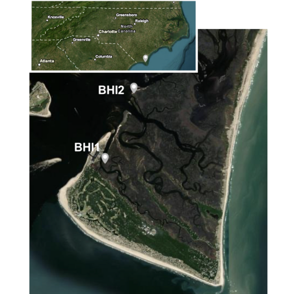
Dr. Darrow’s team plans to establish two Sediment Elevation Tables in lower back-barrier marshes of Bald Head Island (see map). The tidal marshes throughout the Cape Fear watershed are experiencing accelerating sea level rise (avg 2050 projection: 0.52 m year-1 for Wilmington, NC, VIMS 2023). Estimates of rates of marsh migration or other responses to this accelerating sea level rise depend on accurate marsh accretion or erosion rates. As the shipping route to the Port of Wilmington, the Cape Fear River has experienced channel realignment, periodic channel maintenance, and significant wakes from shipping vessels that impact local erosion rates. A proposed channel deepening and widening project (“Wilmington Harbor 403”) is currently under consideration by the US Army Corps of Engineers, with expected substantial adverse impacts to habitat throughout the Cape Fear watershed (USACE 2024).
Included in this project are mitigation plans to use dredge spoil for beneficial use placement, but it is currently unclear where the most beneficial uses of this resource might be. It is important to document the marsh elevation baseline and rate of change in response to the combined stressors of sea level rise, storms, and such river management projects. The SET locations are designed to provide data to examine response to riverine processes. SETs will be installed in areas with uniform vegetation community and cover, regularly flooded low marsh dominated by Spartina alterniflora. BHI1 is located across a tidal creek from the developed west end of Bald Head Island. It will provide site-specific erosion/accretion rates that can be applied to sea level rise models that will be directly applicable to human habitation and resilience planning (e.g., NOAA’s Sea Level Rise Viewer). Surface elevation data can be paired with existing nearby data sources, including a water level meter installed in the BHI marina operated by the Village of BHI. BHI2 is approximately 2.25 km northeast of BHI1, on a marsh island bordering the Cape Fear River. This would be more representative of a “natural” S. alterniflora low marsh in this region with full exposure to the Cape Fear River to the west.
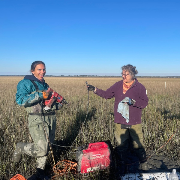
Dr. Will Doar and Katie Luciano, SCGS
Dr. Will Doar is the Senior Coastal Plain Geologist at the South Carolina Geological Survey (SCGS). He installed some of the first SETs in the state of South Carolina, working in collaboration with the Florida Geological Survey and USGS in the late 1990’s. Katie Luciano is a Coastal Geologist with SCGS, and has worked with SETs in South Carolina since 2014. Together, they install, maintain, and monitor an array of 25 SETs state-wide (all installed as Rod SETs or RSETs except two original SET installations). Both Will and Katie are interested in Quaternary (recent) geology, coastal and marine geology, geochronology, and stratigraphy. Their other projects involve Coastal Plain mapping and geomorphology studies.
“Surface Elevation Tables provide important data about elevation changes on the surface of our marshes. However, funding can be difficult to obtain because the datasets involve multi-year (ideally multi-decadal) monitoring – this kind of timeframe does not fit neatly in with many grant requirements. The award from SECOORA will allow us to expand our network to an area where a big data gap exists – Charleston Harbor.”
– Dr. Will Doar and Katie Luciano, South Carolina Geological Survey
With this funding they will install six (6) Rod SETs in the Charleston Harbor area. In addition to quarterly platform elevation measurements, they plan additional data collection at these sites, including monitoring tidal inundation and vegetation. Their office is in the Charleston area, so the proximity of these new stations should allow them to try out some new monitoring techniques that they haven’t used at our other sites.
Dr. Lori Sutter, UNCW
Dr. Lori Sutter’s current research is best viewed through three primary areas: marsh response to global change (especially sea-level rise), carbon/nutrient cycling, and ecosystem restoration. She is particularly interested in how marshes respond to sea-level rise: How do plant communities respond to changes in inundation and salinity, and how does that translate to ecosystem function (such as carbon storage, nutrient cycling, plant productivity) as well as the presence of the marsh itself. She enjoys engaging with the management community to then ask what pre-emptive action(s) might be taken to increase the likelihood of marsh survival. She holds a vision of a scientifically literate society, so she participates in outreach and teaching non-scientists in ways that she hopes brings solutions to anyone who is willing to contribute to a more sustainable way of life. In the classroom, Dr. Sutter has taught courses in global warming, natural history, wetland science, general ecology, and plant physiology.
“Supporting the installation of six surface elevation tables (SETs) along a salinity gradient in the Northeast Cape Fear River allows my group to monitor changes in wetland elevation in our local area. We will have important data to link to other work at the same locations where we are investigating how carbon storage, nutrient cycling, and plant productivity are changing in our local wetlands. With increasing flooding, keeping an eye on marsh and swamp elevation relative to rising seas could allow us to advocate for management action to improve their resilience. The region is likely to support harbor expansion in the coming years, so the effects that our wetlands experience with water levels and salinity intrusion will be faster than in other estuaries. Being able to track ecosystem responses could help other areas know what to expect in their region. Finally, this project is tied into a national network of SETs along similar gradients, so we will be able to contextualize what we find in the lower Cape Fear to the East and Gulf coasts.”
– Dr. Lori Sutter, University of North Carolina Wilmington
Dr. Sutter’s project will include Installing six SETs in marshes and swamps along a salinity gradient.
Dr. Courtney Kimmel, Port Royal Sound Foundation
The Port Royal Sound Foundation is a nonprofit organization focused on conserving the Port Royal Sound along the southern coast of South Carolina. The Port Royal Sound is a unique estuary system with very little freshwater input and an expansive salt marsh, representing approximately a third of the marsh area in the state. As part of its mission, the Port Royal Sound Foundation facilitates the Port Royal Sound Conservation Network, a collaboration of researchers, state and local agencies, conservation partners, and volunteers that monitor and contribute data that supports conservation-forward decision-making in the watershed.
“We are excited to have the Port Royal Sound watershed join the SECOORA SET Station network and community of practice and contribute to a better understanding of marsh dynamics here and throughout the southeast.”
– Dr. Courtney Kimmel, Port Royal Sound Foundation
While there is an extensive array of RSET stations along the coast of South Carolina, none are actively monitored in the Port Royal Sound watershed. In collaboration with the SC Geological Survey, PRSF applied to SECOORA to extend the network in this region and was awarded funding to support 15 stations. These stations will be installed throughout the watershed and monitored in collaboration with Beaufort County, SC State Parks, the University of South Carolina—Beaufort, the Department of Defense, and several private communities.
Related news
SECOORA Request for Proposals for a Data System Development, Operations, and Maintenance Service Provider
SECOORA seeks a Data System Development, Operations, and Maintenance (DMAC) service provider to act as a strategic partner while maintaining the current SECOORA Data System. Proposals are due to SECOORA by 5:00 PM ET, March 31, 2026.

Plankton Perfect: Using Imagery to Document Microscopic Marine Life
Dr. Enrique Montes is working to understand how plankton respond to changes in the ocean by capturing high resolution imagery with advanced technology. This work is funded by the Marine Biodiversity Observation Network (MBON) to use novel techniques like the Continuous Particle Imaging and Classification System (CPICS).

SECOORA Community Spotlight: Craig Harris
When Craig Harris signed on as the Emergency Management and Resiliency Coordinator for the city of Wilmington, North Carolina, he brought with him knowledge of water level sensors. SECOORA worked with Craig to install a water level sensor at the Love Grove Bridge in Wilmington, a site prone to flooding.