

Join us for the webinar “Passive acoustic monitoring on a SV3 Wave Glider for fish spawning aggregation detection and characterization” on April 24 at 12:00 PM ET. Laurent Cherubin from FAU’s Harbor Branch Oceanographic Institute will discuss a novel, autonomous approach to conduct fishery independent surveys in order to search and discover unreported aggregations by mapping the underwater acoustic landscape using an unmanned platform in areas that surround currently known spawning aggregations during the spawning season.
Date: April 24, 2018
Time: 12:00 PM ET
Presenter: Laurent Cherubin, FAU’s Harbor Branch Oceanographic Institute
Abstract
Many commercially important reef fishes in the Caribbean and southeast US have been overfished to the point that some species, like the Nassau grouper, is considered threatened and on the endangered species list. Mature adults of some species gather in large numbers every year for two to three months at specific locations to spawn.
Once located, the spawning aggregations become an easy target that can be reduced until it can no longer be formed. Most grouper and snapper spawning aggregations in the region have been extirpated and the few that have been documented are vulnerable unless protection can be enacted.
We have developed and demonstrated a novel, autonomous approach to conduct fishery independent surveys in order to search and discover unreported aggregations by mapping the underwater acoustic landscape using an unmanned platform in areas that surround currently known spawning aggregations during the spawning season.
While passive acoustic methods have previously been used for fisheries management and stock assessment, the platforms and algorithms are not currently mature enough to allow for advanced autonomy, drastically limiting the spatial and temporal range, and resulting in considerable operational costs.
In addition to discovering previously unknown spawning sites, the development of novel algorithms, and passive acoustic and environmental sensor systems enables monitoring along with automated detection, classification and surveillance of fish vocalizations.
As well as providing significantly finer scale detection with low latency, this innovative approach also enables greater on-board intelligence and autonomy; reduced launch/recovery and satellite data cost thus further reducing the overall operational costs, while enhancing performance for ocean monitoring missions.
About the Presenter
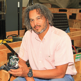
Laurent Cherubin obtained a bachelors with a major in mechanics and a minor in mathematics at the University of Bordeaux (France). Then he acquired a MS in coastal oceanography and PhD fellowship from the French Navy – graduating from the University of the Mediterranean in Marseille (France) in 2000. Laurent Cherubin was a postdoctoral researcher at the University of Lisbon (Portugal), at the Institute of Oceanography for two years, before he joined the Rosenstiel School of Marine and Atmospheric Science at University of Miami, where he spent most of his early career. Since August 2013 he has been a research Associate Professor at FAU’s Harbor Branch Oceanographic Institute and his expertise is in physical oceanography, numerical modeling, biophysical modeling, marine connectivity, fish acoustics and autonomous underwater vehicle. Learn more.
Related news
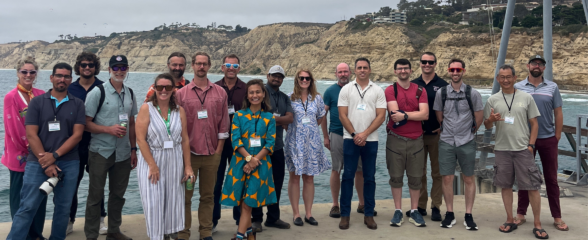
SECOORA Co-Hosts the 2026 WebCOOS Workshop In Person in La Jolla, CA
The 2026 WebCOOS Workshop convened in person on July 21-22, 2026 in La Jolla, CA. 45 attendees representing all 11 IOOS Regional Associations and national partners joined this collaborative workshop to discuss webcam-derived coastal products, stakeholder needs, and the network's transition into its next phase under IRA T2.

SET Webinar Series: Exploring Coastal Change: Digital Coast Resources
Join us on August 28, 2026, from 1:00 - 2:00 PM for the SECOORA SET Webinar Series, where we will explore coastal change using NOAA's Digital Coast resources. This webinar will bring together SET Community of Practice members and partners to learn how geospatial data and tools can support SET monitoring and place site-level observations within a broader landscape context.
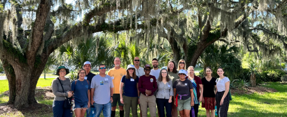
SECOORA Hosts the Second Surface Elevation Table (SET) Community of Practice Workshop In Person in Charleston
The 2nd SECOORA SET Workshop convened in person on July 16-17, 2026 in Charleston, SC. More than 30 Community of Practice members and stakeholders joined this collaborative workshop to discuss SET monitoring, coastal resilience, and data-driven decision making in the Southeast.