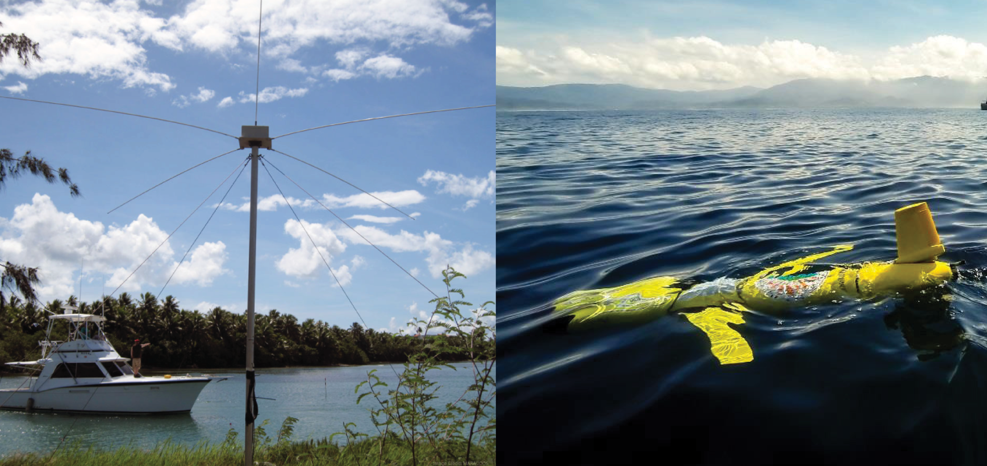
Left image is courtesy of MARACOOS and right image is credited to Ben Hollings, Blue Ocean Monitoring.
The Fiscal Year (FY) 2018 Omnibus Appropriations Act was passed by Congress on March 22, 2018. It included support for many ocean and coastal programs including the Integrated Ocean Observing System (IOOS®).
IOOS regional systems were allocated $35 million, an increase of $4.3 million from FY 17. This support will allow the eleven IOOS regional observing system to fill critical gaps in the High-Frequency (HF) Radar network and underwater glider observatory.
HF radars map the speed and direction of surface currents in real-time. Due to the large coverage area, HF radar data provide valuable input for ocean models and have been used for search and rescue, oil spill response efforts, and fisheries management. For example, the U.S. Coast Guard search and rescue operators use HF radar sea surface current speed and direction data as well as mooring data to initiate the Search and Rescue Optimal Planning System (SAROPS) to better delineate the search area. The integration of HF radar current data into SAROPS has increased the accuracy of the system and helps reduce the size of search and rescue areas, thereby increasing effectiveness of Coast Guard searches.
Gliders are underwater vehicles that relay information about subsurface conditions. In typical use gliders take measurements, such as water temperature, salinity, dissolved oxygen, from the ocean surface to depths of up to 3000 ft (1000m). Deployments of several weeks to up to 6 months are routine. The U.S. Navy estimates that gliders are 1/100th of the cost of ship-collected data. Gliders are revolutionizing ocean observing by being cost-effective, safe, and flexible.
Related news

Claire McGrath Joins SECOORA as Program and Development Manager
SECOORA welcomes Claire McGrath as Program and Development Manager, supporting the Southeast & Caribbean Coastal Disaster Resilience Partnership and membership growth.

Spotlight: Mobilizing to Save Florida’s Coral Reefs
Learn how scientists are racing to save Florida's Coral Reef through coral rescue, gene banking, reef restoration, and innovative conservation efforts after disease and marine heatwaves devastated one of America's most important marine ecosystems.

From a Whale’s Song to an Ocean’s Symphony: How AI Decodes Underwater Sound
Explore how SECOORA-funded research is using AI and machine learning to decode ocean soundscapes, detect boat noise, and support coral reef restoration efforts.