

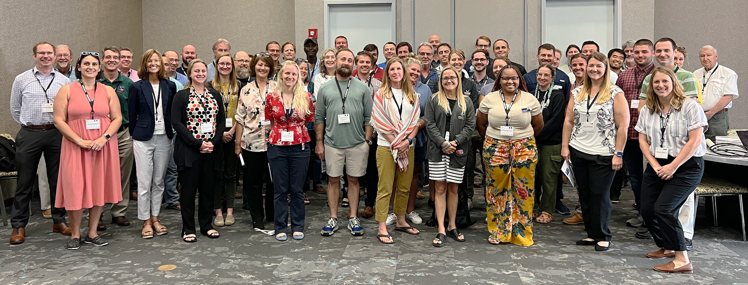
Over 60 representatives from eleven federal and state agencies, four private companies, and nine academic institutions met in Jacksonville, FL to talk water levels in the Southeast on June 15-17, 2023. The workshop purpose was to:
- understand the variety of water level sensors in use, water level station locations, programs, and uses in the Southeast;
- learn about specific online data and stakeholder tools; and
- document priority locations for additional sensors.
Panel and lightening talks allowed participants the chance to learn about federal, state, and NGO approaches to water level data collection. Breakout sessions allowed participants the chance to learn about specific water level sensors and tools and products for processing or displaying data. The workshop ended with attendees identifying priority locations for installing water levels sensors in Florida, Georgia, South Carolina, and North Carolina.
Workshop was hosted by SECOORA and NOAA Center for Operational Oceanographic Products and Services (CO-OPS).
Thank You Sponsors

Meeting Materials
- Agenda
- Attendee List
- Hyperlinked Resources
- USGS Resource (Tools and Products)
- NOAA Resources (Tools and Products)
- North Carolina Department of Emergency Management Resources (Tools and Products)
- SECOORA Resources (Tools and Products)
- NOAA Nitty Gritty Session Resources (documents)
- Handout for Breakout: Gaps, Priorities, and Struggles
- Speaker Biographies (updated as they become available)
- Hohonu One Pager
Meeting Presentations
Water Level Program Overviews
- NC Flood Inundation Mapping and Alert Network (FIMAN) – Gary Thompson, NC Department of Public Safety
- FL Department of Environmental Protection (FL DEP) – Rudolphe (Rudy) Konou, FL DEP
- SECOORA Southeast Water Level Network – Nicole Elko, American Shore & Beach Preservation Association
- Water Observing Systems Network – Athena Clark, U.S. Geological Survey (USGS)
- NOAA’s Tides and Currents – Laura Rear McLaughlin, NOAA CO-OPS
Lightning Talks: Demos of Equipment and Technical Procedures
- NC FIMAN – Gary Thompson, NC Department of Public Safety
- SECOORA Southeast Water Level Network – Brian Glazer, Hohonu Inc.
- NOAA’s Tides and Currents – Nathan Holcomb, NOAA CO-OPS
- NOAA’s Tides and Currents Low-Cost System – Laura Fiorentino, NOAA CO-OPS
Tools and Products I – Federal Resources
- NOAA Resources – David Walcott, NOAA CO-OPS, and Doug Marcy, NOAA Office of Coastal Management
- USGS Resources – Athena Clark, USGS
Tools and Products II – Non-Federal Resources
- NC Flood Inundation Mapping and Alert Network (FIMAN) – Gary Thompson, NC Department of Public Safety
- SECOORA Southeast Water Level Network Quality Assurance and Quality Control Dashboard – Charlton Galvarino, Second Creek Consulting
Other Presentations
- Overview of Alaska Water Level Watch Buildout Tool – Laura Rear McLaughlin, NOAA CO-OPS
- Water Level Stakeholder Survey Results – Jennifer Dorton, SECOORA
Related news

Dave Wells Joins SECOORA as Ocean Observing Systems Team Lead
SECOORA welcomes Dave Wells as Ocean Observing Systems Team Lead where he will oversee SECOORA's coastal observing system assets and data management.
At the Water’s Edge: Lowcountry Coastlines in a Brave New World
A nor'easter's record storm tide. A stalled tropical storm. Two Lowcountry towns adapting to a new era of flooding, with SECOORA data in hand.

Above the High Tide: Water Level Sensors on the Front Line
SECOORA's Southeast Water Level Network has installed 100+ sensors across the Carolinas, Georgia, and Florida, giving communities real-time flood data.