

Above the High Tide: Water Level Sensors on the Front Line
SECOORA's Southeast Water Level Network has installed 100+ sensors across the Carolinas, Georgia, and Florida, giving communities real-time flood data.
By Zoraida Díaz
In the mid-20th century, most Southeast U.S. water level stations averaged 1-3 flood days annually. Today, major coastal cities experience 15 to more than 80 flood events per year. Standouts like Wilmington, NC, and Charleston, SC, recorded peaks of 85 and 89 flood events in a single year over the past decade.
According to NOAA’s Office for Coastal Management, Southeastern coastlines from North Carolina to Florida are experiencing chronic inundation, driven by systemic, long-term factors including land subsidence (the sinking of the Earth’s surface, mostly from the extraction of underground water resources), King Tides, and the loss of natural coastal buffers.
Communities, state and federal agencies, coastal scientists, emergency managers, and local administrators are joining forces to combat the increasing risk. Low-lying regions are adjusting to a world prone to greater flood risk in the coming decades through modernized emergency planning and alert systems, integrated structural and nature-based engineering, updated climate policy and financial planning, community involvement, and data democratization.
With funding from NOAA’s Integrated Ocean Observing System (IOOS), SECOORA partnered with Coastal Carolina University, Georgia Tech University, American Shore and Beach Preservation Association (ASBPA)/Hohonu, Florida International University, Florida Atlantic University, and coastal communities to form the Southeast Water Level Network.
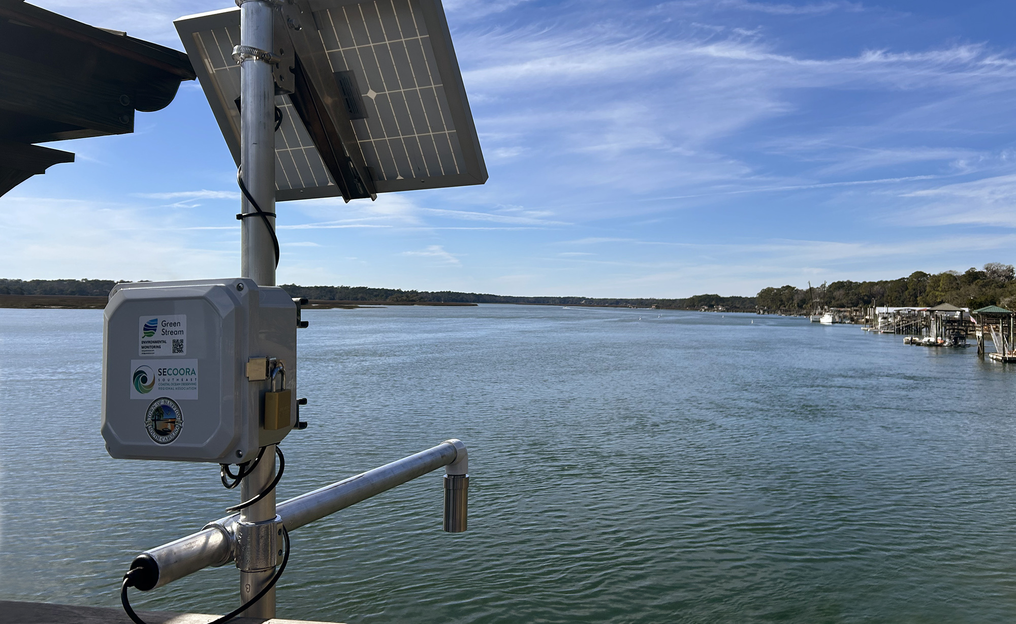
Since 2021, through the network, SECOORA has installed over 100 ultrasonic water level sensors across North Carolina, South Carolina, Georgia, and Florida, expanding water level monitoring across the Southeast.
The low-cost technology collects real-time data on flooding, storm surges, and high tides. The sensors are designed to be mounted above the water on dock pilings, bridges, and other permanent structures. They emit a pulse (sound wave or radar) that bounces off the water’s surface to measure the distance and compute water elevation. The sensors are calibrated to convert the raw distance measurements to a standardized ground-elevation baseline such as NAVD88 (North American Vertical Datum of 1988) or MHHW (Mean Higher High Water).
Through the SECOORA Southeast Water Level Network data portal (an open-access data dashboard), real-time water elevation data is directly available to smartphones, emergency dispatchers, and municipal public works departments, triggering automated alerts once a pre-set flood threshold is reached.
Emergency managers and city administrators can integrate this hyper-local data with risk modeling to guide flood management mitigation strategies and secure funding for structural defenses. The initiative also supports scientific research and promotes education and public outreach.
NOAA and Expanding Water Networks
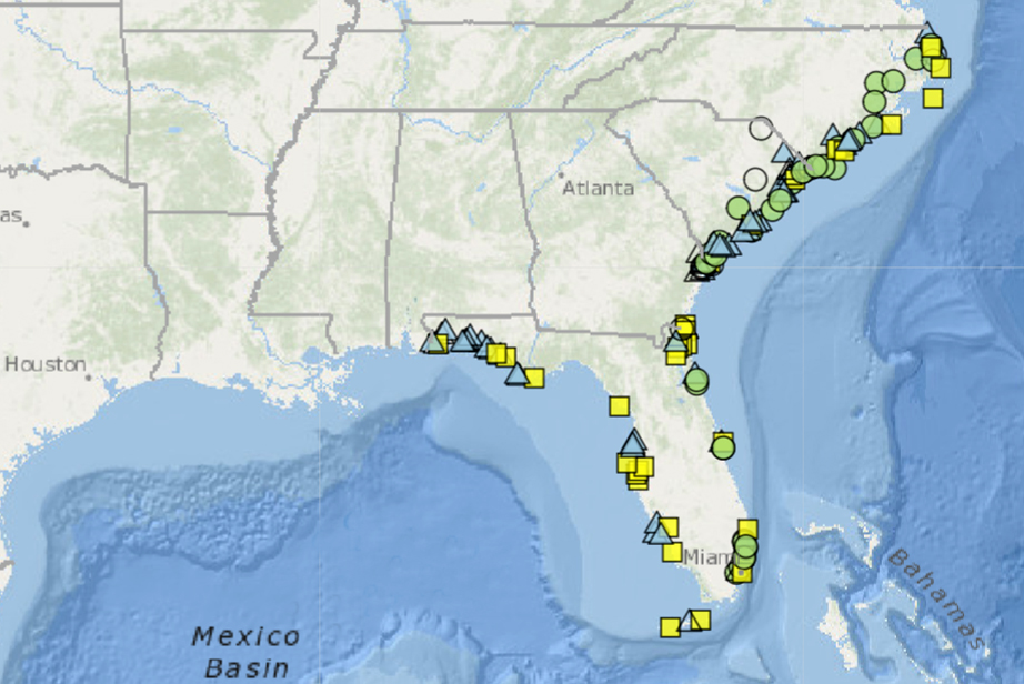
NOAA operates 25 long-term water level and meteorological stations between Duck in northernmost North Carolina and Pensacola, near the Florida-Alabama border. Together, they monitor over 12,000 miles of complex ecosystems and intricate shorelines—if each inlet, bay, barrier island, sound, and marsh were counted.
As part of the NOAA National Water Level Observation Network (NWLON), some stations, including Fernandina Beach, FL, and Charleston, SC, have been taking the pulse of coastal shores since the late 19th century.
Nicole Elko, Executive Director of the American Shore & Beach Preservation Association (ASBPA), explains that NOAA’s NWLON is “foundational” but not designed to answer the day-to-day flooding questions ASBPA members face.
“Permanent gauges are often located at major ports and long-term reference sites,” says Elko, “while flooding impacts can vary block by block because of local topography, drainage, marsh connections, inlets, waves, wind setup, rainfall, and infrastructure.”
SECOORA water level sensors have expanded monitoring along Southeast “blind spots,” providing localized real-time data to residents, city planners, and emergency managers. From road-closure advisories to evacuation orders to sea-level-rise adaptations, water-level data has multiple applications.
“Public access is critical because it builds trust and improves risk awareness. Coastal resilience works best when data is not limited to scientists or agencies, but is available to the people who make daily decisions in communities,” says Elko.
At its most basic, water-level data help residents decide whether flooding will affect road closures. For emergency managers and city administrators, the data are essential for designing long-term flood mitigation strategies and predictive flood-risk models that warn of extreme coastal impacts. They are also used to calibrate local flood alerts, validate models, improve emergency operations, and document chronic flooding.
“ASBPA members want this data now because coastal decisions are being made now,” says Elko. “Where to restore marshes, elevate roads, improve drainage, protect access, and prioritize limited resilience funding.”
Climate Resilience in Beaufort County, NC
Rural coastal populations in Beaufort County face systemic economic and environmental stressors, including low median household incomes and deficits in flood-adaptation infrastructure. These barriers limit local capacity to deploy flood-mitigation strategies, weakening community resilience to sea-level rise, sound-side storm surge, and chronic tidal flooding.
Cayla Cothron, a former North Carolina National Sea Grant College Program (NC Sea Grant) climate resilience extension associate, was instrumental in reaching out to communities highly exposed to repeat flood hazards. Sea Grant, a federal-university partnership administered by NOAA, integrates coastal research, community outreach, and marine science education across U.S. oceans, coasts, and the Great Lakes.
“We defined vulnerability not only as exposure to repeat flood hazards and increasing risk,” said Cothron, “but also as the places that have not been historically prioritized for resource investment—whether that be by underrepresentation or exclusion.”
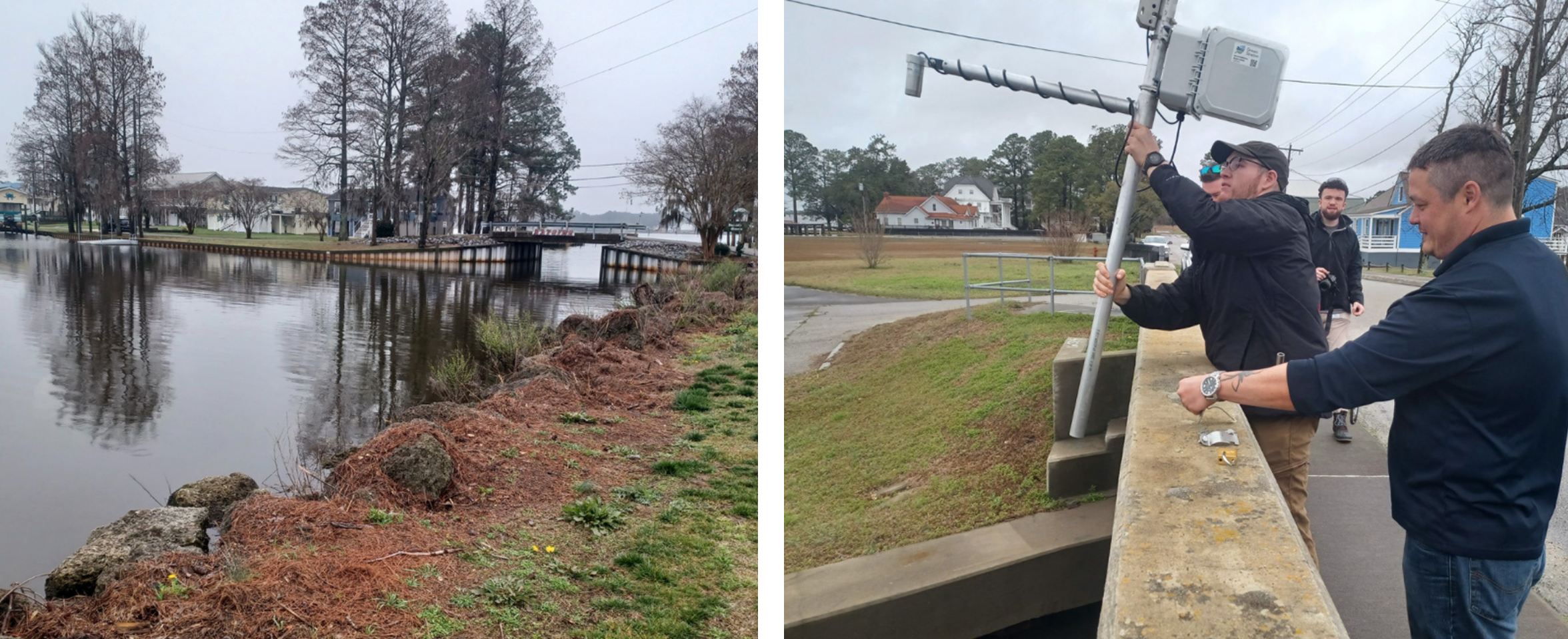
In 2024, North Carolina Public Safety, Beaufort County Emergency Services, and NC Sea Grant partnered with SECOORA to install water level sensors at Bayside, located between Chocowinity Bay and the Pamlico River, and in Belhaven, where the Pungo River meets Pungo Creek.
“There are about 137.5 square miles of water in Beaufort County,” says the county’s Interim Emergency Management Coordinator Melissa Beacham, “roughly one-sixth of the county’s area is water.”
Given the county’s high flood vulnerability, Beacham notes that comparing real-time water-level data against reported roadway flooding and storm surge conditions will allow officials to define flood thresholds tailored to specific locations.
“Instead of relying solely on regional tide gauges, weather forecasts, or modeled flood levels, the County can see what is actually happening at Bayview and Belhaven in real time,” says Beacham.
Progressive emergency management strategies become critical during severe storm and rainfall events, and, according to Beacham, establishing a reliable baseline of normal water-level conditions is the first step in understanding how diverse waterways respond to weather, tides, rainfall, and wind conditions.
Water-level data also translate into practical decision-making, says Beacham, “it helps residents make practical decisions such as when to move vehicles, protect property, adjust travel plans, or prepare for approaching storms.”
Beacham is certain that over time the expanding dataset will become increasingly valuable: “It can be used to validate flood models, identify trends in nuisance flooding and storm surge impacts, improve emergency response planning, and support future mitigation funding requests.”
Dr. Mariko Polk, Coastal Processes Specialist for NC Sea Grant, agrees that the sensors not only fill important monitoring gaps: “As the monitoring record grows, the information will become increasingly valuable for evaluating recurring flood issues and assessing the effectiveness of future projects.”
To align the SECOORA Water Network objectives with local priorities, community and program partners collaborate with SECOORA staff to determine local flooding thresholds, review data visualizations, and identify coastal flood adaptation needs.
“People on the ground who are interested in and need localized data on water levels to shed light on trends and impacts specific to their context are absolutely critical to ensuring that sensors don’t just get placed and become another thing to maintain,” says Cothron.
Belhaven’s Town Manager Lynn Davis is such a person. She has championed the use of sensors by sharing the town’s generational experience with storm-related and tidal flooding with other coastal communities.
“Belhaven is no stranger to high water, so our people are resilient,” said Davis when the sensors were installed. “We will be able to shift from being reactive to being proactive because of these gauges.”
“The value of the Belhaven and Bayside gauges extends beyond the data they collect,” says Beacham. “They help connect scientific measurements with the lived experiences of the people who deal with flooding regularly.”
Florida Fills Critical Data Gaps
In Florida, the Southeast Water Level Network’s water level monitoring stations have recently expanded into the Big Bend, Cape Coral, and Palm Coast regions, says Dr. Dana Stephens, the Okaloosa County Extension Director for Florida Sea Grant (FL Sea Grant).
Farther south, in Pasco County, SECOORA and its Southeast Water Level Network partner, Florida Atlantic University, have installed three water level sensors along the Pithlachascotee River at the Port Richey Waterfront Park, the Energy and Marine Center, and Skeleton Key Marina in Hudson.
The sensors fill critical data gaps where water level data have not existed, or where water level conditions vary from NOAA’s major regional tide stations.
“Access to data provided by SECOORA efforts is critical, but the data are only as valuable as a community’s ability to access, interpret, and use them,” says Dr. Stephens.
FL Sea Grant bridges the gap between raw coastal data and community action by prioritizing access for high-need communities, collaborating with local stakeholders to ensure data are accessible, training local “station stewards” to maintain sensor hardware, and conducting community outreach through meetings and educational workshops.
Dr. Stephens explains that targeted tools such as QR codes posted near the sensors or community-access data dashboards like SECOORA’s allow community members to verify flood levels instantly and understand water fluctuations in their communities.
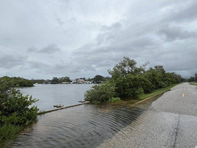
“Just this past week there were heavy thunderstorms in the Fort Walton Beach area,” noted Dr. Stephens. She explained that real-time data from the Francis Park sensor allowed residents to identify flooded roads and map safer routes home from work.
Operated by SECOORA partner Florida Atlantic University, the sensor provided actionable, custom notifications that helped the community navigate an active flooding event.
That afternoon, the National Weather Service issued a Severe Thunderstorm Warning and a Flash Flood Warning for Okaloosa County between 2:40 PM and 4:45 PM.
Seagrass and Tide Fluctuations
Beyond providing real-time data for flood mitigation, water level sensors offer valuable opportunities for research and education.
For instance, Nathan Hall, Research Associate Professor and Director of the University of North Carolina’s Institute for the Environment, has used a SECOORA sensor both to plan fieldwork and to support his students’ Capstone research projects.
The sensor is installed at Emerald Isle, a coastal town on the barrier island of Bogue Banks, just west and across the bridge from Morehead City, North Carolina.
“We used that sensor extensively last fall when we were doing our Capstone project in that area!” he said. “We used it for planning our fieldwork to avoid the highest tides.”
Hall’s students engage in environmental research with real-life applications. He explained that the Capstone project studied a rapidly eroding dredge spoil island off the northern shore of Bogue Banks, for which the NC Coastal Federation has drawn restoration plans. His students used water-level sensor data in their research to adjust their “ruler-based seagrass depth measurements for the tides.”
The artificial dredge spoil island has naturally colonized over decades with marsh grasses and is surrounded by oyster reefs. The project addressed concerns raised by the North Carolina Division of Marine Fisheries and NOAA about the loss of seagrass and wildlife habitats, which act as biological buffers that protect the mainland from wave action and shoreline loss.
The study found that without stabilization efforts, the island will eventually flatten over time, losing its capacity to act as a breakwater and causing severe shoreline erosion and loss of wildlife nesting habitats.
“Our project addressed some of the questions that have come up during the planning and permitting phase regarding habitat trade-offs,” said Hall. “Habitat trade-offs—e.g., lose a little SAV [Submerged Aquatic Vegetation] to save a lot of island.”
The students recommended that the island’s restoration project should continue.
Support water level monitoring across the Southeast. Become an Impact Partner today.
Related news

Above the High Tide: Water Level Sensors on the Front Line
SECOORA's Southeast Water Level Network has installed 100+ sensors across the Carolinas, Georgia, and Florida, giving communities real-time flood data.
SECOORA is Hiring a Grants Manager
SECOORA is hiring a Grants Manager to lead grant and subaward management across a four-state coastal ocean observing network. Based in the Southeast US. Apply now.

Meet the new 2026 SECOORA Board Members
SECOORA welcomes three new members to its Board of Directors, effective July 1, 2026 - bringing fresh expertise in marine science, coastal geomorphology, and ecosystem restoration to guide our work across the Southeast.