

At the Water’s Edge: Lowcountry Coastlines in a Brave New World
A nor'easter's record storm tide. A stalled tropical storm. Two Lowcountry towns adapting to a new era of flooding, with SECOORA data in hand.

By Zoraida Díaz
Coastal communities are in the crosshairs of increasingly severe storms as ocean waters warm and sea level rises.
One in four people worldwide face flooding risk, with roughly 16% facing almost certain flood exposure within the next decade. According to First Street, a data technology company that quantifies flood risk, weather-related disasters have caused more than $5 trillion in global losses since 1980. The majority of that loss is tied to flood impacts.
Tropical systems are growing more powerful and lasting longer. In the last decade alone, slow-moving storms fueled six of the eleven most destructive water-related weather events recorded since 1949. Historically, cyclones weakened upon making U.S. landfall, but they have slowed noticeably, sometimes hovering over the same area and unleashing unprecedented rainfall.
In the U.S. Southeast, state and federal agencies, coastal scientists, emergency managers, city administrators, and residents are uniting to combat the onslaught.
Isle of Palms
“It wasn’t even a hurricane!” said Douglas Kerr, City Manager of Isle of Palms, SC, when referring to the December 2023 low-pressure storm that flooded the barrier island and damaged infrastructure—yet again.
“It was a nor’easter,” Kerr added, his voice still laced with disbelief. “It ranked among the top five highest tides in our history, and the storm was unnamed.”
And that wasn’t the only storm to pass through the Lowcountry that year. In 2023 alone, the nearby Charleston Harbor area recorded 70 coastal flooding days. Most barrier reefs along the Lowcountry are caught between the proverbial “rock and a hard place”. Between an ocean that has been pushing sand bars to the back of the island, rolling on itself for thousands of years, and the human infrastructure blocking that movement.
Before that nor’easter, Isle of Palms, with an average grade elevation of just eight or nine feet above Mean Sea Level, had been grappling with storm surges and flooding occurring year after year, and with greater frequency. Of the 50 top storms recorded since 1934, seventeen—including Hurricanes Irma, Matthew, and Idalia—happened within the last decade.
“Our island was routinely being inundated on the backside by very high tides, and it was happening mostly during major tropical storm events,” he recounted. Kerr, who has worked for the city since 1997 and held various roles, including Director of Planning, was familiar with the cycle of inundation and rebuilding.
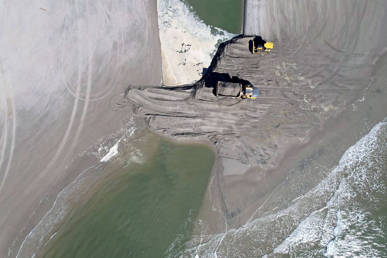
Isle of Palms had dealt with the flooding in several ways. First, the city installed one-way tidal valves in the outfalls of the drainage canals to let rainfall escape while preventing ocean tides from flowing back into the ditches. Crews also replenished the eroded shore with transplanted sand, building up dunes and planting vegetation—only for the next storm to undo the work, often within hours.
The city then planned and budgeted a more robust multimillion-dollar infrastructure project to create a largely undetectable flood-mitigation berm by elevating a corridor of almost two miles of
pathways along the back of the island.
“Based on what we were seeing, we chose a target level of protection of six feet [6 ft NAVD88 or +3.37 ft MHHW],” he said.
When the engineering had been approved and the funding secured, the nor’easter flooded the island—a week before Christmas.
Nor’easters churn ocean waters into a frenzy, driving northeasterly winds onto unprotected shorelines across multiple tide cycles. A nor’easter’s downpours, coastal erosion, and flooding are as familiar to the islanders as the seasons. But this one was different.
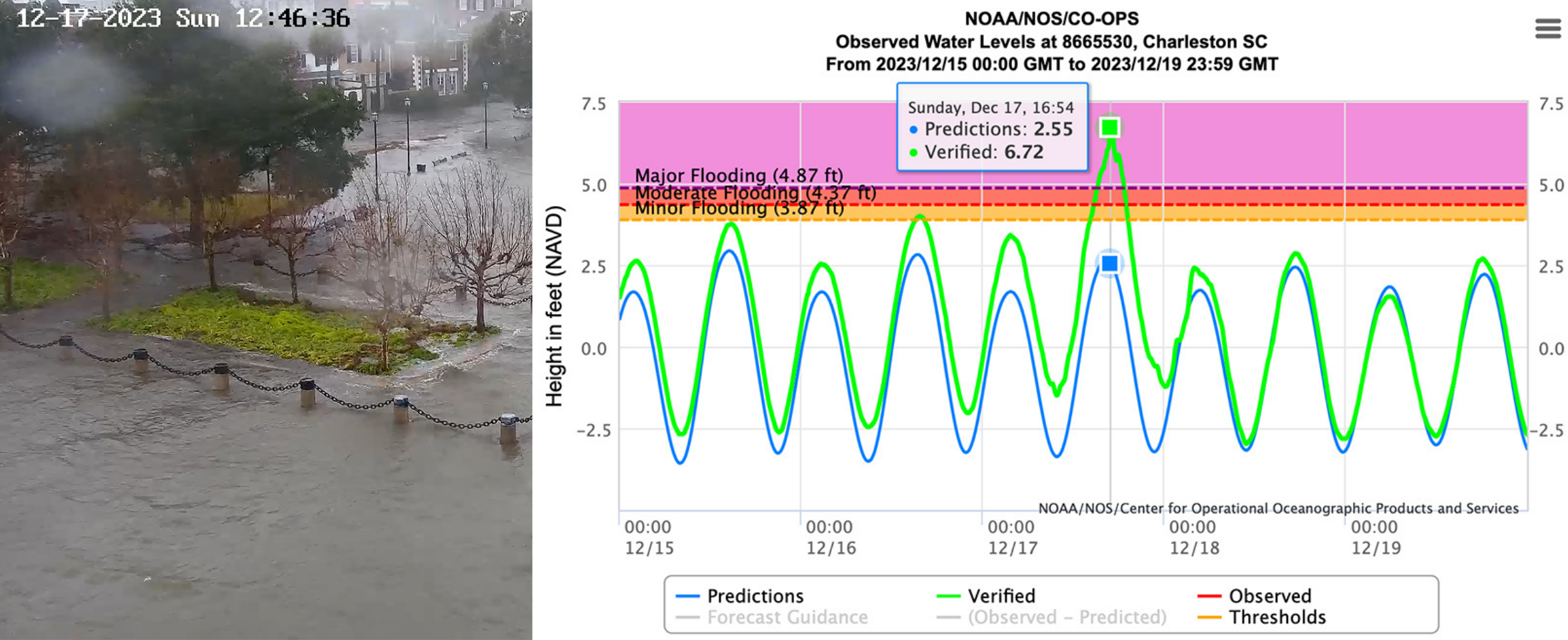
As the low-pressure system swept across Florida, it intensified, causing barometric pressure to plummet and driving offshore wind gusts approaching 70 mph. High tide upon high tide filled marshes and tidal inlets, preventing ocean water from receding at low tide. With no way of draining into the sea, stormwater runoff flooded streets and low-lying infrastructure such as the ironically named Waterway Boulevard.
Tidal gauges at NOAA’s Charleston downtown waterfront recorded a storm surge of +4.09 ft above Mean Higher High Water (MHHW) or +6.72 ft NAVD88. MHHW is the daily average high tide, which varies by location, whereas NAVD88 is the official reference standard to measure land elevation across North America.
The SECOORA/Hononu water level sensor installed in 2021 on the dock of the Isle of Palms Marina on the intracoastal side of the island showed similar data with slight timing differences. Water entering inlets and moving down the intracoastal would experience minor time lags compared to the NOAA sensor situated deep within the harbor.
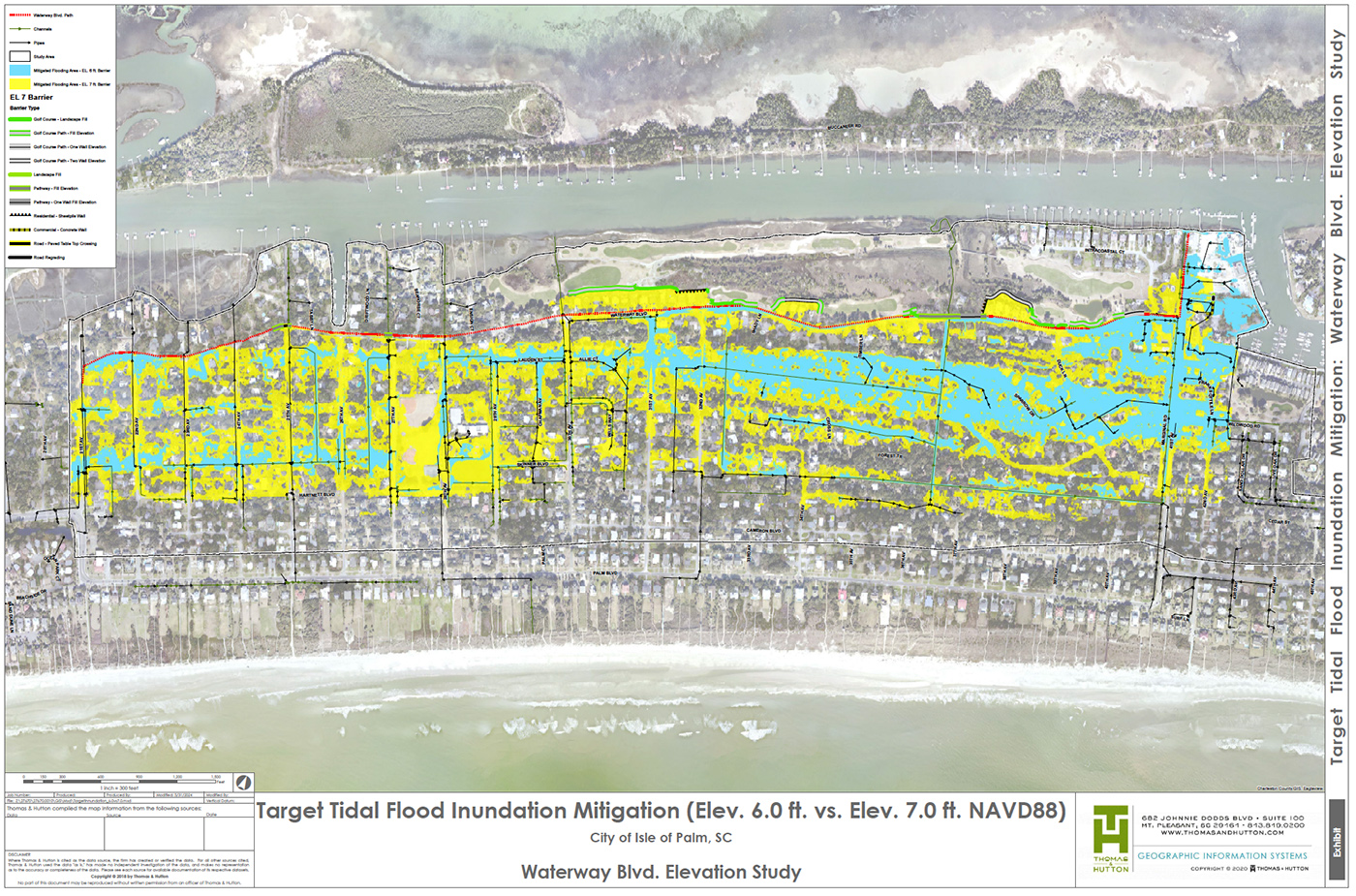
Kerr and his team sat down to reevaluate. Confronted by alarming water-level records and new predictive modeling, Isle of Palms city officials expanded their multi-million-dollar flood mitigation project—using the data to secure additional state and federal funding.
The project includes raising flood barriers along the island’s northern end and raising 1.68 miles of pathways from 6 ft to 7 ft NAVD88 (+3.37 to +4.37 ft MHHW) elevation. This would provide a longer safety net for the island and reduce the probability of catastrophic flooding.
The $6.3 million initiative is expected to be completed by the end of the year.
A Fight-Freeze-Flight Response

Hurricane Hugo was the storm by which all others on the island are measured: the Category 4 storm made landfall on Sullivan’s Island, adjacent to Isle of Palms, on September 22, 1989. The eye of the hurricane struck both islands, with maximum sustained winds near 140 mph and a storm surge of 13 to 16 feet. In nearby Sewee Bay, the storm peaked at 20.2 feet, setting an East Coast record.
Photographs show mountains of debris where beachfront cottages once stood, homes torn from their foundations and carried into the middle of roads that were no longer roads.
Hugo decimated the island, forcing the community to start over, almost from scratch. Stricter building codes required homes to be built on reinforced pilings, with heavily reinforced roofs, hurricane straps, and impact-resistant windows becoming the norm.
It was during this period of resurgence that Kerr joined the city as a planner in 1997.
“The Isle was very close to being fully developed when I came,” he says, “and its population of about 4500 people has remained fairly stable since.”
Since then, federal, state, and city governments have spent tens of millions of dollars rebuilding infrastructure and implementing flood risk reduction projects. In later capacities as Director of Planning, Building, and Licensing and City Administrator, Kerr has implemented dozens of coastal adaptation plans to maintain the island’s integrity.
Federal agencies like FEMA have adopted the “PARA” framework (Protect/Resist, Accommodate, Avoid or Retreat/Relocate) to guide coastal mitigation strategies. It makes sense that these high-flood-risk areas closely mirror the fight-freeze-flight stress responses synonymous with human survival. Communities in low-lying coastal areas like the Lowcountry with high flood risk react with similar outlooks when their homes are under threat.
Building sea walls and levees, or adjusting building elevations and installing permeable surfaces (as in Protect/Resist) describe a “fighting” stance. Adding land use restrictions, downzoning, setbacks, and limiting new construction (Accommodate or Avoid) can be interpreted as “freezing,” and moving existing communities landward and property buyouts (Retreat/Relocate) correspond to a clear “flight” response.
Most coastal communities have implemented most or all of these strategies.
By the time work began on the path elevation project, Isle of Palms had already experienced 18 coastal flooding events in October 2025 alone. Beachfront homes in Wild Dunes saw severe erosion, while downpours swamped the low-lying pathways that had not yet been elevated.
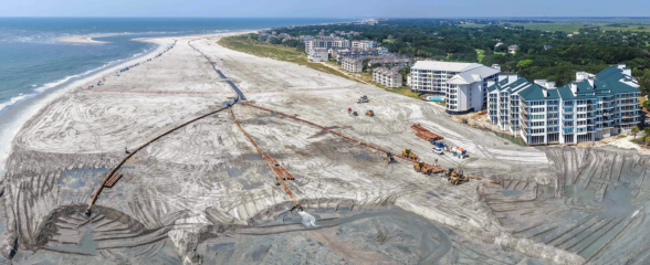
To combat the erosion, Isle of Palms launched a $22.4 million beach renourishment project in 2026: 2.5 million cubic yards of sand are dredged from offshore sites and pumped along 19,200 linear feet of shoreline to widen, rebuild dunes, and reinforce the island’s northern and southern
stretches.
Kerr is enthusiastic about the new elevation efforts, which he foresees may reduce flood risk long-term. “That berm should only be getting inundated over time in the most severe hurricane events,” he says. As to the beach renourishment project, Kerr has a more realistic outlook. “Sand has been eroding from the beach side, particularly on the northern end of the island for at least 40 years,” he explains. “We hope this project will last us eight years, but we know erosion is not going to just stop.”
“This is the joy of being an island. We’re surrounded, and the water— it’s coming up on us, for sure.”
Bluffton, SC
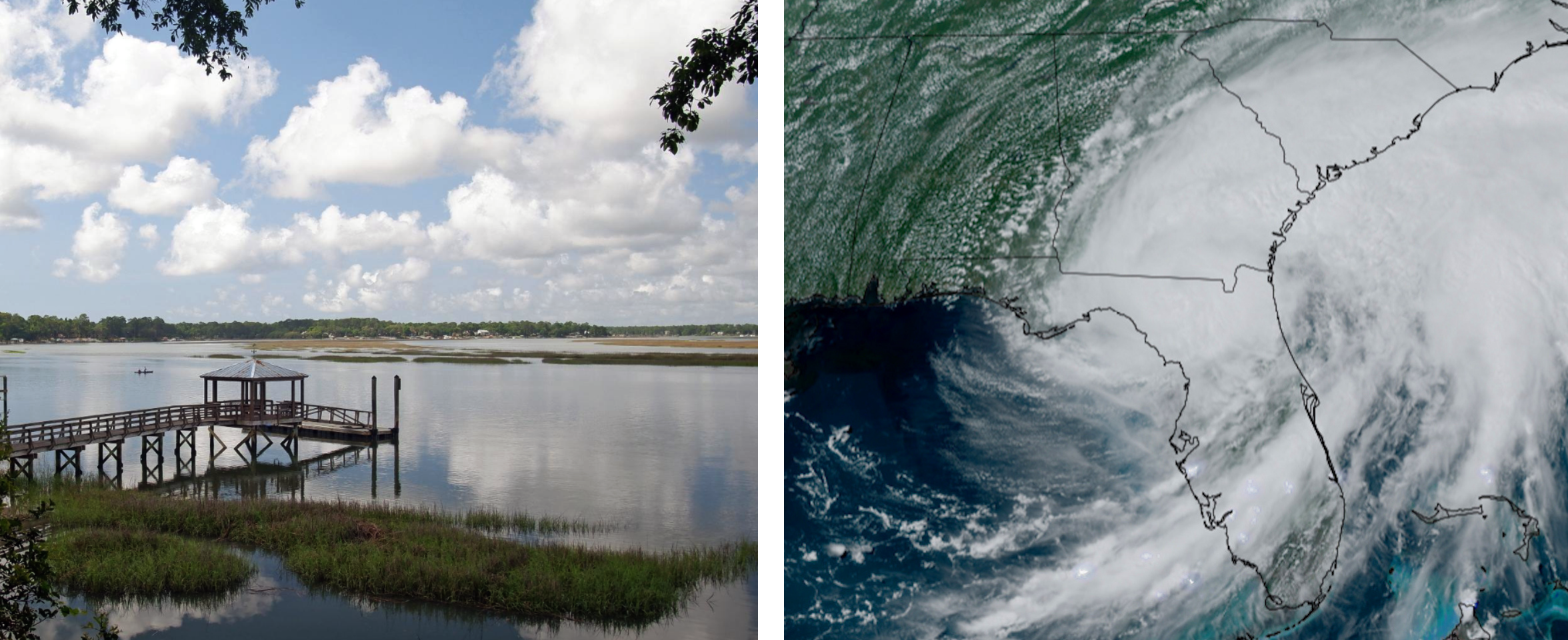
Beth Lewis, Watershed Resilience Manager for the town of Bluffton, SC, knows precisely when Tropical Storm Debby hit: “It struck us on August 8, 2024, and it brought 16-20 inches of rainfall.”
Moving as if in slow motion across southeastern Georgia and coastal South Carolina, the storm drifted along the Lowcountry coast at an excruciating 2 to 6 mph, stalling over the same geographic corridor for over 72 hours.
Though Debby produced an underwhelming 1.0 to 1.5 ft MHHW (Mean Higher High Water) storm surge in the shallow May River estuary, wind gusts reaching 50mph coincided with normal high tide obstructing natural marsh drainage, causing severe backwater flooding that uprooted trees and downed power lines.
“Many neighborhoods, particularly those with older stormwater infrastructure predating updated Town requirements, experienced flooding,” Lewis recalls.
Although Bluffton’s historic downtown sits on a 20-40 foot high bluff overlooking the May River that protects it from tidal flooding, surrounding areas are increasingly vulnerable to flood hazards.
“While we have not yet established a definitive threshold for concern,” says Lewis, “we recognize that sea level rise and extreme tidal events can significantly affect stormwater flows, particularly in the Lowcountry’s flat terrain.”
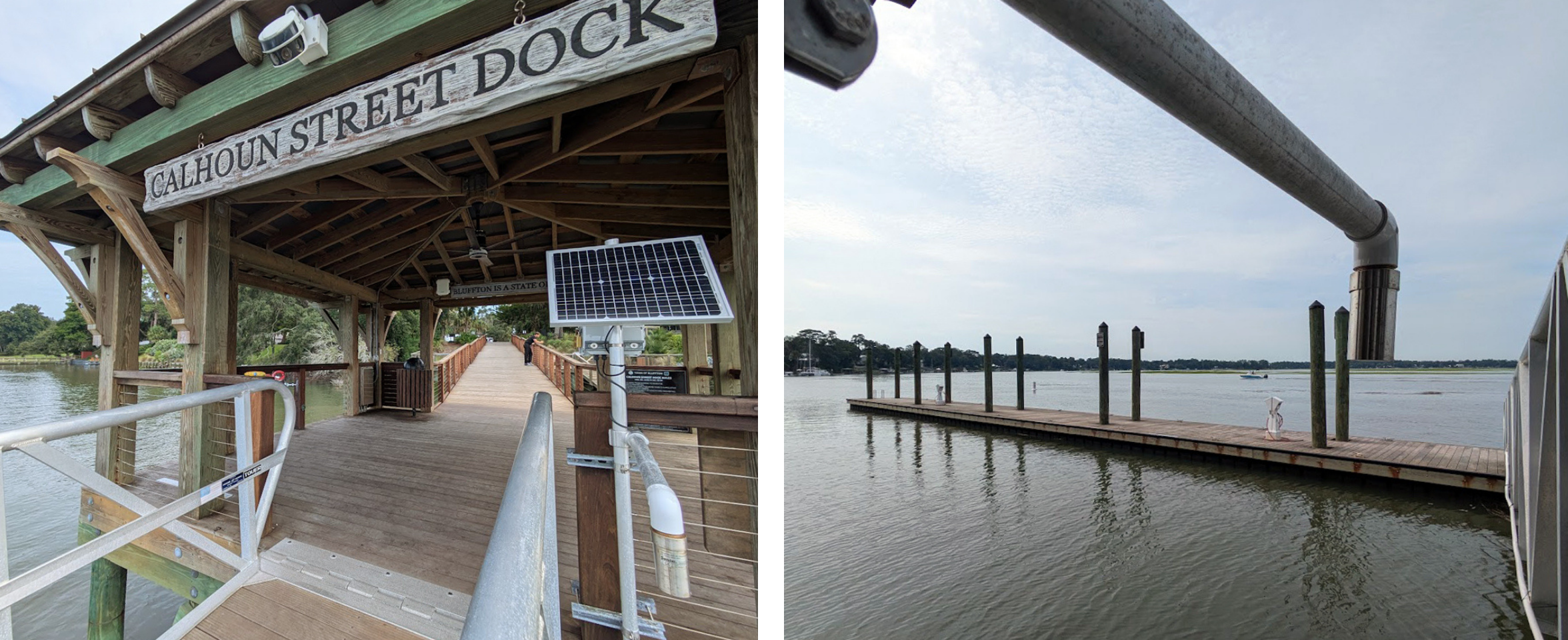
The town proactively partnered with SECOORA to secure a water level sensor after learning about the technology through its long-standing relationship with the South Carolina Sea Grant Consortium.
“The Town aims to track not only flooding but also storm surge and sea level rise, using SECOORA’s accurate and highly localized data, rather than relying on distant sources like Fort Pulaski, to monitor changes in the May River over time,” says Lewis.
Historically, coastal researchers have relied on NOAA’s Fort Pulaski Station located about 15 miles to the south across the May River, Calibogue Sound, and the Savannah River—in Georgia.
Lewis added that before installing the SECOORA sensor at the Calhoun Street Public Dock earlier this year, the Town also relied on data from a submersible device that required periodic manual retrievals to download the water-level record.
Lewis explains how the Calhoun dock sensor plays a vital role in the town’s flood mitigation strategies: “It helps establish and maintain partnerships with federal and state agencies, enables long-term tracking of critical water elevation data in the May River—a tidal river—to drive science-based decision-making.”
“In this context, having precise data from our SECOORA meter is essential for anticipating and managing future storm impacts,” said Lewis.
The town is committed to meeting recurring challenges head-on. Adaptations include an Impervious Surface Restoration Program, integrating low-impact development and water quality improvements into capital projects, and conducting Comprehensive Drainage Studies for predictive stormwater modeling.
Debby struck just as Bluffton was conducting a major Resilience Planning Study with the SC Sea Grant Consortium and the College of Charleston. Community engagement surged, as residents documented widespread flooding, and the focus shifted from stormwater management to “a more comprehensive view of resilience.”
“One direct outcome of Debby and evolving federal regulations was the development of the Wetland Protection Ordinance,” noted Lewis, referencing the U.S. Supreme Court’s 2023 Sackett v. EPA ruling, which removed federal protections for non-adjacent freshwater wetlands.
“Bluffton became the first municipality in South Carolina to adopt such an ordinance following the Supreme Court’s Sackett decision,” said Lewis. “The town is continuously exploring innovative approaches to improve water quality and reduce flooding.”
Key provisions of the adopted Town of Bluffton Wetland Protection Ordinance include a mandatory 50-foot undisturbed natural vegetative buffer surrounding all wetlands—doubling the town’s previous standard—and an expanded definition of what constitutes protected wetlands to include inland freshwater wetlands, bogs, and swamps.
Through these measures, Bluffton is actively strengthening flood-risk protections while securing the future of its most vital resource—the May River watershed.
Related news
At the Water’s Edge: Lowcountry Coastlines in a Brave New World
A nor'easter's record storm tide. A stalled tropical storm. Two Lowcountry towns adapting to a new era of flooding, with SECOORA data in hand.

Above the High Tide: Water Level Sensors on the Front Line
SECOORA's Southeast Water Level Network has installed 100+ sensors across the Carolinas, Georgia, and Florida, giving communities real-time flood data.

SECOORA is Hiring a Grants Manager
SECOORA is hiring a Grants Manager to lead grant and subaward management across a four-state coastal ocean observing network. Based in the Southeast US. Apply now.