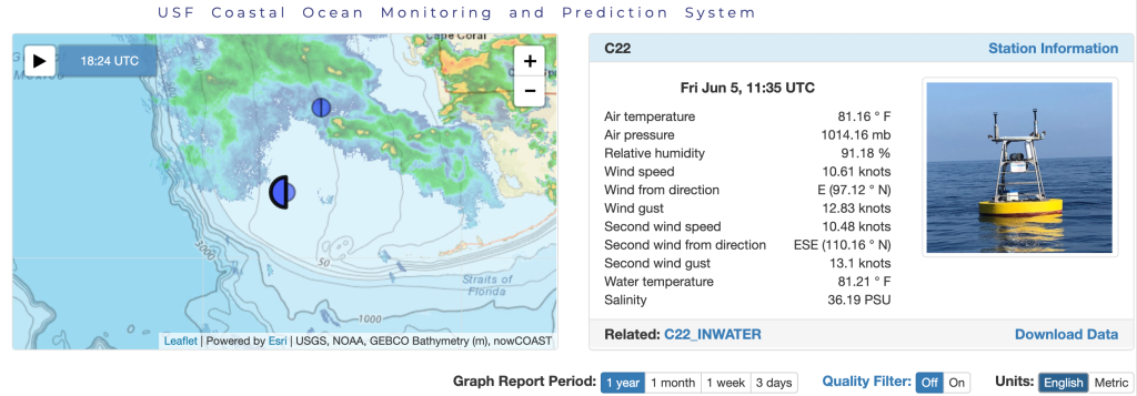
Buoy C22 (funded by National Academies of Sciences, Engineering, and Medicine Gulf Research Program) is located 100 nautical miles southeast of Naples, FL. Click for data.
Hurricane season started on June 1, 2020 and there have already been three named storms. Recently, Tropical storm Cristobal churned in the Gulf of Mexico and made landfall on the coast of Louisiana. A fleet of buoys maintained by the University of South Florida Coastal Ocean Monitoring and Prediction System (USF COMPS) are ready to capture the real time conditions as a storm passes.
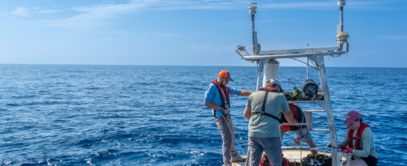
Recently, the USF COMPS offshore mooring team went to sea to make minor repairs on buoys C22, C10 and C13, located along the Florida Gulf coast, to ensure they are reporting data for the upcoming hurricane season. Currently due to the COVID-19, large research vessels are not operating and buoy turnaround cruises are being delayed; therefore, more extensive maintenance cannot be conducted until later summer/early fall 2020.
Buoys not only collect data for hurricane season – they also collect data that help answer science questions, including improving models, such as harmful algal bloom models that assist with public health decision support.
On the southern west Florida shelf, near the Dry Tortugas in the Gulf of Mexico, buoy C22 was deployed in 2019 to better understand the Gulf of Mexico Loop Current. This buoy is funded through an award from the National Academies of Sciences, Engineering, and Medicine Gulf Research Program (NAS-GRP).
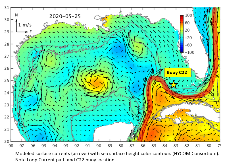
The Loop Current is a warm, deep ocean current connecting the Gulf of Mexico to the US east coast, entering from the Caribbean Sea between Cuba and the Yucatan, penetrating into the Gulf before looping clockwise and flowing through the Straits of Florida, ultimately becoming the Gulf Stream off of the east coast of Florida. Containing massive amounts of warm water, the Loop Current is able to intensify hurricanes. Additionally, it’s meandering pathway has important impacts on the circulation of west Florida shelf waters. Buoy C22 is strategically placed to better understand and predict these impacts, as it collects (and transmits in real time) data on water temperature, salinity and current velocity as well as wind speed, relative humidity, barometric pressure and air temperature. These data are combined with model simulations and used to monitor and better understand hurricane intensification, red tide formation and transport, fish larvae transport, hazardous material transport, support search and rescue operations and provide inputs on other issues important to our coastal society.
The USF COMPS offshore program also operates six High Frequency Radars (HFRs) for observing surface currents, five deployed along Florida’s west coast and one in the Keys (with two more planned for the Keys), and provides daily nowcasts and forecasts of the ocean circulation over the eastern Gulf of Mexico’s continental shelf and estuaries. The HFR and other COMPS data (including some from coastal stations) are available through COMPS and SECOORA web sites and the HFR data are further included in the NOAA Integrated Ocean Observing System Coastal Observing Research and Development Center (CORDC). These data and model simulations collectively contribute to boater safety, supporting U.S Coast Guard Search and Rescue operations, and oil spill and harmful algal bloom tracking in the Gulf of Mexico.
Related news

Spotlight: Mobilizing to Save Florida’s Coral Reefs
Learn how scientists are racing to save Florida's Coral Reef through coral rescue, gene banking, reef restoration, and innovative conservation efforts after disease and marine heatwaves devastated one of America's most important marine ecosystems.

From a Whale’s Song to an Ocean’s Symphony: How AI Decodes Underwater Sound
Explore how SECOORA-funded research is using AI and machine learning to decode ocean soundscapes, detect boat noise, and support coral reef restoration efforts.
Rebuilding the Future: USF’s College of Marine Science Recovers from Historic Blaze One Day at a Time
Following a devastating fire at USF’s Marine Science Lab, researchers rally to salvage decades of critical data and maintain vital ocean monitoring.